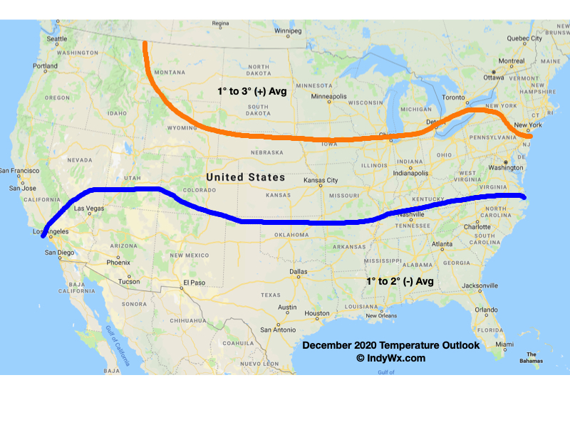
December certainly has opened on a cold note. Through the 1st few days of the month, IND is running more than 6° below normal. Our short-term products will continue to handle the quiet times through the upcoming week. As is typical on Thursday, we’ll look ahead to some longer range items of interest in this evening’s post.
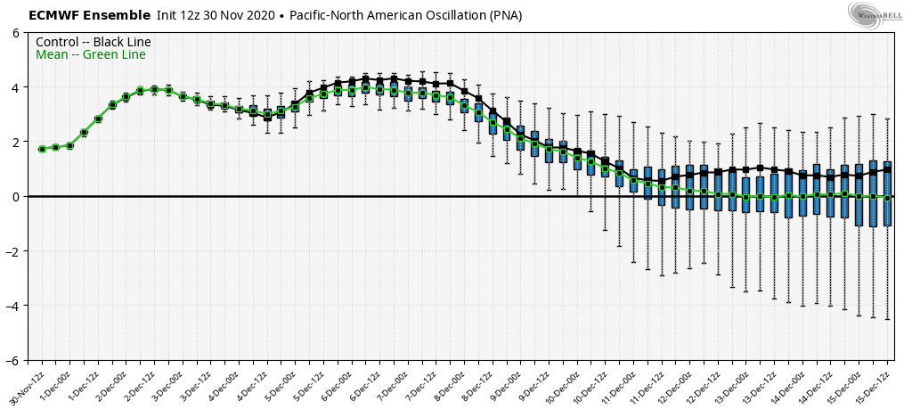
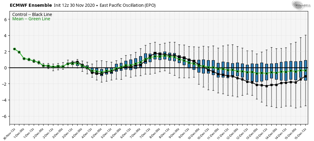
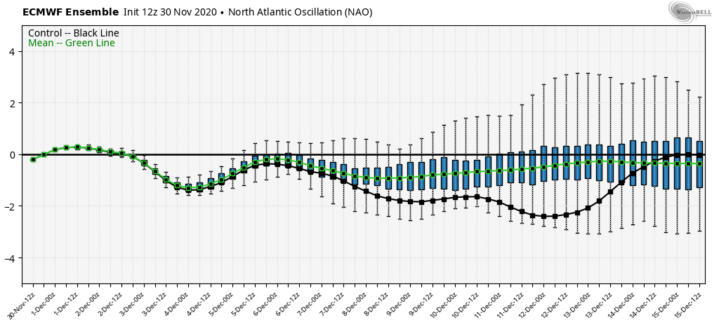
To start, let’s dig in to the pattern drivers. Initially, the PNA and AO are aligned in a manner that supports the chill. As we go into mid-month, we lose the positive PNA (in my opinion, it was this feature that’s responsible for the cold start to Dec and subsequent OHV snow event). The EPO remains unfavorable for durable cold.
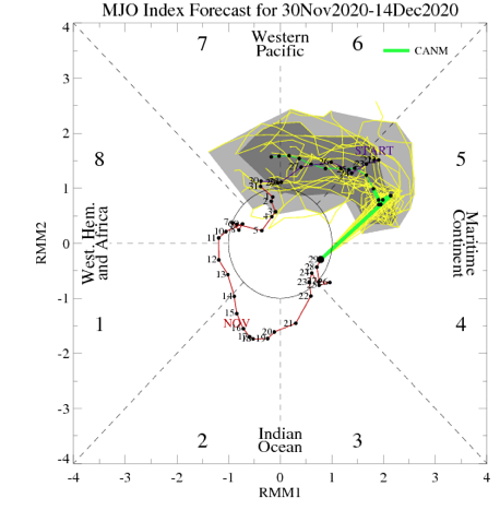
The latest European Monthly MJO plot keeps things in the “null” phase. To me, this says we need to continue to lean more heavily on the teleconnections in the shorter to medium range period. We’ll continue to monitor for the MJO to become more amplified down the road. Once this takes place, the MJO should drive things for the majority of the winter.
Seeing as how 2/3 major teleconnection drivers trend warmer by mid-month and the MJO remains a relative non-factor, it’s no surprise to see the longer range modeling warming things up mid and late month.
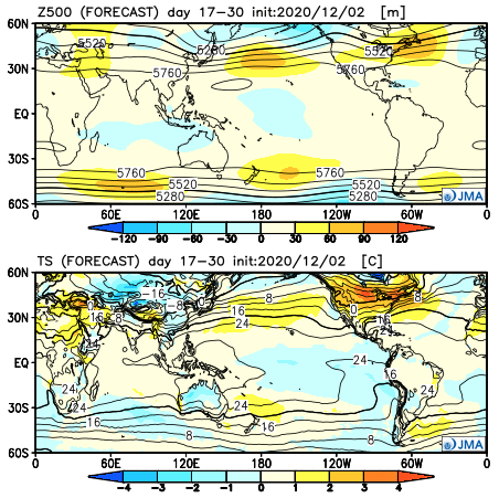
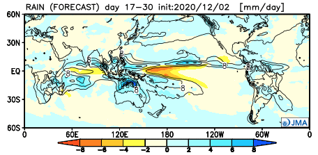
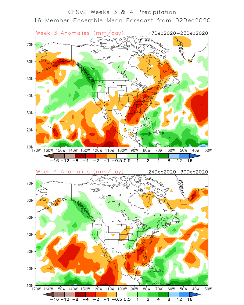
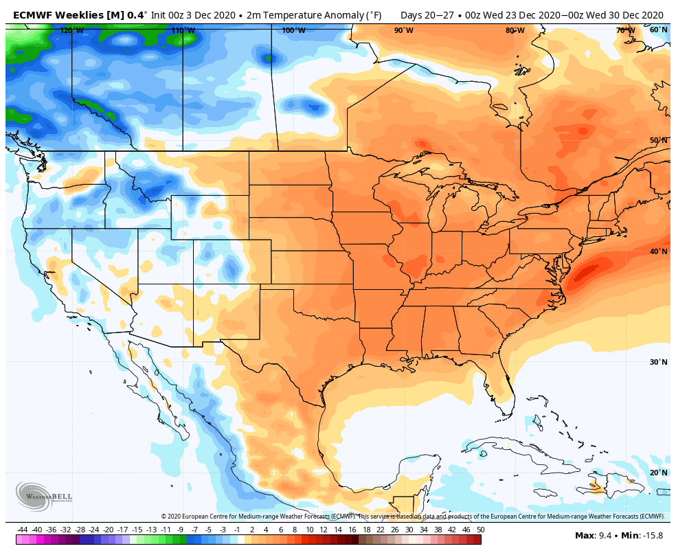
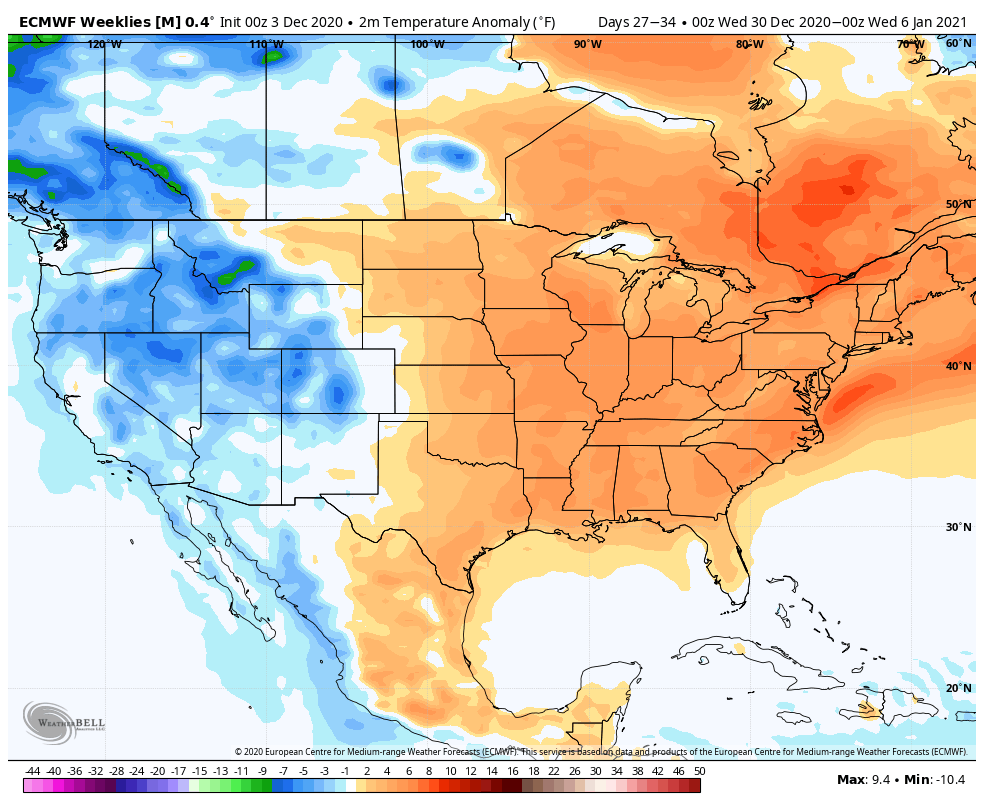
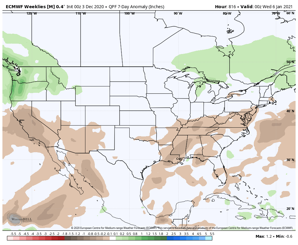
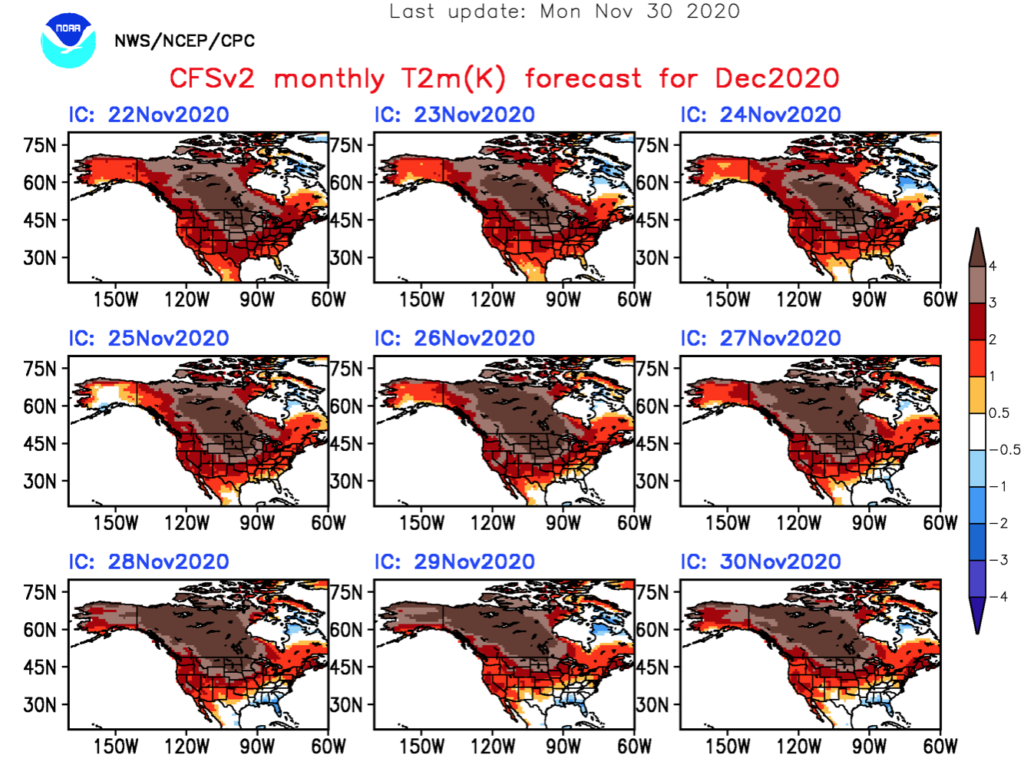
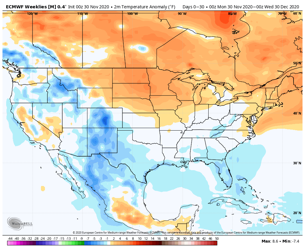
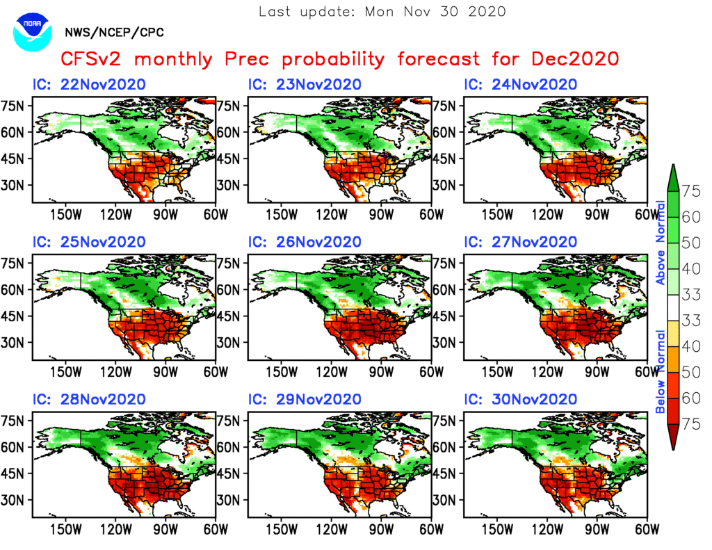
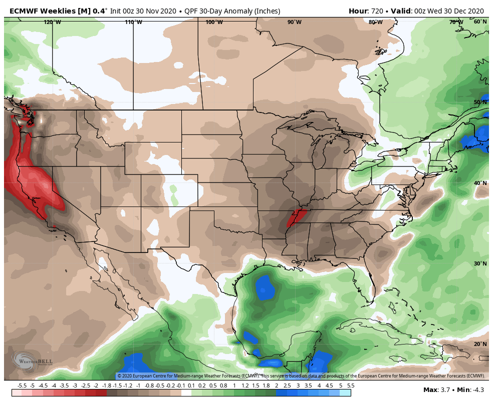
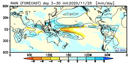
Today, the 3 primary long range models we look at all show warmth carrying the day to wrap up the month. Additionally, they continue the drier than normal theme into early parts of January.
JMA Weeklies:
CFSv2 Weeklies:
European Weeklies:
While shots of chill will continue to impact the region (after the more sustained chilly regime in the immediate term), there’s little reason to buy into any chance of durable, sustained cold to wrap up the month and head into the early parts of January.


