Easter Night Update: Flooding Setup & Severe Weather…

Updated 03.31.24 @ 10:07p

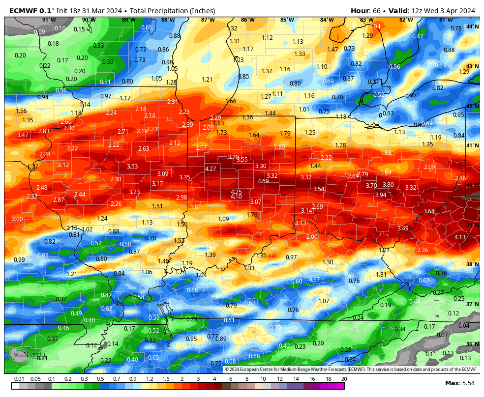
Multiple waves of heavy rain will result in flooding across central Indiana over the next few days. Model guidance agrees on a widespread 3”-4”+ event across the region. Heaviest amounts will fall north of the I-70 corridor.

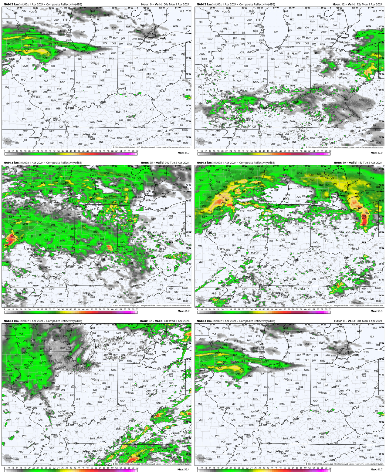
Severe weather will also grab headlines, including large hail and tornado potential. As of this evening’s guidance, greatest chances of severe storms will come during the predawn Monday and Tuesday windows and again Tuesday afternoon directly ahead of the frontal boundary.

Accumulating wet snow follows Wednesday evening & Thursday…

Never a dull moment around these parts!

LR Update Into Mid-March…

Updated 02.18.23 @ 6:45a

Just as many are getting ready to bust into full blown spring mode, it’s becoming increasingly apparent that Mother Nature has other ideas.

We note the most powerful teleconnection (especially by late winter and early spring standards) is set to head into cold phases to close Feb and open March.

NAO

That said, the Madden Julian Oscillation (MJO) is looking like it’ll be more stubborn (has been the story this year with respect to getting all of the pattern drivers to align). Based on the latest guidance, a rumble through warm Phase 7 is possible before the MJO heads into the traditionally cold Phase 8 early March. This will be critical in the ultimate pattern progression as we get into the 1st month of meteorological spring.

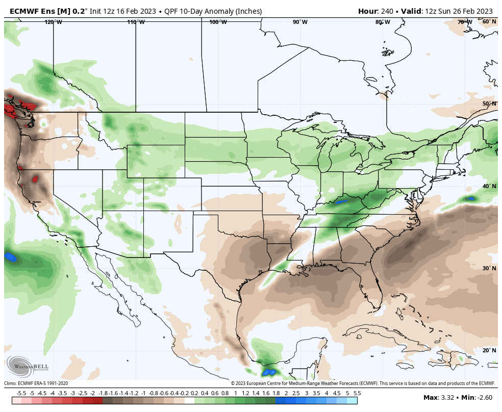
As a result, from a temperature standpoint, the period from now through the end of February likely continues the warmer than normal theme. That’s not to say there won’t be cold “jabs,” similar to what we saw Friday, but the longevity of cold will be fleeting given the drivers above. There’s no reason to argue with the upcoming 10-day period to essentially close out February from the European ensemble:

It’s also a rather active pattern, including at least slightly above normal precipitation throughout the Ohio Valley and Great Lakes, to close the month.

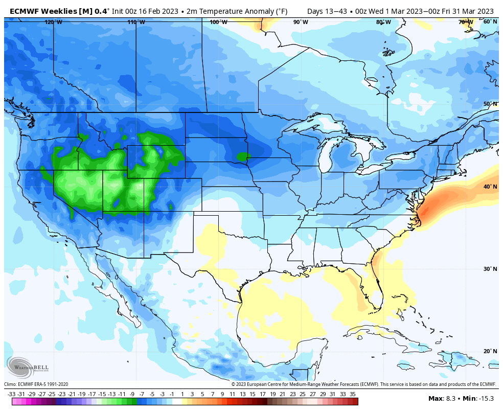
While “proof is in the pudding,” especially this year, it appears as if the MJO and NAO will align to force a shift in the regime towards more sustained cold (relative to normal) as we push through the 1st half of March. Interestingly, the new European Weeklies also highlight this, and are “all-in” on a colder than normal March as a whole.

The period features a wetter than normal look, as well:

Despite what you might believe (or hope) at this point, we’re likely not finished with the accumulating snow prospects, either…
Busy Winter Ride Into The Holidays…

Updated 12.10.22 @ 5a

It’s been quite some time since we’ve seen the kind of alignment of pattern drivers in favor of cold, wintry weather for the heart of the holiday season. The reasoning for such has been outlined in previous posts so we won’t bore you with rehashing those details again this morning.

Simply put, it continues to look like a progressively colder pattern over the upcoming week to 10 days, that also includes plenty of storms. As colder air filters southeast, these storms will take on an increasingly wintry flavor. Potential is very much alive for a period of bitterly cold, arctic air to get involved in the pattern to close December or open January- on the heels of the stormy regime. Prospects for a White Christmas continue to look well above average this year for a good chunk of the country, including right here in central Indiana.

After a series of fairly weak and insignificant systems, a much more impactful storm will blow across the Ohio Valley Tuesday night and Wednesday morning. A period of heavy rain will be accompanied by strong and gusty winds and a significant temperature hit during this period. It’s this system that ultimately will be responsible for ushering in the lead wave of a colder, more wintry pattern moving forward.

We’ll likely continue to see wild swings in the operational guidance over the next couple weeks. That’s common during big pattern transitions. The most intriguing item longer term will be if we can get the MJO into a more amplified state, and, if so, into the traditional cold phases to close December and open January. Much more on that later…