Continued Steamy; Storm Chances Return…

Mon.

Tue.

Wed.

Thr.

Fri.

Sat.

Sun.

 Status-weather-showers-day-icon

 Status-weather-showers-day-icon

 Status-weather-showers-day-icon

 Status-weather-showers-day-icon

 Status-weather-showers-day-icon

 Status-weather-showers-day-icon

 Status-weather-showers-day-icon

71/ 90

70/ 90

70/ 88

69/ 87

70/ 88

71/ 88

64/ 82 

Hot And Steamy…It hasn’t been so much the actual air temperature as humidity that’s made things feel so oppressive out and about the past few days (dew points have been running in the lower to middle 70s, or more like the Gulf of Mexico region).  Today we’ll add more sunshine and this will most likely help temperatures approach, if not exceed, the 90 degree mark.  Most of today will be dry, but we’ll eye developing showers and thunderstorms to our northwest this evening and these may impact portions of the region tonight.

Active Pattern…An active weather pattern will continue through the week, including multiple rain and storm chances. Heat and humidity will remain, as well.  It’s tough to pin point exact times where rain and storm chances will be greatest- individual disturbances rotating around a ridge to our south will be the culprit.  Current thinking places another round of storms into the region Tuesday night into Wednesday and again Thursday night into Friday.

Relief In Sight…We forecast a slightly cooler and much less humid pattern building in to wrap up August and open September. We’re not forecasting any sort of major blast of cool air, but we will see a big relief in humidity values later next weekend.

7-Day Precipitation Forecast:

  • 7-Day Rainfall Forecast: 1″-2″ (locally heavier totals)
  • 7-Day Snowfall Forecast: 0.00″
We'll keep a close eye on thunderstorms to our north later this evening and overnight. Portions of central Indiana may have to deal with storms late tonight into Tuesday.
We’ll keep a close eye on thunderstorms to our north later this evening and overnight. Portions of central Indiana may have to deal with storms late tonight into Tuesday.


Model Battle Late Month

We spoke about this on the video this evening, but there are still more questions than answers in regards to the pattern as we move through the back half of…

You must be logged in to view this content. Click Here to become a member of IndyWX.com for full access.  Already a member of IndyWx.com All-Access?  Log-in here.

“Rain Eater…”

Fri.

Sat.

Sun.

Mon.

Tue.

Wed.

Thr.

 Status-weather-showers-scattered-icon

 Status-weather-showers-day-icon

 Status-weather-showers-day-icon

 Status-weather-showers-day-icon

 Status-weather-showers-day-icon

 Status-weather-clouds-icon

 Status-weather-clouds-icon

63/ 74

61/ 79

63/ 82

61/ 82

58/ 80

54/ 75

52/ 78 

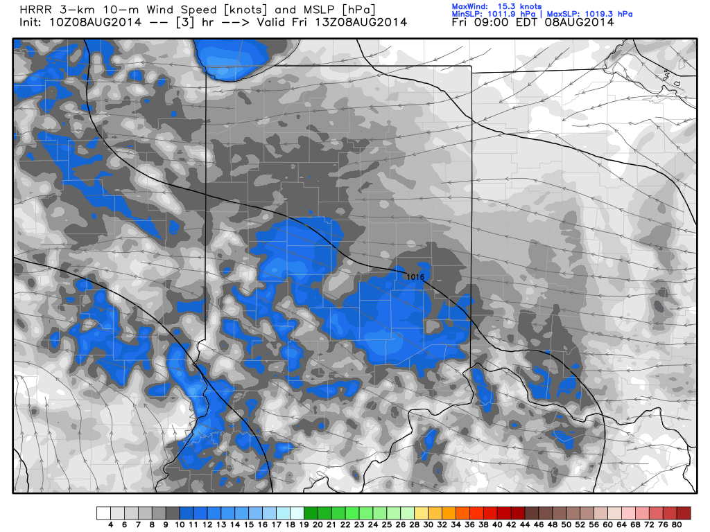
Easterly Flow, Drier Air…An area of low pressure will track across southern portions of the state. High pressure across the eastern Great Lakes will continue the easterly flow across central Indiana and greatly limit the northward extent of heavy rain.  While we’ll see a few showers across central Indiana today, the heavy rain will remain across the southern 1/3 of the state.  Otherwise, cloudy skies and easterly breezes will keep temperatures close to 10 degrees below normal here.

More Sunshine This Weekend…We’ll maintain a mention of a scattered shower both Saturday and Sunday, but this is nothing to cancel any outdoor plans over.  Periods of sunshine will also build in and lead to a nice weekend, overall.

Early Week Cold Front…A cold front will sweep the state Tuesday and could have a couple showers and thunderstorms along it.  The big story though won’t be rain and storms, but instead another push of cooler than normal air for late week.

7-Day Precipitation Outlook:

  • 7-Day Rainfall Forecast: 0.50″-0.75″
  • 7-Day Snowfall Forecast: 0.00″
A drier easterly flow, courtesy of high pressure to our north, will continue to "eat away" at the northward rainfall progress today.
A drier easterly flow, courtesy of high pressure to our north, will continue to “eat away” at the northward rainfall progress today.