
Updated 09.24.22 @ 5a
In the short-term, all eyes will remain on the eastern Gulf and up the eastern seaboard, but what does the broader, long range picture tell?
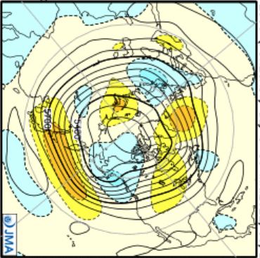
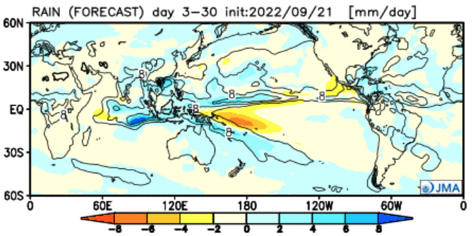
First, despite the cooler start to the month on deck, we continue to believe the balance of October will run above normal. The idea here is that the blocking pattern, in part, responsible for the seasonably cool open to October, will break down and give way to an expanding ridge over the northern tier, including the Great Lakes region. This idea has been long standing from our summer analog research, and is reinforced by Thursday’s European and JMA Weekly update below.
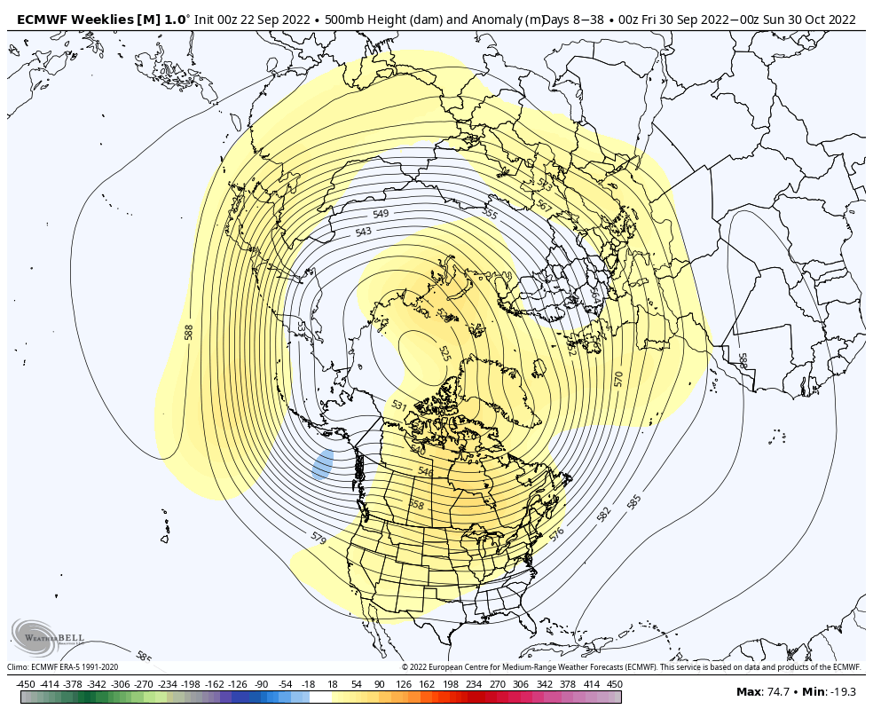
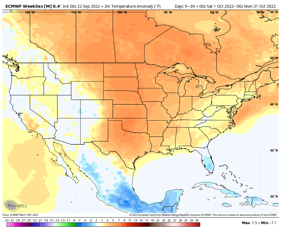
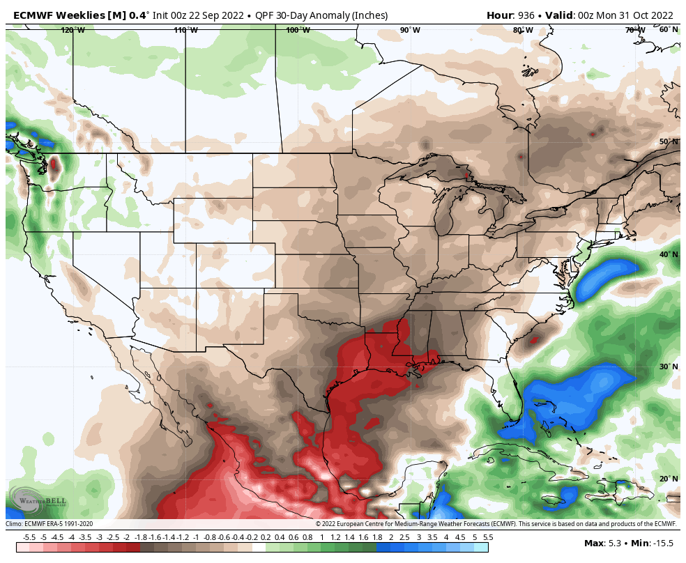
At the surface, this leads to widespread warmer than normal temperatures across the Plains and to a lesser extent into the Mid-Atlantic states. Now, it’s important to understand “normals” are starting to fall faster around this time of year. While likely done with the 90s until next spring, a couple days of upper 70s to lower 80s are still likely with such a pattern, locally, deep into October this year.
It’s also a drier pattern when compared to normal.
As is always the case, we have to pay attention to potential forecast “wreckers.” The wild card in this long range forecast is the MJO. Should the MJO amplify into Phase 5-6, cooler temperatures would be favored across the eastern 1/3 of the country, including here on the home front. As of now, longer range guidance isn’t terribly excited with blowing the MJO into that more amplified state, but is something we’ll still watch carefully moving forward.
As it stands now, it’s nice to see a larger plan working out about as expected from back in the summer. Next up, time to see if the fast start to winter is the right idea as we rumble deeper into November and beyond…