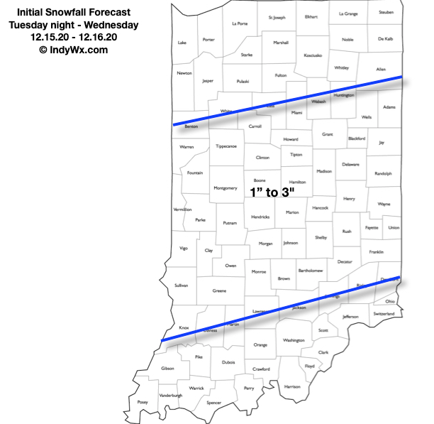
Type: Impactful wintry weather
What: Accumulating snow
When: Late tonight & Wednesday
Temperatures: Upper 20s – lower 30s
Wind: NE 10-20 MPH early in the event, shifting to the NW and decreasing to 5-10 MPH Wednesday
Blowing/ Drifting: Minimal
Pavement Impacts: Salting and plowing required
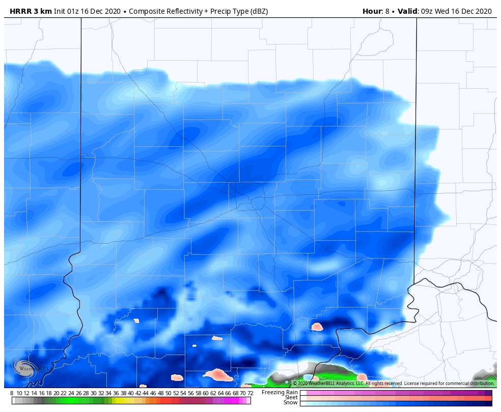
Summary: There’s not a lot much more to add to our client brief tonight from what we’ve been sharing since Saturday morning. This is a system that has behaved as expected throughout and will make a mess of things prior to sunrise Wednesday. While not a blockbuster event by any means, locally, a steady and persistent snow will fall through the majority of our Wednesday. Snow should pull east of the region after sunset Wednesday (5-6p west to 7-8p east). Temperatures will then fall into the middle to upper 20s Wednesday night and Thursday morning helping to allow refreezing on area roadways, and subsequent slick conditions in spots.
The pattern remains quite active into Christmas week. Our evening video package has more details around that below.
Confidence: High
Next Update: Wednesday morning