Tonight we look at the pattern evolution into early January, as well as take a deeper dive into 2 systems of note: heavy rain late Friday night into Saturday and…
You must be logged in to view this content. Click Here to become a member of IndyWX.com for full access. Already a member of IndyWx.com All-Access? Log-in here.
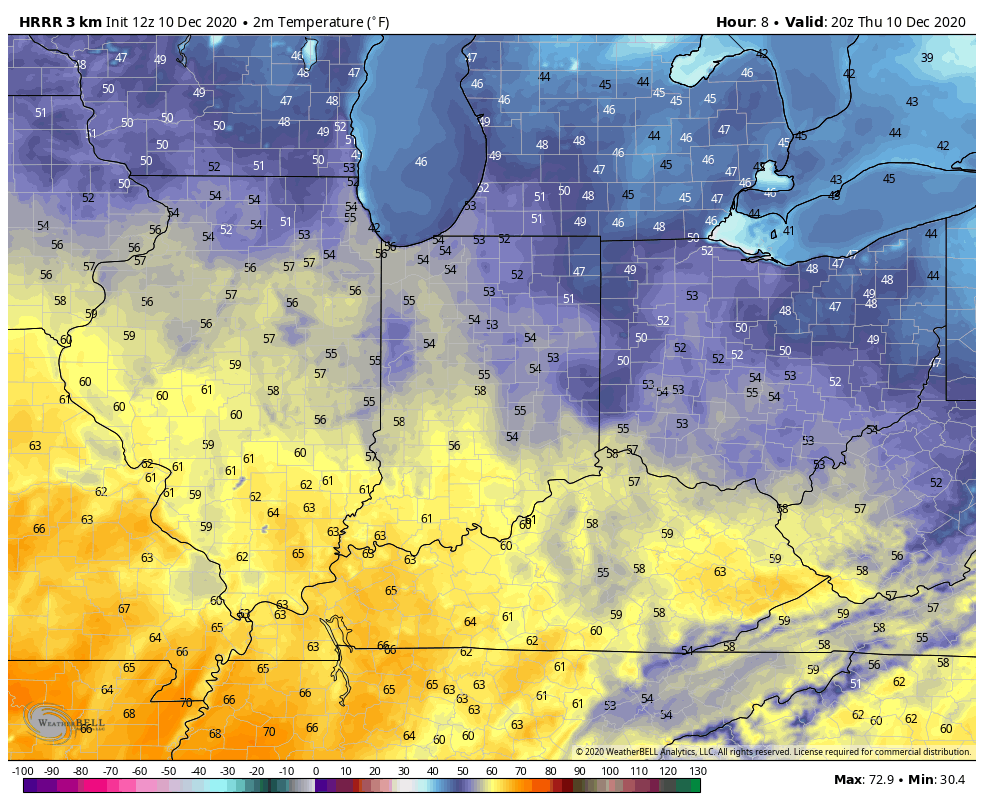
Month-to-date, it’s been a cold open to December, but a warming trend got underway yesterday and will go into high gear today. We forecast highs to “flirt” with 60° for many central Indiana neighborhoods with sunny skies. Find a way to get outside and enjoy!
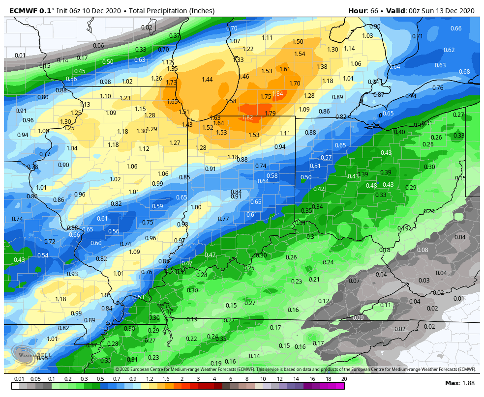
The pattern over the upcoming week will feature a “transient” flavor. The warmth of present will take a backseat to renewed chilly air (nothing unusual for this time of year) early next week behind the passage of a cold front. Speaking of, it still appears as if rainfall amounts should be within 0.50″ to 0.75″ (locally heavier totals) for most Saturday with the passage of the frontal boundary. Widespread heavier amounts of an inch, or more, can be expected across northern IN.
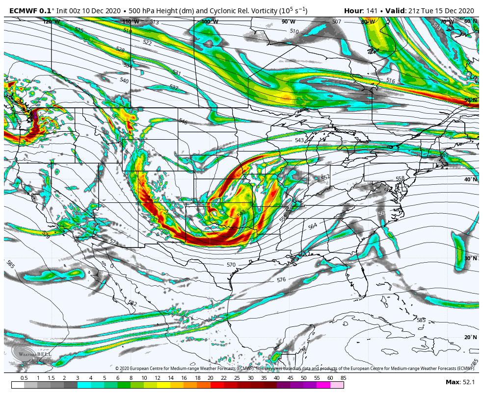
Another system will present itself the middle of next week. With colder air in place, there could be a wintry mix across a portion of the region Tuesday night into Wednesday. We’ll keep an eye on this feature and let our short-term products drill in with more specifics.
The primary purpose of this post is to look ahead to the longer range period, and that includes the all-important early Christmas idea. To start, we always like to look at a blend of the teleconnections and MJO. Interestingly, the teleconnections have been trending towards a colder pattern, overall, for mid and late month (at least when compared to a week, or so, ago). Of note, the AO and NAO are forecast strongly negative which increases the likelihood of high latitude blocking. The outlier? The EPO. Though not forecast as strongly positive as in previous days, the slightly positive EPO favors more of an eastern ridge. Overall, the AO, NAO, and “neutral” PNA outweigh the positive EPO.
The MJO is largely forecast to remain in the “null” phase over the coming few weeks. This suggests we need to lean heavier on the teleconnection trends above (at least until the MJO finally wants to become more amplified). Note how the MJO does “sneak” into Phase 5 briefly in the short-term. Interestingly, this is also associated with the warmth over the coming 7-day period.
So what happens beyond this point? The trends of the stronger negative NAO and AO are beginning to increase confidence that we’re going to be looking at a much more active 2nd half of the month. High latitude blocking usually likes to force the storm track further south, leading to, at times, lengthy periods of active, stormy weather. The positive EPO will be dealt with from time to time and is holding us back from going “overly” cold, compared to normal, for late month. From this distance, what we feel is more likely to happen is that our temperature pattern is closer to average or slightly above, but with a very active storm track through the end of the month. That more active period actually gets going this weekend. At times, wintry threats are likely to emerge, even with marginally cold air. That said, we don’t envision colder than normal temperatures locking in for any sort of length of time between and the end of the year.
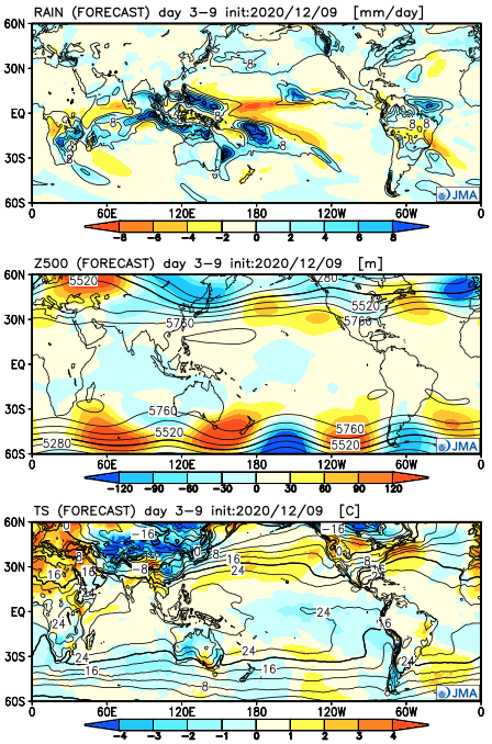
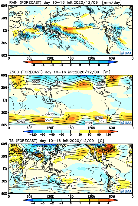
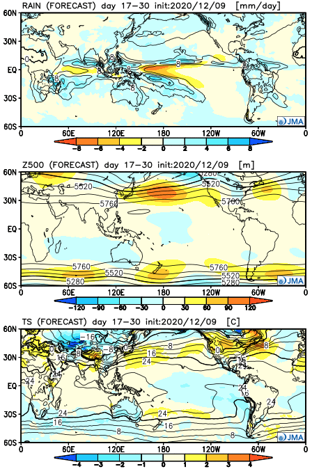
Let’s take a look at the updated JMA Weeklies. Given the forecast upper air pattern, one would assume the model may be overly warm through the period (after Week 1). The active times are shown nicely.
Week 1
Week 2
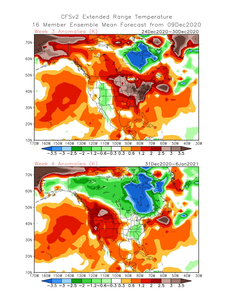
Weeks 3-4
The latest CFSv2 Weeklies show the warmer Week 3 forecast (Christmas Eve-Dec. 30) giving way to a period of cooler air Week 4 (New Year’s Eve-1st week of Jan).
We’ll review the new European Weeklies this evening in our video update. Make it a great Thursday!