December 29, 2020 archive

Rain Returns Tomorrow; Latest Thoughts On New Years…

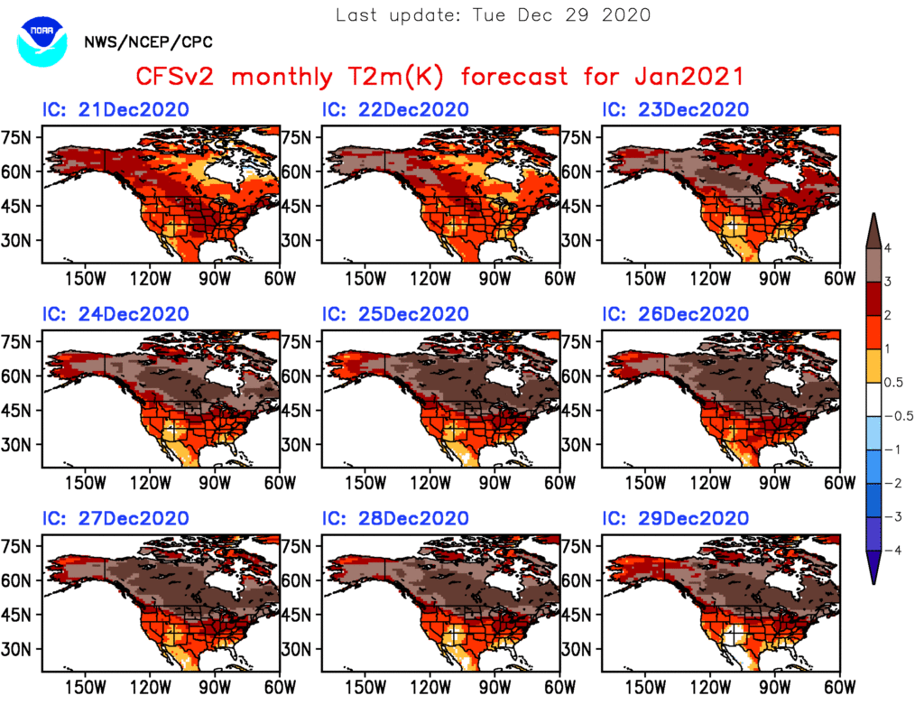
First and foremost, thank you so much for your understanding of the “off schedule” posts this week. I’m trying to keep our normal content flowing but have run into a couple of issues getting our daily video content to load, per usual. I’ll keep working on it and appreciate your patience as we update from the road!

At any rate, we really don’t have any significant changes to our ongoing forecast to wrap up the year. Clouds have increased through the day and have begun to lower and thicken this afternoon. These clouds will eventually yield rain before dawn into Indianapolis, itself.

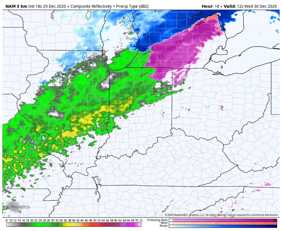
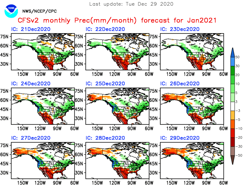
Rain will continue through Wednesday afternoon across central Indiana- totaling 0.50” to 1” for most.

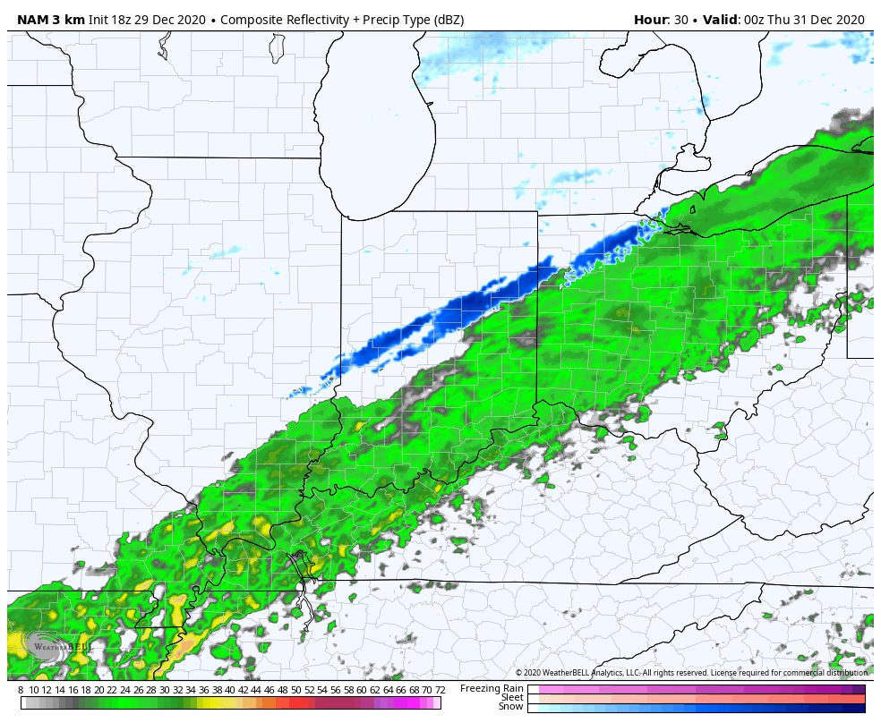
Precipitation may end as a brief period of wet snow after sunset Wednesday, but this shouldn’t be a big deal as the significant moisture will be pushing south as the cold air arrives.

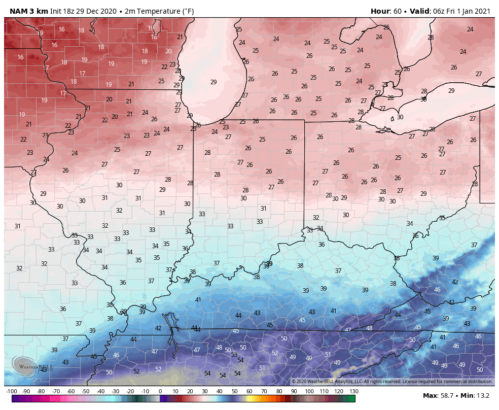
New Year’s Eve, itself, should be dry and cold with temperatures holding around freezing.

A secondary area of low pressure will lift north into the western Ohio Valley New Year’s Day. This will allow widespread moisture to return predawn Friday. While there’s a chance of a brief mix of sleet and freezing rain at the onset, this shouldn’t be a big deal. A cold rain will fall throughout New Year’s Day (great day for a full slate of college football)!

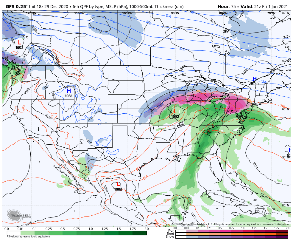
An additional 1” to 1.5” is a good bet Friday as the secondary low moves through.

Permanent link to this article: https://indywx.com/2020/12/29/rain-returns-tomorrow-latest-thoughts-on-new-years/

Warm, Wet Highlight January 2021 Outlook…

As we get set to flip the calendar to a new year, does the similar pattern that dominated in December roll over to January? Yes and no. While we anticipate the relative warmth to remain intact through the majority of the month, the storm track looks to aim itself through the Ohio Valley region for the better part of the month, helping generate above to well above average precipitation.

Forecast Models: Note the consensus on the warm (relative to average, of course), wet theme.

CFSv2

JMA

European

The MJO is becoming increasingly interesting. The European modeling wants to keep the MJO in the “null” phase, but the American modeling is showing the MJO get more amplified with time as we go through early-mid January.

Despite favorable phases for cold (AO and NAO), the Pacific pattern (namely strongly positive EPO) is wrecking havoc on any sort of cold trying to get involved in the pattern with any sort of staying power. Unless we can get a disruption of the polar vortex (big “IF” at this point), the relative warmth should continue to dominate.

We think this will be an active month with multiple storms of significance impacting the Ohio Valley. Despite our thinking that relative warmth will dominate, remember January, climatologically speaking, is the coldest month of the year. It would only take 1 or 2 of the expected storm systems tapping into only marginally cold air to generate more meaningful wintry weather and this is something we’ll keep an eye on in the weeks ahead.

Permanent link to this article: https://indywx.com/2020/12/29/warm-wet-highlight-january-2021-outlook/

IndyWx.com