
You must be logged in to view this content. Click Here to become a member of IndyWX.com for full access. Already a member of IndyWx.com All-Access? Log-in here.
December 1, 2020 archive
Permanent link to this article: https://indywx.com/2020/12/01/video-cold-open-to-meteorological-winter-big-weekend-differences-on-the-models/
Dec 01
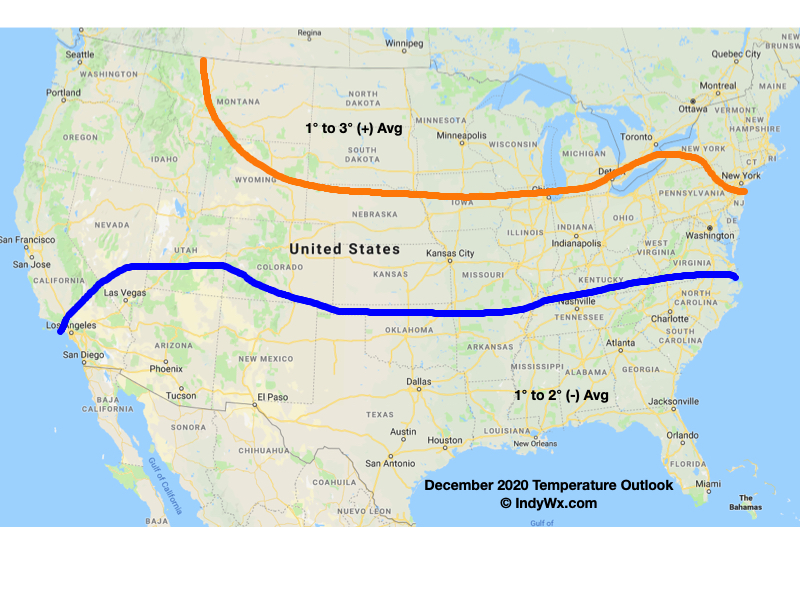
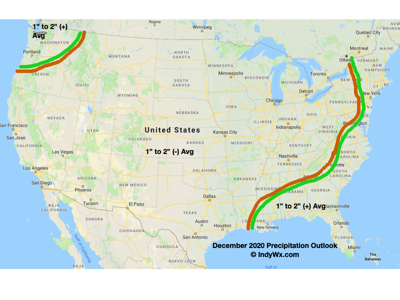
December 2020 Outlook…
The way modeling has been “forced” to correct colder over the past week to 10 days to open December has been staggering. Without question, the initial driver of this change has to do with the strongly positive PNA. Note how this is forecast to remain strongly positive over the upcoming week before trending neutral by mid-month.
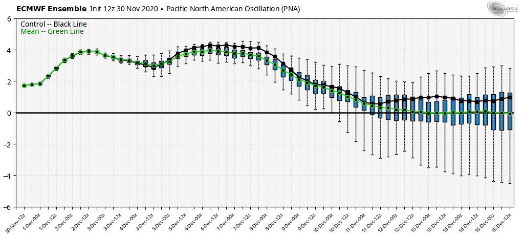
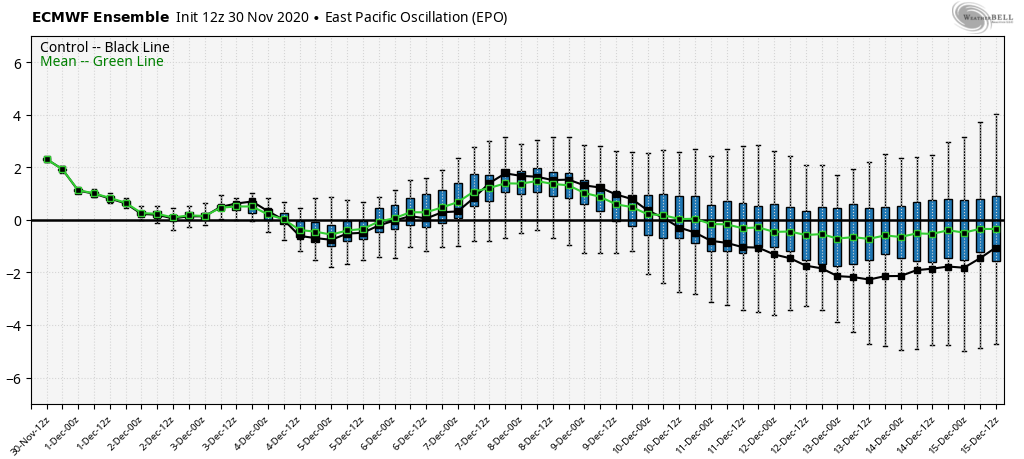
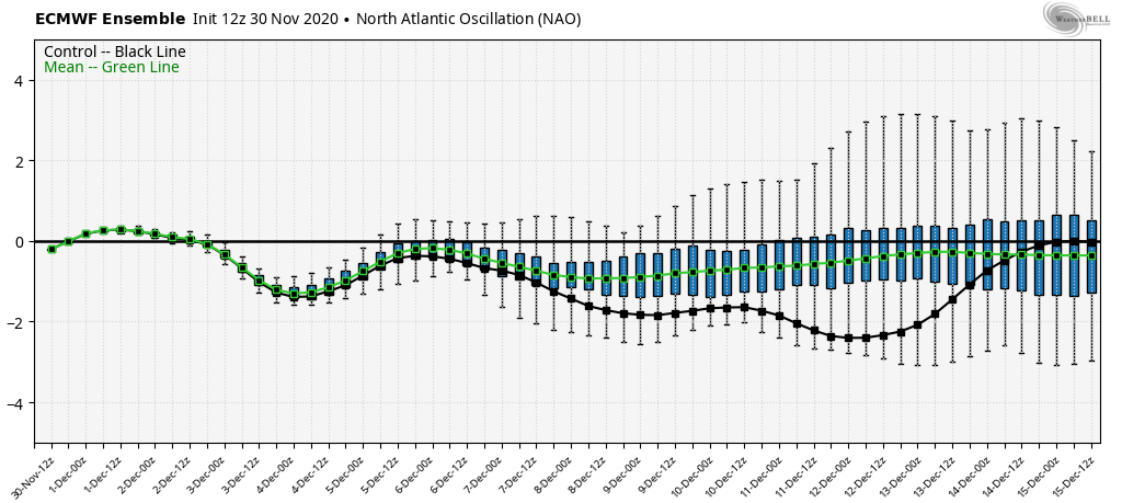
This favors a trough over our part of the country and into the Deep South through the better part of the upcoming couple of weeks. We’ve been posting about how the strongly positive PNA could lead to other teleconnections aligning in a manner that could lead to the possibility of more “meaningful” or longer lasting cold beyond mid-month. The trends of the AO, EPO, and NAO have been towards this colder direction over the past few days and it’ll be interesting to see if these trends continue.

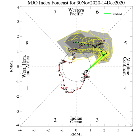
Perhaps more importantly has to do with the MJO. While the majority of guidance keeps the MJO in the “null” phase (meaning we’ll lean heavier into the teleconnections above) into and through mid-month, it’ll be worth keeping a close eye on this. The one outlier is the Canadian taking a highly amplified MJO towards the cold phases (after blasting through the warm phases quickly) by mid-month. Again, we’re not throwing our eggs into the MJO basket right now and prefer to lean heavier on the tele. trends.
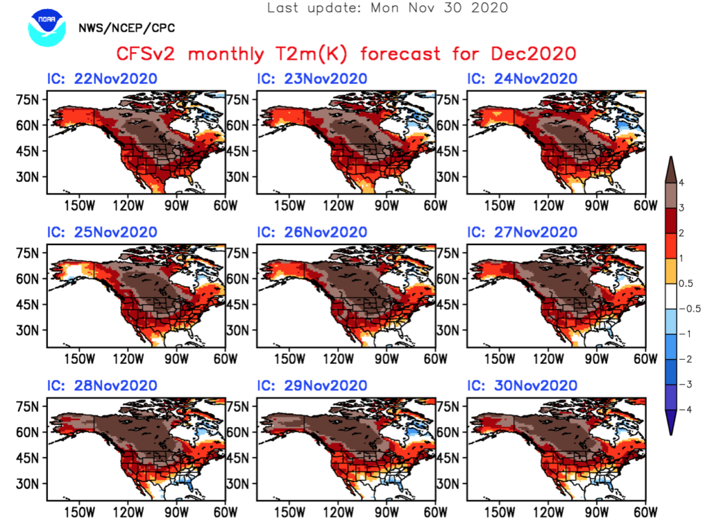
The latest CFSv2 has been trending colder for December with each model update- especially over the Southeast and TN Valley:
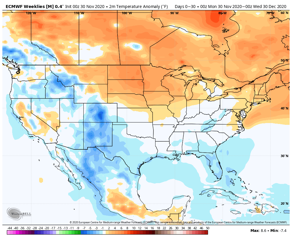
The latest European Weeklies are somewhat similar, but colder across the West.
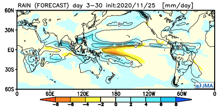
The JMA Weeklies want to put the ‘mean’ trough (and associated cooler pattern) over the Southeast for December:

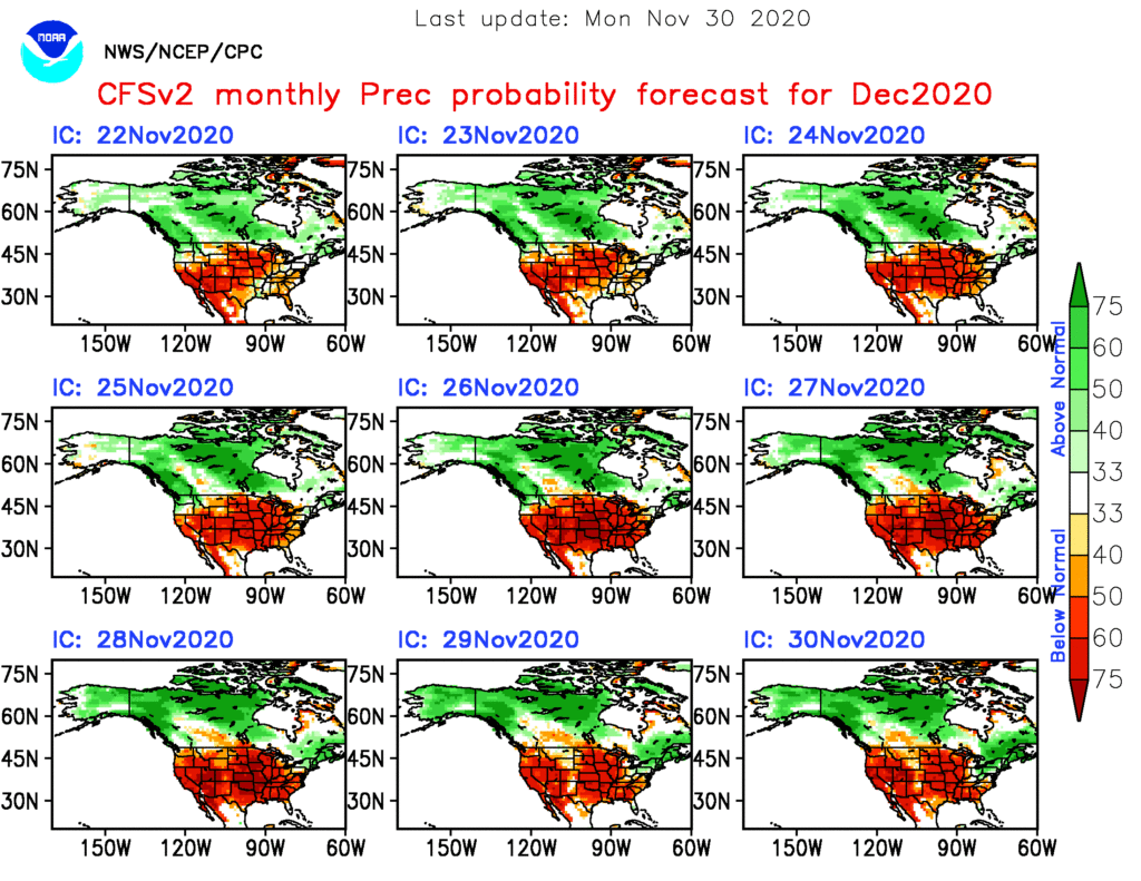
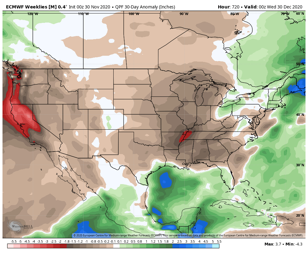
Consensus of longer range, monthly products places an area of widespread drier than normal weather across a good chunk of the country:
While there are obvious reasons for a lower confidence forecast around mid-month, thinking here is that we’ll maintain a seasonal to slightly colder than normal regime for our immediate region into the Southeast this month. This is quite different than the recent December torches we’ve been dealt and may seem much cooler than normal as a result. I believe the strongly positive PNA will “force” those other pattern drivers towards a manner that will drive the cooler pattern for the better part of the month before potentially trending milder around Christmas and New Years.
Permanent link to this article: https://indywx.com/2020/12/01/december-2020-outlook/