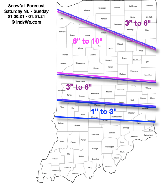
Updated: 01.29.21 @ 7:38a
Type: Impactful wintry weather
What: Accumulating snow
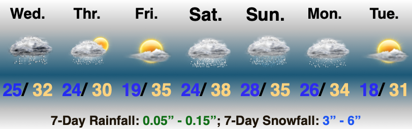
When: 4p Saturday – 4a Sunday
Temperatures: 29° to 32°
Wind: SE 10 – 20 MPH and gusty
Blowing/ Drifting: Considerable
Pavement Impacts: Plowing and salting will be required
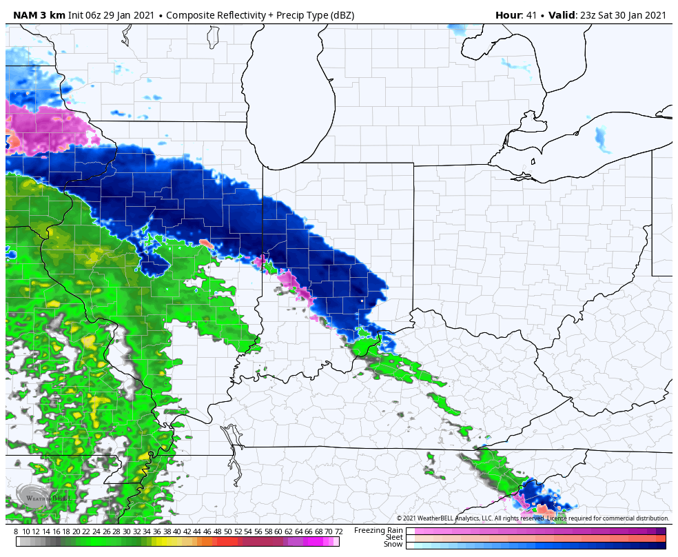
Summary: Saturday will likely start off with early morning sunshine before a lowering and thickening cloud canopy rolls in through late morning. By early afternoon, the sky across most of central IN will have that classic look of a snowstorm brewing, and rightfully so. The initial band of snow will arrive mid to late afternoon (we bracket 4p to 5p into Indianapolis, itself) and will hit like a wall. The combination of evaporative cooling, strong lift, and embedded banding features will likely result in S+ (heavy snow) throughout the evening hours across central Indiana. This will be a wet, heavy snow. Most of central Indiana should remain snow throughout the night, the exception being areas on the south side of the city (line from Greencastle to Greenwood to Greensburg) and points south where temperatures may creep just above 32° and result in a brief mix before transitioning over to rain. Drizzle or mixed rain and snow showers Sunday will transition back to snow showers throughout the afternoon, but the majority of accumulating snow across our region will fall in that 12 hour period from 4p to 4a Sunday.
Confidence: High
Next Update: This afternoon (video)