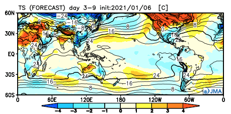
We’ve opened the month of January on a very warm note, compared to normal. Through the first (6) days of the month, temperatures are running 6.3° above average.
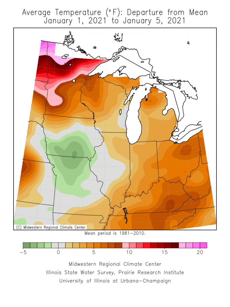
Well above average temperatures have dominated the northern tier into the eastern 1/3 of the country to open the month.

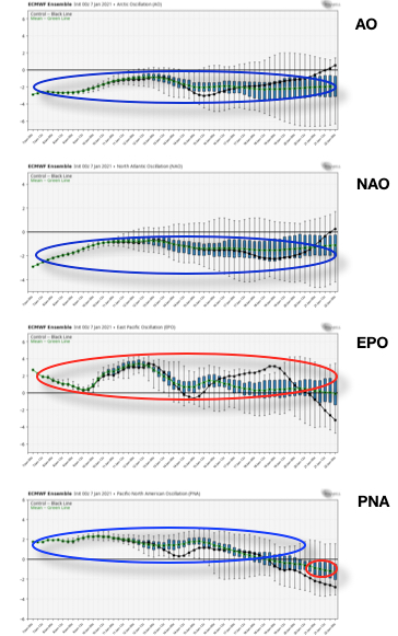
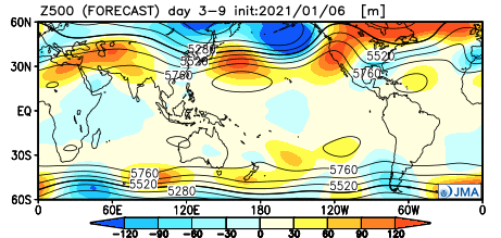
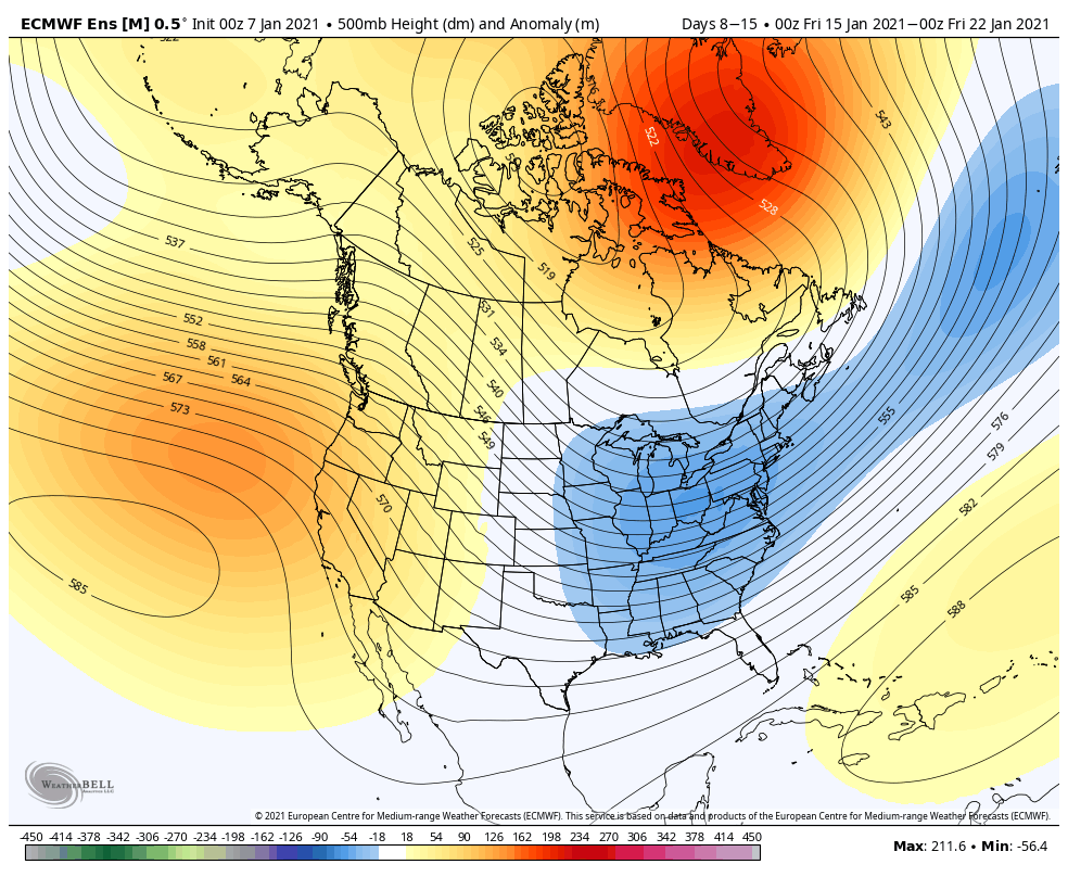
Looking ahead, the basis of the forecast over the next 3-4 weeks will be built on favorable teleconnection phases (for cold) with the AO, NAO, and PNA, while the predominantly positive EPO keeps any sort of sustained/ significant cold hard to come by. This is a pattern that can turn quite active (and we think it will), but one that still doesn’t appear as if it’ll grow overly cold- compared to normal.
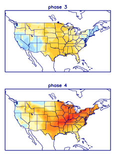
We continue to eye the MJO propagation. The latest European models keep things in the null phase, but the American products seemingly want to get things more amplified. For now we’re not biting, but if things did sneak into Phases 3-4 by late month, warmer times would follow.
Week 1


Week 2


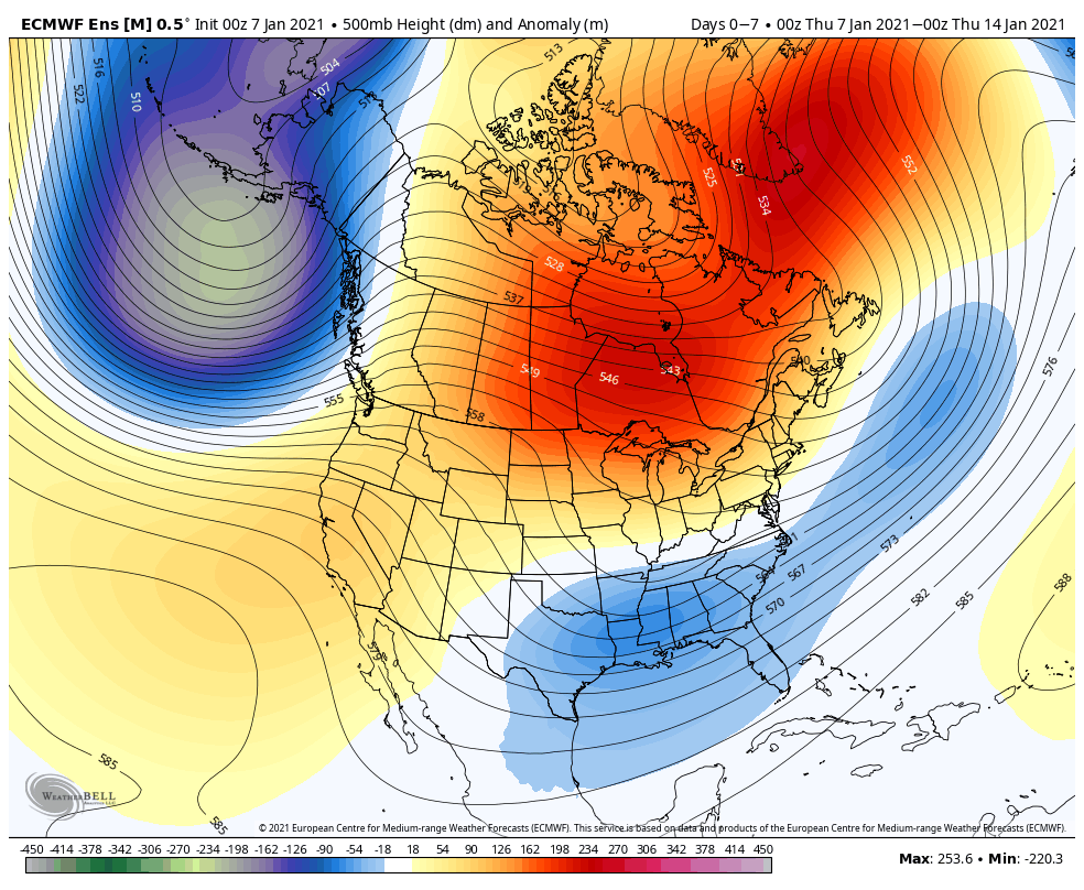
Through the first couple of weeks, modeling is in about as good of agreement as you could expect. After a period of quiet weather (immediate term), the pattern should turn much more active next week and the week thereafter, locally. While I don’t think cold overwhelms the pattern as much as the GFS ensemble is showing, I would go with more of a blend between that and the warmer JMA/ European.
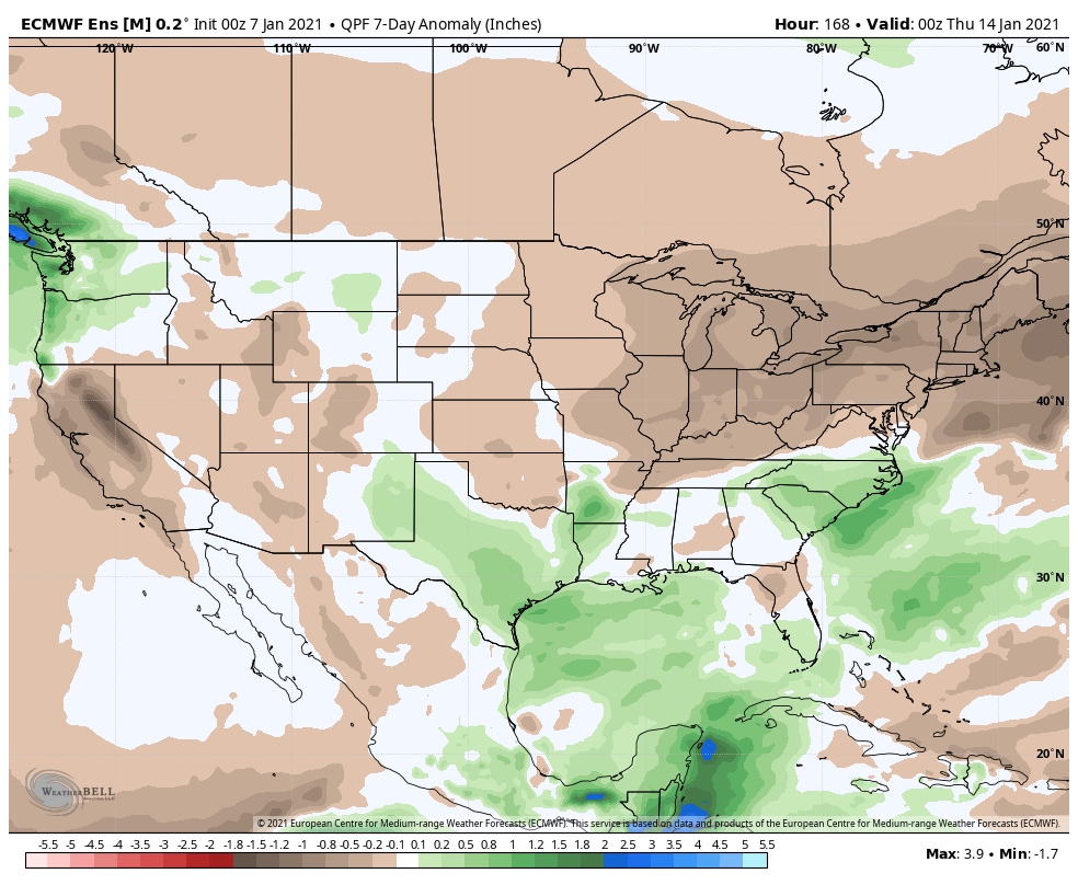
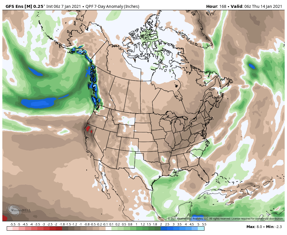
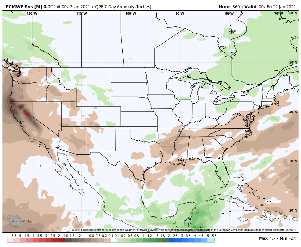
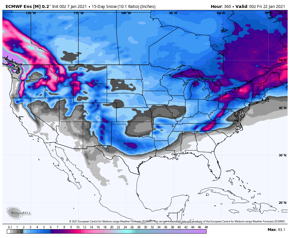
Snow should also begin to get laid down across more of the Mid West and Ohio Valley. This is a stout look from the latest European and GFS ensemble means over the next 2 weeks (our daily videos and short-term products will handle this):

Thereafter, the weekly products take the pattern in two different directions and confidence is much lower late month and to open February. If the MJO remains a non-factor, colder solutions should carry the day. On the other hand, if the MJO does, indeed, roll into Phase 3/4, warmer times should follow in the Weeks 3-4 period. Stay tuned.