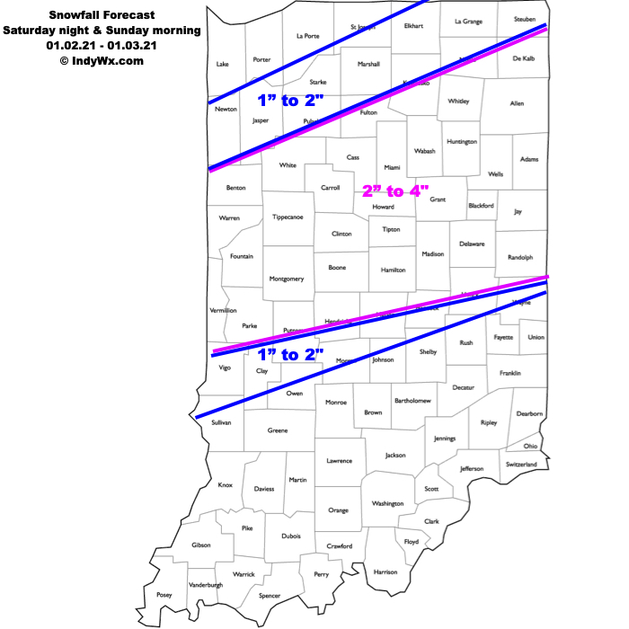
Type: Impactful wintry weather
What: Accumulating snow
When: 10p Saturday – 10a Sunday
Temperatures: Lower 30s
Wind: E shifting to the NW Sunday morning 5-15 MPH
Blowing/ Drifting: Minimal
Pavement Impacts: Plowing and salting will be required
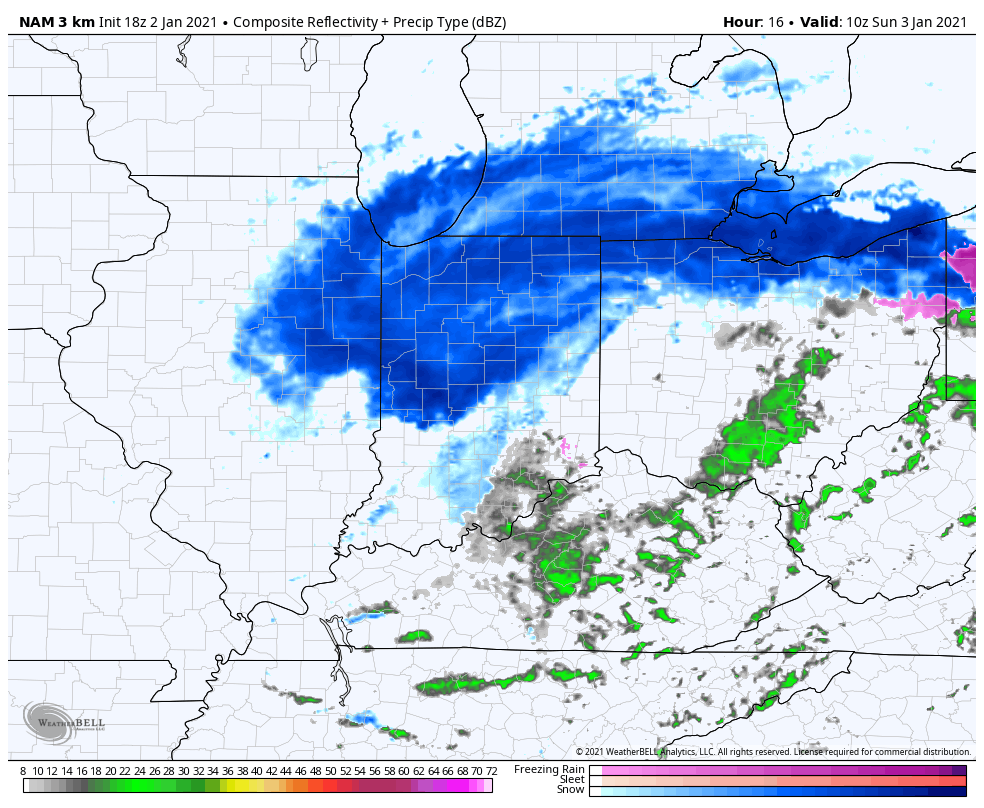
Summary: A cold core upper level disturbance will move directly over Indiana tonight and Sunday morning. After a dry period of weather through the daytime Saturday, a mix of rain and snow will overspread central IN by late evening. As the upper level disturbance moves overhead, the column of air should become just cold enough to allow the wintry mix to transition to all snow during the overnight. Embedded bands of moderate to heavy snow will develop early Sunday morning along and just north of the I-70 corridor. Today’s high resolution guidance has “honed in” on the heavier snow zone being located from Vermillion county northeast to Randolph county and points north. The system will pull east of the state Sunday afternoon, allowing the snow to come to an end through the morning (prior to dawn across western IN, shortly after sunrise immediate central, and mid-morning east-central).
Confidence: High