
Updated 01.27.21 @ 7:51a
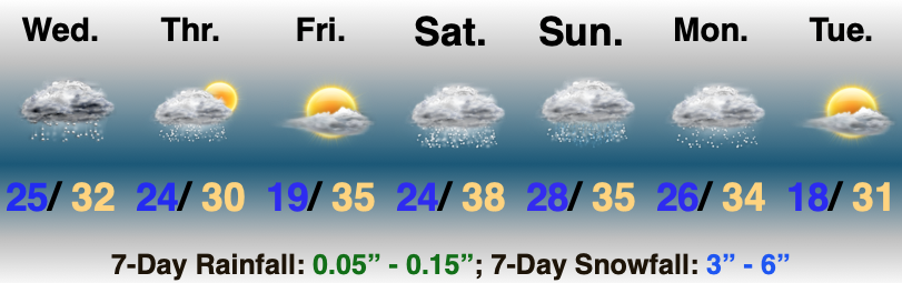
No Rest For The Weary…A fast moving area of low pressure will scoot east this afternoon and evening. This will spread a swath of light to moderate snow across the southern half of the state in the 1p (west) to midnight (exiting southeastern portions of the state) window. While still primarily a light event, models have “beefed up” snow amounts ever so slightly with this system over the past 24 hours. Our snowfall forecast for system #1 can be found below.

Colder air will pour in for all during the overnight and should be just enough to kick up some lake-generated scattered snow shower activity into Thursday morning.
Weak high pressure will then build in and supply a sunny close to the work week. You enjoy the sun and briefly quieter weather and let us worry about the weekend!
Speaking of the weekend, this is the period that continues to look increasingly likely to produce the most impactful winter storm of the season for our immediate area. We forecast early sun to quickly give way to a lowering and thickening cloud canopy Saturday (the sky will have the looks of a snow storm brewing by lunch for most). Precipitation will then overspread the region from southwest to northeast as we progress through the afternoon. The potential is there for a heavy wet snow thump Saturday PM before precipitation transitions to a wintry mix as low pressure scoot by just to our south. Before that transition, “several” inches of wet snow is looking increasingly likely. As colder air wraps back around into the region, wrap-around moisture will fall as light snow and snow showers into early next week.