
You’d be hard pressed to find one single day where there’s more interest and speculation on the weather than Christmas Day. Many (self included) dream of scenes like this every Christmas:

An arctic front will put many in the game (including deep into the South) for the opportunity of snow (or Christmas Eve snow) on the big day, itself. As energy rounds the base of a deepening trough, a wave of low pressure will develop along the pressing arctic boundary.

We expect the front to blow through our neck of the woods late Wednesday night and early Christmas Eve morning. A period of precipitation will likely accompany the front. We expect rain to develop Wednesday night before mixing with and changing to snow early Christmas Eve morning.
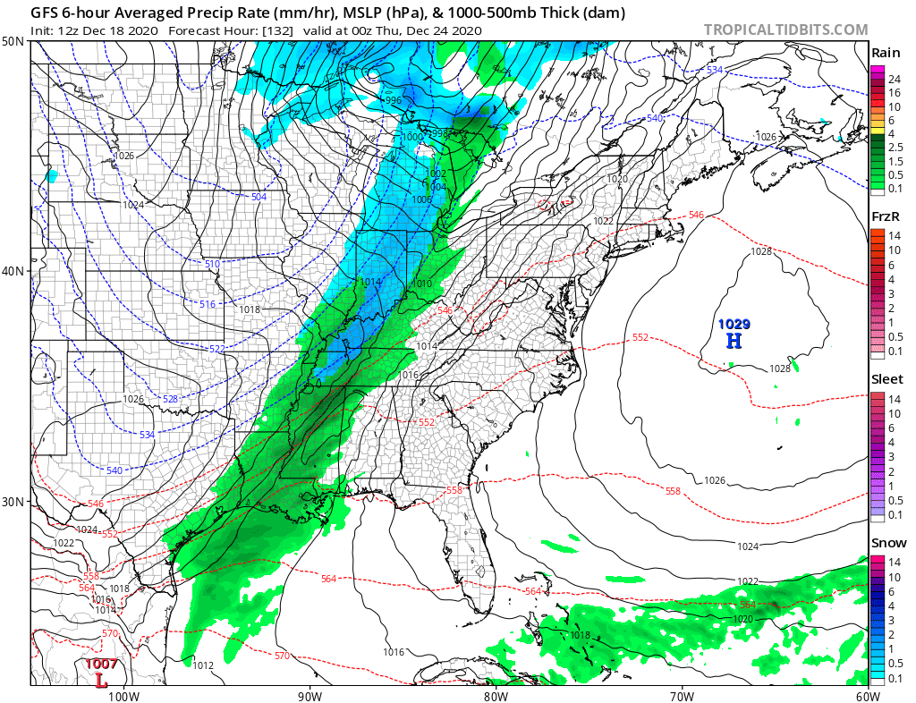
Heavier snow is anticipated across the interior portion of the Northeast down the spine of the Appalachians Christmas Eve into Christmas Day as the wave of low pressure becomes better organized. The pattern is simply too progressive to allow for a big event this far west.

Trailing upper level energy could spark scattered snow showers back this way, but we believe between the 2 opportunities for that magical Christmas snow, only minimal accumulations can be expected here across central Indiana (“ridiculously” early call is for a dusting to perhaps 2″ type event). Further northeast, lake effect snow will likely add up to several inches across the northeastern IN snow belts.
Bitterly cold, arctic, air will pour into the region Christmas Eve and Christmas Day along with gusty northwesterly winds. We still anticipate below zero wind chill values (0° to – 10° Christmas morning).
A blocky pattern looks to remain in place as we close the year and open up 2021. As such, active times will continue for the foreseeable future…
