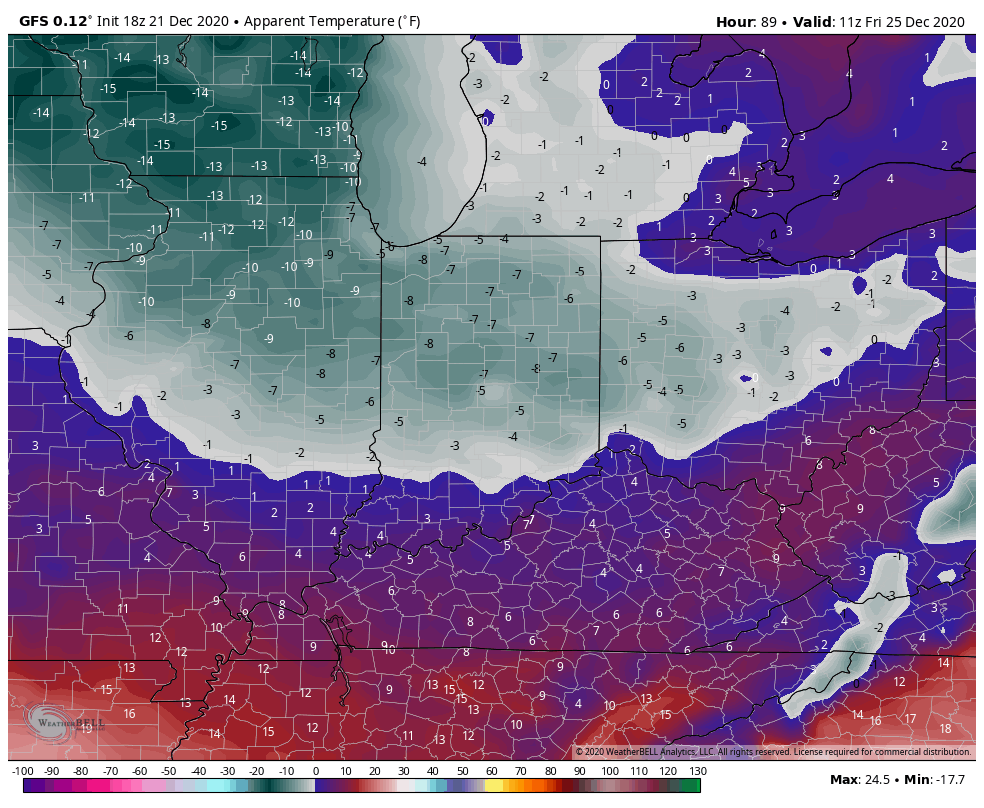
Before we touch on the post-Christmas period, I wanted to provide a quick update on the pre-Christmas arctic front. In short, we have no changes to our ongoing thoughts concerning this system.
The arctic front is still expected to arrive Wednesday night with showers that end as a “touch” of snow.

MUCH colder and windy conditions can be expected Christmas Eve with upper level energy teaming up with the pressing arctic airmass to help generate backlash snow showers and embedded squalls. These may deposit a dusting to less than 1″ for some, but others likely won’t see any accumulation. Winds will absolutely howl and combine with the falling temperatures to create bitter wind chill values Christmas Eve night into Christmas Day. We still anticipate wind chill values to fall into the 0° to 10° below zero range.

Highs Christmas Day will only top out in the lower 20s.
Then our attention will shift to the period Dec. 27th through Jan. 7th. During this time frame, I’m expecting at least a couple of storm systems to put us on the playing field for more meaningful wintry conditions.
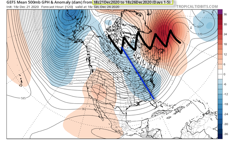
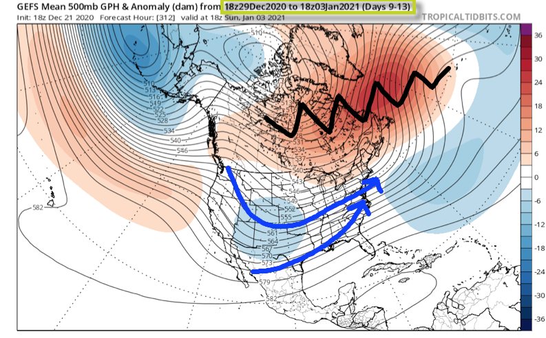
The teleconnections will finally align in a manner more conducive for interior and east coast wintry weather (remember, we’ve been “fighting” that positive EPO as of late). A byproduct of the negative AO and NAO is high latitude blocking. Unlike our Christmas storm (photo 1 below), the blocking matures in significant fashion during the aforementioned period and should force a more favorable storm track (photo 2 below).


Once to the medium to long range (Days 9-13), the once progressive pattern is no more. Instead, we should see much slower moving storm systems that try and cut into the Ohio Valley only to be forced south. This is the type pattern that can lead to a couple of back-to-back winter weather makers of various significance, including a wintry mix of precipitation across the greater OHV region- especially if only marginally cold air is available. The other item to keep an eye on is the likely trend that develops with the operational data over time. Don’t be surprised to suddenly see guidance trend south with the ‘mean’ storm track during the 12/27 through 1/7 time period as we get closer to real time. This is all a byproduct of the blockiness. Should we get into a situation where we have a couple of winter events lay down accumulating ice and snow then don’t be surprised if the data trends away from the “seasonal” look right now towards one colder as time draws closer.

As it is, this is still a pattern that looks more active/ stormy as opposed to overly cold. With that said, as much as we were against the idea of a big pre-Christmas storm, locally, we remain as bullish as ever on the last few days of December and to open January feeding those hungry for winter weather.
Stay tuned…
