Updated: 01.08.21 @ 8:12a Sunshine returns over the weekend. A shot of colder air (and perhaps snow) looms late next week…
You must be logged in to view this content. Click Here to become a member of IndyWX.com for full access. Already a member of IndyWx.com All-Access? Log-in here.
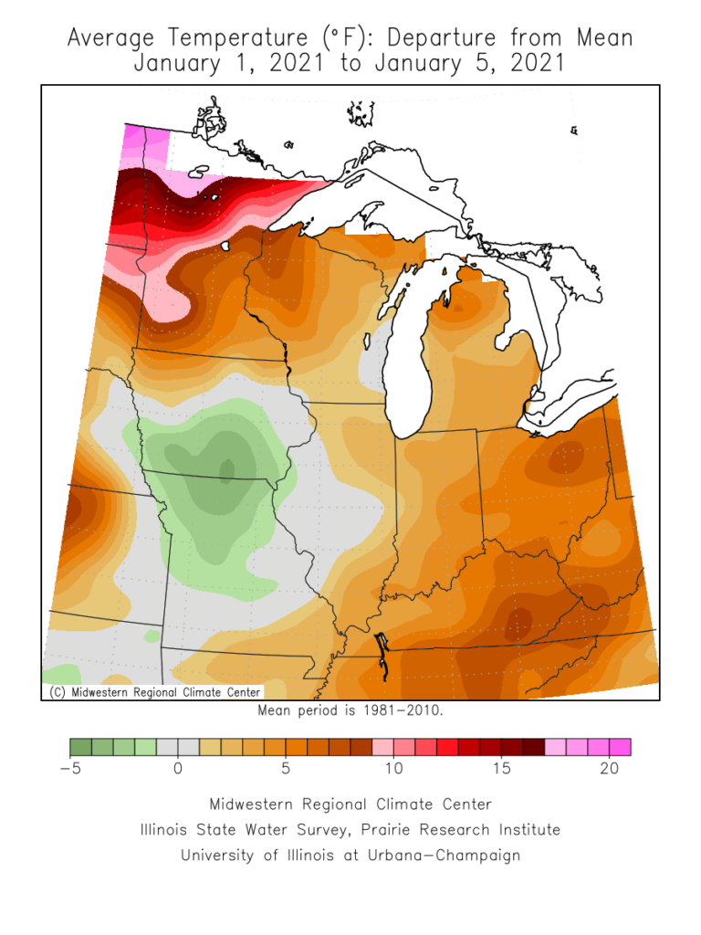
We’ve opened the month of January on a very warm note, compared to normal. Through the first (6) days of the month, temperatures are running 6.3° above average.
Well above average temperatures have dominated the northern tier into the eastern 1/3 of the country to open the month.
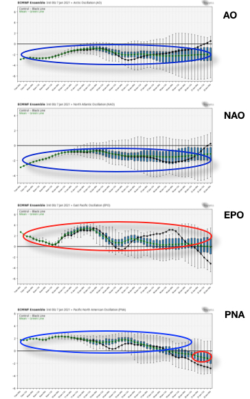
Looking ahead, the basis of the forecast over the next 3-4 weeks will be built on favorable teleconnection phases (for cold) with the AO, NAO, and PNA, while the predominantly positive EPO keeps any sort of sustained/ significant cold hard to come by. This is a pattern that can turn quite active (and we think it will), but one that still doesn’t appear as if it’ll grow overly cold- compared to normal.
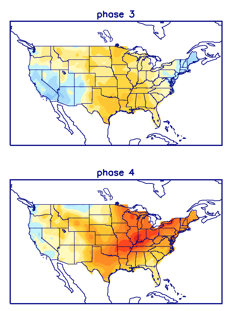
We continue to eye the MJO propagation. The latest European models keep things in the null phase, but the American products seemingly want to get things more amplified. For now we’re not biting, but if things did sneak into Phases 3-4 by late month, warmer times would follow.
Week 1
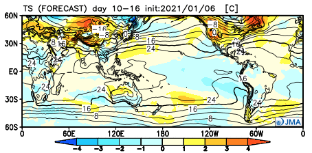
JMA Week 1- Upper air pattern
JMA Week 1- Temperature anomalies
JMA Week 1- Precipitation anomalies
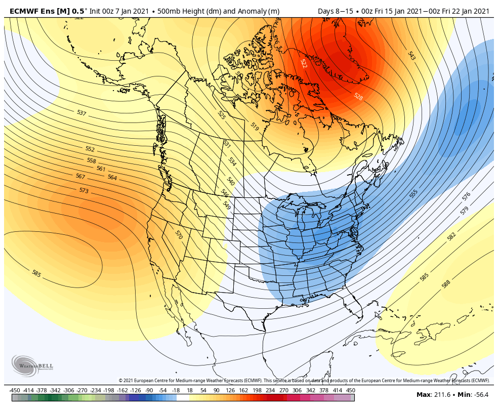
European Ensemble Week 1- Upper air pattern
European Ensemble Week 1- Temperature anomalies
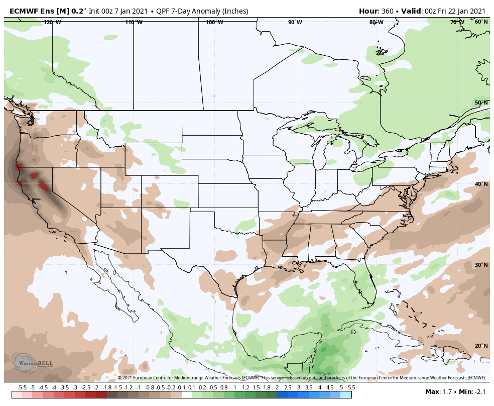
European Ensemble Week 1- Precipitation anomalies
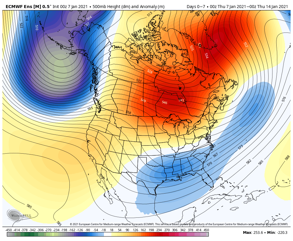
GFS Ensemble Week 1- Upper air pattern
GFS Ensemble Week 1- Temperature anomalies
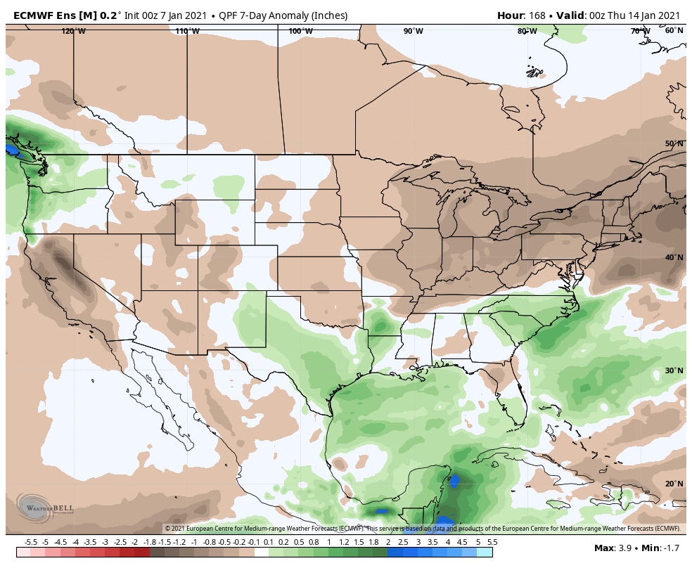
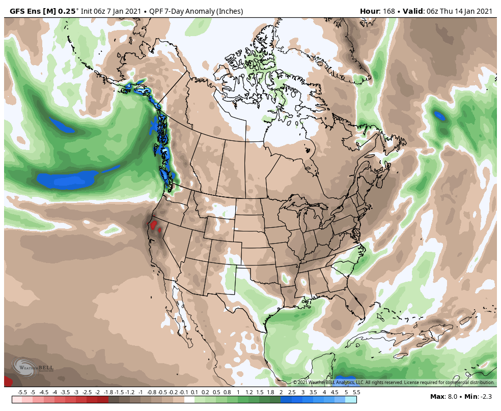
GFS Ensemble Week 1- Precipitation anomalies
Week 2
JMA Week 2- Upper air pattern
JMA Week 2- Temperature anomalies
JMA Week 2- Precipitation anomalies
European Ensemble Week 2- Upper air pattern
European Ensemble Week 2- Temperature anomalies
European Ensemble Week 2- Precipitation anomalies
GFS Ensemble Week 2- Upper air pattern
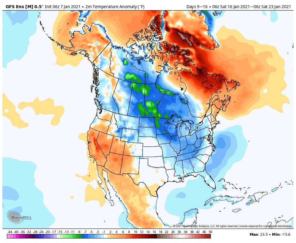
GFS Ensemble Week 2- Temperature anomalies
GFS Ensemble Week 2- Precipitation anomalies
Through the first couple of weeks, modeling is in about as good of agreement as you could expect. After a period of quiet weather (immediate term), the pattern should turn much more active next week and the week thereafter, locally. While I don’t think cold overwhelms the pattern as much as the GFS ensemble is showing, I would go with more of a blend between that and the warmer JMA/ European.
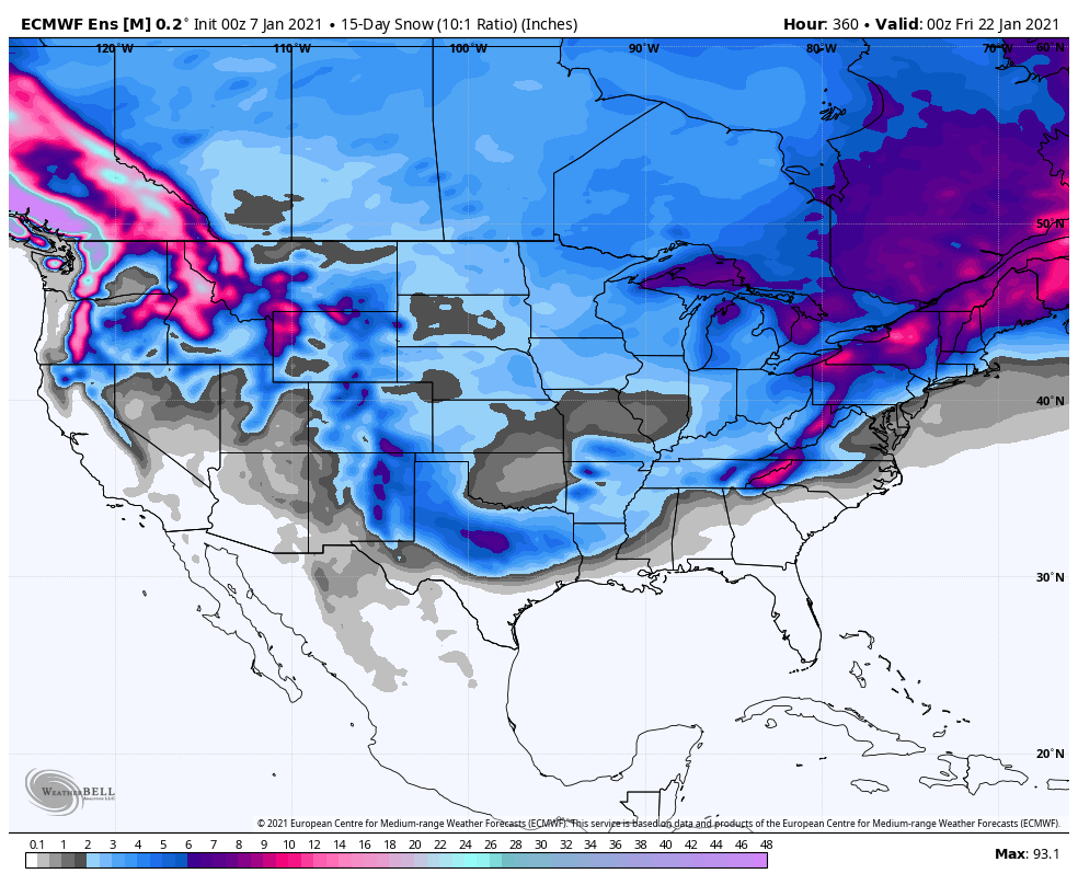
Snow should also begin to get laid down across more of the Mid West and Ohio Valley. This is a stout look from the latest European and GFS ensemble means over the next 2 weeks (our daily videos and short-term products will handle this):
Thereafter, the weekly products take the pattern in two different directions and confidence is much lower late month and to open February. If the MJO remains a non-factor, colder solutions should carry the day. On the other hand, if the MJO does, indeed, roll into Phase 3/4, warmer times should follow in the Weeks 3-4 period. Stay tuned.
MJO Phases 3-4 in January
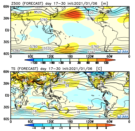
JMA Weeks 3-4- Upper air pattern (top); Temperature anomalies (bottom)
You must be logged in to view this content. Click Here to become a member of IndyWX.com for full access. Already a member of IndyWx.com All-Access? Log-in here.
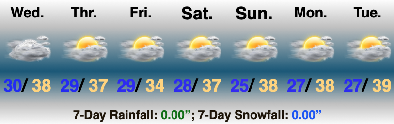
All The Excitement Is South (For Now)…We’ll be “sitting on the sideline” through the upcoming 7-day forecast period as we watch two or three storm systems track through the Deep South. The first of these storms will drop an accumulating snow event for Southern Appalachia Thursday evening and Friday. Meanwhile, we’ll remain quiet back here on the home front with mostly cloudy to cloudy skies. The only other item of note will be an increasingly stiff northeast breeze during this time period (gusts of 10 to 20 MPH).
“Dirty” high pressure will keep our region dry early next week. Despite the extended dry period, we still anticipate dealing with a good deal of cloudiness (hence the labeling). We’ll watch another storm system organize well to our south to open the new work week. Low pressure will move from the northwestern Gulf of Mexico northeast- once again laying down a nice swath of snow for our friends in Southern Appalachia (as well as deeper into the south this next go around).
We still believe things here will start to get busier by the 2nd half of next week…
Evening video update recapping the 12z model trends and the potential of a more active pattern by mid-month…
You must be logged in to view this content. Click Here to become a member of IndyWX.com for full access. Already a member of IndyWx.com All-Access? Log-in here.