
You must be logged in to view this content. Click Here to become a member of IndyWX.com for full access. Already a member of IndyWx.com All-Access? Log-in here.
October 2019 archive
Permanent link to this article: https://indywx.com/video-weather-more-of-a-trick-vs-treat-this-halloween-cold-open-to-november/
Oct 27
Harvest ’19: Tracking Another Significant Storm This Week…
*Starting November 1st, our weekly agriculture and harvest updates will transition to weekly winter storm outlooks. We’ll maintain a lot of the feedback y’all have provided with the new weekly winter products. Come next growing season, the weekly agriculture and severe weather updates will return.
Forecast Period: 10.27.19 through 11.03.19
7-Day Precipitation: Average average precipitation is expected through the period.

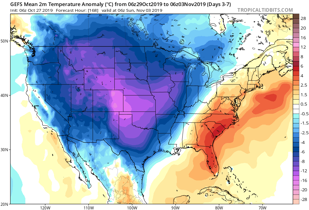
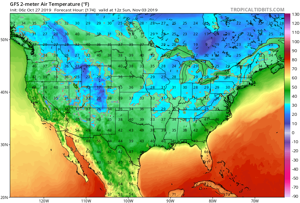
7-Day Temperatures: Once the forecast period is said and done, below average temperatures can be expected, overall.
Severe Weather: Organized severe weather isn’t expected during the period.
Frost/ Freeze: The first frost and freeze of the fall season will likely take place next weekend across portions of the Deep South.
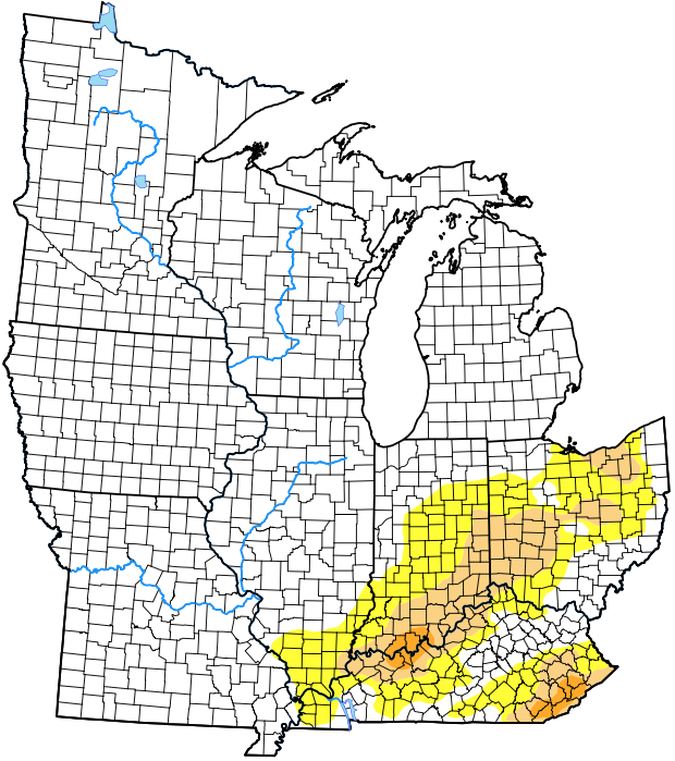
Drought Monitor: The latest drought monitor (taken before Friday and Saturday’s rain) shows abnormally dry/ drought conditions in place across southern IN into central OH. Thankfully, a long-term drought isn’t expected here. The pattern not only at present, but throughout the upcoming winter will feature plentiful precipitation, erasing any of the abnormally dry conditions that are currently in place.

Summary: We’re monitoring a couple of storm systems this week. The first system will scoot by to our northwest with a band of rain and snow from KS, IA, and into IL and WI during the early part of the work week. A second, stronger system will impact the region Wednesday into Friday. Another wind-driven rain will be the result, locally, Wednesday into Thursday before sharply colder air arrives to close the work week. The air will grow cold enough to support the potential of flurries or scattered snow showers late Thursday night into Friday. The first official freeze of the season is likely next weekend. Upcoming 7-day rainfall totals are expected to fall in the 0.75″ to 1.25″ range for most of immediate central Indiana.
Permanent link to this article: https://indywx.com/harvest-19-tracking-another-significant-storm-this-week/
Oct 26
VIDEO: Wet, Windy Saturday; Looking Ahead To Halloween And The Colder Pattern That Awaits…
You must be logged in to view this content. Click Here to become a member of IndyWX.com for full access. Already a member of IndyWx.com All-Access? Log-in here.
Permanent link to this article: https://indywx.com/video-wet-windy-saturday-looking-ahead-to-halloween-and-the-colder-pattern-that-awaits/
Oct 25
VIDEO: Busy Time Of Things In The Good Ole Forecast Office…
You must be logged in to view this content. Click Here to become a member of IndyWX.com for full access. Already a member of IndyWx.com All-Access? Log-in here.
Permanent link to this article: https://indywx.com/video-busy-time-of-things-in-the-good-ole-forecast-office/
Oct 25
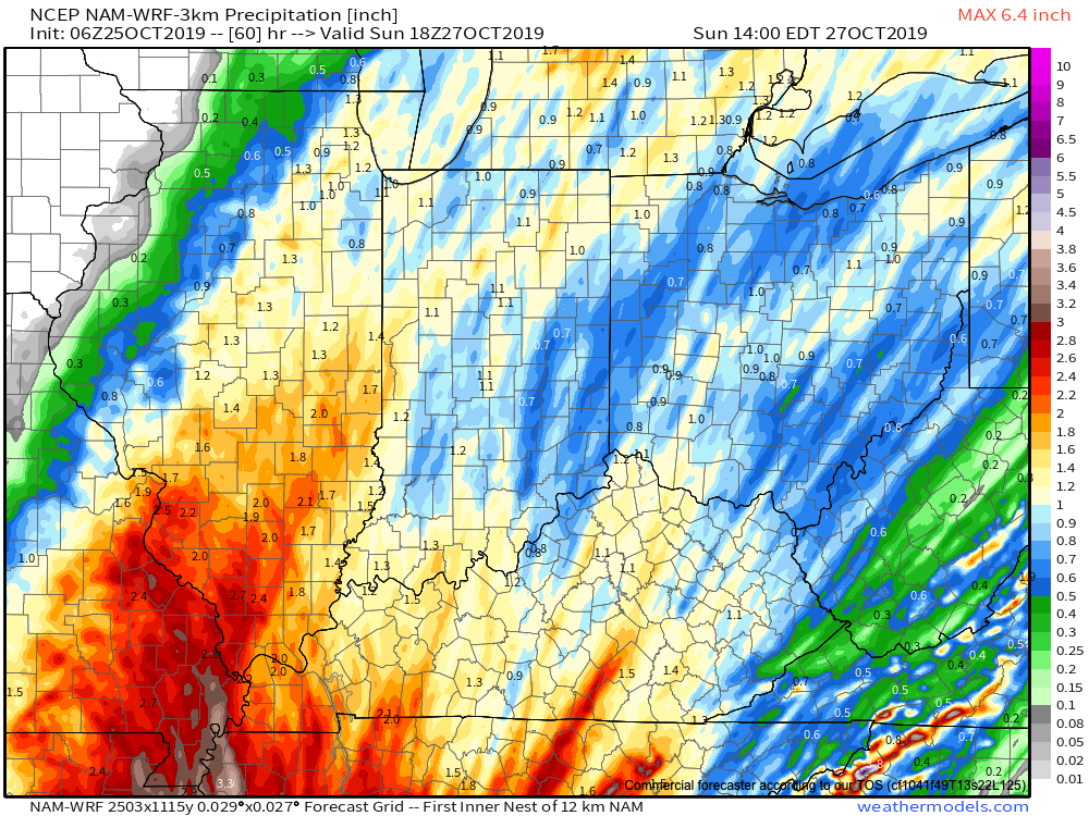
Client Brief: Updates On The Latest With Saturday’s Rain/ Wind…
Type: Heavy Rain & Strong Wind
What: Heavy rain and gusty winds
When: Saturday
Rain Amounts: 1″ to 2″
Wind: Variable 15-30 MPH with gusts to 45 MPH
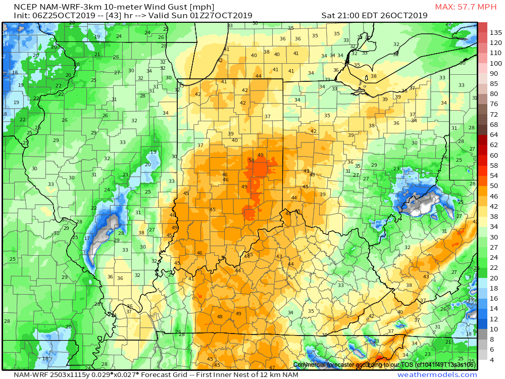
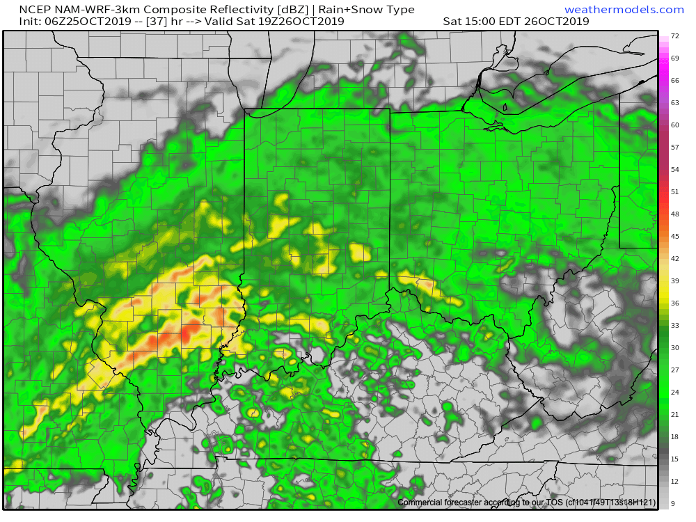
It continues to look like a significant rain and wind maker wants to take up residence across the Ohio Valley this weekend. Focusing more specific to central Indiana, Saturday is the day for the biggest impacts. A rather expansive rain shield will lift north across the state late tonight into Saturday morning, becoming heavy at times during the day Saturday. The other item to focus on is the wind. East winds will become strong and gusty during the day Saturday before shifting to the southeast, south, and eventually southwest as the area of low pressure moves very close to overhead. During this timeframe, winds may gust to 45 MPH Saturday night. Once the area of low pressure moves to our northeast, winds will shift around to the west Sunday morning and diminish. Overall, storm total rainfall amounts across central Indiana continue to look like they will check-in between 1″ and 1.5″ for most with a few locally heavier reports. The last of the rain will exit to the northeast before sunrise Sunday.
Permanent link to this article: https://indywx.com/client-brief-updates-on-the-latest-with-saturdays-rain-wind/