
Forecast Period: 10.06.19 through 10.13.19
7-Day Precipitation: Average precipitation is expected through the period.

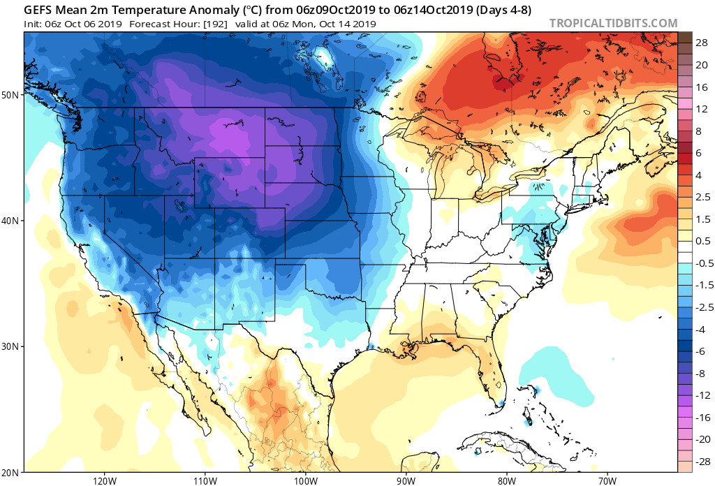
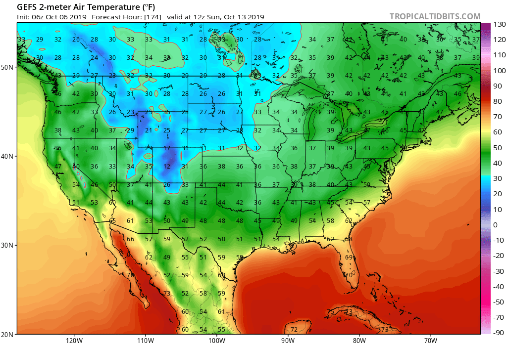
7-Day Temperatures: Between some wide swings in the temperature department over the upcoming week, things should “balance out” right around seasonal norms when all is said and done.
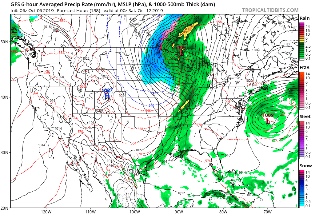
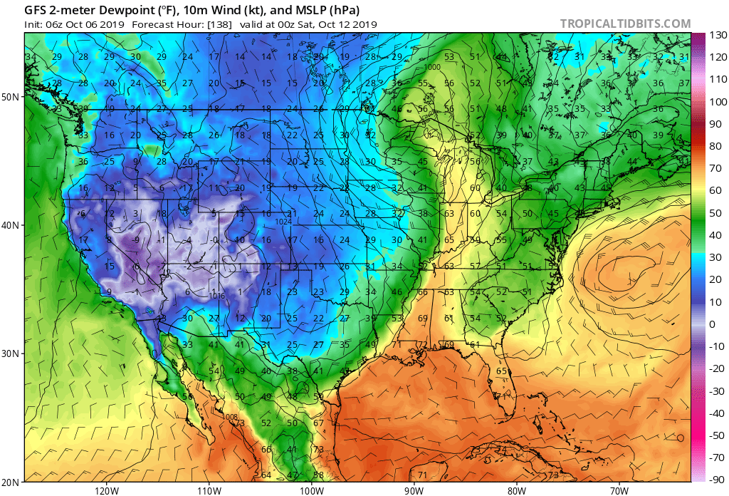
Severe Weather: We’ll continue to monitor the possibility of a few strong storms Thursday evening into Friday as a potent cold front pushes across the region. A strong southerly flow will help to briefly pull a warmer and moist air mass north across the Ohio Valley and southern Great Lakes and could be sufficient enough to promote strong-severe storms directly ahead of the boundary. We’ll have to fine tune timing in the days ahead, but target the period between late Thursday and Friday afternoon for now.
Frost/ Freeze: A killing freeze will put an end to the growing season across the Plains by late week and the season’s first frost will likely occur for many across the central and northern Ohio Valley next weekend.
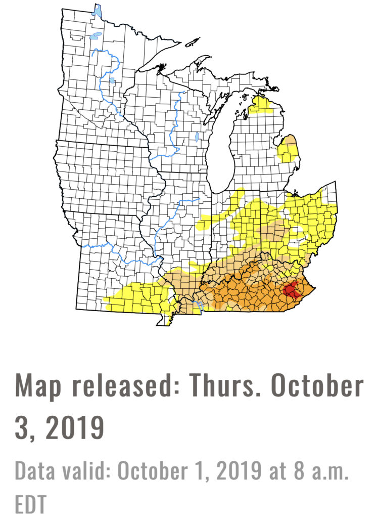
Drought Monitor: Abnormally dry areas are still present across portions of east-central IN into Ohio with more widespread droughty areas across KY. Today’s weather system into early Monday will help our friends across southern IN and KY pick up beneficial rainfall.
Summary: A cold front will move through the area today into Monday morning with needed moisture, especially across southern areas of the viewing area. Cooler, drier air will settle into the state as we move through the early portion of the work week before things turn potentially stormy late week ahead of the next strong cold front. The coolest air so far this autumn season will arrive next weekend, including the potential of the first frost for some…