
*Starting November 1st, our weekly agriculture and harvest updates will transition to weekly winter storm outlooks. We’ll maintain a lot of the feedback y’all have provided with the new weekly winter products. Come next growing season, the weekly agriculture and severe weather updates will return.
Forecast Period: 10.20.19 through 10.27.19
7-Day Precipitation: Average to slightly above average precipitation is expected through the period.

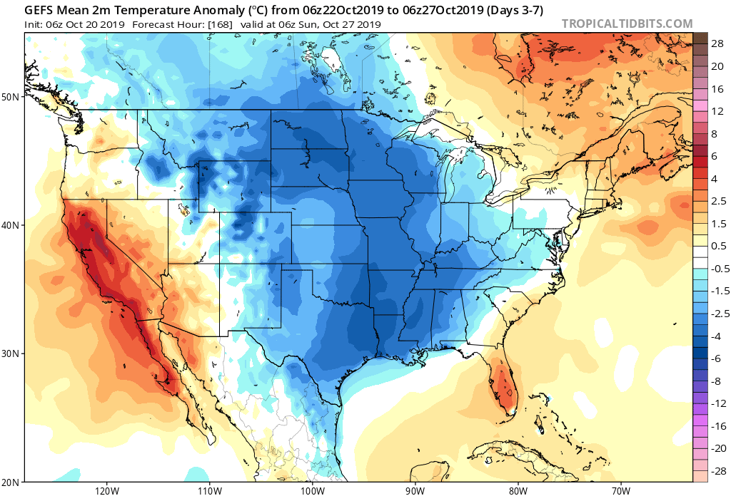
7-Day Temperatures: Below average temperatures are expected through the period.
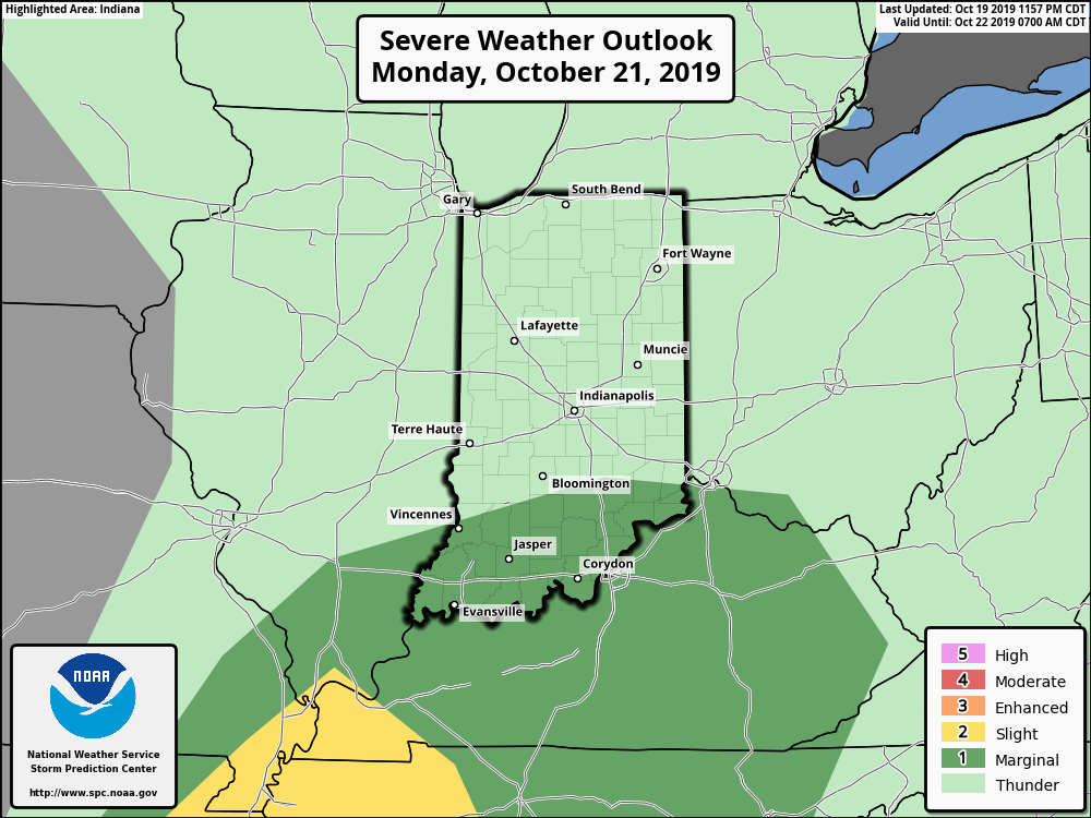
Severe Weather: We’re monitoring the potential of a few strong to severe thunderstorms- mostly across southern portions of the state Monday afternoon and evening. The biggest concern has to do with the potential of damaging straight line winds with embedded cells that form directly ahead of the cold front tomorrow evening.

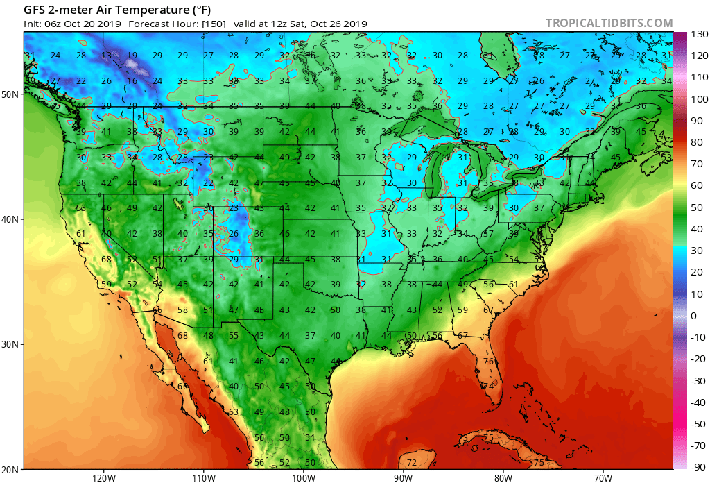
Frost/ Freeze: While most of the immediate region has already dealt with multiple hard frosts, frost and freeze conditions will expand south over the upcoming week. The coldest morning, overall, appears to be Saturday with the potential of a freeze extending south into the Ozarks and northern TN Valley.
Drought Monitor: The southern and eastern portion of the region remains in abnormally dry or drought conditions. The pattern ahead longer term does look favorable to erase a lot, if not all, of these dry/ droughty areas before the end of the year.


Summary: The upcoming 7-day period will feature two primary storm systems. The first arrives Monday with showers and thunderstorms. We’ll continue to monitor the potential of strong-severe storms across southern portions of Indiana tomorrow PM and update accordingly later this evening. The second system will be a colder feature and thunderstorms aren’t anticipated with Friday’s storm system. The pattern still seems poised to produce the coldest air so far this season just beyond the forecast period. Overall, upcoming 7-day rainfall totals are expected to range between 0.50″ and 0.75″ for most of immediate central Indiana.