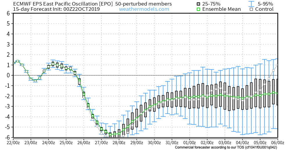
As we look ahead to Halloween, the pattern continues to look mighty “interesting” to say the least. A deeply negative EPO (East Pacific Oscillation) will take the drivers seat and potentially lead to some early wintry “fun and games” as we close out the month and head into early November.

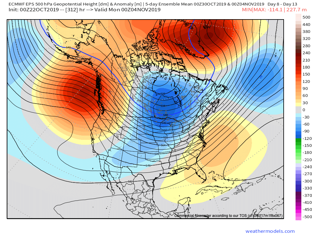
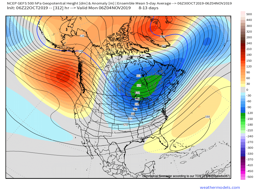
Ensemble data, centered on Halloween, is in excellent agreement with respect to the overall upper air pattern. That said there are subtle differences in the handling of the southeast ridge.


These seemingly subtle differences at 500mb can mean a world of difference in terms of the resulting weather we deal with here at the surface.
We’re confident there will be a rather significant weather event on or around Halloween, but caution we’re far from being able to provide details around the specifics. The early thinking is that a storm system provides a round of showers and thunderstorms just before the holiday with sharply colder conditions pouring into the area on Halloween, itself, with the threat of the first lake effect snow outbreak of the year heading into next weekend. Stay tuned. Run-to-run differences within the operational suites will be significant in the days ahead. It’s far too early to latch on to any one particular solution.
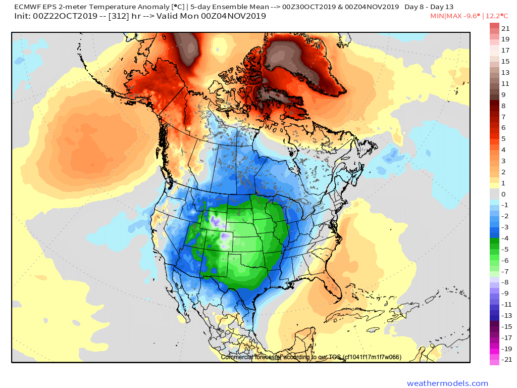
Regardless, with high latitude blocking in place, a colder than average period of weather is likely as we move through early November. The brunt of the cold, relative to normal, should be featured across the central Plains.


More on the longer range November pattern in the days ahead. Our official November Outlook will be posted over the weekend.
