
You must be logged in to view this content. Click Here to become a member of IndyWX.com for full access. Already a member of IndyWx.com All-Access? Log-in here.
November 2019 archive
Permanent link to this article: https://indywx.com/video-busy-pattern-time-to-batten-down-the-hatches-tuesday-nt-wednesday-morning/
Nov 23
VIDEO: Thanksgiving Week Keeps Us Busy…
You must be logged in to view this content. Click Here to become a member of IndyWX.com for full access. Already a member of IndyWx.com All-Access? Log-in here.
Permanent link to this article: https://indywx.com/video-thanksgiving-week-keeps-us-busy/
Nov 23
Client Brief: Wet Snow Develops This Afternoon Into The Evening…
Type: Impactful Winter Weather

What: Accumulating wet snow
When: This afternoon into early evening
Temperatures: Falling from the upper 30s early afternoon to around 30° by late evening.
Wind: North 20-25 MPH
Blowing/ Drifting: Non-existent to minimal
Pavement Impacts: Salting required. Plowing will also likely be needed across east-central Indiana.
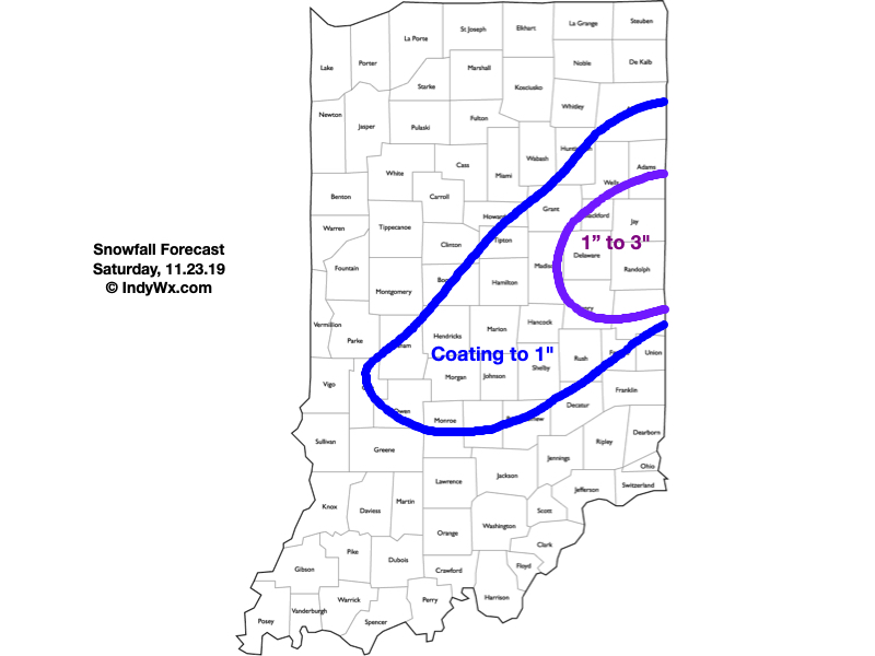
There’s an old saying in the weather business of an “upper low being a weatherman’s foe.” That’s particularly true early and late in the season due to the added complexities of marginally cold air typically available. As we discussed over the past week, the dynamics and cold air these type of systems can manufacture also creates added headache. Many instances these kind of systems result in essentially a “now cast” scenario. With all of that said, our confidence is increasing after another look at overnight model runs to put out the snowfall forecast above. Rain will overspread central Indiana late morning into the early afternoon, however, as the precipitation rates increase, we’ll notice a transition to wet snow this afternoon into the evening. There could also be a brief wintry mix, including sleet, during the transition to wet snow. Banding features will likely develop late afternoon into early evening leading to heavier snowfall across east-central parts of the state where we have the 1″ to 3″ snowfall forecast up. For the remainder of central Indiana, most should be closer to a coating with a few 1″ reports. The snow will exit even far eastern areas before midnight.
Confidence: Medium
Next Update: This afternoon
Permanent link to this article: https://indywx.com/client-brief-wet-snow-develops-this-afternoon-into-the-evening/
Nov 22
VIDEO: Latest Details On Saturday; Reviewing Thanksgiving Week Weather…
You must be logged in to view this content. Click Here to become a member of IndyWX.com for full access. Already a member of IndyWx.com All-Access? Log-in here.
Permanent link to this article: https://indywx.com/video-latest-details-on-saturday-reviewing-thanksgiving-week-weather/
Nov 21
Note On Saturday’s Snow Threat…
Boy, this snow season has gotten off to a rollicking start. It’s been a while since we’ve had to deal with multiple legitimate winter threats prior to Thanksgiving, but that’s the case this year. (December is also looking quite active from a wintry precipitation perspective).
As for Saturday’s event, confidence is too low to issue an initial snow “zone” map. The overall idea remains here that the best shot of accumulating wet snow will likely fall from north-central parts of the state into the northern half of Ohio, but the nature of the event will likely result in some “haves and have nots.”
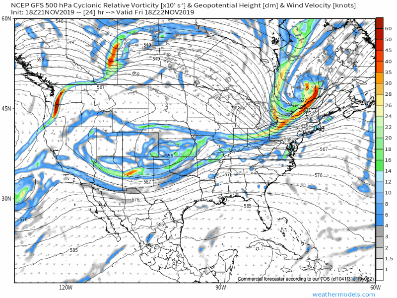
Note the upper low is poised to track along the I-70 corridor, per this evening’s GFS model run. This looks reasonable to us.
With only marginally cold air in place, this is the kind of setup that can help manufacture air cold enough to result in a “thump” of wet snow for portions of the region- especially if heavier precipitation rates are involved. This is also the kind of event that would likely lead to banding features as opposed to a more “uniform” snow shield (hence the “have and have nots” that will likely occur).
At the end of the day, an accumulating wet snow event is most certainly still on the table for portions of central Indiana, but we need to factor in a couple of additional model runs before publishing our initial snow zone map.
More overnight or early Friday morning…
Permanent link to this article: https://indywx.com/note-on-saturdays-snow-threat/