
Our Friday is starting off with heavy rain and embedded thunder across western portions of the state.
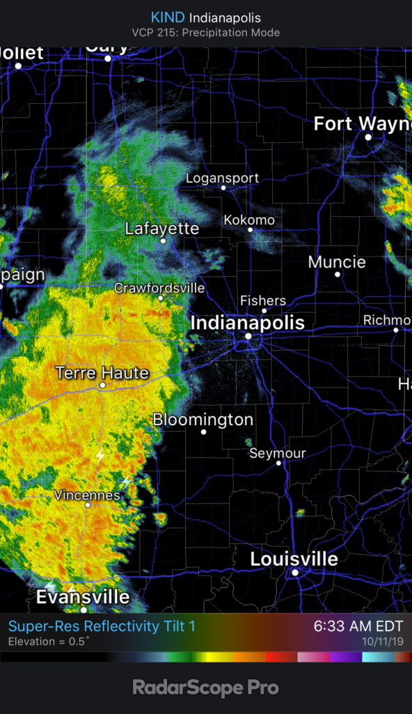
It’ll still be a while before central Indiana gets in on the more concentrated, widespread rain. We think this arrives later this afternoon into the early evening hours. Most can expect to pick up between 0.20” and 0.40” across central parts of the state, but there will be a few locally heavier totals.

Before the rain arrives, a strong southerly wind ahead of the front will send temperatures to around 70°. Meanwhile, note temperatures at the same time already into the 40s across eastern IL.
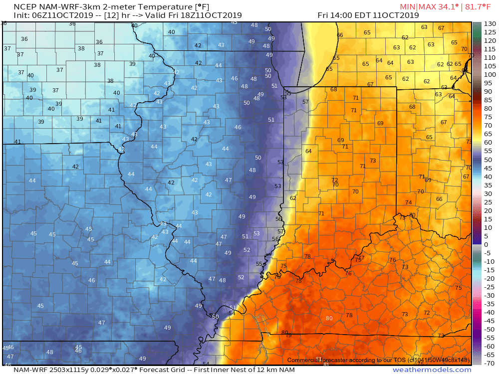
The temperature crash will continue through the evening hours advancing east. By 7p, temperatures in and around Indianapolis and points west will be in the 40s. A gusty wind will result in “feels like” temperatures into the 30s.

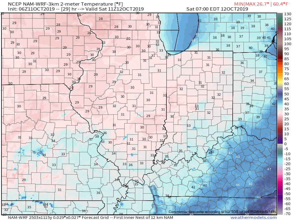
The first freeze of the season is expected Saturday morning for many across central Indiana into western and northern portions of the state. We anticipate wind chill values to fall into the middle 20s.
Another reinforcing shot of chilly air is dialed up next week. More on this and other items a bit later…