You must be logged in to view this content. Click Here to become a member of IndyWX.com for full access. Already a member of IndyWx.com All-Access? Log-in here.
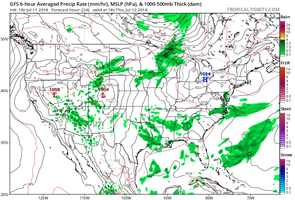
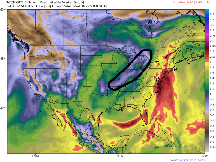
I. Drier air will work into the region and limit rain chances today and Wednesday (isolated coverage at best). Highs will also warm back up to seasonal levels during the time.
Drier air will work into the Ohio Valley today and Wednesday. Image courtesy of weathermodels.com.
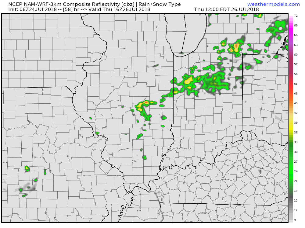
II. Our next frontal boundary will arrive Thursday afternoon. Scattered showers and a few thunderstorms are expected ahead of the front during the afternoon and evening hours. Behind the boundary, cooler and refreshing air will return to wrap up the work week.
Cooler, more refreshing air will return to wrap up the work week. Image courtesy of weathermodels.com.
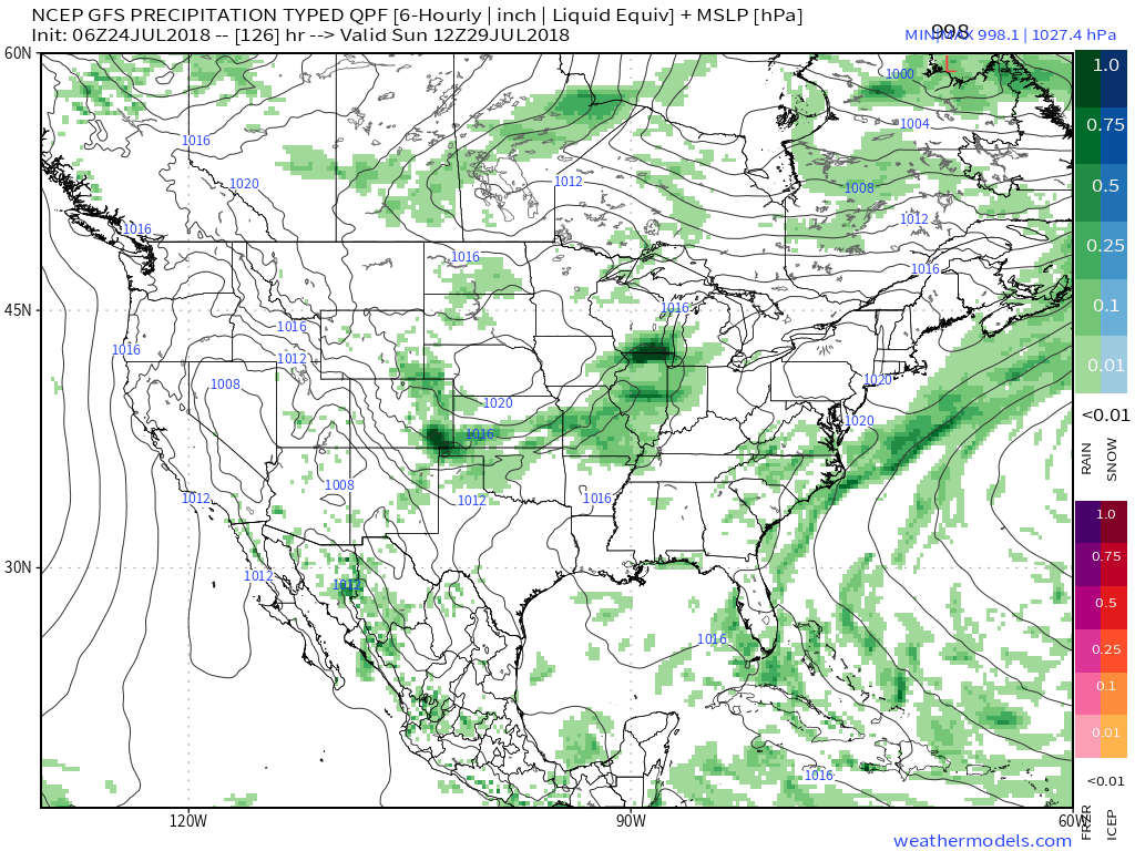
III. We’re timing out our next storm system for a weekend arrival. While the weekend won’t be a wash out, rain chances will return late Saturday into Sunday. Forecast models differ on the specifics with respect to timing, track, and rainfall amounts and all will have to be fine tuned over the next few days.
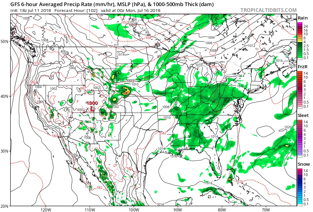
The GFS is faster and more aggressive on weekend rain. Image courtesy of weathermodels.com.Meanwhile, the European is slower with rain, bringing the bulk of precipitation in AFTER the weekend. Image courtesy of weathermodels.com.
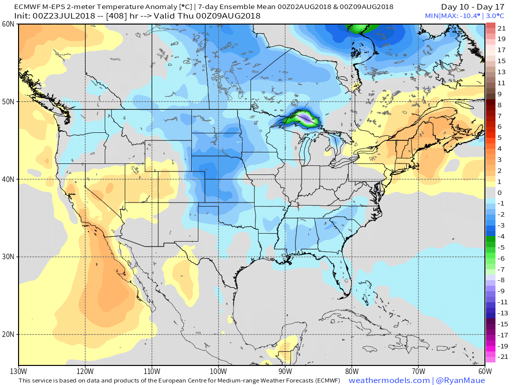
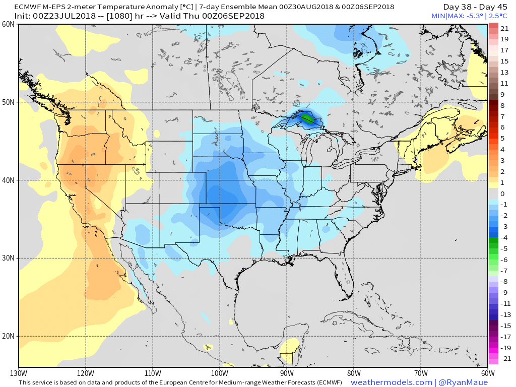
IV. Longer range, we don’t see any significant heat on the immediate horizon. On that note, while we aren’t saying additional hot days won’t occur the rest of the way in, we continue to believe the hottest weather of the summer is behind us. The new European Weeklies in last night continued a seasonal to cooler than average theme for August into early September. All images below are courtesy of weathermodels.com.
Days 10-17Days 18-25Days 25-32Days 32-39Days 38-45
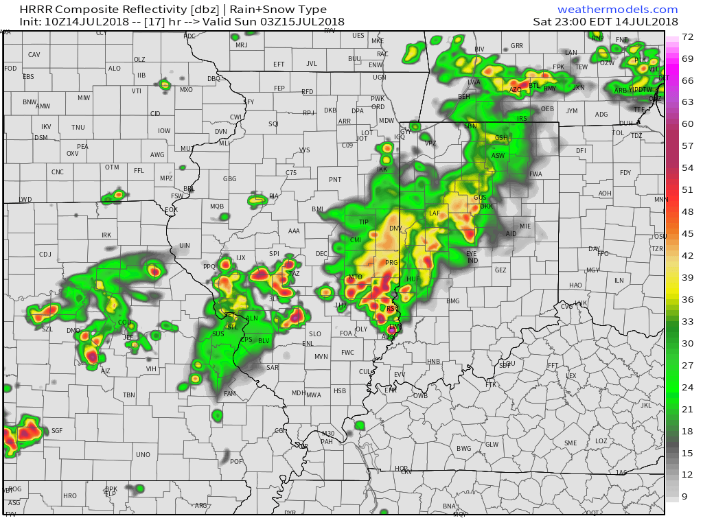
It was a tale of two worlds across the state on Friday. Despite a couple of non-severe, gusty showers that impacted western portions of the state Friday evening, the majority of the “excitement” took place in the eastern half of the state. Multiple large hail, wind, and tornado reports were included along with heavy rain. When we look at storm total rainfall through 8a today, we note widespread 2″ to 3″ amounts across eastern Indiana. Muncie recorded amounts in excess of 3″!
As we look ahead, our weekend weather will continue to be dominated by a “cut off” area of low pressure. As it meanders around the region, shower and thunderstorm chances will remain. Aerial coverage of rain will reach greatest heights during the afternoon and evening hours today and Sunday. With the colder air aloft, don’t be surprised if a few of the stronger showers produce hail.
Additionally, highs today will run close to 10° below the average high of the mid-80s.
As we open up the new week, showers and embedded thunder will also be around Sunday before the upper low begins to lose it’s influence on the region. We’ll maintain shower chances into the new work week, but overall coverage should be diminished Monday.
Shower and embedded thunder chances remain Sunday. Image courtesy of weathermodels.com.
A couple of cold fronts will make a run at the Ohio Valley over the upcoming week. The first will pass through during the midweek stretch, followed by a stronger frontal passage as we get ready to head into the weekend. Each front will provide a shower/ thunderstorm threat. A stronger push of pleasantly refreshing air should arrive behind front number 2 as we head into next weekend.
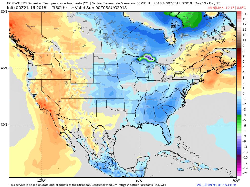
On the temperature note, models continue to show a cooler than average pattern as we open August.
Longer term, the NEW JMA Weeklies suggest the worst of the summer heat is now behind us as they keeps the Weeks 3-4 time period unseasonably refreshing…
Our Saturday morning is dawning with pleasant conditions- filtered sunshine and temperatures in the mid and upper 60s for most. We’ll notice a couple of items today: 1.) increasing humidity as the day progresses and 2.) increasing storm chances later this evening. While most of the daytime hours should remain dry across central Indiana, that begins to change tonight. A cold front lies off to our northwest this morning and this front will slowly push southeast between now and Monday, passing the region Monday evening. Until the front passes, a more unsettled pattern can be expected. While it won’t storm the entire time over the next (3) days, a couple of rounds of hefty shower and thunderstorm activity can be expected. With a tropical air mass in place (PWATs flirting with 2″), locally heavy rain will accompany the storms.
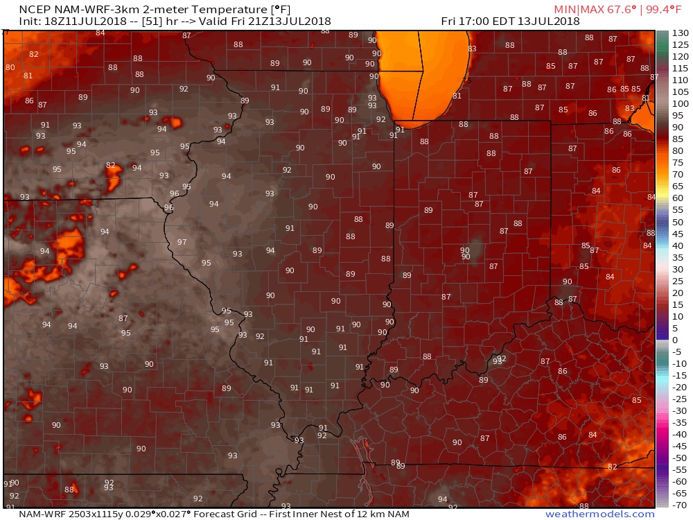
The big story through the daytime today will be the heat. Most central Indiana neighborhoods will top out in the lower to middle 90s with heat indices approaching 105° at times. Take the heat seriously this afternoon and evening and ensure you have means to take frequent breaks if planning any time outdoors.
We’ll notice thunderstorms becoming more numerous for our friends in Illinois through the afternoon and evening, but central Indiana should remain mostly dry until tonight. Forecast radar products want to bring these storms into the state after the 7p to 8p time frame. We’ll keep close tabs on radar trends this afternoon.
(Again, with high moisture content, any thunderstorm that passes through your neighborhood will be capable of producing torrential rainfall). For that matter, the same story can be said with storms that develop Sunday and Monday, as precipitable water values will remain around 2″ until the front sweeps through the state.
A “juicy” air mass will help fuel locally heavy rain through early week.
Finally, the aforementioned cold front will sweep the state Monday evening. This will put an end to rain chances through midweek and allow for a refreshing air mass to blow into the region. How do highs in the upper 70s to lower 80s sound with low humidity? Overnight lows will be allowed to fall into the 50s during this time frame.
Overall, dry conditions should prevail until late next weekend when a secondary, even stronger, front will make a run at the region. We’ll ramp storm chances back up ahead of this expected front and the air mass behind the boundary in the Week 2 time period will be even cooler than we we’ll enjoy the middle part of the upcoming week.
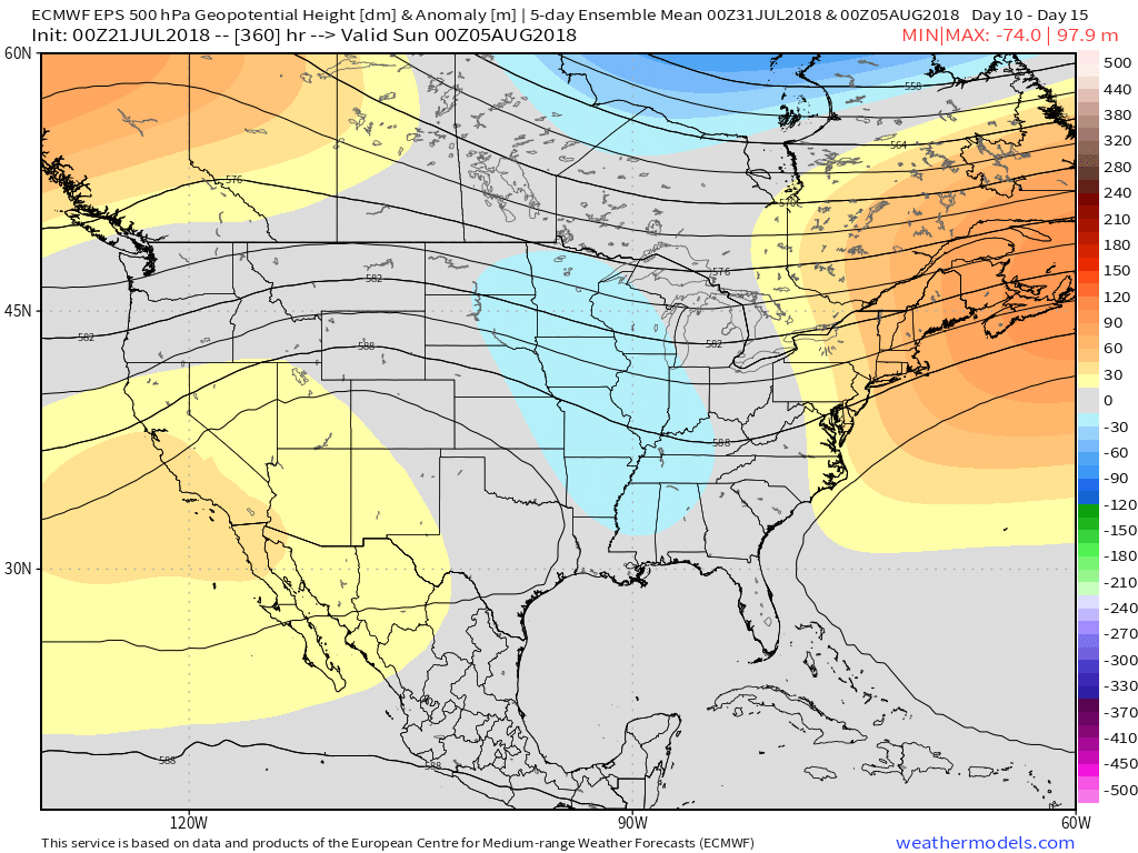
Speaking of cool, the pattern continues to look vastly different as we put a wrap on the month than what we’ve grown accustomed to over the past couple of weeks. Note the dominant trough the models show setting up shop over the Mid West…
I. High pressure will remain in control of our weather as we wrap up the work week providing dry conditions. Expect another day of low humidity Thursday before a tropical air mass returns.
II. Heat and humidity will return to oppressive levels this weekend. Highs will top out in the lower 90s Friday and will be the start of a few days of highs in the lower to middle 90s and lows in the lower 70s through the weekend. Heat indices will go north of 100° at times this weekend.
III. A more unsettled regime will develop as we rumble into Sunday and Monday with increasing shower and thunderstorm chances. As cooler air begins to fight into the heat and humidity, a few heavy storms and locally heavy rain will result early next week before the front passes Tuesday. Widespread 0.50″ to 1″ rainfall should be expected during this time with localized heavier totals.
IV. A secondary cold front will approach the following weekend with another push of more significant cool air, along with widespread rain and storm chances.
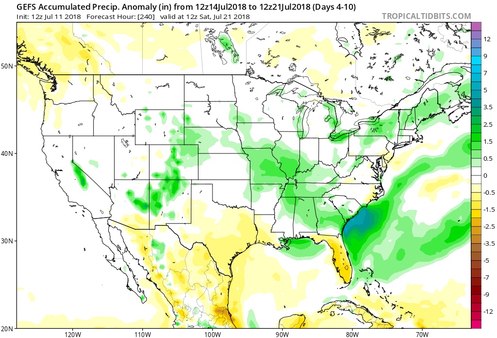
As a whole, the last 10 days, or so, of the month look to run cooler than average and the transition to cool will come with beneficial rainfall…
V. Looking even longer term, we continue to believe that after this weekend the worst of the summer heat will be behind us. That’s not to say additional hot days won’t resurface at times in August (it is August, after all), but the pattern, as a whole, doesn’t seem to support the duration of significant heat that the first half of July has offered.
Attention here is squarely on what the upcoming fall and winter will deal central Indiana…


 As we look ahead, our weekend weather will continue to be dominated by a “cut off” area of low pressure. As it meanders around the region, shower and thunderstorm chances will remain. Aerial coverage of rain will reach greatest heights during the afternoon and evening hours today and Sunday. With the colder air aloft, don’t be surprised if a few of the stronger showers produce hail.
 Additionally, highs today will run close to 10° below the average high of the mid-80s.
 Longer term, the NEW JMA Weeklies suggest the worst of the summer heat is now behind us as they keeps the Weeks 3-4 time period unseasonably refreshing…
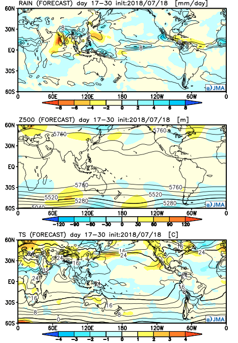
 We’ll notice thunderstorms becoming more numerous for our friends in Illinois through the afternoon and evening, but central Indiana should remain mostly dry until tonight. Forecast radar products want to bring these storms into the state after the 7p to 8p time frame. We’ll keep close tabs on radar trends this afternoon.
 (Again, with high moisture content, any thunderstorm that passes through your neighborhood will be capable of producing torrential rainfall). For that matter, the same story can be said with storms that develop Sunday and Monday, as precipitable water values will remain around 2″ until the front sweeps through the state.
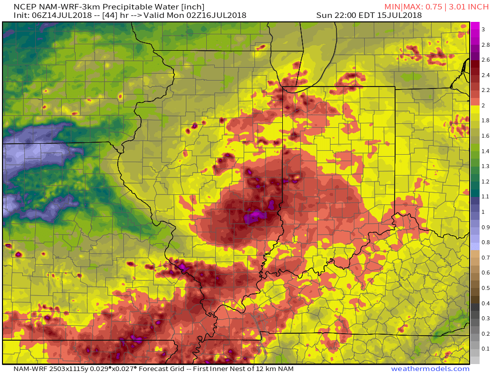
 Overall, dry conditions should prevail until late next weekend when a secondary, even stronger, front will make a run at the region. We’ll ramp storm chances back up ahead of this expected front and the air mass behind the boundary in the Week 2 time period will be even cooler than we we’ll enjoy the middle part of the upcoming week.
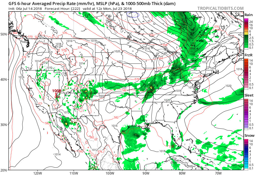 Speaking of cool, the pattern continues to look vastly different as we put a wrap on the month than what we’ve grown accustomed to over the past couple of weeks. Note the dominant trough the models show setting up shop over the Mid West…