Stormy Pattern Ahead For The Heart Of The Holiday Season?
A “relaxation” of the well below normal cold is on the way.

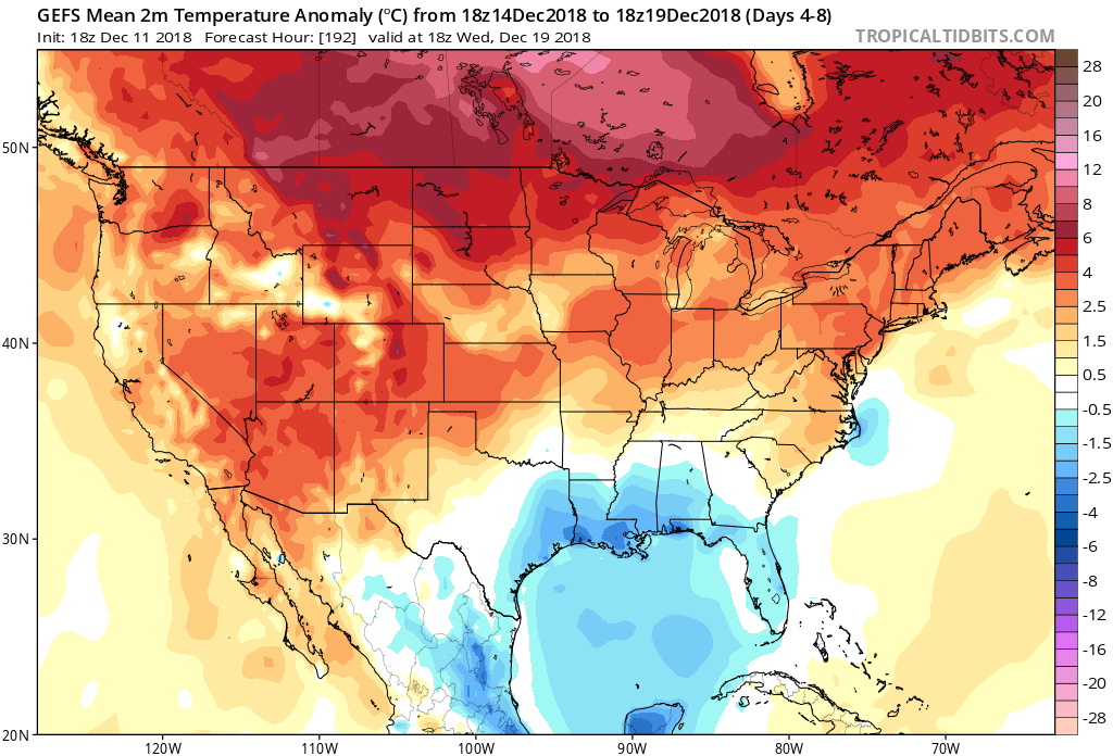 While this will support a 5-10 day period of temperatures of 5° to 10° above average (milder overnight lows, and a few days with highs at or above 50° are a good bet during the period, as well), the stage is already being set in motion for a return of colder conditions around the Christmas holiday. While admittedly, transitional periods can be “finicky,” there’s support from other pattern drivers behind a wintry return between the 12.22 and 12.24 time period. Furthermore, data suggests that there will be plenty of storminess to boot.
For those that love to review the operational model data as it rolls in (in some cases, up to 4 times per day), expect wild swings as the data begins to “hone in.” Despite some of that model fluctuation, we expect the pattern to look something like this around Christmas.
 We expect the mean ridge position to set up shop over the Pacific northwest. This will result in a warmer than average regime across the west. At the same time, the trough will be pushing back into the east. As the cold air settles back in, we expect a rather active time of things during the period. This certainly doesn’t mean we’re talking snow storms, but it does appear likely that at least one or two systems of interest loom. We’ll have to deal with the challenges that will come from one or both as time draws closer.
While a “transitional” pattern appears likely around Christmas, there are growing concerns of a return of sustained cold as we get into the new year.

 II. Highs today will come tonight (mid-to-upper 50s) ahead of the cold front. Once the front moves through, colder air will return for the second half of the weekend. As wrap-around moisture combines with the colder air, light snow showers will develop late Sunday night into Monday morning (shown below). This won’t be a huge deal.
 III. The next item of interest will come from a clipper system Thursday. This won’t only serve up another round of light snow, but also help to reinforce the unseasonably cold air. Highs will return to around freezing to close the week with lows in the 20s.
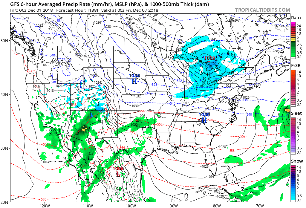 IV. That leads us to what comes next weekend. While it’s still far too early for any sort of specifics, we’ll simply say to keep a mental note in the back of your mind for the potential of a more disruptive winter event coming out from the southern Plains into the Ohio Valley. We’ll certainly have to fine tune things and “hone in” as we progress through the upcoming week. From this distance, prospects range from nothing more than a light snow to a “plowable” storm. Unlike this weekend’s storm, there will be a limit to how far north next weekend’s storm will be able to track…
 With that said, data does agree on the more active and wetter than average pattern continuing (from now) through the period.
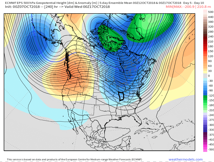
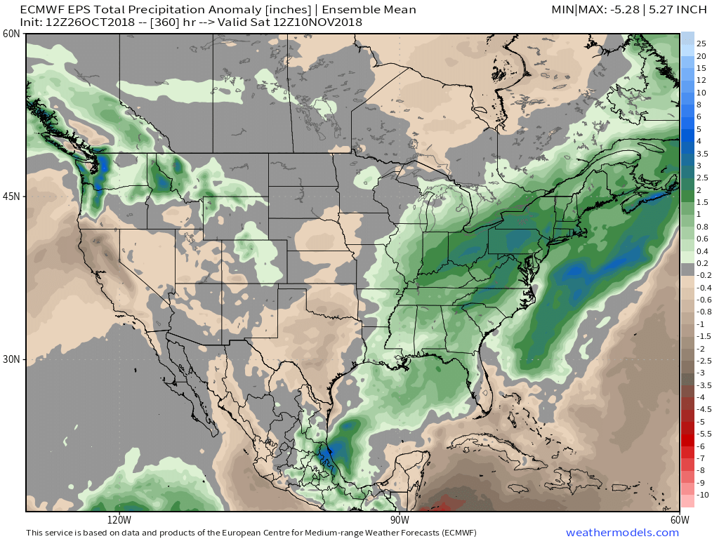 We’ll continue to look over the data this weekend to see if agreement can be reached on temperatures between the various modeling and update things accordingly. As things stand now, we still anticipate a “pull back” in the anomalous chill around the mid month time frame, but stay tuned. As the mean trough axis transitions into the central portion of the country, the more active storm track up through the Ohio Valley should continue.
 II. TD 14 will strengthen into Tropical Storm Michael later today and eventually a hurricane before making landfall along the Florida panhandle during the middle of the week. The remnant moisture of Michael will then race northeast and impact the flood-ravaged Carolinas during the latter stages of the work week.
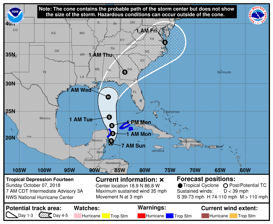 III. As Michael’s remnant moisture tracks northeast into the Carolinas, a strong cold front will sweep through the Mid West and Ohio Valley. Better chances of organized showers and thunderstorms will arrive ahead of the front Wednesday. Once the front passes, a dramatic wind shift to the northwest will push a MUCH cooler and drier air mass into the region.
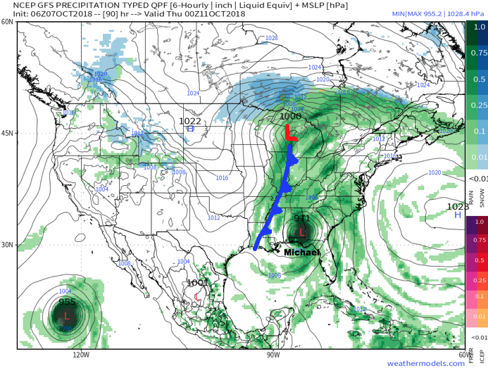 IV. We note the PNA (Pacific North America pattern) is flipping to a positive state and that will drive a more sustained period of colder air during the medium and longer range period- or mid and late October.
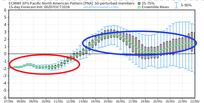
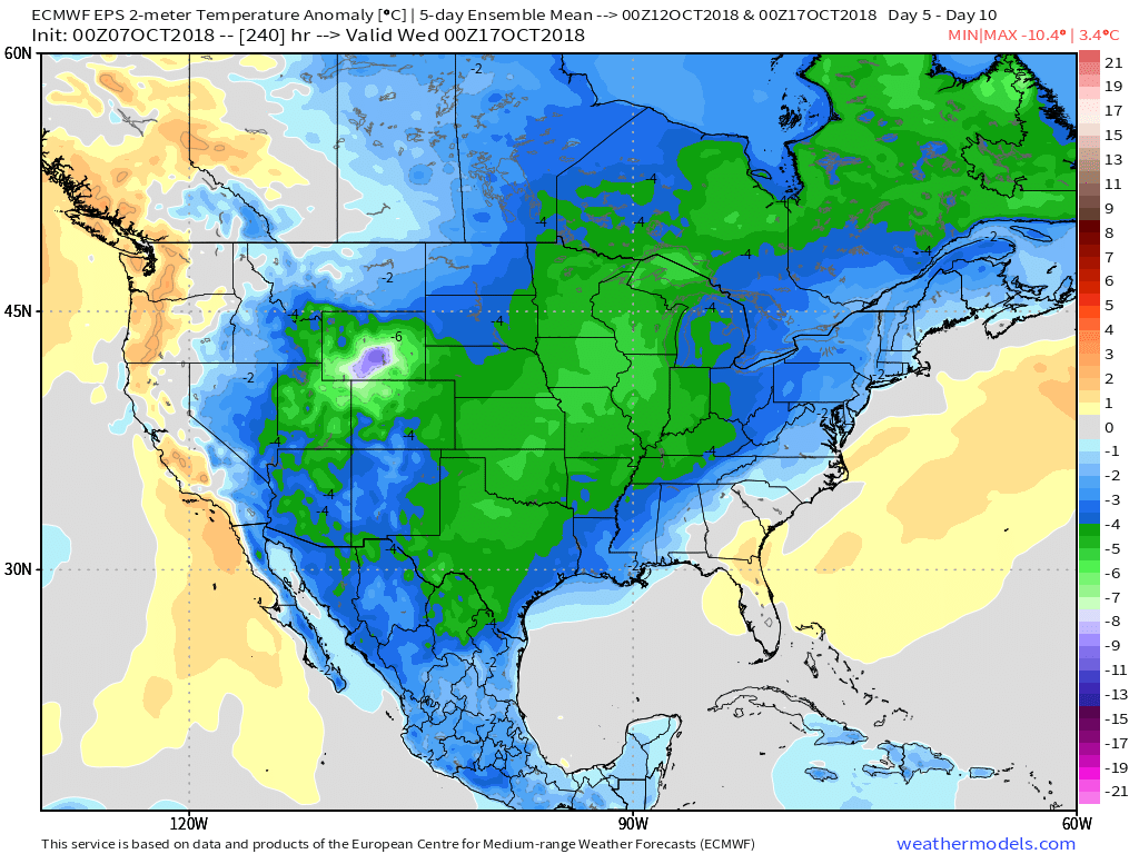 The air will grow cold enough to support the potential of frost during the 5-10 day period on at least a couple of nights. Additionally, reinforcing chilly air may ignite the lake effect to our north and northeast during Week 2… “Times, they are a changing!”