Frigid Open To March And Late Month Musings; Reviewing The NEW European Weeklies…
Average temperatures through the 1st (5) days of the month include highs of 46 F and a low of 29 F at Indianapolis. Instead, a frigid pattern will grip the region as we move through early March, including highs that will likely only top out in the lower to middle 20s and lows in the upper single digits to lower 10s as we move through the first week of the month (coldest centered on Sunday through next Wednesday).
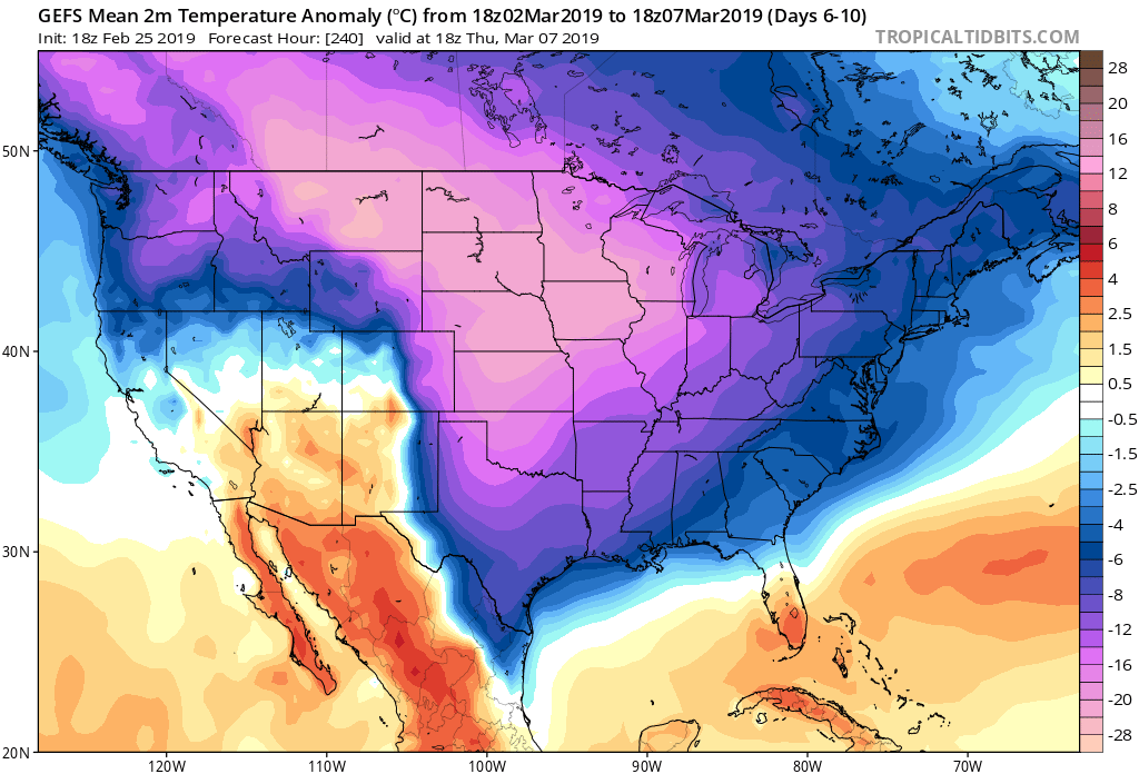
Should we get any sort of snow down during the period (still up for debate as of this evening), lows will likely approach 0 F. The best opportunity for accumulating snow over the upcoming week would come Friday night into Saturday, but confidence remains low. Thereafter, we prefer the “suppressed” ideas currently portrayed by modeling as more meaningful winter storm threats impact the lower Ohio/ TN Valley and southern Appalachian region- especially with such an anomalously cold pattern in place.
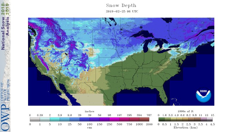
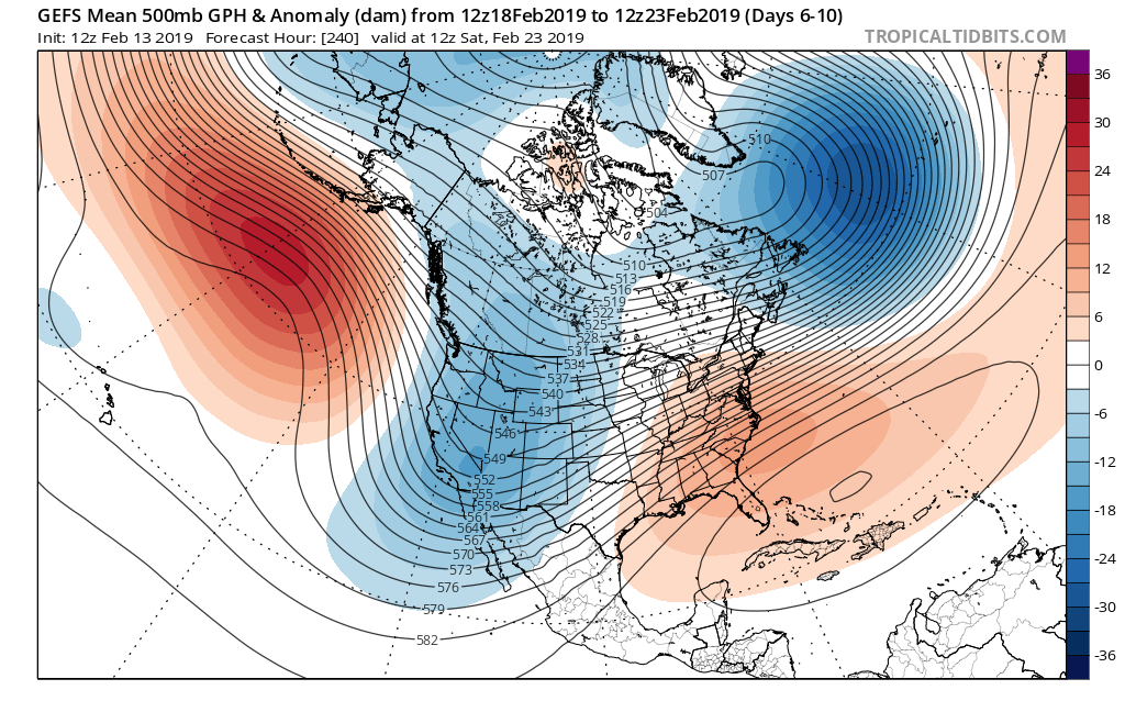
Speaking of cold, the deep and expansive snowpack across the central and northern Plains won’t allow the late season taste from the arctic to modify as much as it may otherwise. As the frigid air mass settles southeast, below zero wind chill values are a good bet early next week across the northern half of the state. “Tap the breaks” on meteorological winter kicking off March 1st…
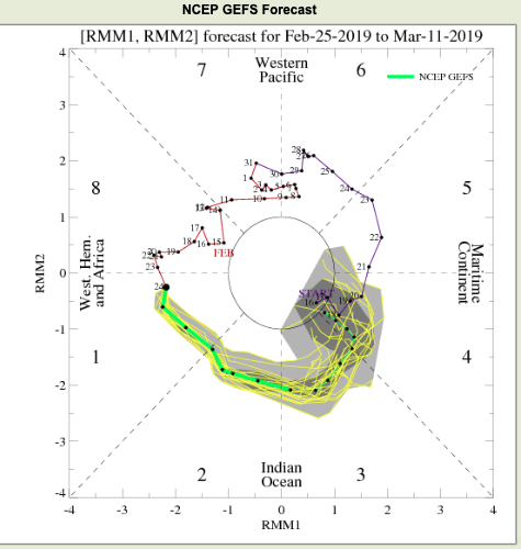
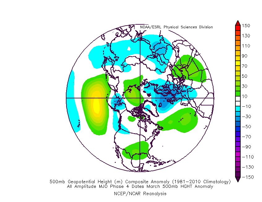
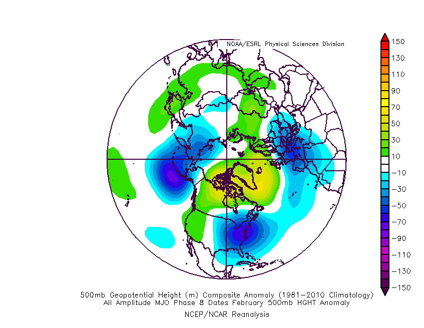
With that said, the NAO and AO are expected to remain positive and while initially “trumped” by the significantly negative EPO, this will trend positive by mid-month. These all suggest the cold is limited and that there shouldn’t be any change to the idea that we really begin to feel more spring-like by the middle of March. This is backed up by the continued idea that the MJO rumbles into Phase 4 by mid-March, as well (again argues for warmth).
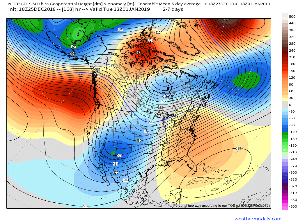
Sure enough, longer range models show the ridging and associated warmer times ahead:
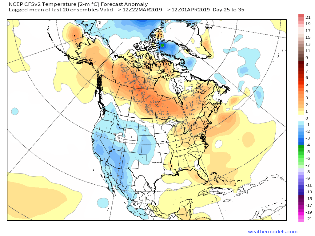
It should be noted that with the mean trough position taking up shop across the western portion of the country mid-March, not only should we moderate, but we should also see a return of wetter/ stormier times. With the GOM (Gulf of Mexico) running above normal, early season severe weather outbreaks will have to be closely monitored…
The new European Weeklies in this evening also back up the idea of an unseasonably cold 1st half of the month giving way to milder conditions by mid month. The model paints a drier than normal pattern over the Ohio Valley and Mid West over the next couple of weeks before wetter signals return by the middle of March.


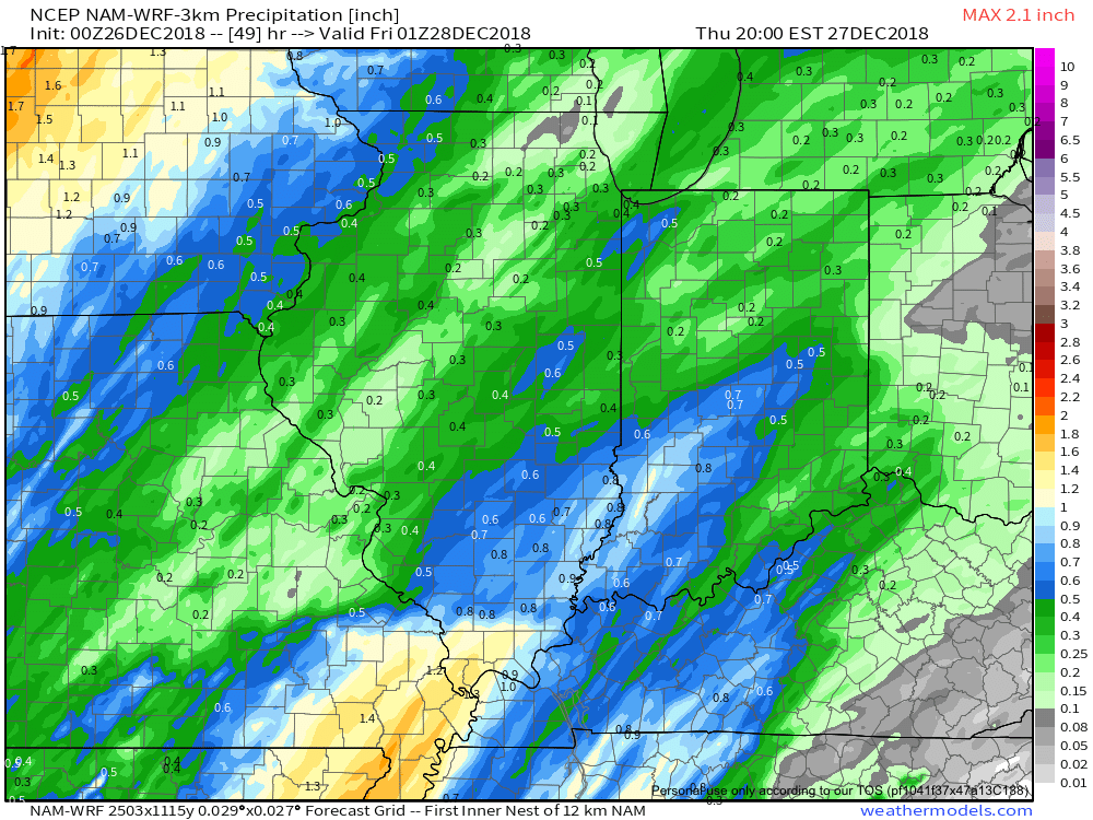 Most of the concentrated rain should come to an end around dark Thursday. By that time we forecast a general 1/2″ to 1″ to fall in area rain gauges.


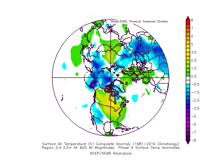
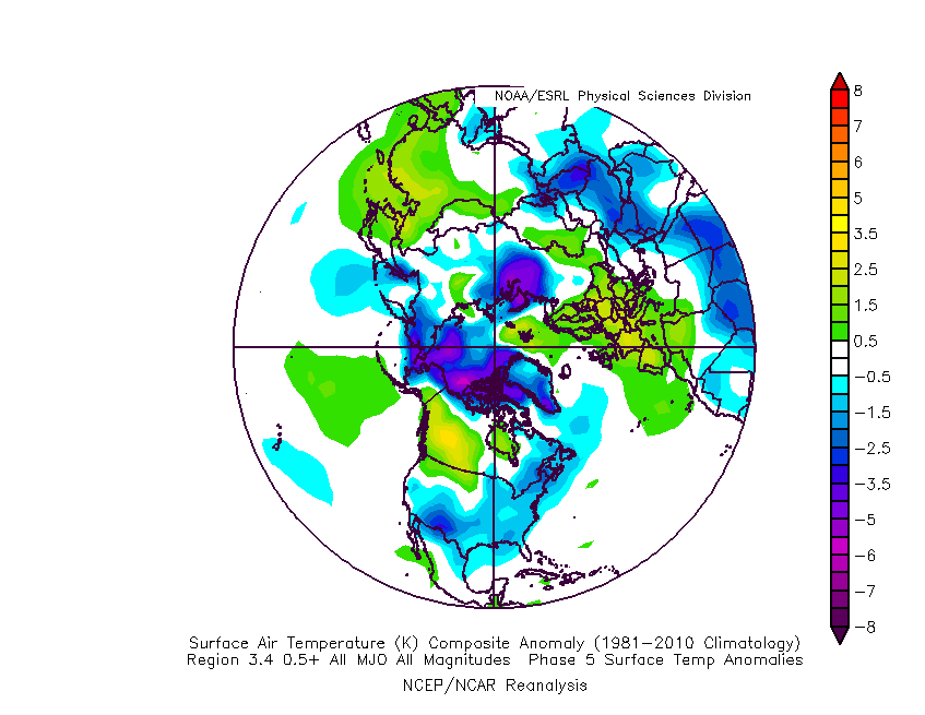
 The basis of our late-December forecast is built from the MJO, or Madden-Julian Oscillation. We note the MJO is expected to rumble through Phase 4 before heading into Phase 5 around Christmas. Phase 4 (image 2 below) is a warm phase and correlates well to what the week ahead will provide. However, Phase 5 (image 3 below) is a colder phase and could “up the ante” for the potential of wintry weather around Christmas.
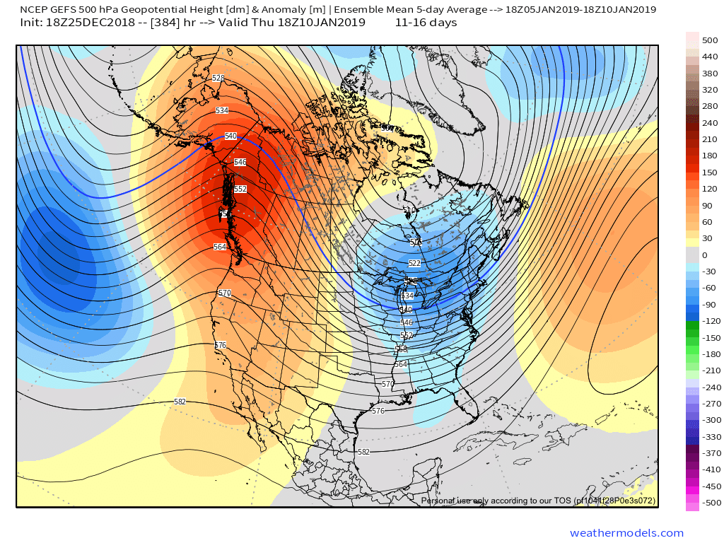
 If the MJO amplitude remains, it’ll roll into Phase 6 to close the month and open January. Here’s how that would correlate in the temperature department:
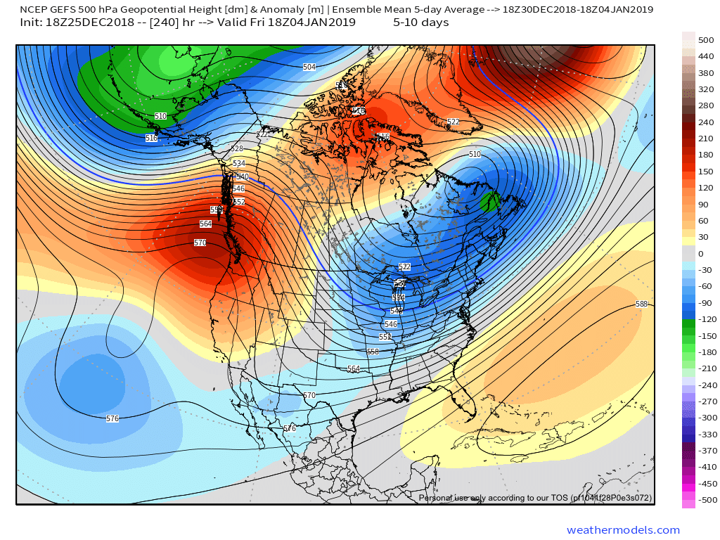
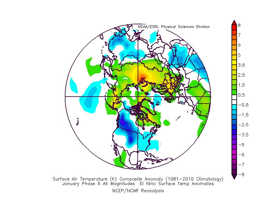 The upcoming week will run milder than normal- lining up perfectly with MJO Phase 4.
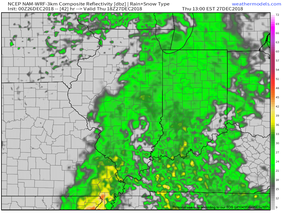
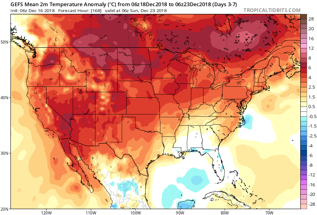 The first of our targeted holiday storm systems will come at the tail end of the warm Phase 4 and will likely deliver a wind-whipped rain in here as early as Wednesday night and Thursday morning. However, as the storm pulls northeast along the Ohio River, it’ll deepen on its journey into the eastern Great Lakes region. This will help pull colder air into the region, likely resulting in rain transitioning to snow Friday. Given the path of the storm, this doesn’t favor some sort of prolonged backlash snow event, but it could be enough to result in accumulating snow across eastern Ohio Valley sections and downwind of the snow belt regions of northern IN, OH, and MI.
 The pattern, as a whole, appears to be one of transition to close the month and open January and it’s not really until we get to mid-January where we think all of the drivers “align” to create more of a lock and hold cold pattern. With that said, a stormy late December pattern can present problems, even in the midst of relatively mild times. We’ll be here to dissect the storms as they come throughout the holiday season…