Thursday Evening Rambles…
1.) A gorgeous Thursday evening will give way to increasing cloudiness overnight along with isolated to widely scattered thunderstorm coverage into the wee morning hours Friday. The culprit? A warm front lifting north through central Indiana.
 2.) Sunshine will develop as the day progresses Friday and we’ll notice an increasingly muggy feel through the afternoon and evening. A true taste of summer can be expected as we put a wrap on the work week, including highs in the middle 80s and dew points climbing into the mid and upper 60s.
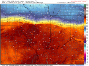
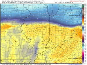 Also note the tight temperature gradient across the state. That temperature gradient will serve as the focal point between a mostly dry central Indiana through the first half of the weekend and “busier” times across northern parts of the state into the southern Great Lakes region. Locally heavy rain will fall at times with storms for our friends “up north!” We’ll remain very summer-like here into next week.
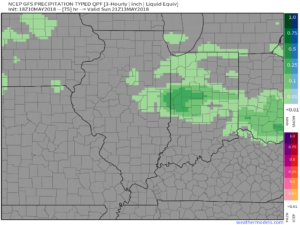
3.) Most of the weekend will be rain and storm free across central Indiana with many more dry hours than not. With that said, we’ll monitor for the prospects of a couple rounds of showers and thunderstorms Saturday evening into Sunday.
 4.) The balance of next week will run significantly warmer than normal and feature an almost daily threat of showers and thunderstorms. While there will be some “haves and have nots,” most area rain gauges should accumulate 1″ to 2″ of rain by the end of next week.


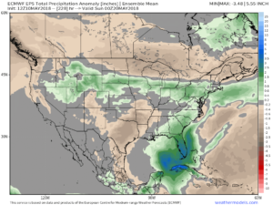 5.) Speaking of rain, the new European Weeklies in tonight, courtesy of weathermodels.com, also point towards wetter times in our future. This is encouraging as it supports the going idea shown this morning from the JMA Weeklies, CFSv2 Weeklies, and GEFS. Needless to say, despite the recent dry shift, we’re not concerned for long term moisture issues (or lack thereof ;-)).
 Concern is on the increase for the potential of strong to severe thunderstorms to impact central parts of the state Wednesday evening and night. That said, there are questions with how quickly the atmosphere will be able to recover from morning cloudiness and scattered thundershowers.
 Current thinking leans towards a brightening sky through the mid and late afternoon hours which will help destabilize things for potentially a “more significant” event Wednesday evening and night (bracketing the hours of 6p to midnight from west to east).
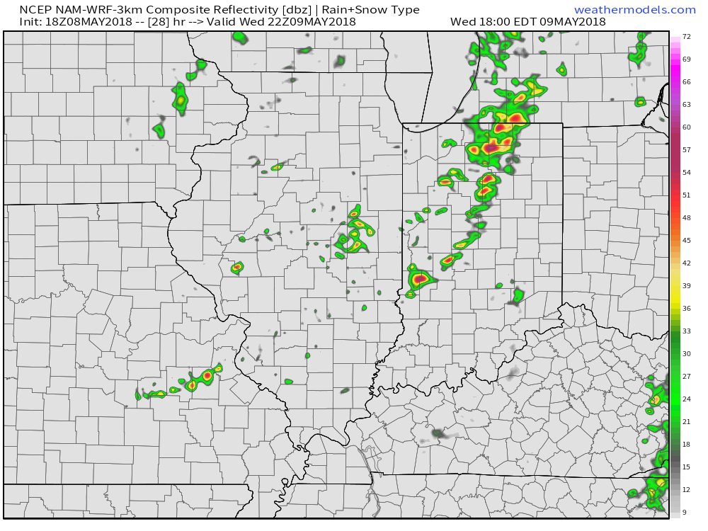 Storms are expected to exit off to the east by midnight:
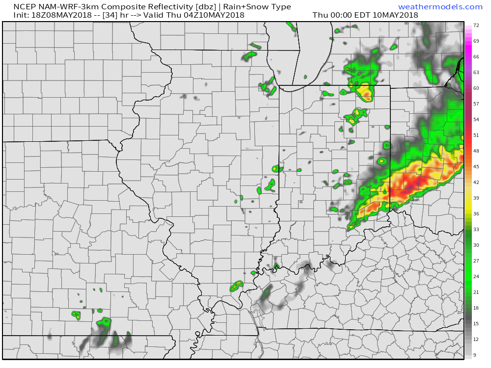 The primary concern that severe thunderstorms may deal central Indiana lies around damaging straight line winds and large hail, however, it should also be noted current parameters also suggest a couple of storms could spawn a tornado.