Hottest Air (So Far) This Season Arrives Over The Weekend…
A cold front is sinking south as we write this (6:45p) Wednesday evening. A couple of strong to severe storms have developed ahead of the boundary and if you’re reading this from the southern 1/3 of the state, remain weather aware this evening. Otherwise, a drier regime will arrive behind the boundary and at least temporarily lead to a more refreshing air mass for our Thursday. Those 50s sure will feel nice out the door Thursday morning!
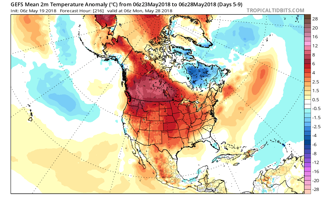
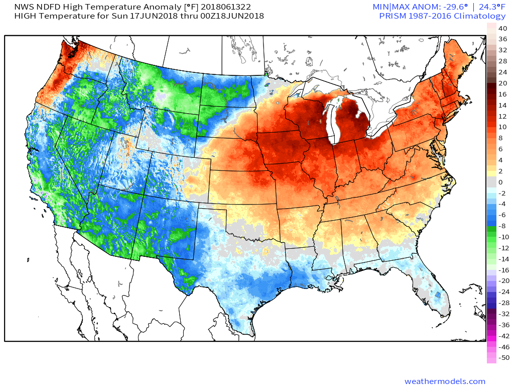
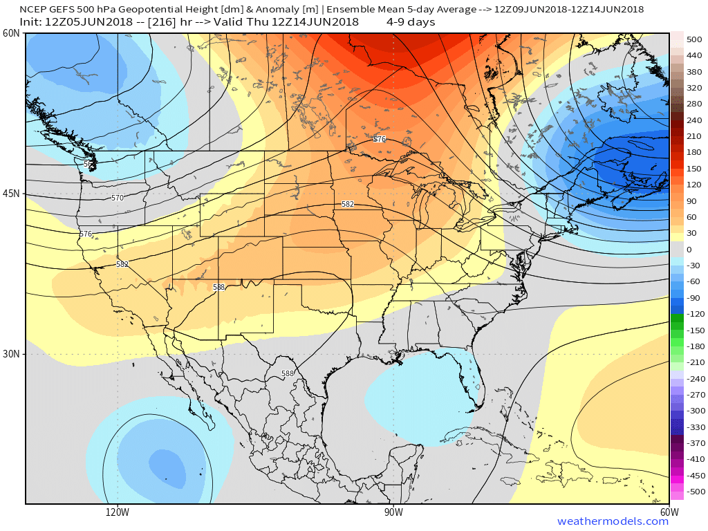
Unfortunately, the nice and refreshing air won’t last long. A building hot dome (ridge of high pressure) will center itself over the Ohio Valley this weekend and help promote excessive heat. It’s not just the high temperatures that will reach dangerous levels (lower to middle 90s), but overnight lows will remain oppressive, as well (low to mid 70s). Heat indices will surge north of 100° at times. The ridge will also serve to limit storm chances this weekend- “isolated” coverage at best.
 A cold front will drop south early next week and help increase overall coverage of showers and thunderstorms late Monday into Tuesday along with provide relief (at least temporary) from the hot, humid conditions. Temperatures will settle back closer to average by the middle of next week.


 An early look at next weekend shows general agreement with the GFS and European forecast models: drier air returning along with slightly cooler air. We’ll keep you updated!
 Eventually these storms should pick up momentum and head off to the southeast later tonight.
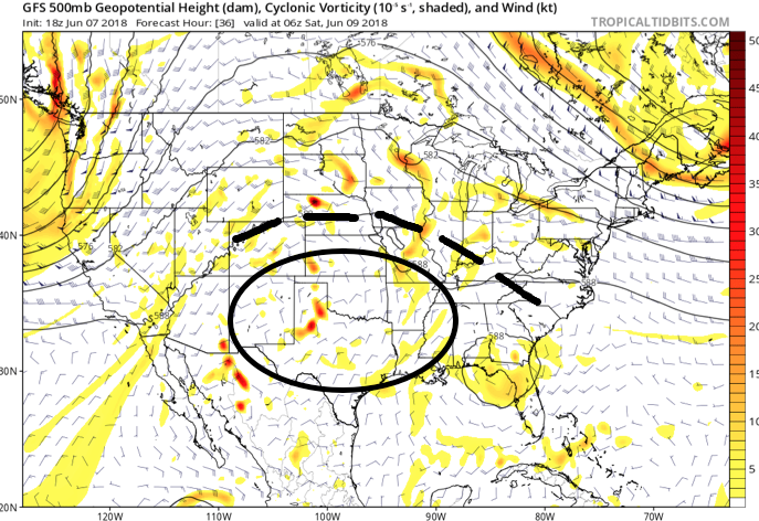 An increasingly muggy air mass will take hold of the region as we close the work week, with dew points approaching 70° at times. The term “air you can wear” comes to mind. As impulses of energy interact with this tropical air mass, thunderstorms will blossom- particularly in the afternoon and evening hours.
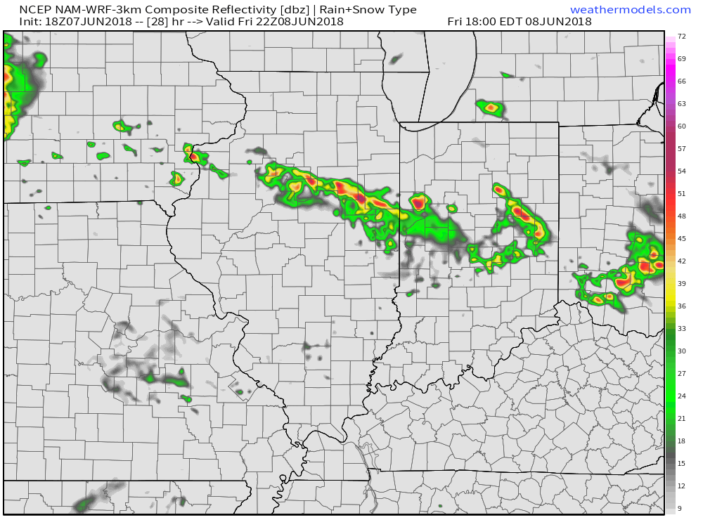
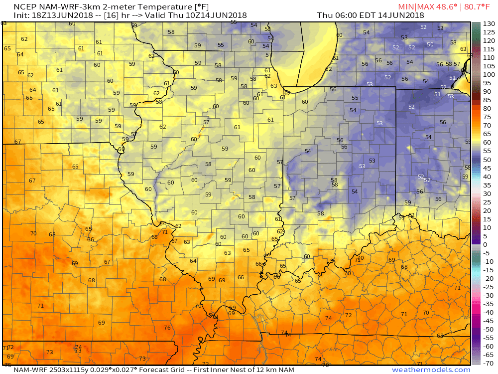
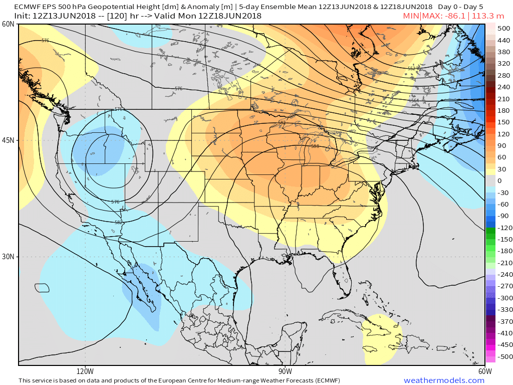
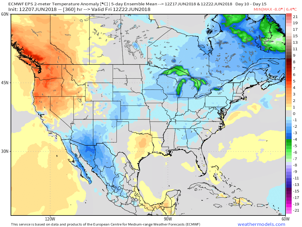
 Looking down the road, a “sticky” summer feel will remain intact through next week, but changes are brewing in the longer range. These changes would support a cooler regime developing just past mid-June (in the 10 to 15 day time frame). While the duration is up for debate, it’ll be nice for at least a few days of cooler air…
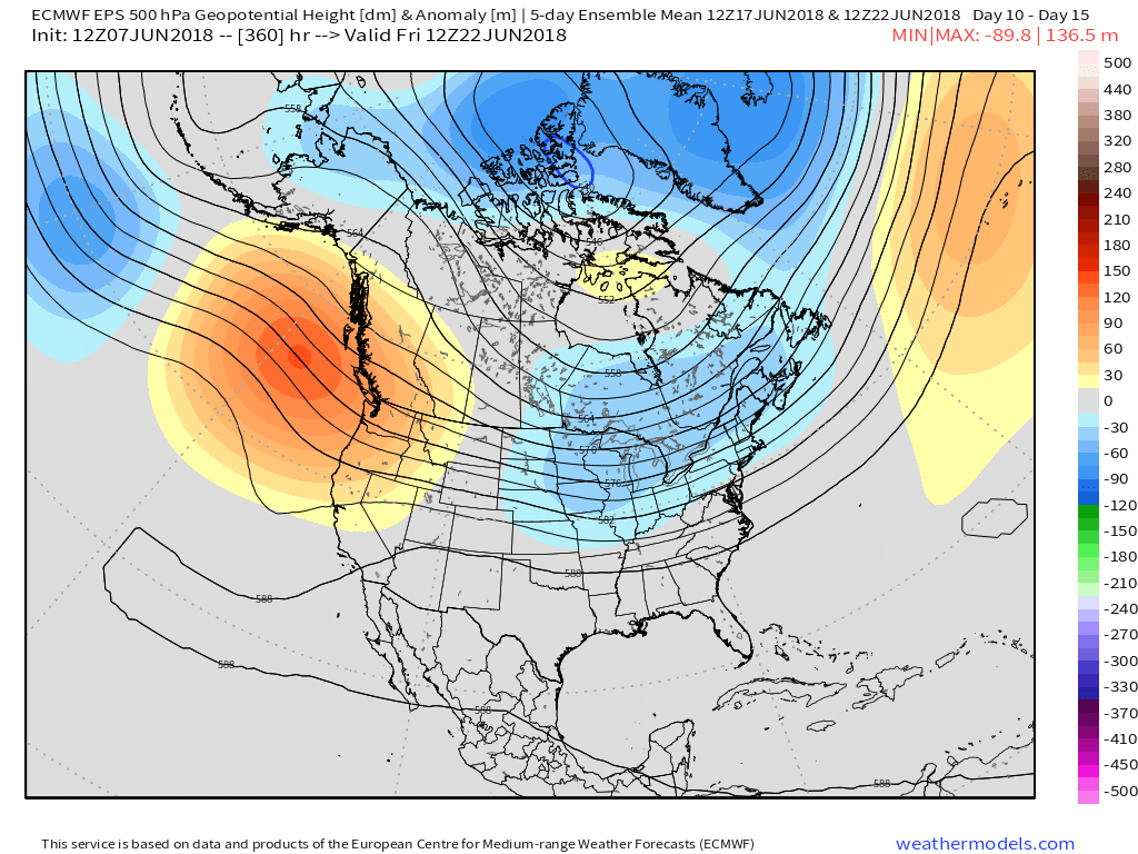

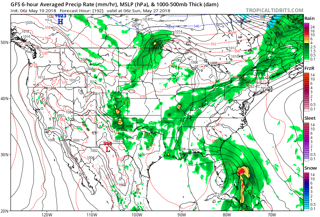
 While impossible to nail down exactly which back yards would see beneficial rainfall, it would be an overall more conducive pattern for widespread showers and thunderstorms for our general region. We’ll have to lean on high resolution, shorter-term models as time draws closer to gain more insight around more precise timing and track details, but we continue to trend our forecast wetter Friday through Sunday than we’ve been over the past couple weeks- Alberto remnants excluded.
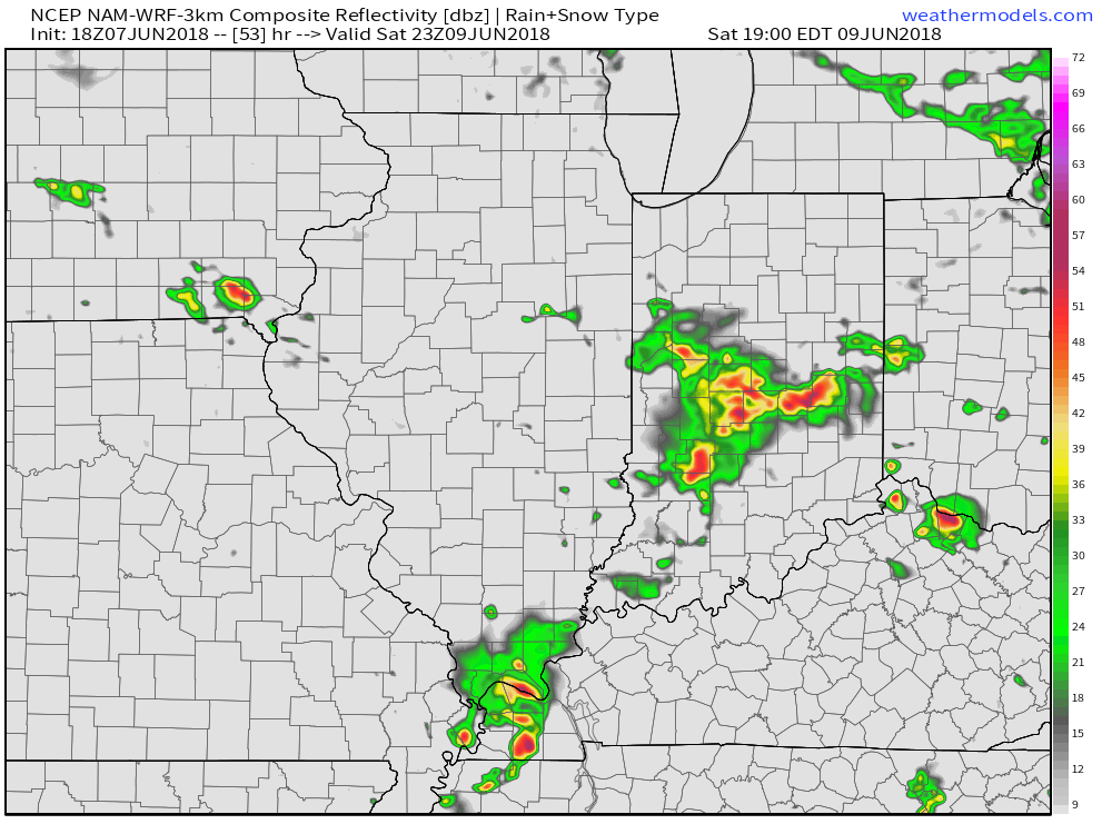
 Our attention will then shift to the potential of strong thunderstorms late Sunday. Higher resolution guidance suggests storms will begin to rumble into western Indiana late Sunday evening (around 9p to 10p) before tracking east into the overnight hours.
 With a stalled front nearby, shower and thunderstorm chances will remain in our forecast into the middle of the week. While it won’t rain the entire time, unsettled conditions will remain into Wednesday before high pressure provides drier conditions Thursday and most of Friday.