More Unsettled Weekend Ahead And Closing Out May…
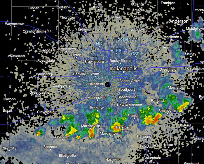
An upper level low pressure system will track northeast today into tonight, and as it does, look for more numerous showers and embedded thunder to develop. Some localized heavier downpours are a good bet this evening across central Indiana.

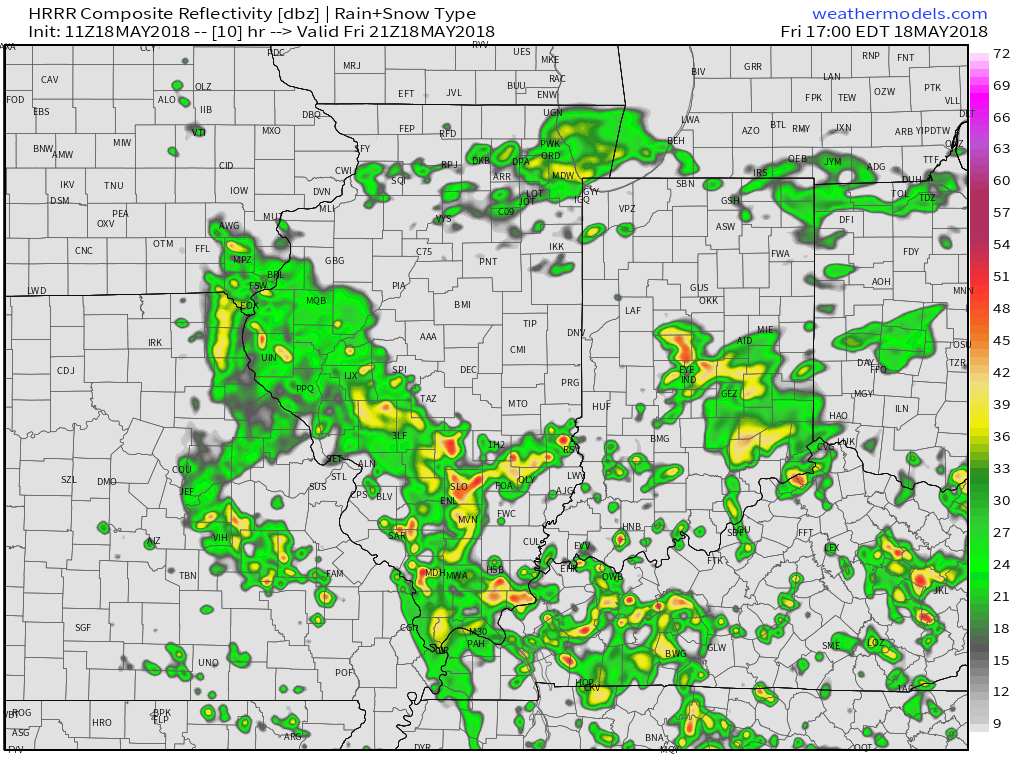 Otherwise, look for considerable cloudiness and highs topping out in the lower 70s today.
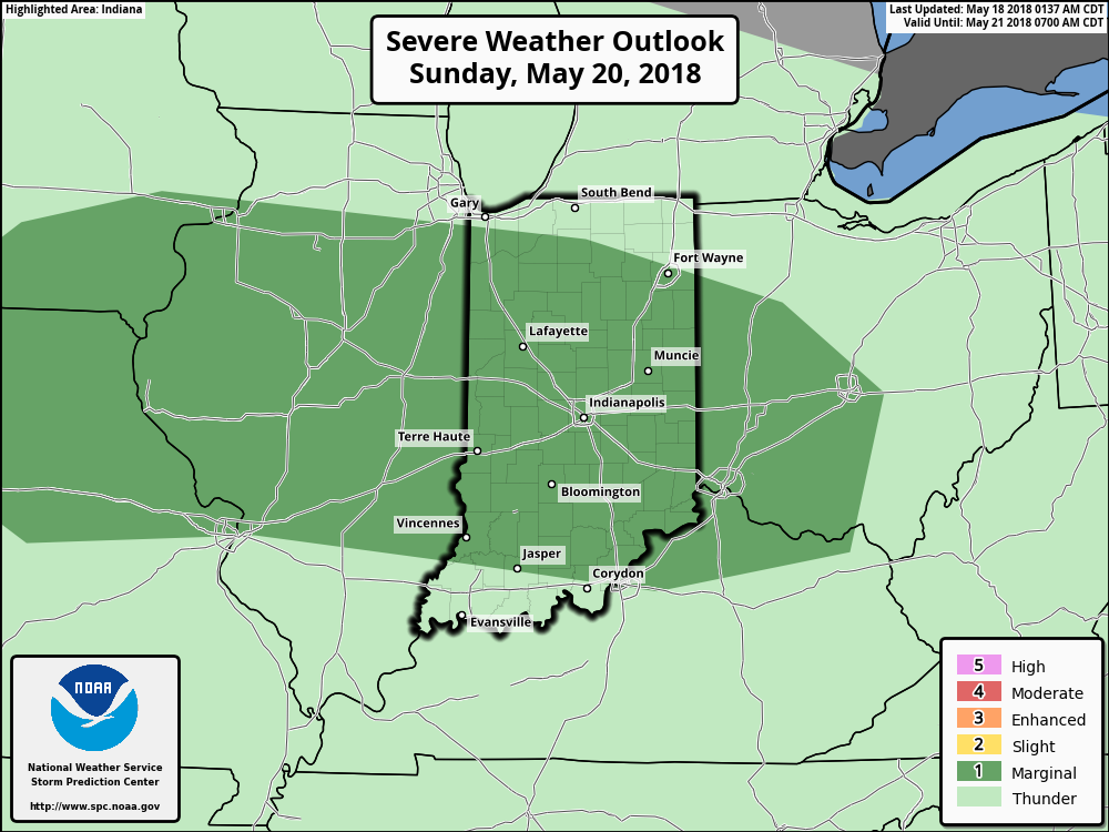
While we’ll have to contend with a few showers Saturday, overall, the day should be drier compared to today and what lies ahead Sunday. Speaking of Sunday, we’re monitoring the potential of a couple of storms reaching strong to severe levels to close the weekend. The Storm Prediction Center includes central portions of the state in a “marginal” risk of severe with their update Friday morning. It wouldn’t surprise us if a portion of the marginal risk is upgraded to a “slight” risk in future updates. We’ll fine tune storm timing over the next 24 hours.
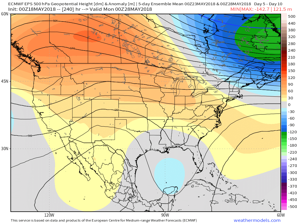
 As we look ahead to the end of May, there really aren’t any significant changes to the overall warmer than normal theme we’ve enjoyed so far this month. Longer range guidance off of the European ensemble continues to support broad scale upper ridging across the Mid West and Ohio Valley and a corresponding warmer than average regime. From a precipitation perspective, the next couple of weeks do look more active compared to the dry start to the month. Case in point, the balance of the upcoming week will be dominated by a stalled frontal boundary. While we’ll have to fine tune exactly where the front stalls, daily chances of showers and thunderstorms (scattered fashion) can be expected.
 2.) Overall, a drier air mass will build into central Indiana today and Thursday (cooler, too) before moisture returns to close the week. Scattered showers and embedded thunder are more likely Friday and again late Sunday into Monday.
 3.) Looking ahead, we notice a more active pattern is presented off the overnight GEFS model. The heat ridge backs west and sets up a busy “ring of fire” pattern with a northwest flow aloft across our region. We have a ways to go before developing consistency and overall confidence, but this is at least an encouraging sign. The end result, should this come to fruition, would be a significantly wetter open to June.
 2.) Sunshine will develop as the day progresses Friday and we’ll notice an increasingly muggy feel through the afternoon and evening. A true taste of summer can be expected as we put a wrap on the work week, including highs in the middle 80s and dew points climbing into the mid and upper 60s.
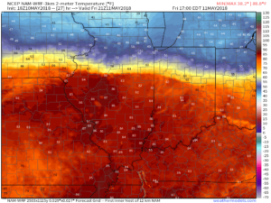
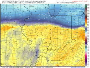 Also note the tight temperature gradient across the state. That temperature gradient will serve as the focal point between a mostly dry central Indiana through the first half of the weekend and “busier” times across northern parts of the state into the southern Great Lakes region. Locally heavy rain will fall at times with storms for our friends “up north!” We’ll remain very summer-like here into next week.
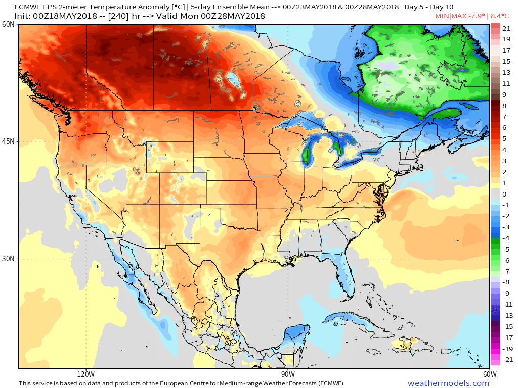
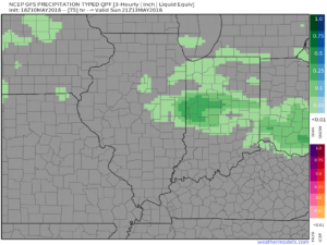 4.) The balance of next week will run significantly warmer than normal and feature an almost daily threat of showers and thunderstorms. While there will be some “haves and have nots,” most area rain gauges should accumulate 1″ to 2″ of rain by the end of next week.

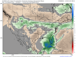 5.) Speaking of rain, the new European Weeklies in tonight, courtesy of weathermodels.com, also point towards wetter times in our future. This is encouraging as it supports the going idea shown this morning from the JMA Weeklies, CFSv2 Weeklies, and GEFS. Needless to say, despite the recent dry shift, we’re not concerned for long term moisture issues (or lack thereof ;-)).