
You must be logged in to view this content. Click Here to become a member of IndyWX.com for full access. Already a member of IndyWx.com All-Access? Log-in here.
April 23, 2019 archive
Permanent link to this article: https://indywx.com/2019/04/23/video-looking-at-the-weekend-and-ahead-towards-early-may/
Apr 23
Reviewing Model Changes And Differences For The Weekend…
The theme this week is for relatively weak and fast-moving weather systems to impact our area. The first of (2) systems will slip through central Indiana this afternoon without much fanfare in the least (increased cloud cover and a noted wind shift that will deliver cooler air, but not much, if any, precipitation).
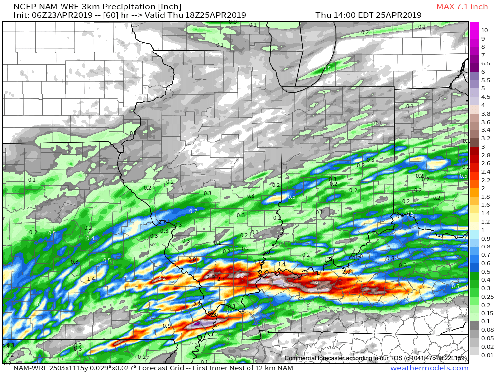
The 2nd system will have a bit more moisture to work with and, accordingly, we anticipate better rain chances in the Wednesday-Thursday time period. With that said, this is still nothing to “write home about.”

For most central Indiana rain gauges, an average of 0.25″ to 0.50″ can be expected with this midweek system.
Weak high pressure will return Friday to allow for a dry and increasingly sunny close to the work week. Sunshine should be with us to open the weekend Saturday morning, but models are speeding up our next weather maker. At one time what appeared to be a Sunday arrival, it now looks like clouds will be on the increase through the late morning and early afternoon Saturday with rain chances arriving as early as late afternoon Saturday.
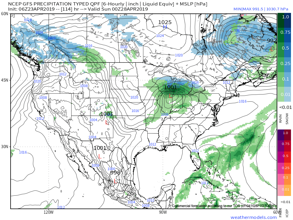
Heaviest rainfall (and even snow) will be located to the north of the surface low track- well north of central Indiana. Nonetheless, better coverage of showers and embedded thunder is expected Saturday afternoon into the evening hours.
Early rain is possible Sunday, otherwise we anticipate an increasingly sunny sky to take hold as we move through the 2nd half of the weekend. The big story will be the cooler air to wrap up the weekend. Highs will top out around 60 Saturday and likely remain in the 50s Sunday.
Permanent link to this article: https://indywx.com/2019/04/23/reviewing-model-changes-and-differences-for-the-weekend/