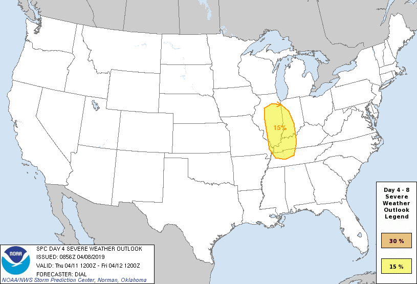
We continue to monitor the potential of strong to severe thunderstorms Thursday evening across the region. Already, the Storm Prediction Center highlights the possibility in their Day 4 Outlook below.
The setup will feature unseasonably warm and moist air being drawn northeastward ahead of a strong spring storm system to our northwest Thursday. This is the same storm system that will deliver a late season blizzard to the north-central Plains and upper Midwest.
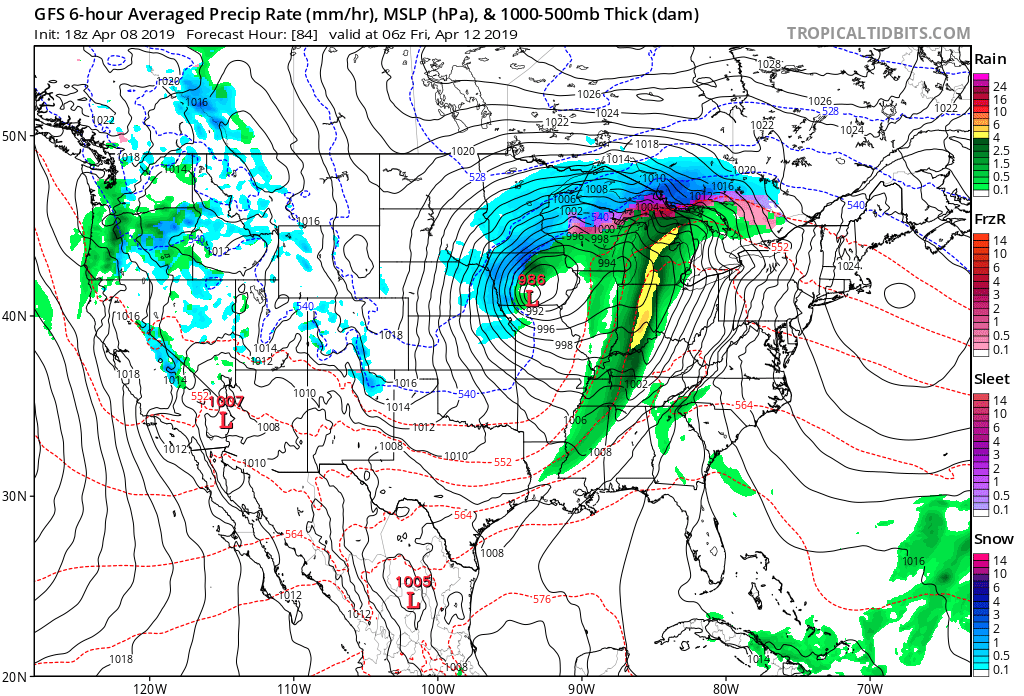
A trailing cold front will push east into the unseasonably warm air mass (expecting highs in the mid-upper 70s Thursday with a strong and gusty SW wind) and we expect a line of thunderstorms to organize to our west Thursday afternoon. While timing will have to be fine tuned over the next couple of days, current thinking places this line of storms into central Indiana by Thursday evening. The primary threat continues to be damaging straight line winds.
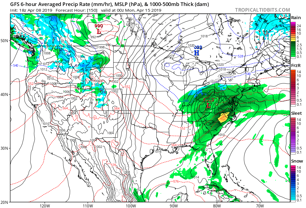
We’ll turn drier and cooler to close the week and another storm system will approach by Saturday night. This particular storm system looks to deliver a widespread cold, soaking rain especially across the eastern half of the OHV region- from central IN and points east. More on this storm after we get rid of Thursday’s storms.