
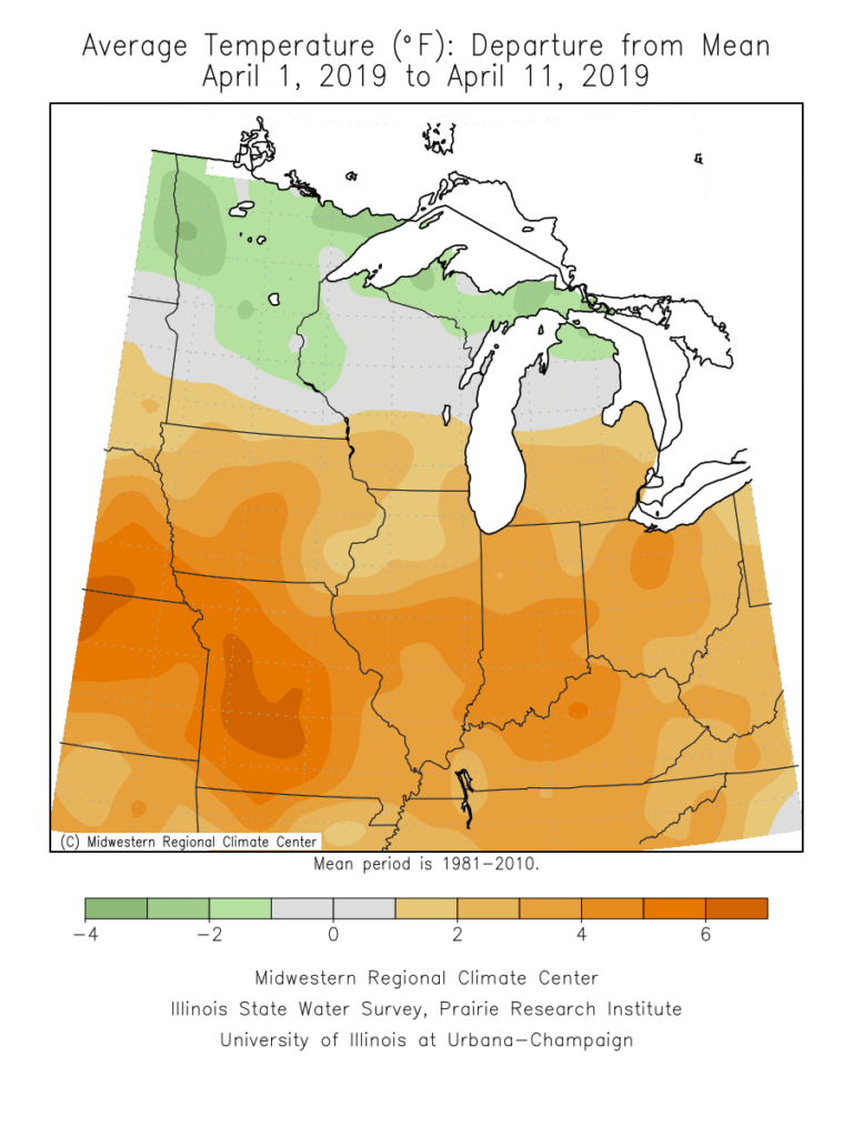
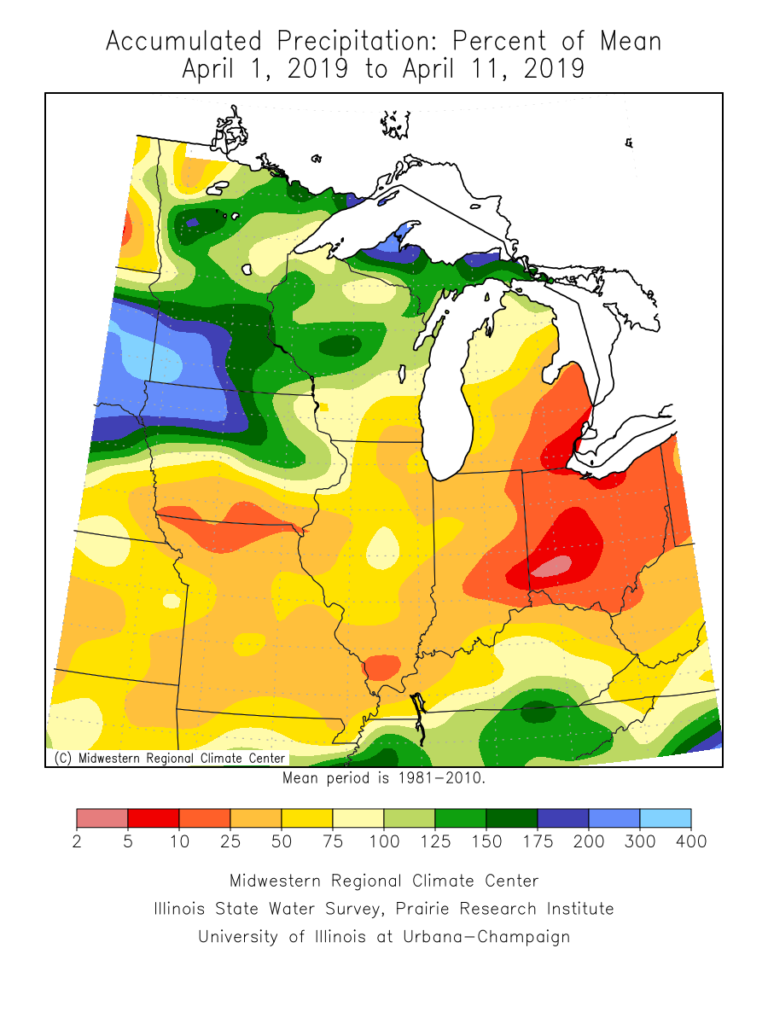
Before we look ahead to the upcoming period, reviewing April so far shows a warm and dry start to the month. April 2019 is running nearly 5 F above average and 0.76″ below normal in the rainfall department.
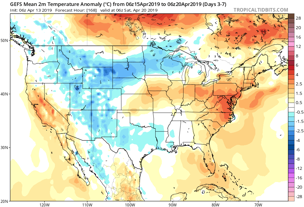
Forecast Period: 04.14.19 through 04.21.19
7-Day Precipitation: Above normal amounts of precipitation expected during the period.

7-Day Temperatures: Above normal temperatures expected during the period.
Severe Weather:
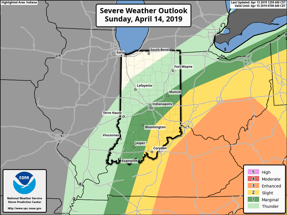
A risk of strong to potentially severe storms looms across southeast portions of the state Sunday (4.14.19). While widespread severe weather isn’t anticipated, there’s the potential of scattered strong storms Thursday, 04.18.19.
Summary:
A strong spring storm system will deliver heavy rain and thunderstorms late tonight into Sunday. Due to the track of the surface low, a tight temperature gradient can be expected across the state Sunday. Low-mid 60s are on deck across SE IN with upper 30s across western and northern portions of the state. In the warmer sector, a severe threat looms Sunday morning into the afternoon hours. Large hail is the primary concern with storms that may form. Elsewhere, a rather widespread 1″ to 2″ of rain is a good bet with the passage of this system.
While we’ll remain cool to open the work week, a warm front will lift north Tuesday helping to usher in much warmer conditions for the mid-week stretch (70s return). The next system will approach Wednesday into Thursday with scattered showers and thunderstorms (some of which may be strong Thursday). That particular system will track overhead Friday into next weekend with cooler air returning during the period (highs in the 50s and lows in the upper 30s to lower 40s for next weekend).