You must be logged in to view this content. Click Here to become a member of IndyWX.com for full access. Already a member of IndyWx.com All-Access? Log-in here.
April 5, 2019 archive
Permanent link to this article: https://indywx.com/2019/04/05/enjoy-the-spring-warmth-while-weve-got-it-cold-stormy-pattern-on-deck/
Apr 05
April Turns Active: Timing Out Storms…
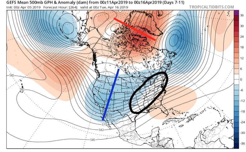
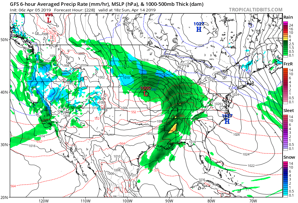
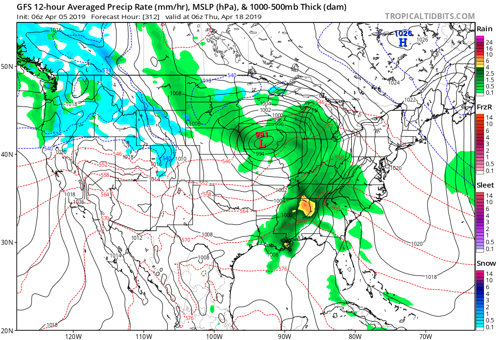
A series of storm systems will impact the OHV region over the next couple of weeks. As we look at the overall pattern, a negative NAO will begin to have significant influence on the overall pattern through mid-April. We note the mean trough position settles into the western portion of the country with a reflection of a southeast ridge in place. Accordingly, the Ohio Valley will find itself in the middle of the primary storm track as we progress through the middle part of the month.
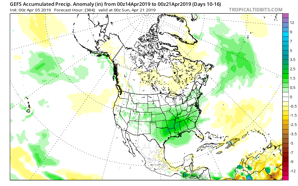
With said pattern in place, precipitation is expected to run above, to significantly above, normal during the mid-month stretch.
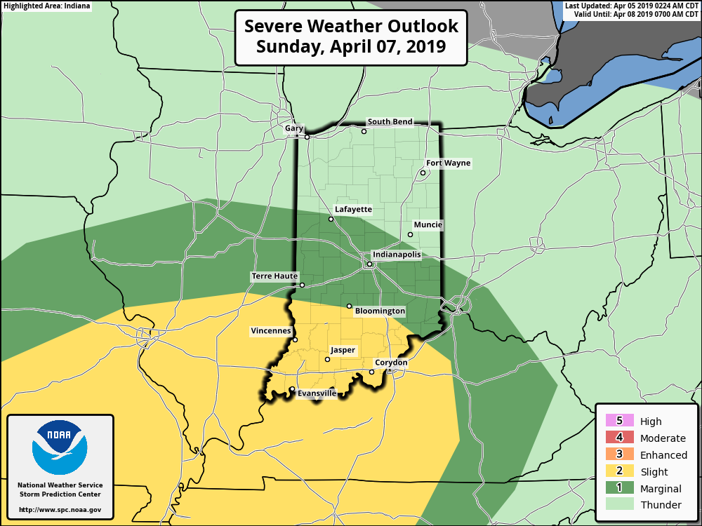
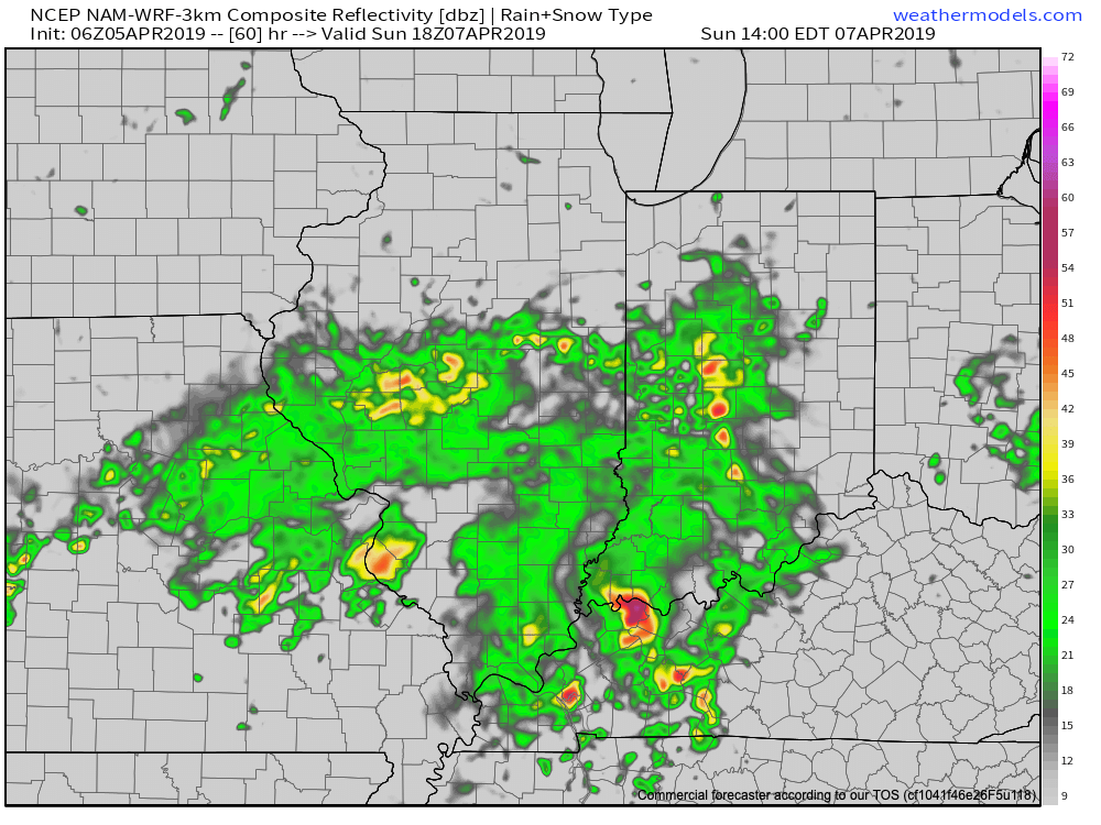
After a gorgeous Saturday (sunshine and lower 70s), the first of a series of storm systems will begin to impact the region Sunday. A couple of strong to severe thunderstorms are possible across southern and central IN- especially during the afternoon.
Thereafter, additional dates to monitor for storm impacts include the following:
Wednesday night and Thursday- April 10th and 11th

Saturday and Sunday- April 13th and 14th
Wednesday and Thursday- April 17th and 18th
We’ll be able to get much more specific with these individual storms as we get closer! An updated video will hit this evening looking closer at Sunday’s storm threat. In the meantime, get set to kick off the weekend with superb weather!
Permanent link to this article: https://indywx.com/2019/04/05/april-turns-active/
