
You must be logged in to view this content. Click Here to become a member of IndyWX.com for full access. Already a member of IndyWx.com All-Access? Log-in here.
June 2018 archive
Permanent link to this article: https://indywx.com/2018/06/19/video-heat-relaxes-and-storm-coverage-increases/
Jun 18
Stormy Pattern Returns; Localized Flash Flood Threat Emerges…
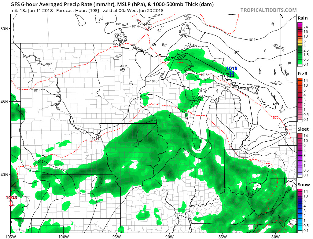
A cold front will sink south into the Ohio Valley Tuesday afternoon before stalling out through the remainder of the work week and into the weekend.
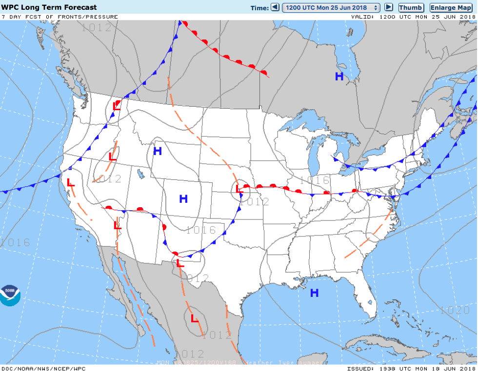
Unsettled weather returns as a frontal boundary stalls out across the region into the upcoming weekend.
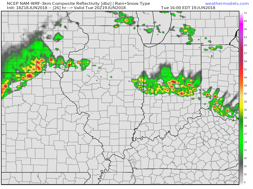
Rain and storm chances will increase in overall coverage and intensity as we move into Tuesday- particularly during the afternoon hours. With precipitable water values exceeding 2″ at times, locally heavy downpours can be expected.
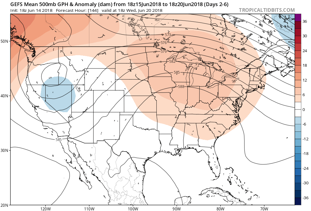
 Despite cooler (still mighty humid) temperatures arriving, the overall pattern won’t change significantly into late week and this weekend. With the frontal boundary draped across the Ohio Valley, periods of showers and thunderstorms will remain in the forecast. At times, disturbances will track along the boundary and lead to increased coverage of storms. Perhaps Thursday and Friday will serve up the greatest coverage of thunderstorms as a surface wave moves out of the central Plains into the Great Lakes.
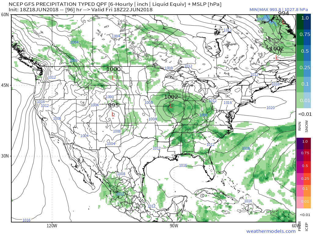 The combination of a juicy air mass and a stationary boundary draped overhead spells a flash flood risk. The lack of any sort of overall steering current suggests the potential of thunderstorms that may train over the same communities at times. As mentioned earlier, precipitable water values (PWATS) will approach and exceed 2″ and this will support torrential downpours at times.
 Officially, we think the upcoming 7-day period will deal out widespread 2″ to 3″ rainfall totals across central Indiana, but there will be locally heavier amounts where thunderstorms train.
After a dry few days with exceptional heat, the unsettled and cooler pattern, overall, will be welcomed with open arms!
Permanent link to this article: https://indywx.com/2018/06/18/stormy-pattern-returns-localized-flash-flood-threat-emerges/
Jun 18
VIDEO: Heat Gives Way To Increasing Storm Chances…
You must be logged in to view this content. Click Here to become a member of IndyWX.com for full access. Already a member of IndyWx.com All-Access? Log-in here.
Permanent link to this article: https://indywx.com/2018/06/18/video-heat-gives-way-to-increasing-storm-chances/
Jun 16
Father’s Day Weekend Heat Wave; Turning Unsettled Next Week…
You must be logged in to view this content. Click Here to become a member of IndyWX.com for full access. Already a member of IndyWx.com All-Access? Log-in here.
Permanent link to this article: https://indywx.com/2018/06/16/fathers-day-weekend-heat-wave-turning-unsettled-next-week/
Jun 14
Scorcher Of A Weekend Before Relief Arrives…
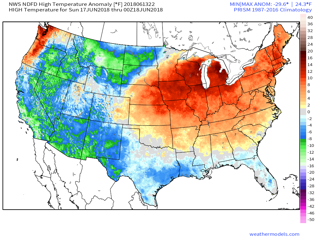
It’s not just the daytime temperatures that will grab the weekend weather headlines (low-mid 90s), but the overnight lows will remain “oppressive,” as well (low-mid 70s) in what will be a very muggy air mass this weekend. “Air you can wear” will be an appropriate way to describe things this weekend around the entire Mid West. At times, heat indices will exceed the 100° mark. With an upper level ridge parked over the region, any storm coverage should be isolated at best. Most neighborhoods should remain free of rain or storms over the weekend.
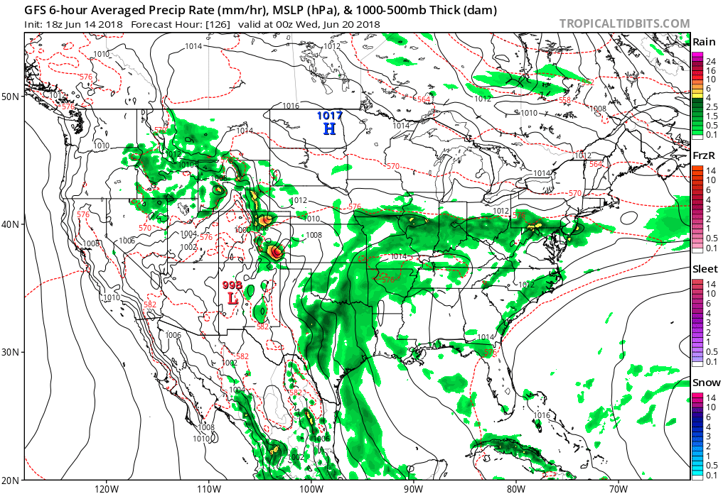
 Thankfully, even as the heat gets going in earnest, at least some slight relief is in sight. A cold front will approach the region early next week and increasing coverage of showers and thunderstorms should follow suit. We’ll forecast isolated to widely scattered coverage of storms Monday before better coverage (scattered to numerous) Tuesday. Some model data suggests the front will “stall out” over the Ohio Valley region which would keep high rain chances in our forecast into the middle and latter parts of next week. Stay tuned.
 From this distance, late next week into the weekend looks seasonably warm and drier, overall.
Find a pool and stay cool this weekend, friends!
Permanent link to this article: https://indywx.com/2018/06/14/scorcher-of-a-weekend-before-relief-arrives/
Jun 14
VIDEO: Refreshing Air Gives Way To Building Heat And Humidity…
You must be logged in to view this content. Click Here to become a member of IndyWX.com for full access. Already a member of IndyWx.com All-Access? Log-in here.
Permanent link to this article: https://indywx.com/2018/06/14/video-refreshing-air-gives-way-to-building-heat-and-humidity/
Jun 13
Hottest Air (So Far) This Season Arrives Over The Weekend…
A cold front is sinking south as we write this (6:45p) Wednesday evening. A couple of strong to severe storms have developed ahead of the boundary and if you’re reading this from the southern 1/3 of the state, remain weather aware this evening. Otherwise, a drier regime will arrive behind the boundary and at least temporarily lead to a more refreshing air mass for our Thursday. Those 50s sure will feel nice out the door Thursday morning!
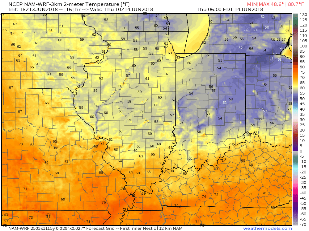
Lows will fall into the middle 50s for many communities outside of the city Thursday morning.
Unfortunately, the nice and refreshing air won’t last long. A building hot dome (ridge of high pressure) will center itself over the Ohio Valley this weekend and help promote excessive heat. It’s not just the high temperatures that will reach dangerous levels (lower to middle 90s), but overnight lows will remain oppressive, as well (low to mid 70s). Heat indices will surge north of 100° at times. The ridge will also serve to limit storm chances this weekend- “isolated” coverage at best.
 A cold front will drop south early next week and help increase overall coverage of showers and thunderstorms late Monday into Tuesday along with provide relief (at least temporary) from the hot, humid conditions. Temperatures will settle back closer to average by the middle of next week.

Permanent link to this article: https://indywx.com/2018/06/13/hottest-air-so-far-this-season-arrives-over-the-weekend/
Jun 12
VIDEO: Additional Storm Chances Before Drier Air Takes Hold…
You must be logged in to view this content. Click Here to become a member of IndyWX.com for full access. Already a member of IndyWx.com All-Access? Log-in here.
Permanent link to this article: https://indywx.com/2018/06/12/video-additional-storm-chances-before-drier-air-takes-hold/
Jun 11
Upper Level Ridge (And Heat) Builds This Weekend…
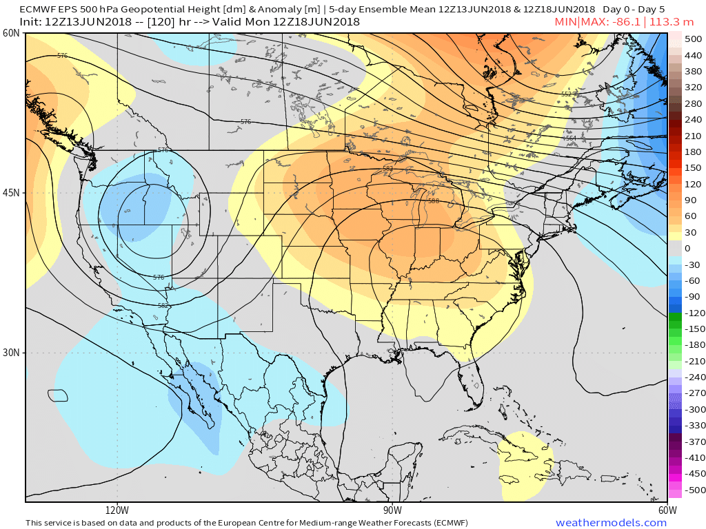
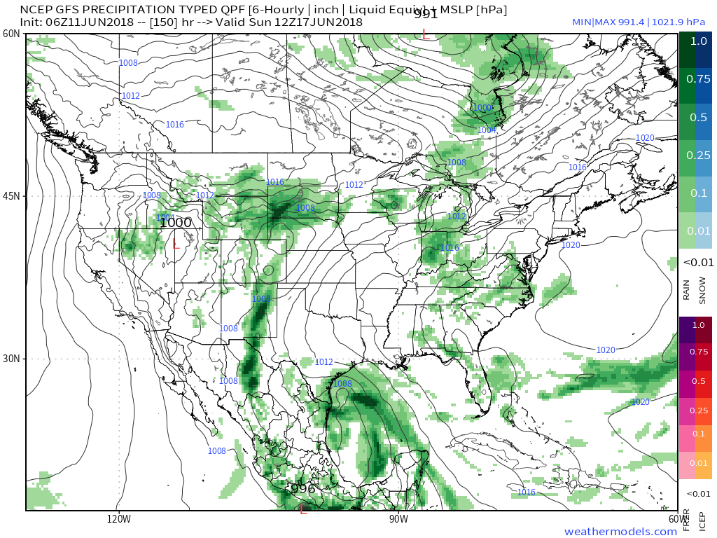
As our attention shifts to the medium range, it’s becoming increasingly apparent that this weekend will be dominated by an upper level ridge “ballooning” over the Ohio Valley. Both the GFS and European forecast models (and their ensembles) show this.
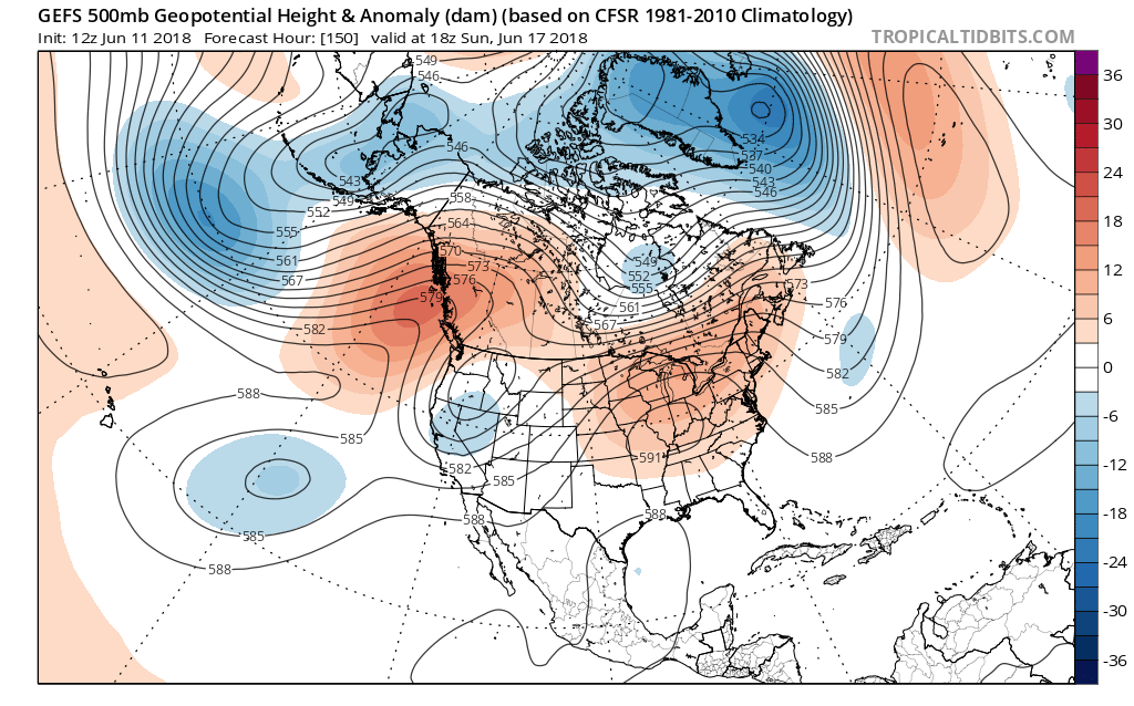
 The end result shouldn’t only be an increasingly hot pattern taking hold Friday through Monday, but one that features mainly dry conditions, as well. With the upper ridge expanding over the immediate region, the majority of central Indiana neighborhoods should expect to remain mostly dry this weekend (only “isolated” coverage of storms expected at best).
Highs Friday through Monday should flirt with 90°- if not exceed the 90° mark at times (hottest days appear to arrive Saturday and Sunday).
 Rain and storm coverage should increase early next week as a cold front approaches the region. With the increasing moisture, temperatures should also cool- at least slightly, as well…
Permanent link to this article: https://indywx.com/2018/06/11/upper-level-ridge-and-heat-builds-this-weekend/
Jun 11
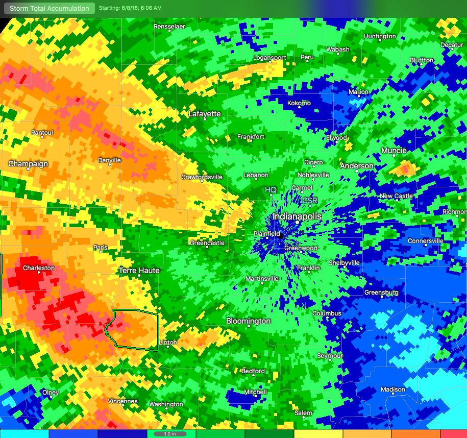
And Then The Rains Came…
Central Indiana has dealt with heavy rain over the past (24) hours, and it’s continuing this morning. In some areas, rainfall has been excessive. Note the latest Storm Total Rainfall map below. Areas of light green indicate where 1″ of rain has fallen (since June 8th), yellow indicates where 2″ of rain has accumulated, and the orange hues represent areas of 4″ to as much as 5″ in spots. – Again this is just rainfall from Friday morning through 7a Monday.
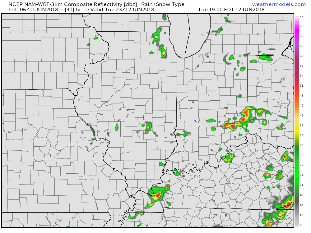
 Moisture continues to stream across central and southern Indiana this morning, and some of this rain is falling at a moderate to heavy rate.
 Widespread rain will eventually come to an end later this afternoon before scattered showers and thunderstorms redevelop this evening into tonight. Potential is also present for the possibility of another thunderstorm complex impacting parts of the region late tonight into early Tuesday- especially across the southwest part of the state. Scattered thunderstorm chances will remain Tuesday (more of the splash and dash variety as opposed to a widespread soaker).
 Eventually, drier air will work into the state for midweek and rainfall coverage will diminish Wednesday and most of Thursday.
An increasingly moist air mass will return to close the week and with the increasing humidity, rain and storm chances will make a return Friday into the upcoming weekend.
Permanent link to this article: https://indywx.com/2018/06/11/and-then-the-rains-came/