
As attention turns to the 4th of July holiday, there aren’t any changes to the ongoing idea of a significant heat wave gripping the region.
A strong ridge of high pressure will anchor itself over the Ohio Valley during this time frame and help power a big time period of hot and mostly dry weather. It’s the type of pattern that has legs to promote multiple days of highs in the middle to upper 90s across central Indiana. With tropical dew points in place, overnight lows won’t be allowed to fall much below the middle 70s during the height of the heat wave. Heat indices will rise into the lower 100s to near 110° at times.
Take this period of heat seriously. With many area festivals, firework shows, and events going on during the holiday week, it’ll be important to have a means of keeping cool. Simply put, this kind of heat wave doesn’t come around every year (and thank heavens for that).
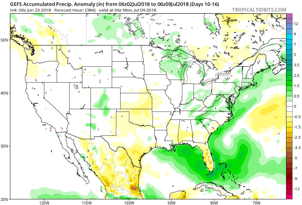
 With the hot dome centered over the Ohio Valley, it’ll really help to limit shower and thunderstorm chances. That’s not to say isolated coverage of cooling thunderstorms won’t occur on occasion during the afternoon and evening, but widespread rain of significance won’t be around during the period. Thankfully, the recent wet pattern and additional storm complexes coming in Tuesday into Wednesday have and will help surface moisture levels. Had we not seen the recent wet shift over the past couple weeks, you could easily tack on an additional 3° to 5°…
For those longing for the cool, crisp days of fall, hang in there. Heck, it’s only 69 days until my beloved Auburn Tigers tee it up and kick it off against the University of Washington… I am one that says “bring it on!”
 Sunshine will increase for the second half of the weekend and highs will respond- mid 80s after a refreshing start Sunday morning.
 While it’ll certainly turn more humid through midweek, the rain and storms will keep temperatures at seasonable levels. All of that changes once to Thursday and Friday as a building ridge of high pressure expands across the Ohio Valley.
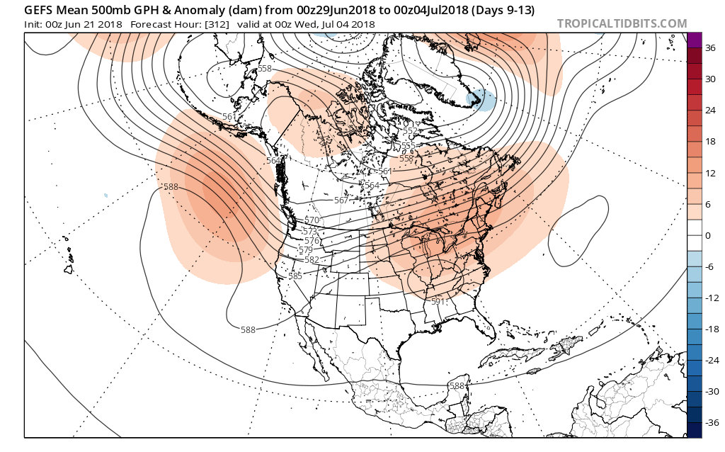
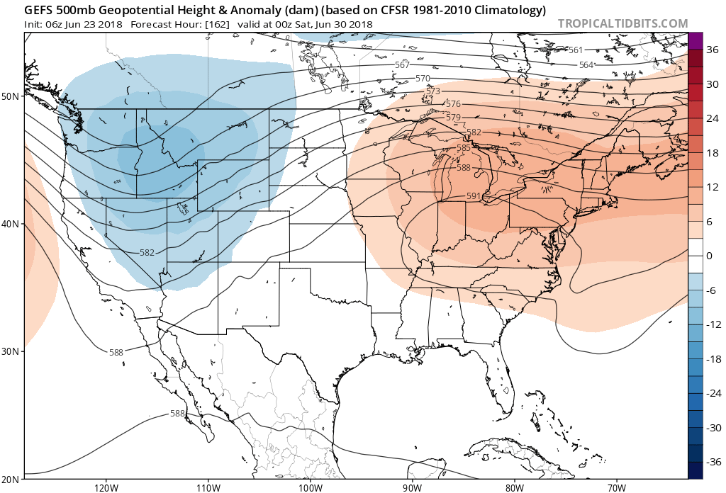 This will limit rain chances and potentially offer up the hottest air of the summer. We expect 5-6 days of low-mid 90s for highs and oppressive overnight lows in the lower to middle 70s.
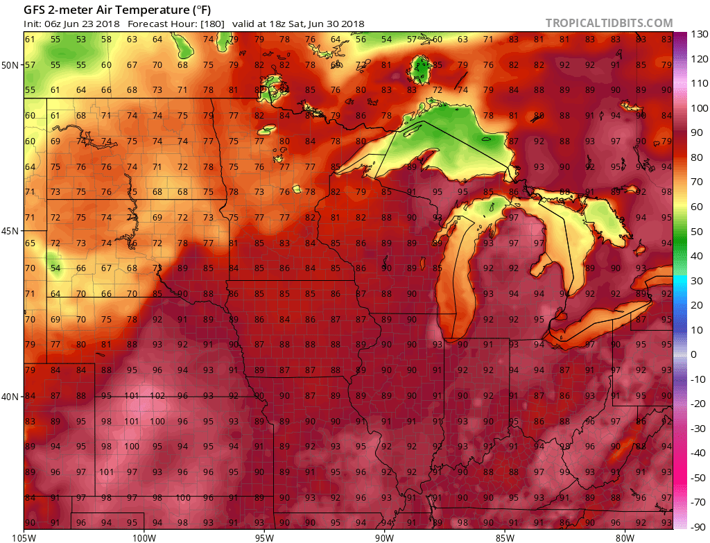 Thankfully, the hot dome will retrograde west and lead to “less hot” and increasingly stormy conditions after the first week of July. An active northwest flow pattern will take hold and provide an active time of things during this period.
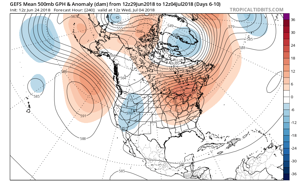
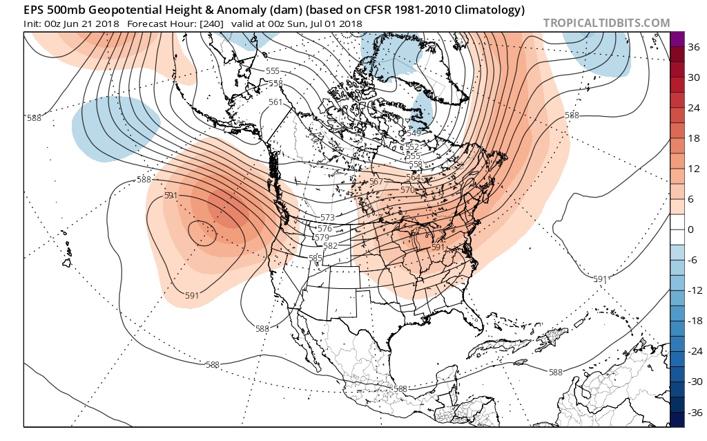 The end result would be anomalous heat and a drier pattern, as a whole, as we transition through the early stages of July. Heat to the magnitude of what we experienced last weekend isn’t off the table with such a similar pattern.
 Looking ahead, thankfully, one of our more trusted longer range computer models (JMA Weeklies), shows the pattern relaxing as we move into mid-July. The model shows the heat backing west and a more active northwest flow (wetter pattern) returning here…