
I. A cold front will move across the state this evening. Ahead of the front, a warm and moist air mass will remain in place and the frontal boundary will serve as a “trigger” to ignite scattered to numerous showers and thunderstorms, especially this afternoon and evening. While widespread, uniform rains aren’t anticipated, a couple of strong storms and localized downpours will develop ahead of the front.
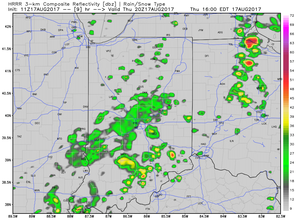
Scattered t-storms will impact the state today.
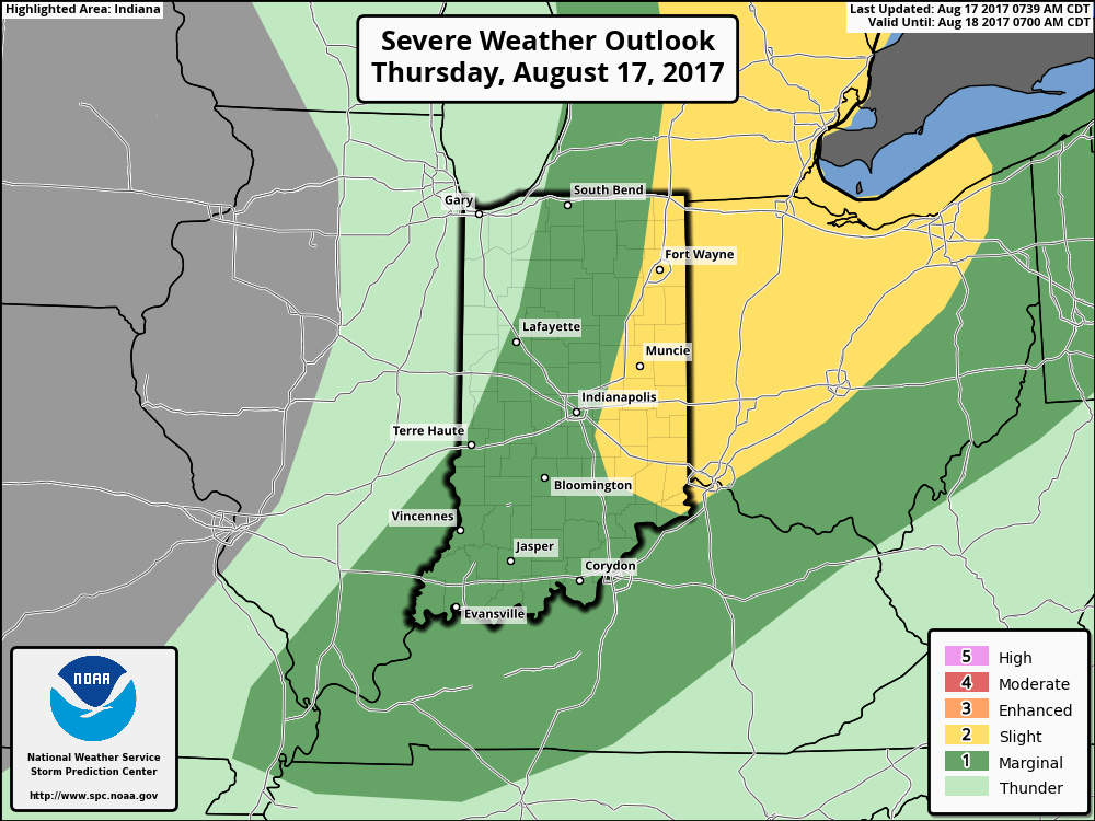
Eastern IN is included in a Slight Risk of severe weather this afternoon.
II. After a drier close to the work week (less humid, as well), an upper level disturbance will race across the Ohio Valley Saturday. This will provide enough lift to generate scattered showers and thunderstorms across the region, but all day rains won’t occur.
 III. Ridging will return early next week and, though brief, a shot of late-summer heat will eject northeast across the Mid West and Ohio Valley. Sunday through Tuesday will feature temperatures that top out in the upper 80s to around 90°.
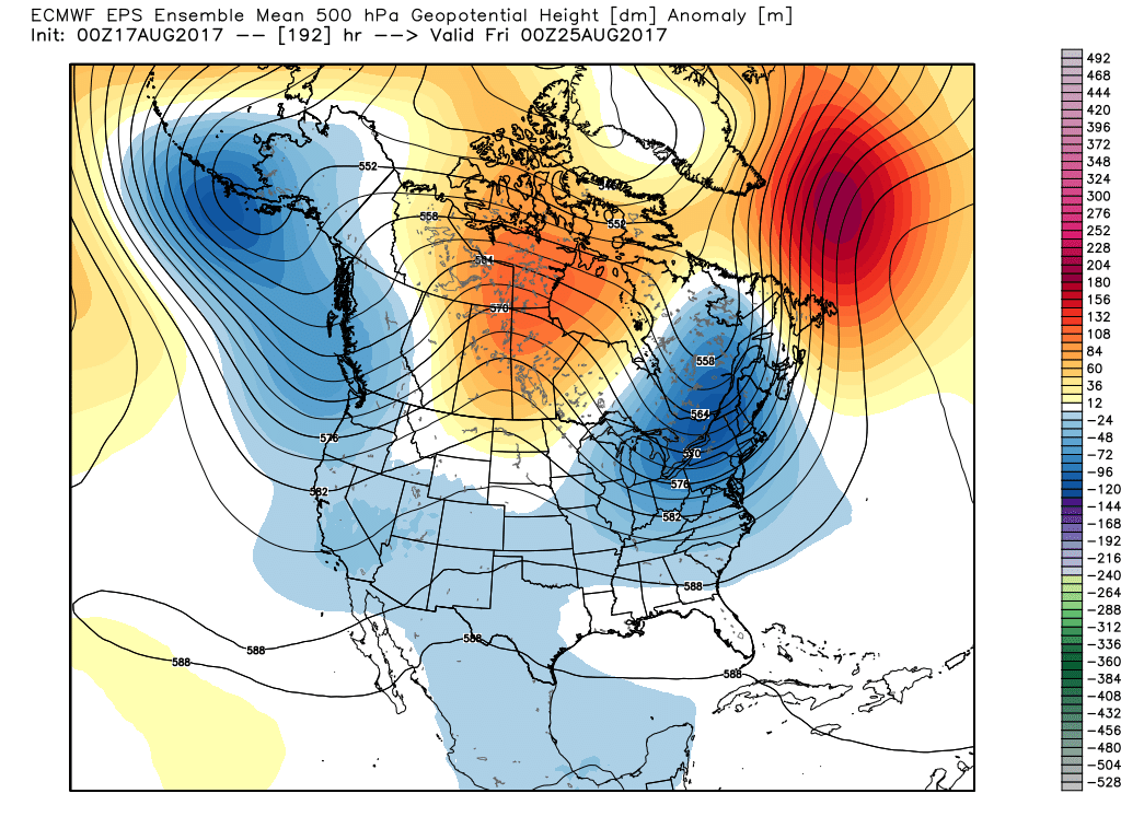
 IV. A cold front will drop in by the middle of next week. Scattered showers and thunderstorms will accompany the frontal boundary, but the bigger story will be a dramatic change to a much cooler regime as we get set to put a wrap on the month of August. In fact, temperatures may grow cool enough to allow some 40s to develop across central and northern parts of the state at night. Meteorological summer sure looks like it’ll end with more of a fall-like feel…
 As of now, we think the cold front will pass Friday evening and set-up another pleasant weekend with seasonable temperatures. The stretch of gorgeous August weekends’ appears to roll along.
 2.) While the radar is rain and storm-free this morning, a left over boundary, combined with daytime heating will help spark isolated to widely scattered storm coverage this afternoon.
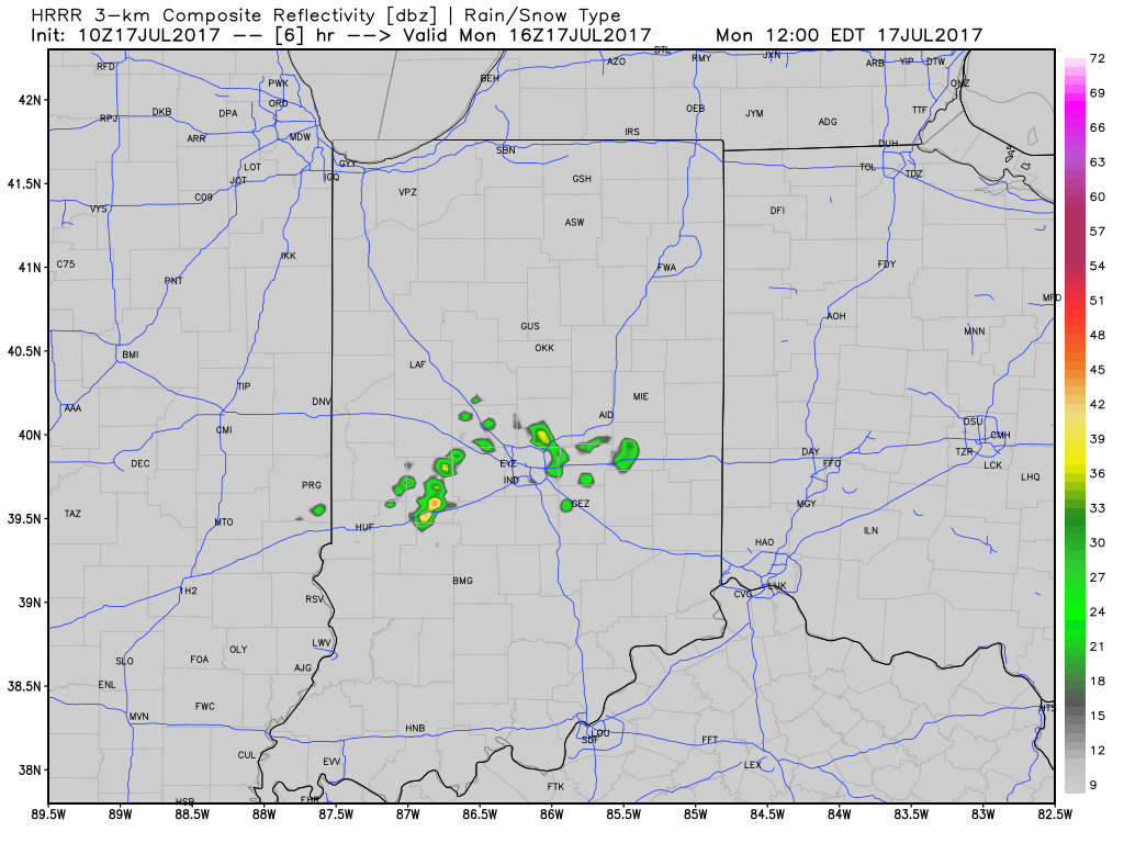 3.) The big weather story this week will be an increasingly hot and humid feel once to mid and late week, including the weekend. While today will continue the theme of slightly cooler than average from the weekend, we’ll more than make up for the refreshing feel later this week. Highs will push to around 90° Wednesday through Sunday as the ridge expands.
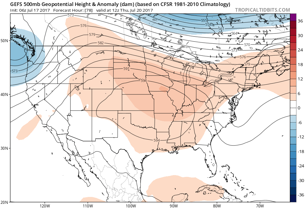 4.) Despite the hot and humid feel that develops this week, it won’t last. Like so many other times this summer that heat tries to build east, the transient weather pattern will continue to prevent it from “hitting and holding.” You guessed it, as we transition from the hot conditions to cooler weather next week, rain and storm chances will be on the increase, including the potential of heavy rain. As of now, best rain and storm chances appear lined up for late week through the weekend and into early next week.
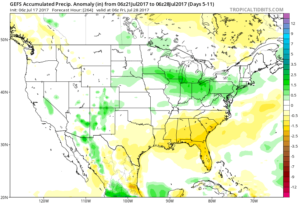
 2.) With the increasing warmth and humidity will also come an increase in shower and thunderstorm chances today through Saturday. Most widespread coverage of thunderstorms should occur during the evening hours today and Friday night into Saturday morning. Drier air will try and work in Saturday afternoon into Sunday. Here’s a look at the forecast radar valid at 7p this evening.
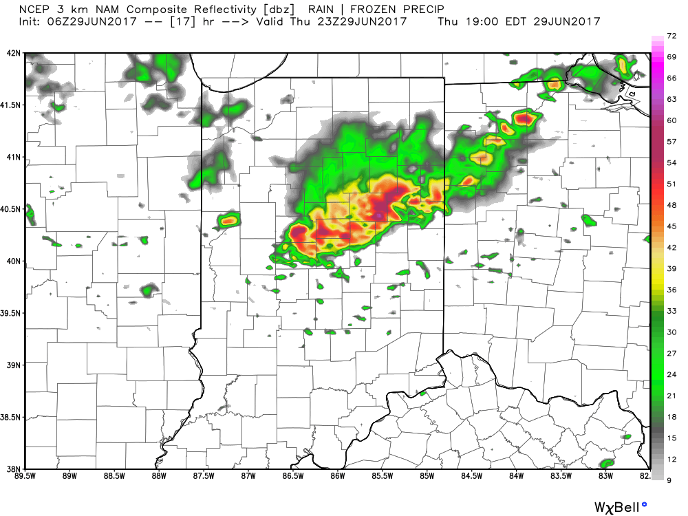 3.) While we should dry things out Saturday afternoon into Sunday, active times will return early next week. We’ll have to fine tune timing, but the period Monday into Independence Day may feature a rather strong storm complex moving in a southeast fashion across the region. Again, details still have to be determined. While strong storms are possible at some point during the period, more dry time than wet can be expected.
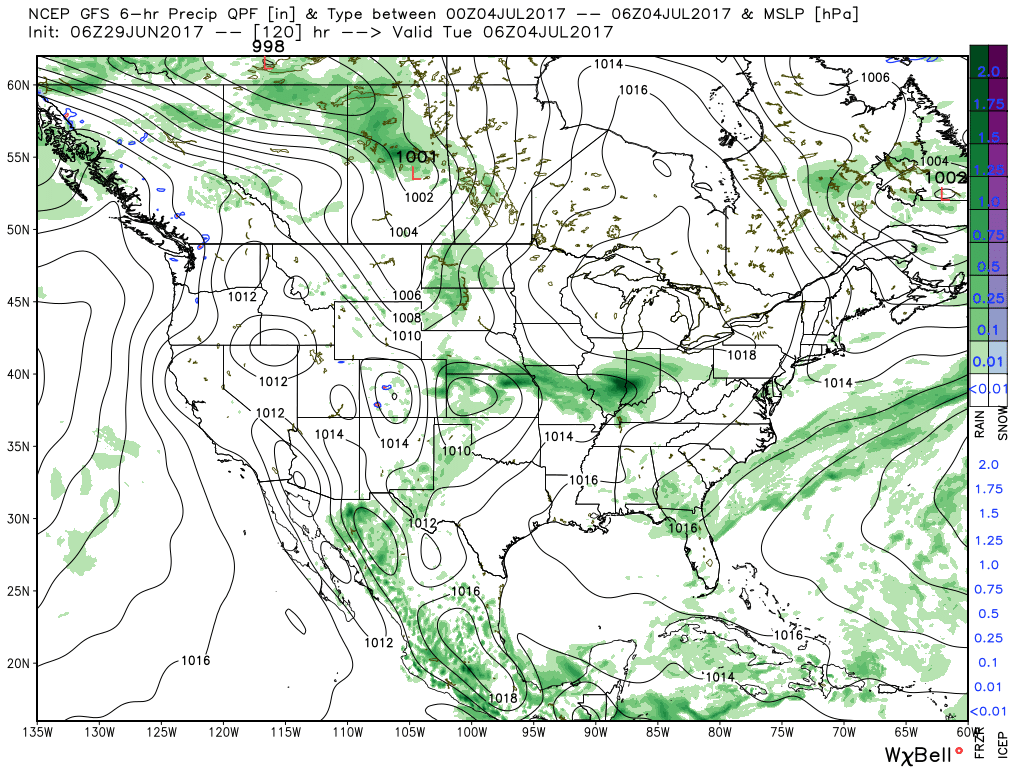 4.) The latest JMA Weeklies are in and while we’ll have a more extensive post this evening on the weekly breakdown, the screaming message to us is an active period continues along with cooler anomalies setting up shop across the central, including our region.
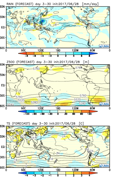
 Best overall coverage of showers and thunderstorms should come in (3) waves over the upcoming 10-day period:
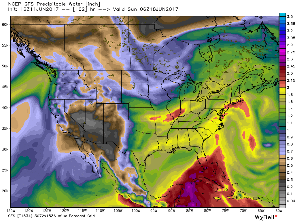 As I type this outside on the back porch this evening, I hear the sounds of sprinklers in full-force through the ‘hood. Thankfully, Mother Nature will help save on the water bill later this week. Longer-term, you’ll hear us use the word “transient” many times this summer when discussing the overall weather pattern. Thankfully that tends to result in a fairly busy time of things. Before you know it, college football season will be back (83 days until my beloved Auburn Tigers kick-off), those wetter autumn storms will return, and thoughts will begin to shift to winter (they may have already started here :-))- not that we’re trying to rush summer away or anything…