VIDEO: “Backdoor” Cold Front Presents Weekend Challenges; Active Close To April…
You must be logged in to view this content. Click Here to become a member of IndyWX.com for full access. Already a member of IndyWx.com All-Access? Log-in here.
You must be logged in to view this content. Click Here to become a member of IndyWX.com for full access. Already a member of IndyWx.com All-Access? Log-in here.
You must be logged in to view this content. Click Here to become a member of IndyWX.com for full access. Already a member of IndyWx.com All-Access? Log-in here.
Quick video update on the go this evening discussing an overall wintry time of things over the upcoming 5-7 days!
You must be logged in to view this content. Click Here to become a member of IndyWX.com for full access. Already a member of IndyWx.com All-Access? Log-in here.
In the midst of trying to keep Bo, our youngest golden doodle, from becoming a tremendous distraction in this morning’s video, here are some thoughts on what lies ahead over…
You must be logged in to view this content. Click Here to become a member of IndyWX.com for full access. Already a member of IndyWx.com All-Access? Log-in here.
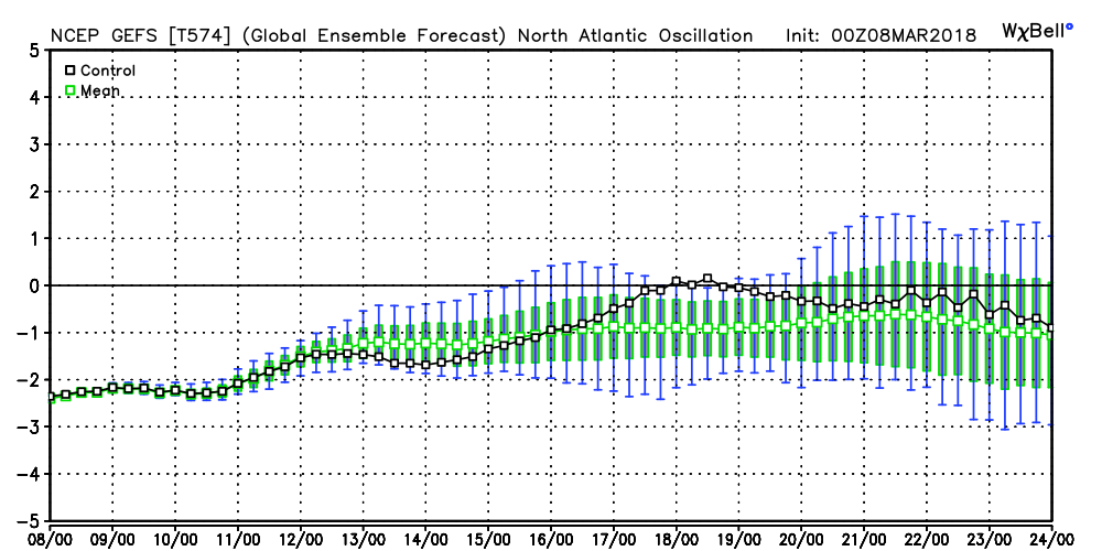
We note the modeling continues to want to keep the North Atlantic Oscillation (NAO) negative into late month. As mentioned in previous discussions, the NAO is “king” late winter and spring.
 It should be no surprise that the GEFS 5-day temperature anomaly shows widespread below normal air centered on March 22nd.
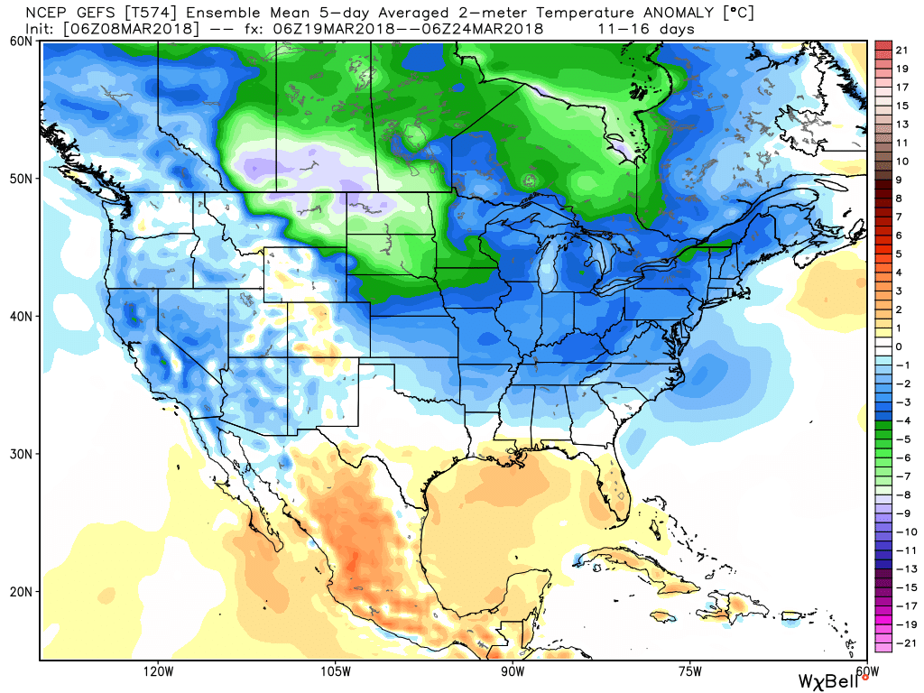 This doesn’t mean brief surges of warmth, originating in the southern Plains, can’t shoot into the Ohio Valley for a couple of days. Perhaps we’ll “luck out” and enjoy a briefly milder time for St. Patrick’s Day. This does, however, mean that overall we have a long, long way to go before “stick and hold” spring can arrive, locally, and the balance of the upcoming 2-3 weeks looks colder than average.
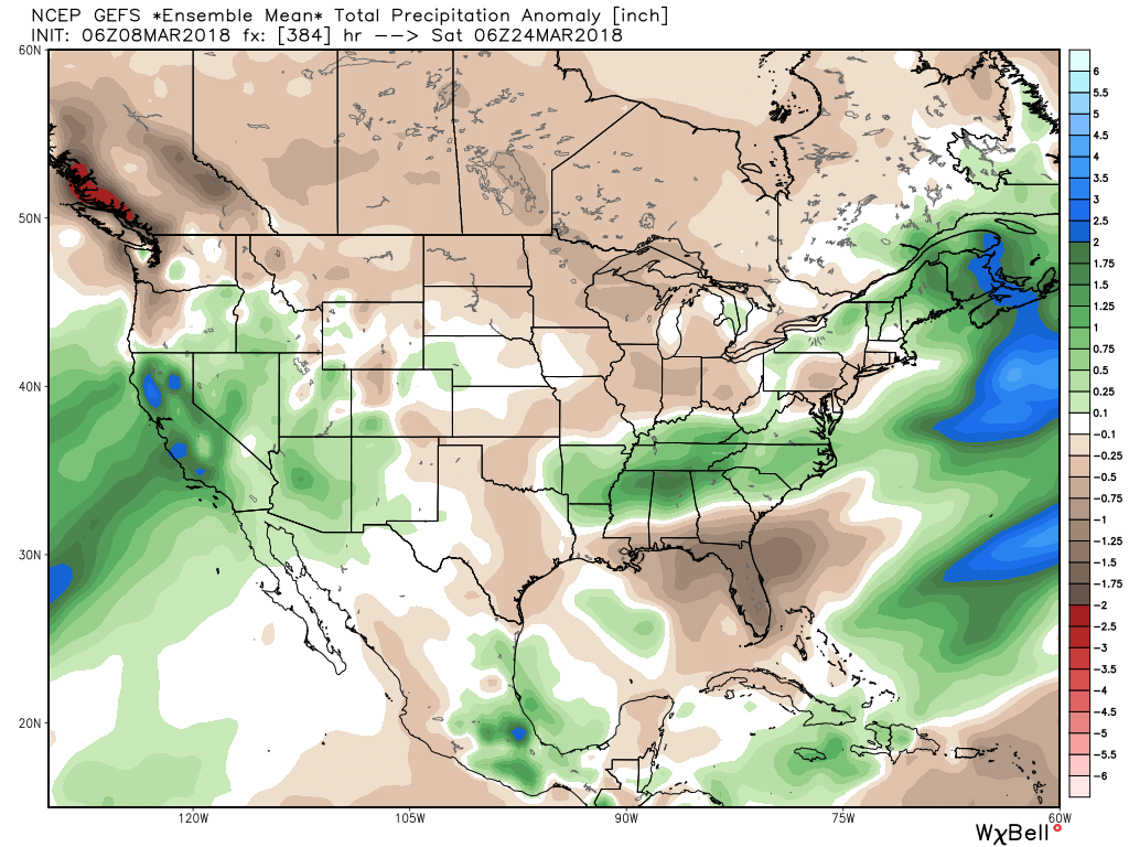
Side note: The upcoming couple weeks looks drier than average for our region, while the TN Valley into the Carolinas remains abnormally wet. Our friends in the southern Plains continue to deal with dry times and the drought will only worsen in coming weeks there…