Monday Morning Rambles: Pleasant Open To The Week…
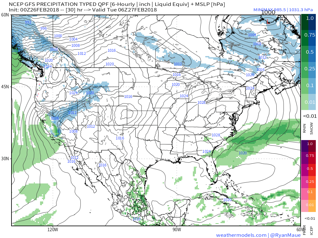
I. High pressure will dominate the early part of the work week, helping to supply plentiful sunshine and seasonably mild temperatures. We’ll continue to enjoy the much-needed dry theme the weekend ended on!
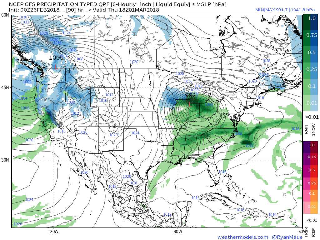
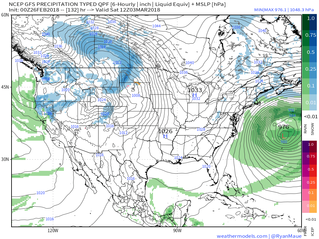
 II. Our next weather maker will arrive midweek and provide a few showers Wednesday (not a huge deal from a precipitation perspective). However, as a deepening surface low tracks into the Great Lakes Thursday morning, a period of heavier rain and even thunder is possible. In general, this looks like a 0.50″ to 1.00″ type event.
 III. Somewhat cooler air will whip in behind the low, allowing leftover precipitation to end as a couple wet snowflakes across the northern half of the state Friday morning. The bigger story will be the “bumpy” start to Friday with strong and gusty north winds.
 IV. High pressure returns for the weekend and with it will come a return of sunny skies. Though the mornings will be frosty, afternoon temperatures will “warm” to pleasant levels, especially with the increasingly strong early-March sun angle.
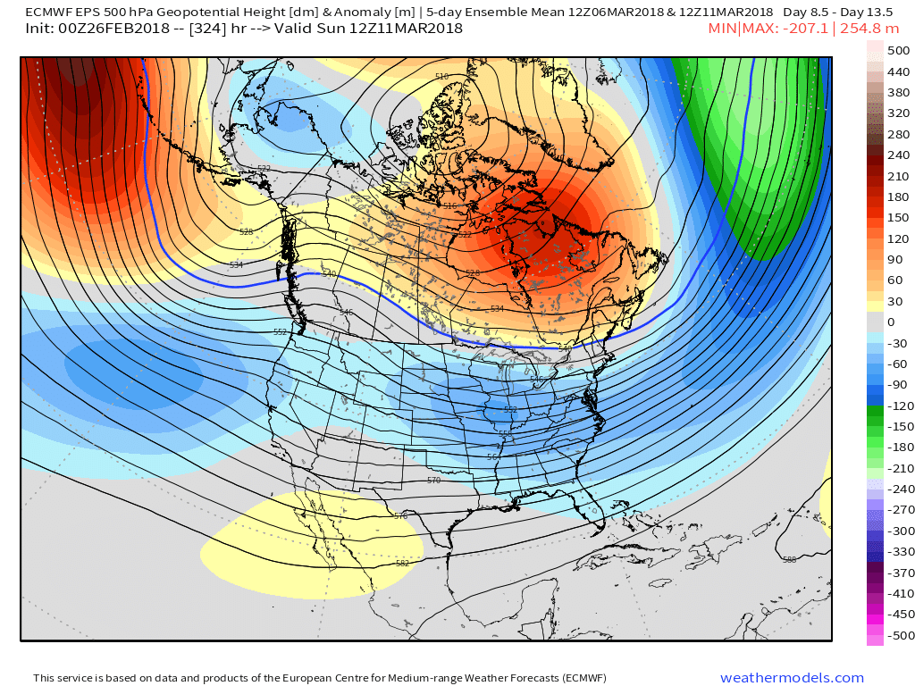
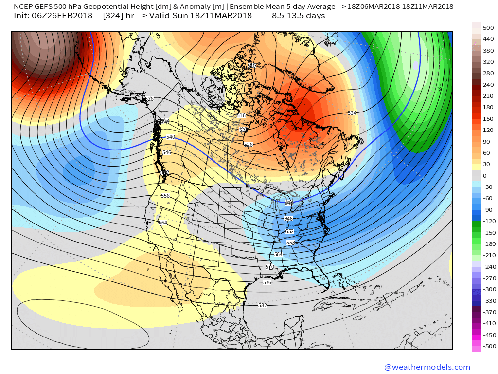
 V. Looking ahead, let’s keep a close eye on the second week of March. Potential is present for a stormy period to emerge under the block. We note the GEFS and EPS (respective ensembles of the GFS and European models) are in relative agreement on a stormy, cold look during this time frame. While far too early for specifics, the potential is there for a rather widespread wintry event from the Plains into the Northeast.
 II. We’re hopeful for much needed sunshine Sunday as we’ll be in between storm systems, however any sun that we see won’t last long.
 While this is an unseasonably warm pattern (we forecast highs of 50°, or above, 5 out of 7 of the upcoming days, and at least 2 60°+ days), it’s one that will likely result in periods of heavy rain not only next week, but in waves over the upcoming 10 days.
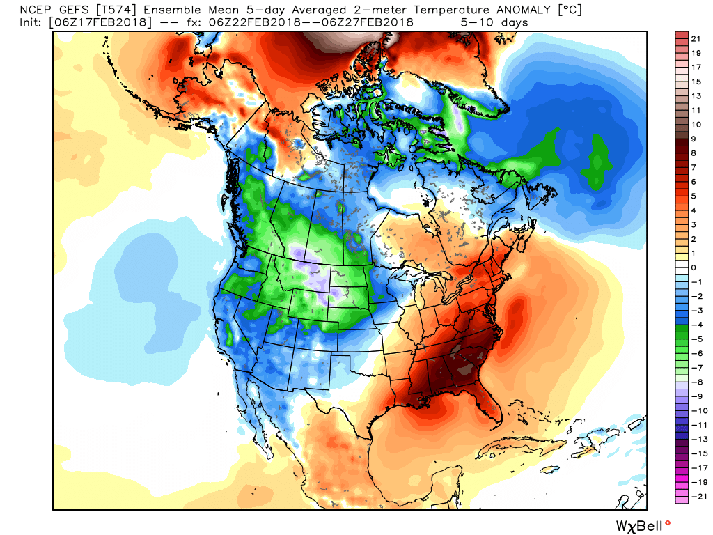
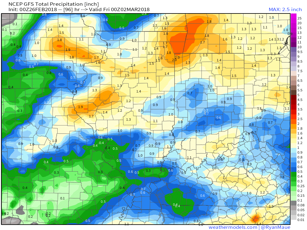
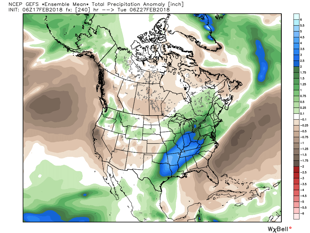 Widespread 10-day rainfall numbers of 3″ to 4″ will be likely in this setup, including locally heavier amounts of 5″ to 6″ in spots. Certainly, if you live near waterways we suggest having a plan in place as it’s not a matter of if, but when flooding takes place in spots across the region with such a setup.
 Looking ahead, a rather prolonged and significant snow event is setting up shop across northern Indiana. We forecast snow to begin falling Thursday night before becoming heavy at times Friday. A tight thermal gradient will aid in the combination of ingredients to produce hefty snowfall across far northern IN and also provide a brief break from the cold, locally, Friday afternoon (forecasting highs into the 40s here). With that said, if your travels take you north, prepare for significant travel disruptions with the heavy snow.
 A cold front will drop south into central Indiana overnight Friday into Saturday. At the same time, a couple of disturbances will ride northeast along the front. This will result in periods of light wintry precipitation across central Indiana over the upcoming weekend. Initially, this should be rather insignificant with a mix of light rain and perhaps some light sleet or light freezing rain Saturday.
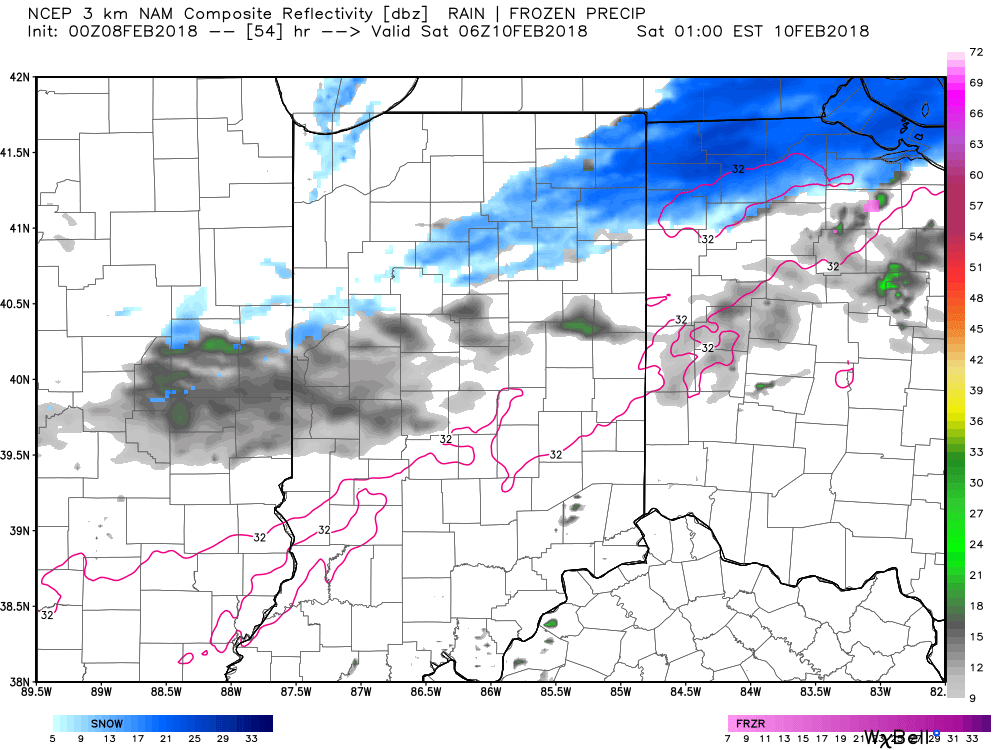 However, as our airmass becomes progressively colder Saturday night into Sunday things will become more interesting. At the same time, a final wave of energy will lift northeast, spreading moisture into the colder air mass. We forecast more widespread wintry precipitation to engulf central Indiana Saturday night into Sunday. A wintry mix of sleet and snow is possible early on before transitioning to all snow Sunday morning. A period of accumulating snow is expected Sunday and we’ll fine tune numbers as we move closer.
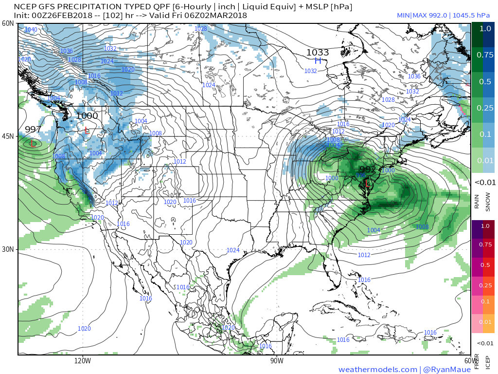
 Looking further ahead, an active time of things will continue as the battle remains between cold centering itself across the northern Plains into the Lakes and Ohio Valley and resistance from the southeast ridge. This will continue to lead to a busy period of weather across the region, including storm systems that will come along every couple of days.
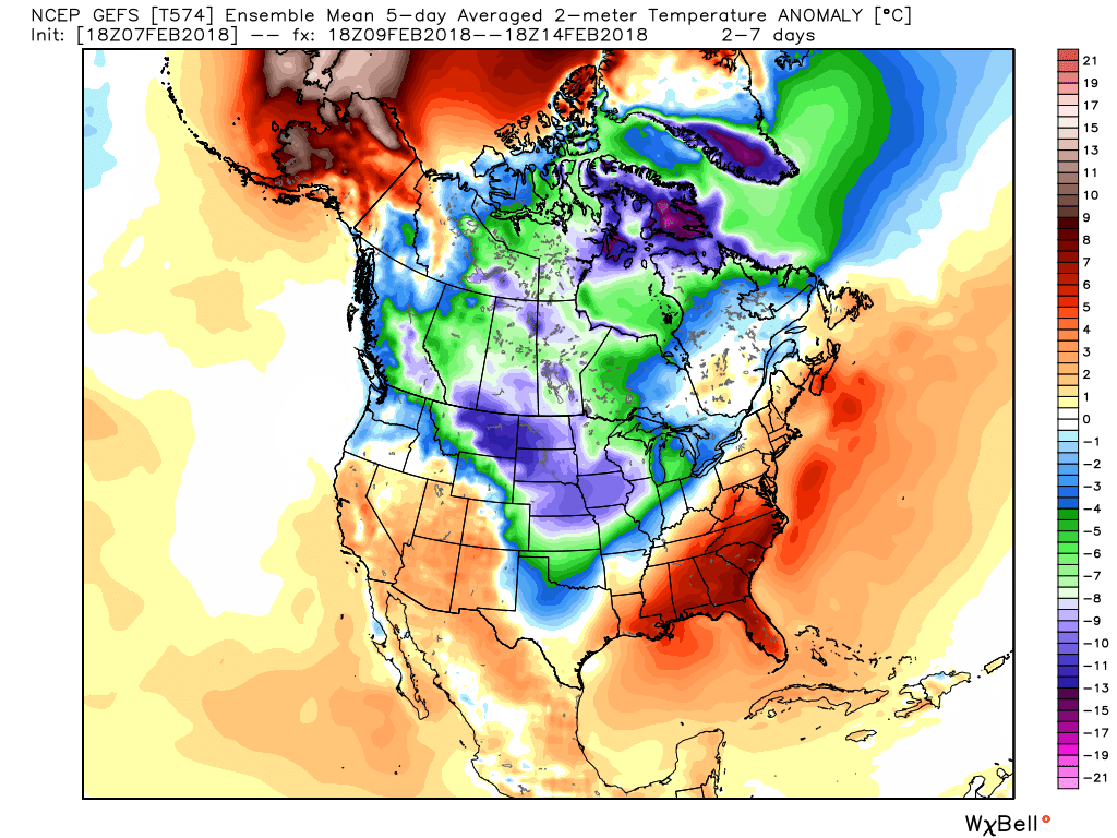 We continue to think things are aligning in a fashion that should result in a significant period of cold developing during the second half of February into March this year. We note the teleconnections continue to trend in cold directions and the MJO is also rolling along into the colder phases. We have a long, long ways to go this winter and think some headline events remain on the table as we close the month and open March. Time will tell.
 Arctic high pressure will result in a cold, but dry (and sunny) close to the work week.
 As we move into the weekend, our weather will begin to turn more active. This will be the first of a series of snow systems over the upcoming 7-10 days. While this initial event won’t be significant, it’ll get the ball rolling on (at least what we believe will be) another extended stretch of wintry conditions. We forecast a couple periods of light snow (“light” being the key word) this weekend: Saturday evening and again Sunday evening. It appears as if the energy will remain very disorganized over the weekend and the result will be light snow accumulations during the Saturday through Sunday period.
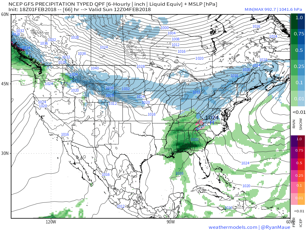 Again, this is only the beginning of a very active pattern; one that will shoot snow systems at us in an “every other day” fashion over the upcoming 7-10 days. We’ll keep close tabs on last minute adjustments that may be needed with such a pattern. Often times modeling will struggle with the fast-paced northwest flow and models will have to “correct” last minute towards a more significant event.
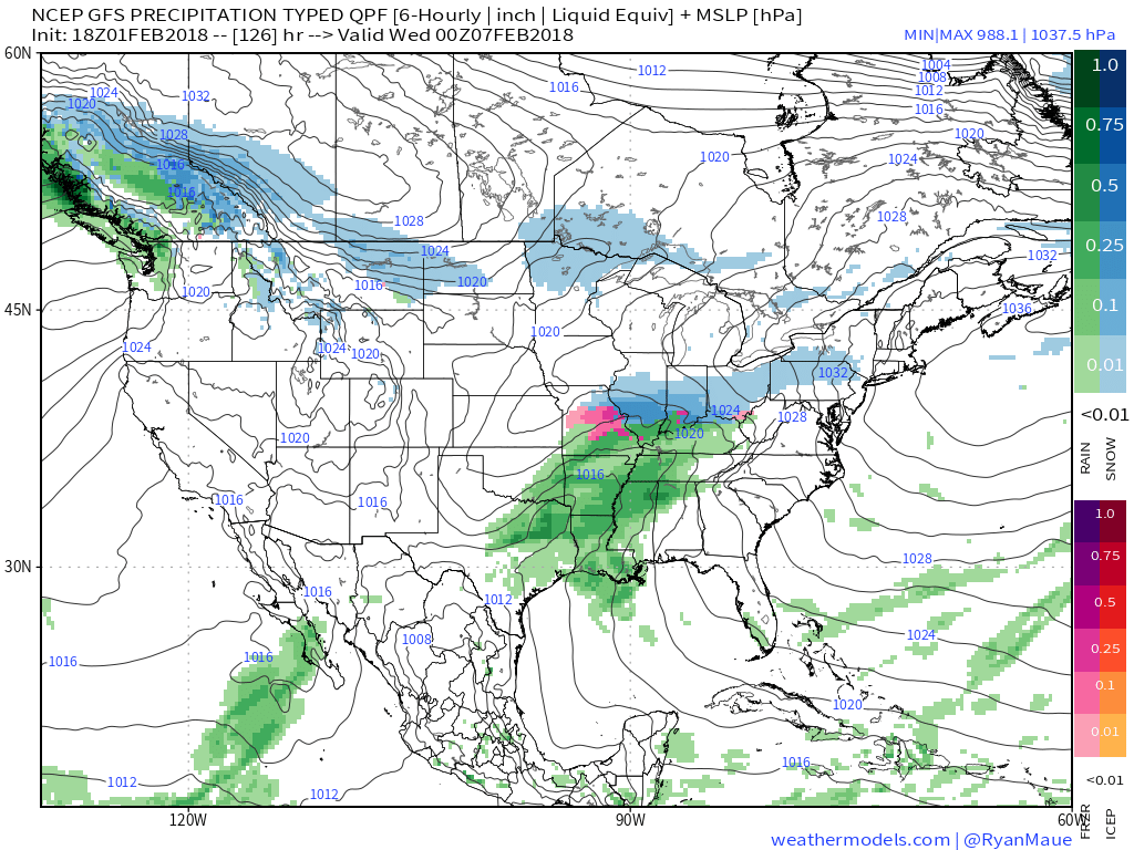 Additional opportunities for accumulating snow lie ahead, including: