VIDEO: Busy Week Ahead…
You must be logged in to view this content. Click Here to become a member of IndyWX.com for full access. Already a member of IndyWx.com All-Access? Log-in here.
You must be logged in to view this content. Click Here to become a member of IndyWX.com for full access. Already a member of IndyWx.com All-Access? Log-in here.
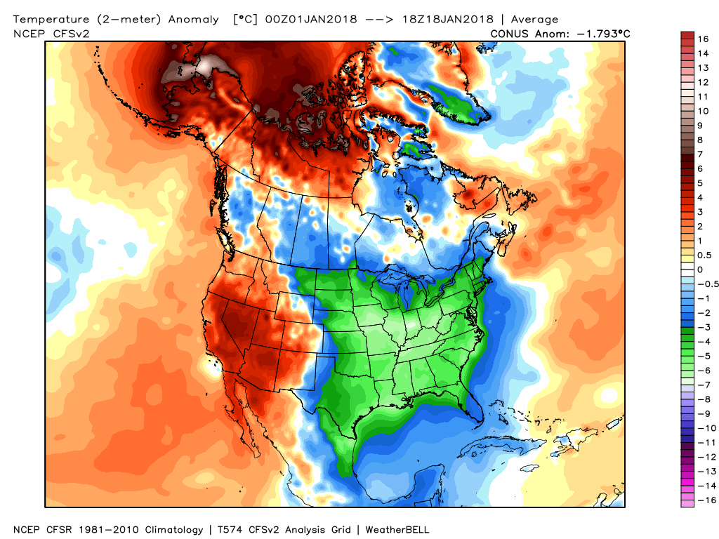
January is running more than 11.5° below average and more than 50% of the country is currently covered in snow.
 However, big changes begin to take place this weekend and will remain intact for the majority of the next couple weeks. The mean trough position will back into the west while ridging takes hold across the east. This will feature temperatures that will push to above average values and lead to an active and moist southwesterly flow.

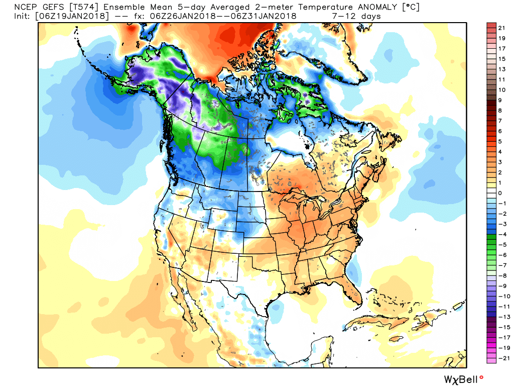
 Over the upcoming (10) days, temperatures may reach 50°, or greater, on 3 to 4 of those days. Compared to how frigid we’ve been (already had 7 mornings this month with sub-zero lows), this will feel like a heat wave.
We’ll leave you with a heads up to enjoy the January thaw (yes, even if you’re one of those winter lovers out there) as the pattern sure looks like it’ll deliver a return to bitterly cold, wintry times as we head into February… In fact, analogs would suggest once winter returns, it’s likely to remain in place deep into spring this year.
You must be logged in to view this content. Click Here to become a member of IndyWX.com for full access. Already a member of IndyWx.com All-Access? Log-in here.
I. Bitter Cold: We’re adding another morning below zero to an already impressive (and growing) list of frigid lows this winter. Take a look at these morning lows in the…
You must be logged in to view this content. Click Here to become a member of IndyWX.com for full access. Already a member of IndyWx.com All-Access? Log-in here.
You must be logged in to view this content. Click Here to become a member of IndyWX.com for full access. Already a member of IndyWx.com All-Access? Log-in here.