VIDEO: Early Accumulation Idea Friday Night-Saturday; Bitterly Cold Open To 2018…
You must be logged in to view this content. Click Here to become a member of IndyWX.com for full access. Already a member of IndyWx.com All-Access? Log-in here.
You must be logged in to view this content. Click Here to become a member of IndyWX.com for full access. Already a member of IndyWx.com All-Access? Log-in here.
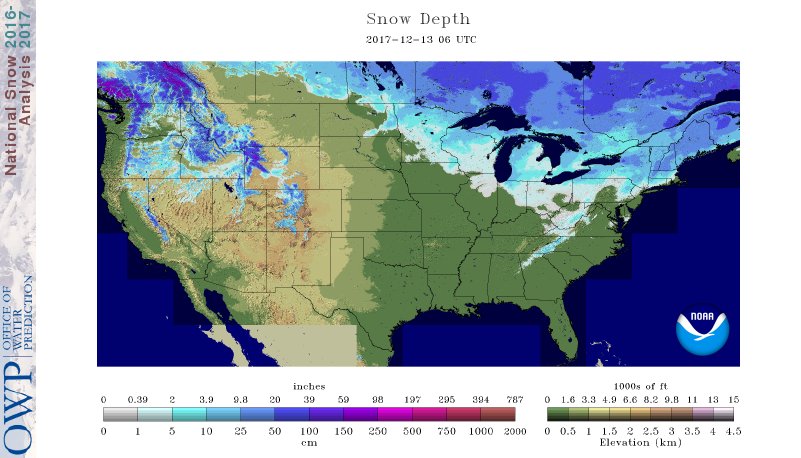
I. A look at the current snowpack shows the northwest flow nicely, and another storm is just missing central Indiana to the north and northeast this evening (not included in this morning’s snowpack update). The southern Appalachians have also been capitalizing in this northwest flow pattern, not to mention the southern stream event that dumped hefty snows on the Deep South.
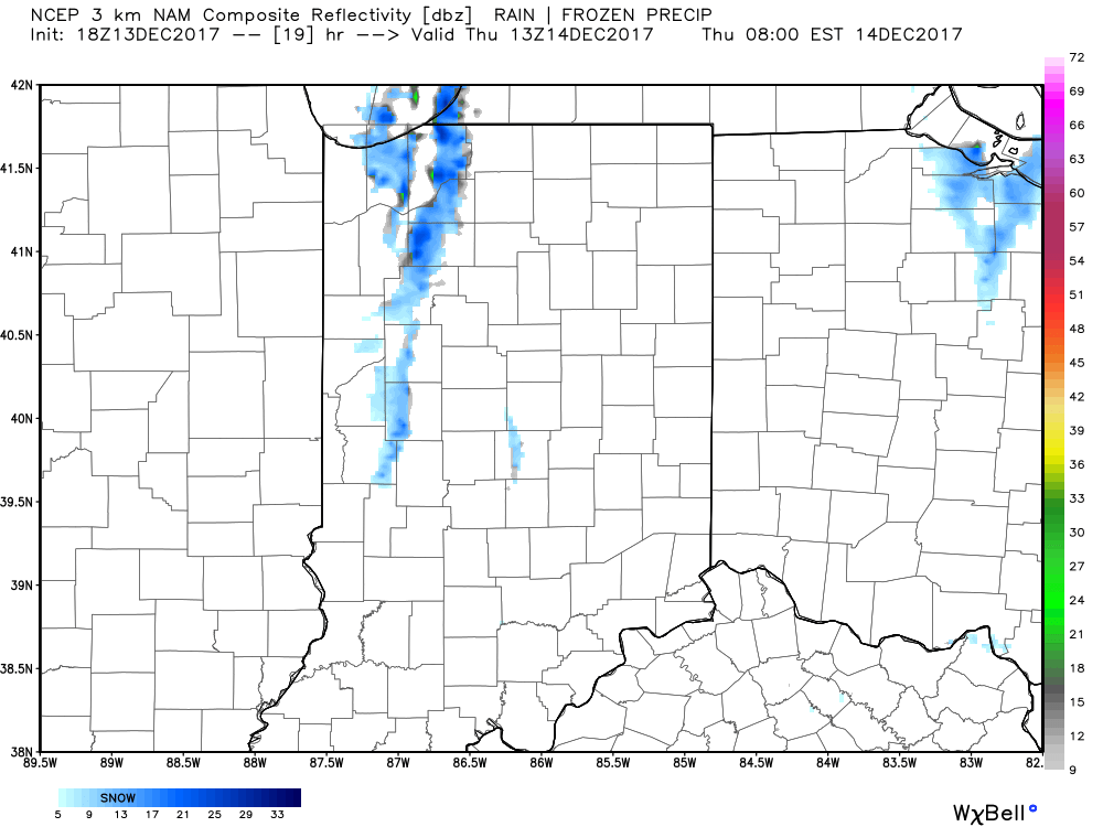
 II. While the sticking snows will miss us this go around, scattered snow showers will impact central IN overnight into early Thursday morning. There’s also still the potential of a skinny lake effect snow band to impact a narrow portion of western and north-central IN early Thursday.
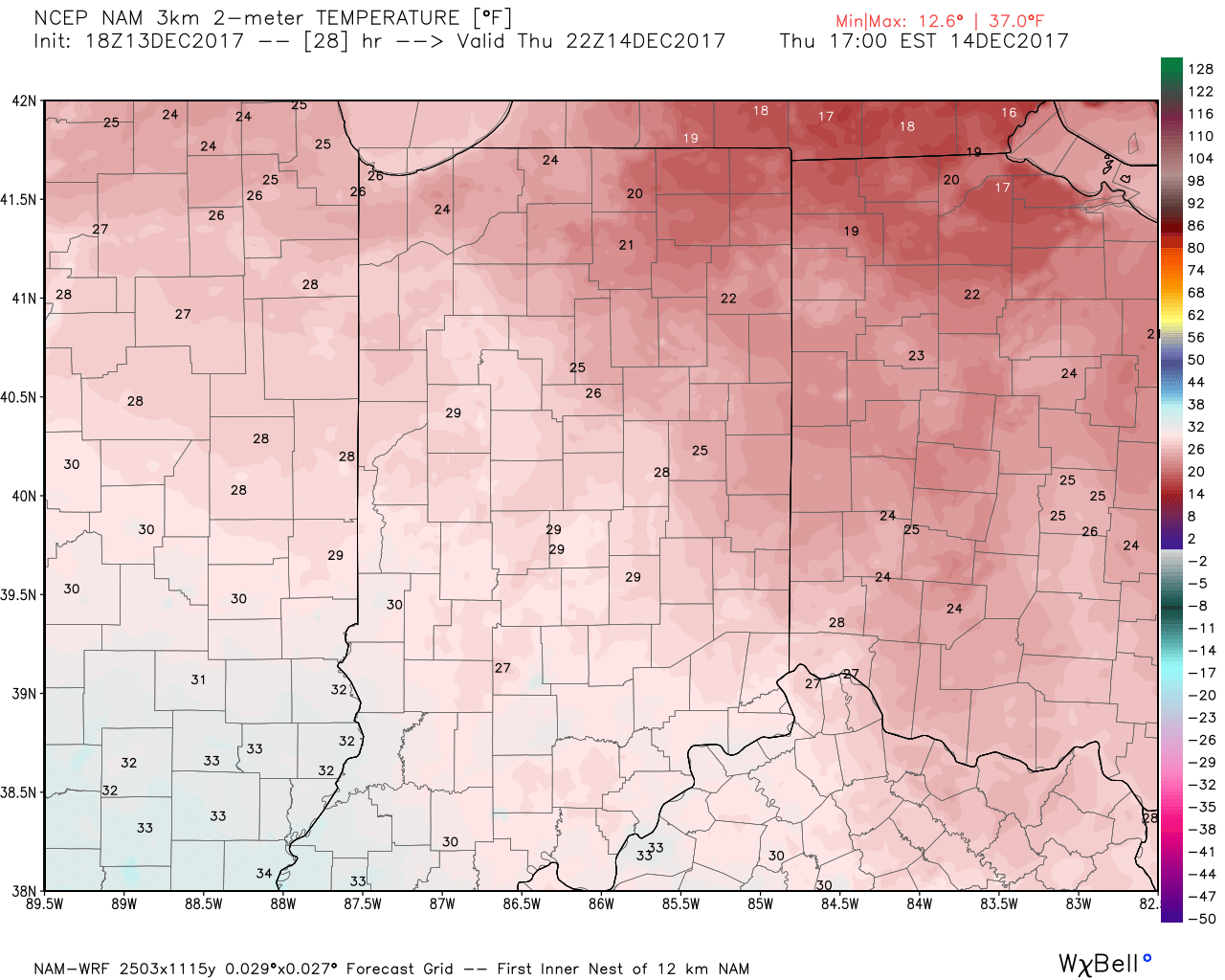
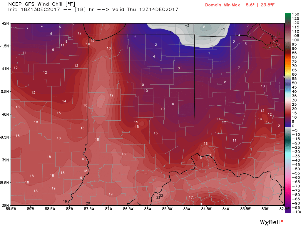
 III. Reinforcing cold air will plunge south Thursday. Highs will remain below freezing along with wind chill values in the 10s most of the day.
 IV: A milder southwesterly air flow will result in slightly “warmer” temperatures this weekend (mid 40s for highs Saturday) before showers arrive to close the weekend. Despite the slight relaxation of the cold, this will come with a gusty breeze over the weekend.
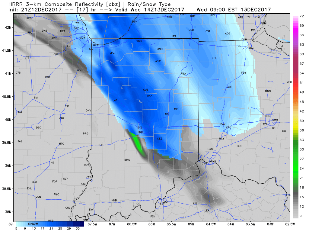
I.) The pattern we’re currently dealing with is one that presents multiple challenges in the near term. East-central and northeastern portions of the state have gotten in on the snow act today, but, so far, most of central Indiana has missed out on the snowy goods. With such a fast-paced northwest flow, we have to remain on guard for potential “surprises” in this pattern. Perhaps the HRRR is beginning to pick up on this. Latest runs want to deliver a “pop” of snow Wednesday morning, associated with “warm” air advection (WAA). We’ll monitor tonight.
II. The northwest flow will continue to provide disturbances plenty capable of producing periods of snow again Wednesday evening through the end of the week. Are these monster storms? Hardly, but they can “suddenly” become sufficient enough to create travel problems given the pattern. For those who live across the northern half of the state, plan to keep close tabs to local forecasts if you have travel plans through the end of the week.
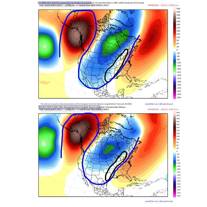
 III. A period of brief moderation will come in this pattern early Christmas week, but all eyes continue to focus on the period between December 22nd through December 26th for the potential of impactful weather across our region. For model “worshipers” out there, we suggest paying more attention to overall trends, and a blend of ensemble data, as opposed to specifics associated with operational runs. It’s a “jailbreak” pattern of sorts as true arctic air will be pouring down the Plains while the southeastern ridge tries to fight for a time. The resistance from the southeastern ridge and associated tight thermal gradient should promote a very stormy regime for the interior (Ohio Valley into the interior northeast) as we head into the true holiday/ Christmas stretch. As of now, we favor the idea of multiple waves along the pressing arctic boundary, as opposed to one big storm. Looking back through the records shows some of the heaviest snows at IND have come from similar set-ups. Understanding each set-up is unique, the overall pattern does have to raise an eye brow for potential of wintry weather in, or around, our region as Christmas approaches…
You must be logged in to view this content. Click Here to become a member of IndyWX.com for full access. Already a member of IndyWx.com All-Access? Log-in here.
The short-term weather pattern will continue to be dominated by rather “boring” conditions for this time of year, along with much milder than normal air. A weak frontal system will swing through here Thursday and while a light shower is possible, that’s really the only significant (if you want to call it that) weather feature through the upcoming 7-10 days.
In addition to the rather quiet weather, relative warmth will dominate as we open December. When “normals” feature lows in the upper 20s and highs in the lower 40s, actual overnight lows will only fall into the low-mid 30s and highs will reach the middle to upper 50s.
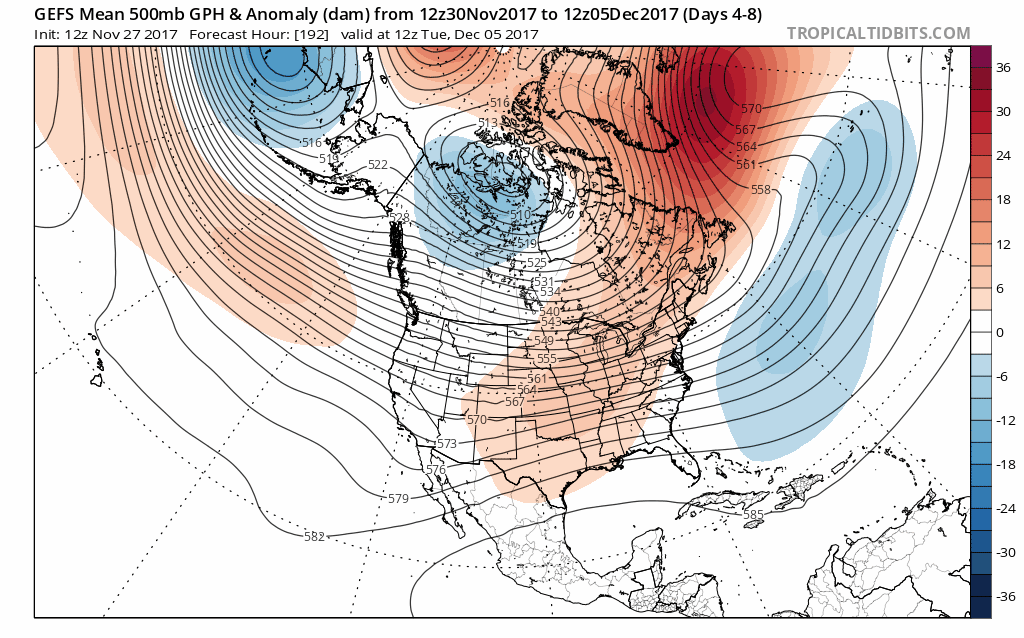
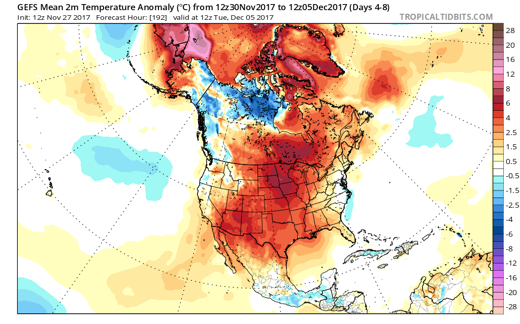 When we look ahead, the shelf life of this warmth is certainly limited. The GEFS showcases this shift in the pattern from a warm open to the month towards a much colder pattern very nicely. The GEFS has other model support, as well.
 This is the type of dramatic shift in the overall pattern that not only threatens to “lock in” a colder than average regime, but potentially lead to plenty of wintry mischief to boot, and just in time for the holiday season.
There’s teleconnection support for the wintry shift, as well, leading to further confidence of a significant move towards cold, and potentially snowy/ icy, conditions as the true holiday and Christmas season approaches.
 To summarize, while unseasonably quiet and mild conditions will rule in the short-term, Mother Nature sure seems to have an attitude of making up for “lost time” in the medium to longer range. This is the type pattern that we’ll have to monitor the potential of some sort of leader-follower scenario as the transition from warm to cold takes place, and given the blocky nature of the pattern, it sure seems like we’re heading into a busy time of things from a wintry perspective mid and late month.
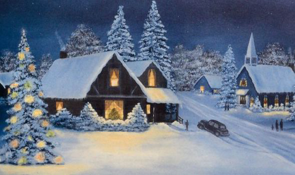
Perhaps this will be the scene as Christmas time nears across the Mid West, including central Indiana? Time will tell…