First and foremost, from our family to yours, we wish you a blessed Thanksgiving. Enjoy the day with loved ones, eat a ton, and ensure you get a little football…
You must be logged in to view this content. Click Here to become a member of IndyWX.com for full access. Already a member of IndyWx.com All-Access? Log-in here.
You must be logged in to view this content. Click Here to become a member of IndyWX.com for full access. Already a member of IndyWx.com All-Access? Log-in here.
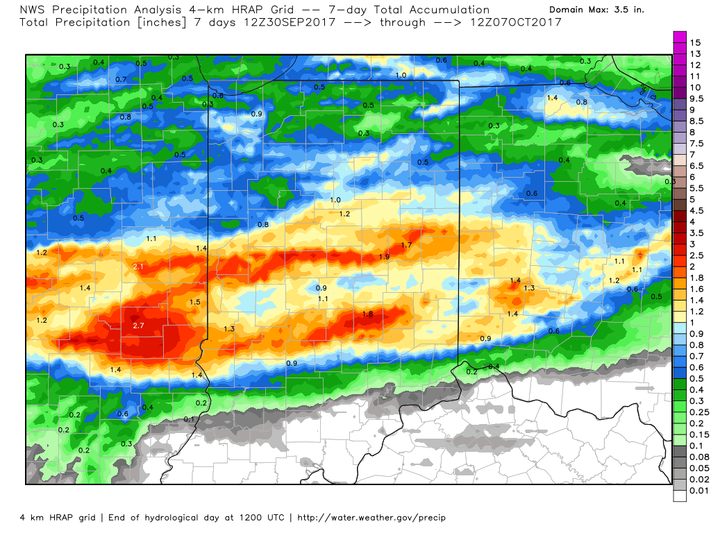
For a change, the past (7) days has been generous to central Indiana from a precipitation perspective. As we’ll discuss, a new rain maker awaits this week.
A look at rainfall totals over the past 7 days, courtesy of weatherbell.com.
Officially, IND sits at 0.26″ above normal, month-to-date.
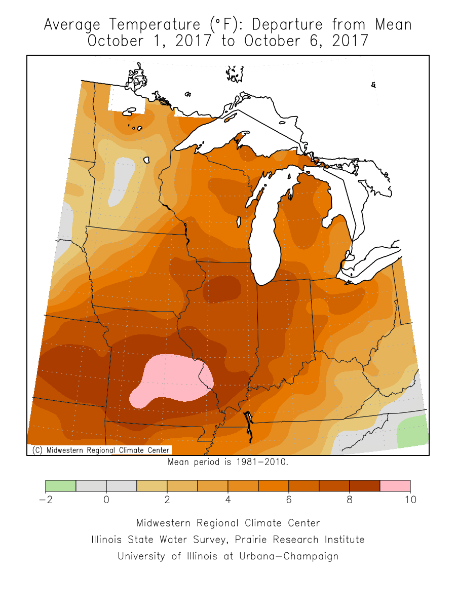
It’s also been an incredibly warm start to the month (IND is running 10° above normal, month-to-date) and that warm theme won’t change through the near-term.
An all-too-familiar pattern engulfs the country late week. This will showcase more “bonus” summer-like conditions, locally, that will include highs approaching 80° next weekend with a strong southerly flow in place. Additionally, early winter-like conditions will continue to impact the western high ground. The pattern definitely represents a Nina look.
The southeast ridge will provide more bonus summer-like conditions next weekend across the eastern half of the country.
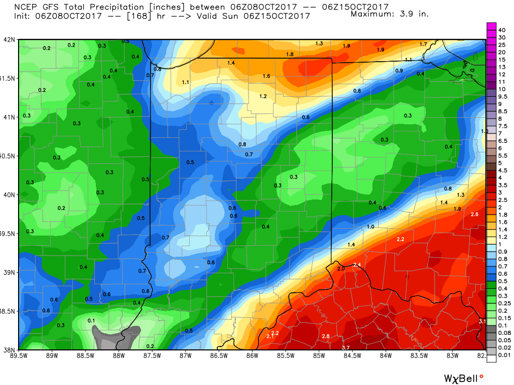
In the shorter-term, a new rainmaker will move across the Ohio Valley Tuesday into Wednesday. This will spread showers and embedded thunder across the state Tuesday PM into Wednesday. In general, this storm system should deliver 0.50″ – 1″ of rain, but there will be locally heavier amounts.
Thereafter, dry times will settle in along with slightly cooler temperatures. Let’s remember it was only a few days ago where modeling suggested a “pop” of the season’s coldest air thus far. No longer is that the case, and while it will turn briefly cooler, temperatures will still remain above average.
A southerly air flow will return late week and help boost temperatures next weekend, along with continued dry times through the balance of the weekend. From this distance, our next storm system should arrive late Sunday or early Monday in the form of a cold front.
Looking longer-term, there are indications that colder conditions loom as we wrap up October and head into November and we’ll discuss this in more detail later this week…
After a cool, fall-like, weekend, we still expect a new surge of summer-like air to return next week as a strong (and expansive) ridge of high pressure “balloons” over the eastern half of the nation.
This will be enough to send temperatures into the 85° to 90° range by the early to middle of next week. To shed some perspective on that, our averages for early October include low temperatures in the upper 40s and highs in the upper 60s. For at least a couple of days next week, overnight lows will be much closer to where our afternoon highs should be this time of year.
There are differences on how modeling handles the evolution of things once past midweek. The European model has been jumping on a potential wet weather maker and much cooler trend in the medium term (late next week), but the GFS is having none of that- keeping us dry and hot. We’ll keep a close eye on things over the next couple of days and have a fresh 7-day soon!
Finally, we’re receiving many questions that are centered on whether or not the current overall warm pattern is an indication of what we can expect this winter. The simple and short answer to that question is an emphatic “no.” Transitional seasons are fickle, regardless of ENSO state. Throw in an emerging Nina and all sorts of additional “fun and games” ensue. With that said, there’s no direct correlation specifically between warm (or cold) patterns this time of year and the winter ahead. In fact, there’s been many instances where unseasonably warm Octobers give way to cold winters, and vice-versa.
I.) Overnight rain and storms impacted central Indiana during the overnight. Some of the slow moving storms dumped a quick 2″ of rain in isolated areas, but most ended up…
You must be logged in to view this content. Click Here to become a member of IndyWX.com for full access. Already a member of IndyWx.com All-Access? Log-in here.
 An all-too-familiar pattern engulfs the country late week. This will showcase more “bonus” summer-like conditions, locally, that will include highs approaching 80° next weekend with a strong southerly flow in place. Additionally, early winter-like conditions will continue to impact the western high ground. The pattern definitely represents a Nina look.
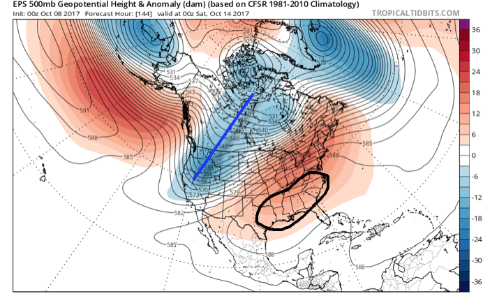
 Thereafter, dry times will settle in along with slightly cooler temperatures. Let’s remember it was only a few days ago where modeling suggested a “pop” of the season’s coldest air thus far. No longer is that the case, and while it will turn briefly cooler, temperatures will still remain above average.
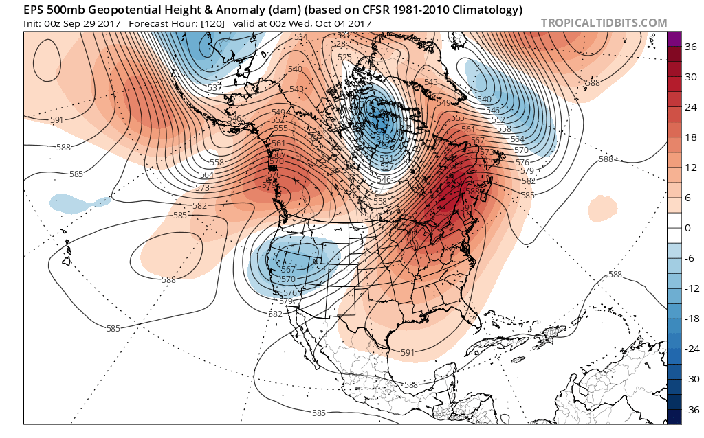 This will be enough to send temperatures into the 85° to 90° range by the early to middle of next week. To shed some perspective on that, our averages for early October include low temperatures in the upper 40s and highs in the upper 60s. For at least a couple of days next week, overnight lows will be much closer to where our afternoon highs should be this time of year.