VIDEO: Summer Feel Returns…
You must be logged in to view this content. Click Here to become a member of IndyWX.com for full access. Already a member of IndyWx.com All-Access? Log-in here.
You must be logged in to view this content. Click Here to become a member of IndyWX.com for full access. Already a member of IndyWx.com All-Access? Log-in here.
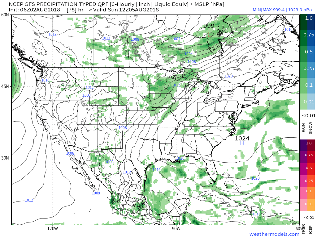
A summer-like feel will return as we move through the weekend. While the heat and humidity won’t be excessive by any means, you’ll certainly notice a different feel when compared to the cooler air we’ve enjoyed over the past 10 days, or so. We forecast highs in the mid-upper 80s with plentiful sunshine through the weekend. While an “isolated” thunderstorm is possible, most will remain rain-free until early next week. That said, best rain and storm chances will be confined to northern Indiana Thursday evening and forecast radar products are picking up on a skinny line of showers and thunderstorms.

This area of thunderstorms is forecast to diminish before it would impact central Indiana.

The weekend will be highlighted by plentiful sunshine with only isolated storm coverage and an increasingly muggy feel. Note the southwest air flow returning around an area of high pressure off the East Coast and our next approaching storm system to the northwest.
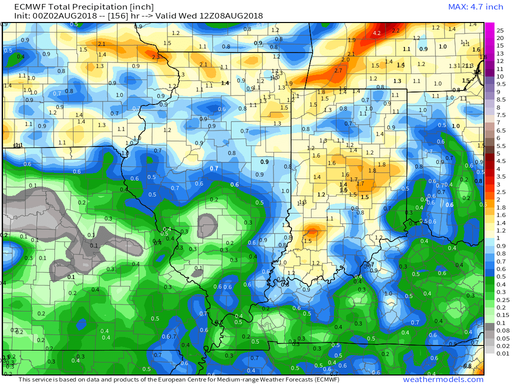
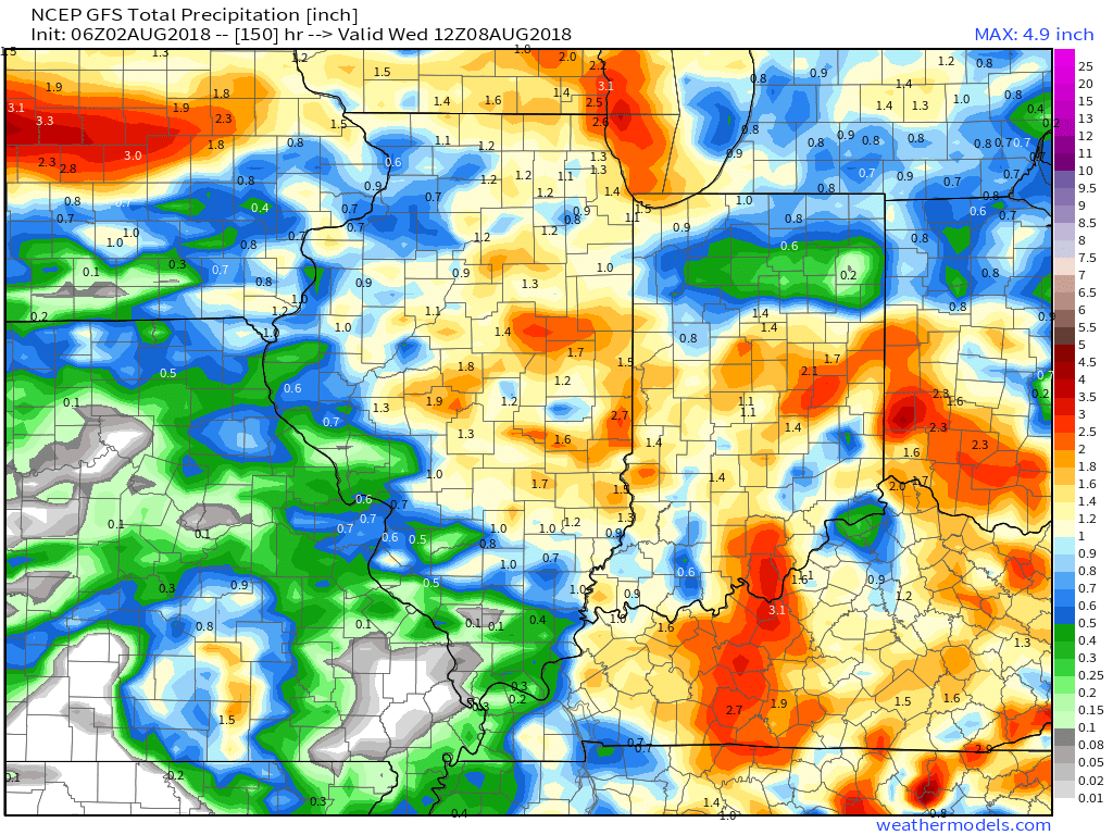
 That storm system will settle south and begin to impact central Indiana early next week with storm chances increasing Monday into Tuesday. With rich tropical moisture in place, locally heavy rain will be likely as the front moves in.
 Models are in overall agreement of additional significant rainfall early next week (widespread 1″ to 2″).
You must be logged in to view this content. Click Here to become a member of IndyWX.com for full access. Already a member of IndyWx.com All-Access? Log-in here.
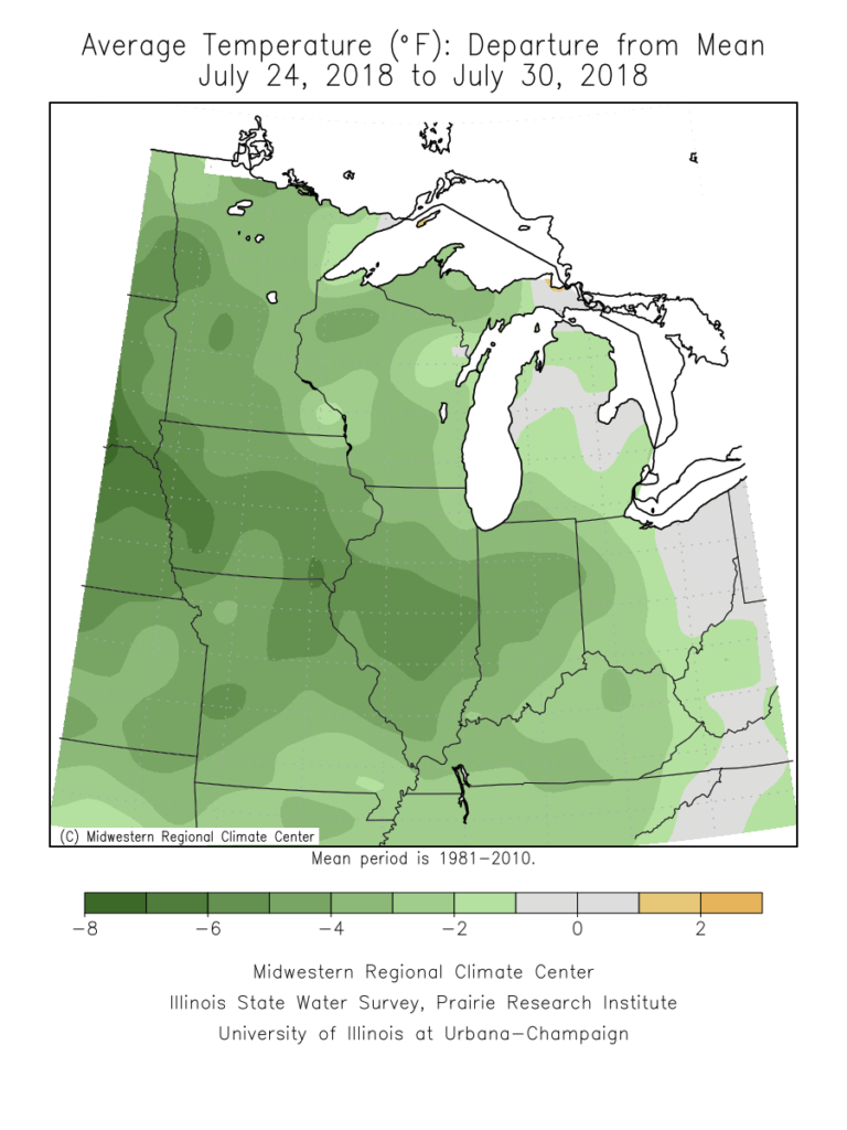
The past (10) days have been particularly pleasant across central Indiana, especially by late-July standards. 80% of the period has featured temperatures at, or below, normal, and the past couple of days have been impressively cool. Hat tip to Sean Ash (@SeanWTHR) for the most recent stat: “Just the 12th time in 147 years of back-to-back July days in Indianapolis with a high of 72° or below.” Rainfall has been plentiful across central Indiana, including widespread amounts of 1″ to 2″ with some reports of 3″ to 5″ over the past 48 hours.
As we rumble into August, you knew that summer feel had to return, right?! 🙂
Forecast models are in agreement that an upper level ridge will expand across the Great Lakes region in the 6-10 day period. This will deliver a return of warm-to-hot and muggy conditions to central Indiana- beginning this weekend into next week.
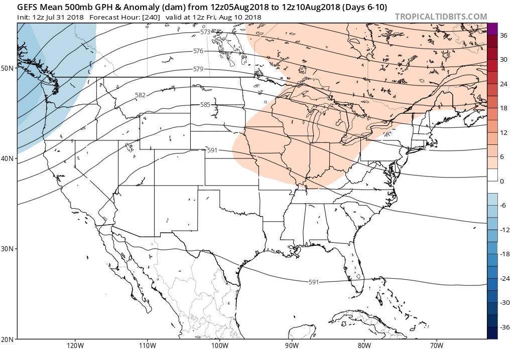
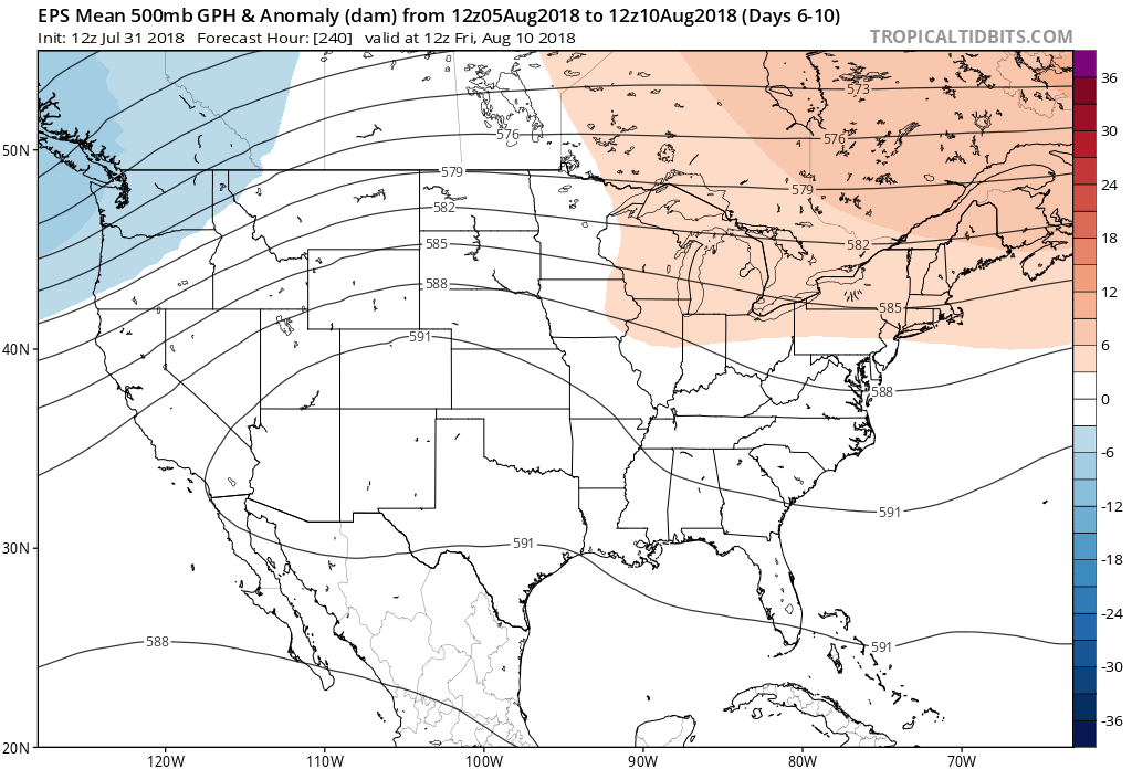
While the next couple of days will continue the cooler than normal theme, temperatures will return to a “summery” feel over the weekend, continuing into next week. Along with the warmer air will also come increasing humidity. In short, we recommend incorporating a pool visit (or two) into your weekend schedule. Highs will return into the upper 80s to around 90° and overnight lows will dip into the upper 60s to around 70°. While warmer and certainly more humid than we’ve been, we still believe the hottest of the season is behind us (highs of 94° on July 4th and 14th).

While a more summer-like feel will replace the unseasonably cool close to the month and open to August, it sure looks like the hotter regime will be transitional. The general consensus from data points towards a return of seasonable to below average temperatures along with a continuation of active times as mid-month approaches…
You must be logged in to view this content. Click Here to become a member of IndyWX.com for full access. Already a member of IndyWx.com All-Access? Log-in here.