VIDEO: No Looking Back On The Active, Wet Pattern…
You must be logged in to view this content. Click Here to become a member of IndyWX.com for full access. Already a member of IndyWx.com All-Access? Log-in here.
You must be logged in to view this content. Click Here to become a member of IndyWX.com for full access. Already a member of IndyWx.com All-Access? Log-in here.
A cold front is slowly sinking south and will feature a weak wave of low pressure that will track along the boundary Tuesday. The end result spells for increased chances of showers and thunderstorms across central Indiana over the upcoming 24-36 hours.
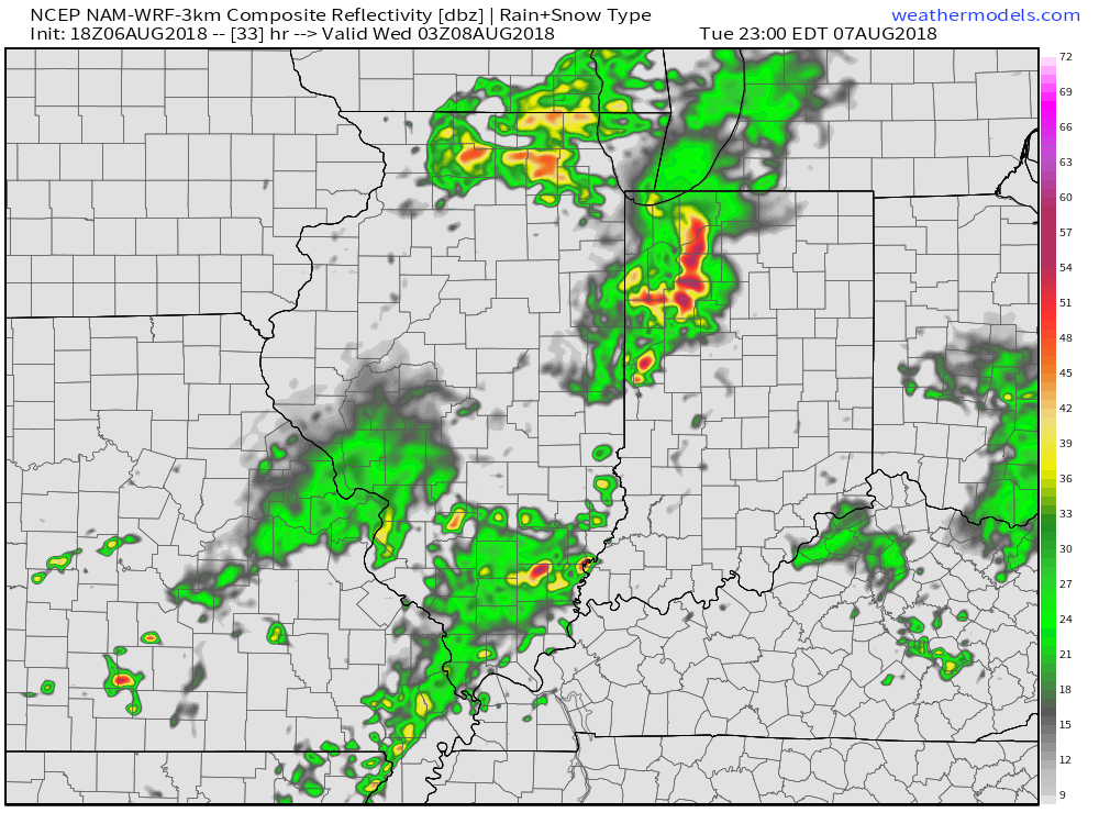
Initially, we expect an area of thunderstorms to push south and potentially impact north-central portions of the state later tonight. The latest high resolution NAM forecast radar gives us an idea what the radar may look like late tonight- just after midnight.
 Some of the storms across the northern third of the state may “pulse” to severe levels this evening, including the potential of large hail and damaging winds. (This complex will weaken as it surges south later tonight).
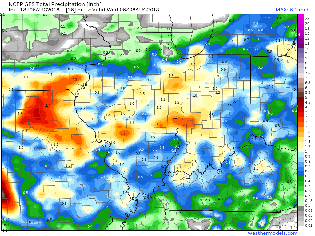
As we turn our attention to Tuesday, scattered to numerous showers and thunderstorms are expected, especially during the afternoon and evening hours. A few strong storms are possible, including locally heavy rain.
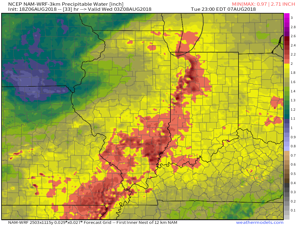
 Eventually, drier times will return by mid-week. Beforehand, most central Indiana rain gauges should receive somewhere between 0.50″ to 1″ of rain. With a rich, tropical airmass in place, there will be some locally heavier totals.
As the cold front moves south during the midweek stretch, drier times will return Wednesday and Thursday. With that said, the drier regime won’t last long, as a cut off upper low “mucks” things up over the weekend. While it certainly won’t rain the entire time, daily rain chances will return late Friday, continuing throughout the weekend. There’s no need to cancel any outdoor plans, but have the rain gear handy, as you’ll likely need it at times throughout the weekend.
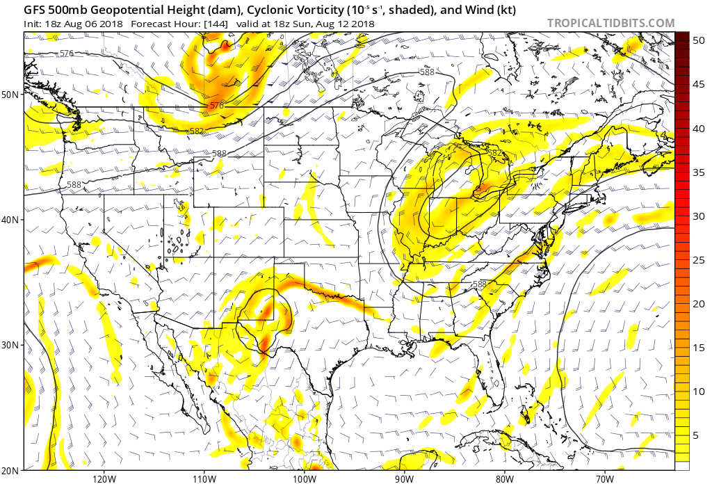
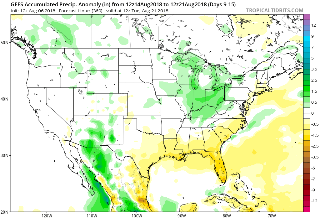
Speaking of rain and overall unsettled times, the pattern sure looks active around these parts into the mid and longer range. More on that in future updates…
You must be logged in to view this content. Click Here to become a member of IndyWX.com for full access. Already a member of IndyWx.com All-Access? Log-in here.
You must be logged in to view this content. Click Here to become a member of IndyWX.com for full access. Already a member of IndyWx.com All-Access? Log-in here.
You must be logged in to view this content. Click Here to become a member of IndyWX.com for full access. Already a member of IndyWx.com All-Access? Log-in here.