VIDEO: Bumpy Start Friday; Early Week Storm Is Followed By A “Hint” Of Fall…
You must be logged in to view this content. Click Here to become a member of IndyWX.com for full access. Already a member of IndyWx.com All-Access? Log-in here.
You must be logged in to view this content. Click Here to become a member of IndyWX.com for full access. Already a member of IndyWx.com All-Access? Log-in here.
You must be logged in to view this content. Click Here to become a member of IndyWX.com for full access. Already a member of IndyWx.com All-Access? Log-in here.
Tuesday will remain dry across central Indiana with plentiful sunshine and warm temperatures. The quiet times will give way to unsettled conditions as we progress through the second half of the week, including periods of locally heavy rain.
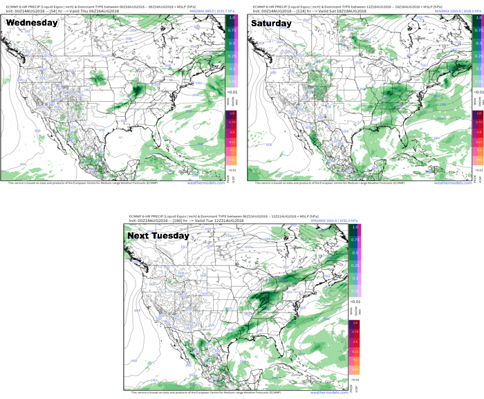
This is all part of a pattern that will remain active around these parts. We note the latest European model delivers three storm systems between now and this time next week. Each of these systems will be capable of producing hefty rainfall across the region.
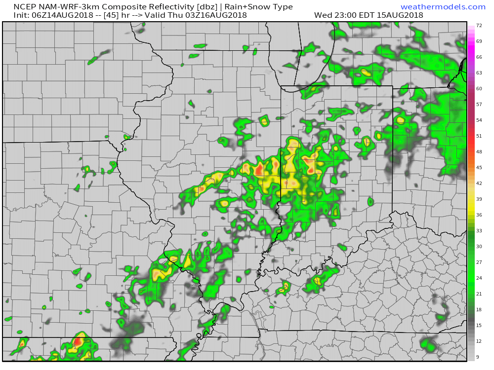
 In the more immediate term, after a dry Tuesday, rain will arrive on the scenes Wednesday afternoon.

Rainfall coverage and overall intensity will increase as Wednesday evening gives way to night, continuing into Thursday morning.

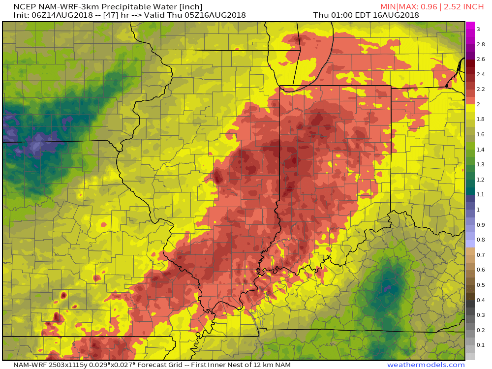
Note the high resolution models suggesting widespread precipitable water values (PWATs) in excess of 2″. This is a significant ingredient that will help fuel heavy rain Wednesday evening into Thursday morning.
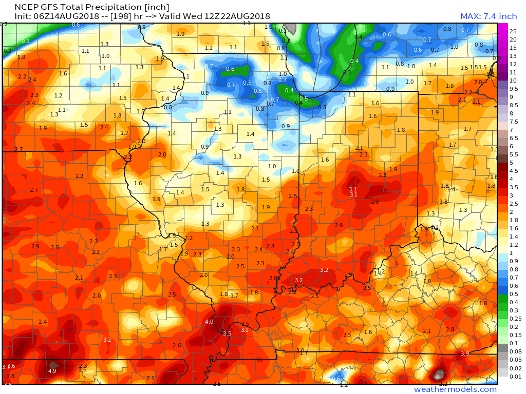
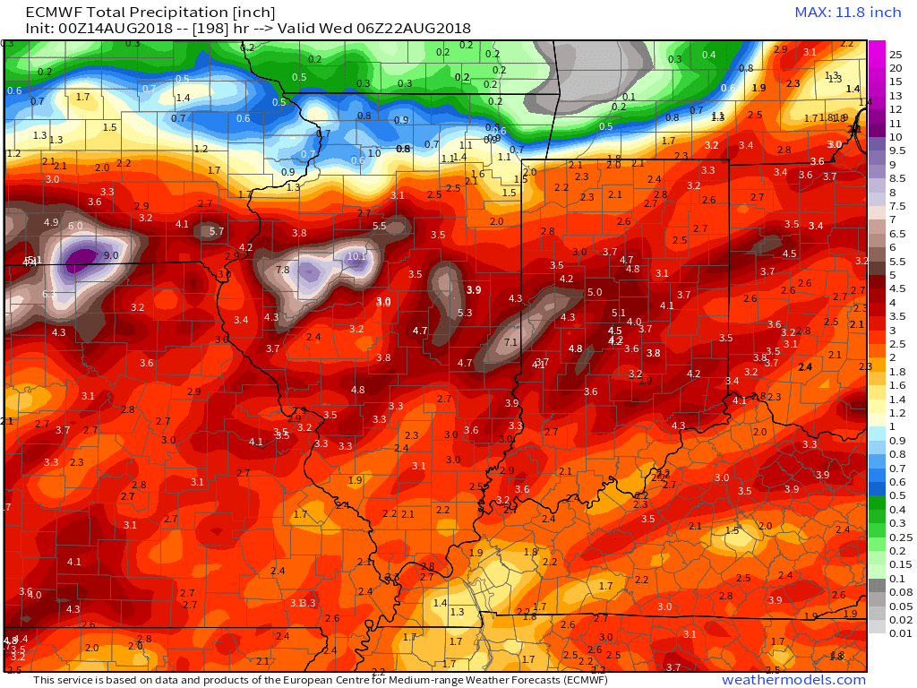
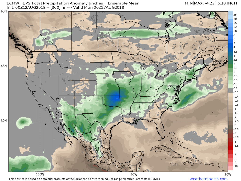
 As mentioned above, a couple of other storm systems promise for continued unsettled times over the weekend and on into early next week. When we total things up by the middle of next week, both the GFS and European model agree on widespread 3″ to 5″ totals.
High pressure will dominate our early week weather. With the exception of an isolated shower or thunderstorm across eastern portions of central Indiana this afternoon, most should remain rain-free through the daytime hours Tuesday.
The pattern will begin to turn busy once again as we move into midweek. An approaching storm system will increase shower and thunderstorm chances late Tuesday night through Thursday. While it won’t rain the entire time, locally heavy downpours are expected at times during the midweek stretch.
 Most of central Indiana can expect to pick up 0.75″ to 1.25″ of rain during the aforementioned period, but there will be locally heavier totals.
 Looking towards next weekend, forecast models generally agree on active times continuing, but disagree on the important specifics. We’ll go with a “blend” right now and increase rain chances again Saturday and Sunday- after a briefly drier Friday. The ranges are anywhere from a flood threat, such as the European currently suggests, to typical scattered showers and thunderstorms, per the latest GFS. Stay tuned as we continue to fine tune through the upcoming week.
This is all part of a continued active weather pattern that will likely produce above normal precipitation as we close out the month and look towards September…
You must be logged in to view this content. Click Here to become a member of IndyWX.com for full access. Already a member of IndyWx.com All-Access? Log-in here.