We’ve been relatively spoiled so far this summer- both in regards to temperature and precipitation. That said, as we approach the second half of July, things appear to be changing for the hotter and drier side of things.
July, so far, has been very pleasant, locally. BTW- another push of drier air is inbound that should lead to a nice weekend, including low humidity values.
 Ensemble data continues to suggest that the mean ridge position (hot dome) develops over the eastern portion of the country early next week before slowly retrograding northwest with time.
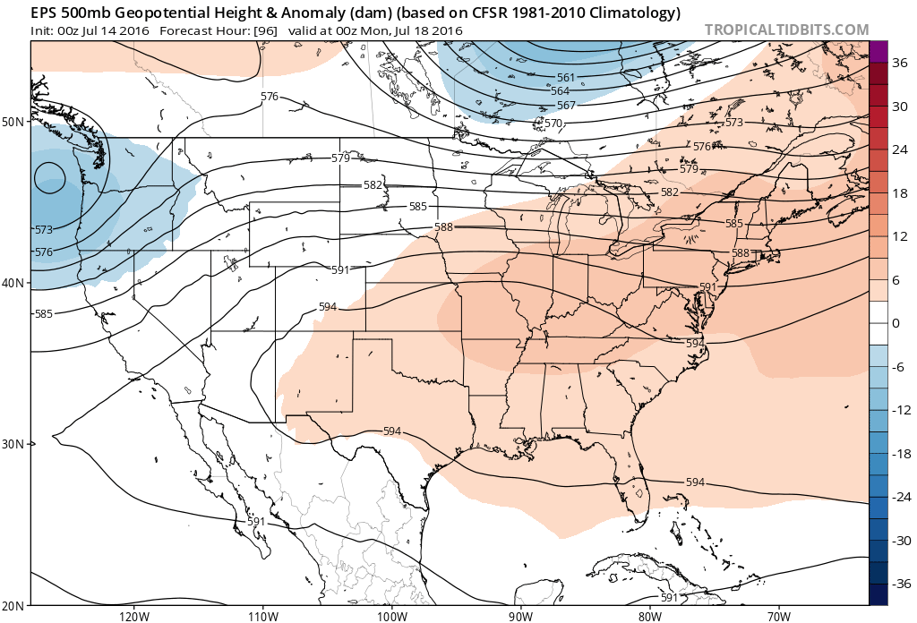 By the middle and latter portions of next week, the hot dome is set up in a position that will yield an extended stretch of hot temperatures across the state, including multiple mid-90 degree highs across central IN.
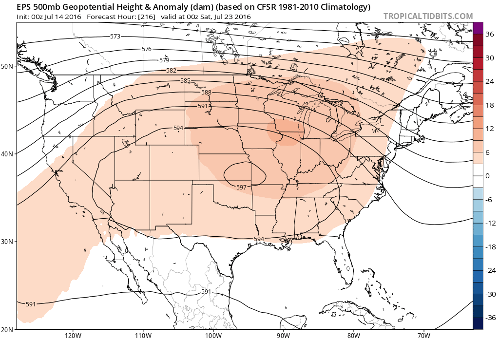
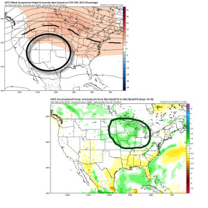
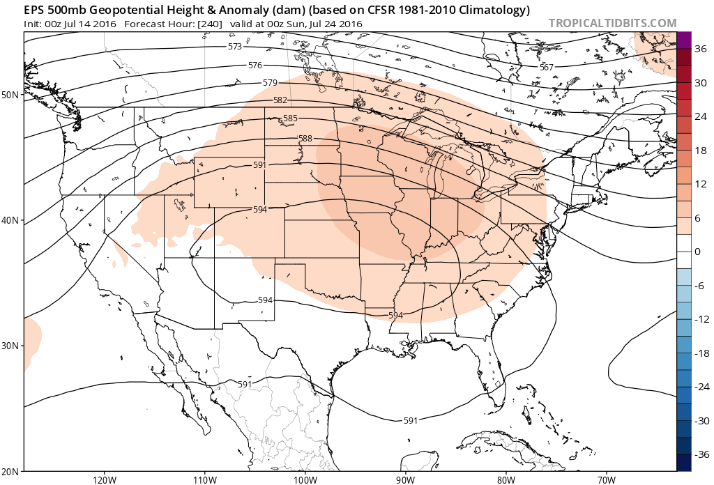 Given the current look of the ridge position, this would also be a rather dry pattern, as well, as the storm and rain track would shift north across the Canadian border into the northern Great Lakes states. (Follow that 588 line above for a good indicator of the storm track).
 One always has to be careful in trying to predict the timing of the ridge breaking down/ overall placement this time of year (models can struggle), but for now it appears as if we really heat things up and dry things out as we move through next week- especially the middle and latter portions of the week.
 2.) The aforementioned cold front will sweep through the state tonight and allow a much drier and cooler air mass to push in for the weekend. We’ll enjoy a downright pleasant feel this weekend, including lots of sunshine. Enjoy!
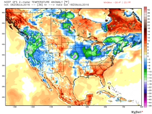 3.) Dry weather should continue into early next week, but wet and stormy weather will return as early as Tuesday, continuing into the latter portions of the week.
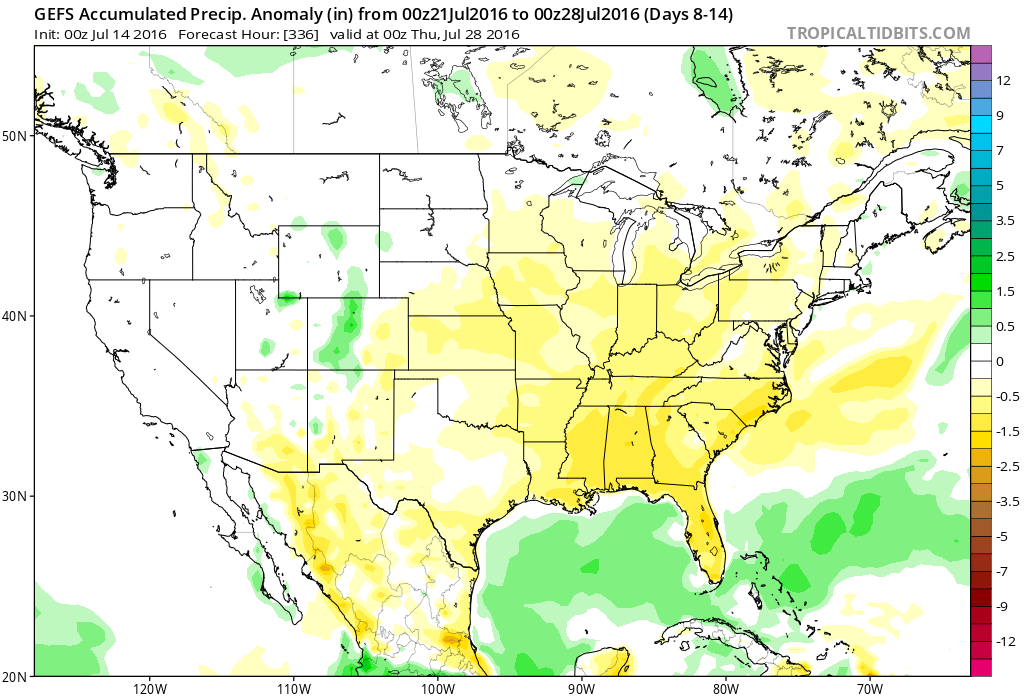
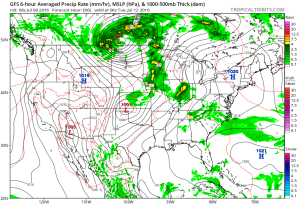 This is the start of what should be a rather wet period for mid and late month.
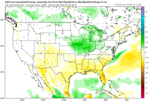 4.) This is also a continued “transient” pattern through the end of the month, meaning we really don’t see any sort of sustained dry, hot weather in the foreseeable future…
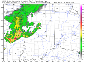 We’ll go through a quiet period during the afternoon hours before a second surge of storms takes aim on the region tomorrow night into Thursday morning (again, understanding we’ll have to “sure up” timing as we go).
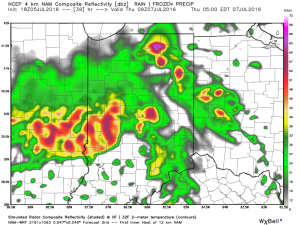 Additional storm complexes will follow Thursday into Friday before that drier air gets here. Some of these could be strong to severe.
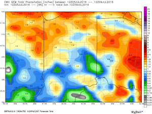 Looking ahead, after a dry weekend and open to next week, indications point towards a return of wet and active times as we approach Day 10. Long range ensemble data backs up the wet, stormy look nicely, and there’s really no end in sight…