Weekend Heavy Rain Threat…
We still have a few nice days to enjoy this week before our forecast takes an increasingly wet shift as we progress through the weekend. As a side note, we still expect scattered showers and thunderstorms late Wednesday night into Thursday morning, but this shouldn’t be a significant event, locally.
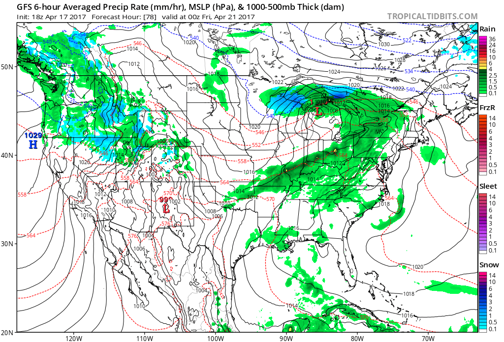
What will become an increasing concern is the threat of periods of heavy rain and thunderstorms this weekend. The overall setup is a classic one for widespread heavy rain.
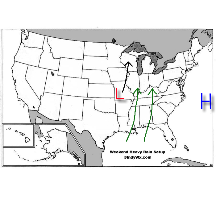 An area of high pressure will be located off the Mid Atlantic coast while surface low pressure develops in the southern Plains and tracks north over the weekend. The combination of these two ingredients will help pull abundant Gulf of Mexico moisture northward into the Ohio Valley. With a true Gulf connection, moisture-rich air will overspread the region this weekend. In addition to feeling truly muggy for the first time this year, this will also aid in periods of heavy rain this weekend.
Precipitable water values will approach 2″ at times this weekend and that’s plenty enough to create a localized flash flood concern.
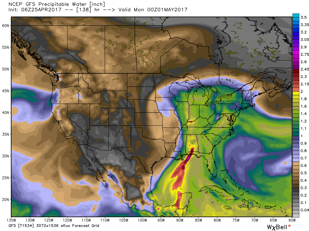 From this distance, it appears like widespread 2″ to 3″ of rain will fall over the weekend, but localized heavier totals are expected where thunderstorms “train” over the same areas. While it won’t rain the entire weekend, times of wet weather will outnumber dry hours and if you live near a creek or stream, keep abreast of this developing weather situation as significant water rise is expected over the weekend.

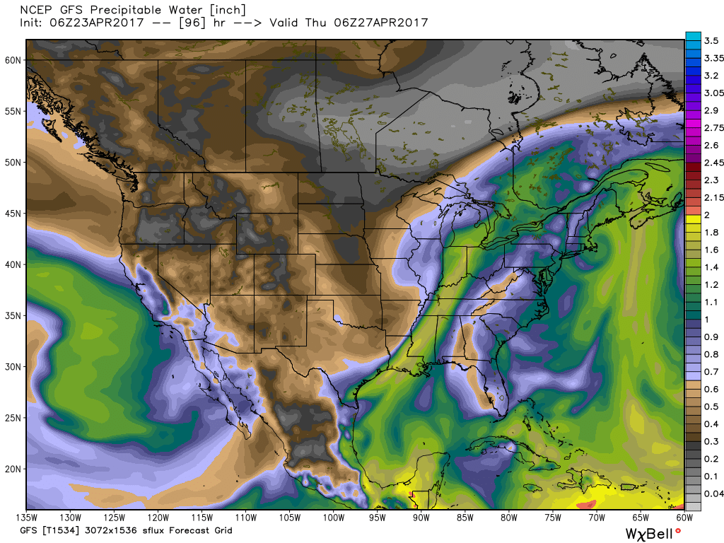

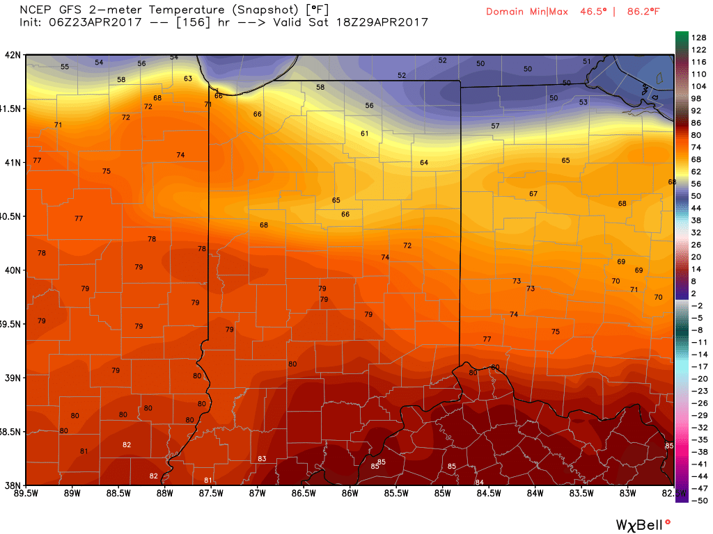 Finally, after Saturday morning thunder, we think the majority of next weekend is dry before a cold front brings a return to widespread showers and thunderstorms late Sunday.
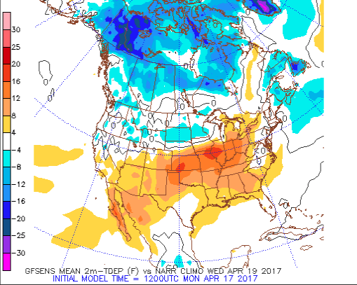 As a cold front slices into the summer-like warmth (highs will approach 80° Wednesday afternoon), scattered showers and thunderstorms will develop late Wednesday into Thursday.
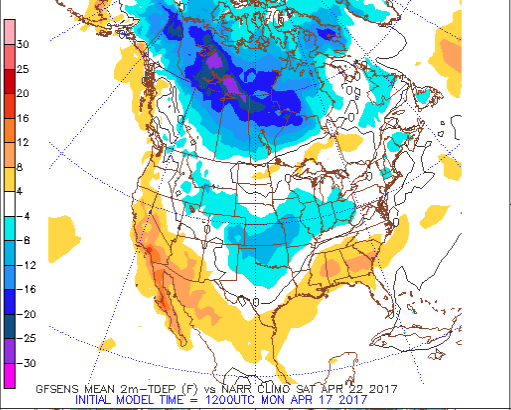
 We then will shift gears rather abruptly as we move through the latter portions of the work week and on into the weekend with well below normal chill. In fact, if current data comes to fruition, most of the weekend will be spent in the 40s.
 Factor in a stiff northeast wind and periods of rain, we have the makings for a downright “raw” weekend. We suggest having indoor activities planned this weekend as an extended period of damp, blustery, and unseasonably cool weather awaits.
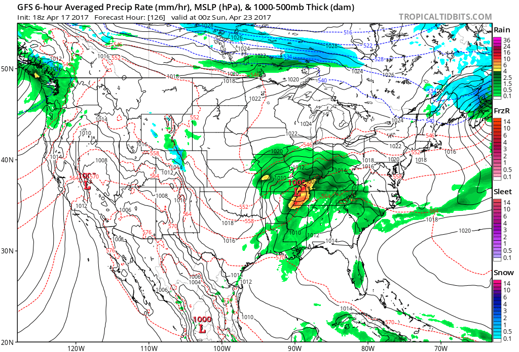 We still have a few days to continue watching the data, but early indications suggest locally heavy rainfall is possible (1″-2″) across the region…
 Highs will run close to 15° above average this afternoon.
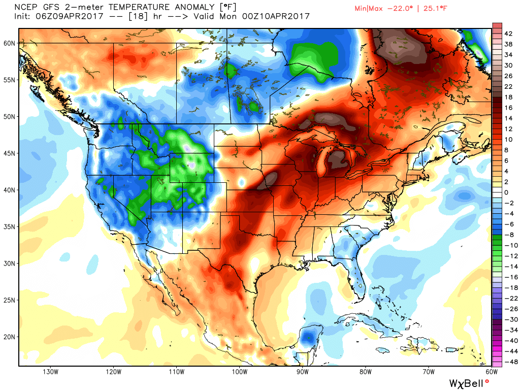 Stormy weather returns Monday as a frontal boundary slips into the state. A couple storms may become strong or severe Monday afternoon and the Storm Prediction Center highlights northwestern portions of the state for a Slight Risk. Damaging straight line winds are of greatest concern with any severe storm that may develop.
 High pressure returns for midweek and supplies a dry regime, along with increasing sunshine and temperatures that will run slightly above average (mid-40s at night and 65°-70° during the day).
 There are questions once to the end of the period as the GFS and European handle the evolution of our late-week storm differently. The GFS brings energy out into the Ohio Valley and results in unsettled weather returning Friday, continuing into Easter weekend, while the European is slower. We’ll keep an eye on things over the next few days and update accordingly. The GFS suggests some localized heavier downpours would be possible in the Friday-Sunday period as the majority of the 7-day precipitation snapshot below falls within the timeframe.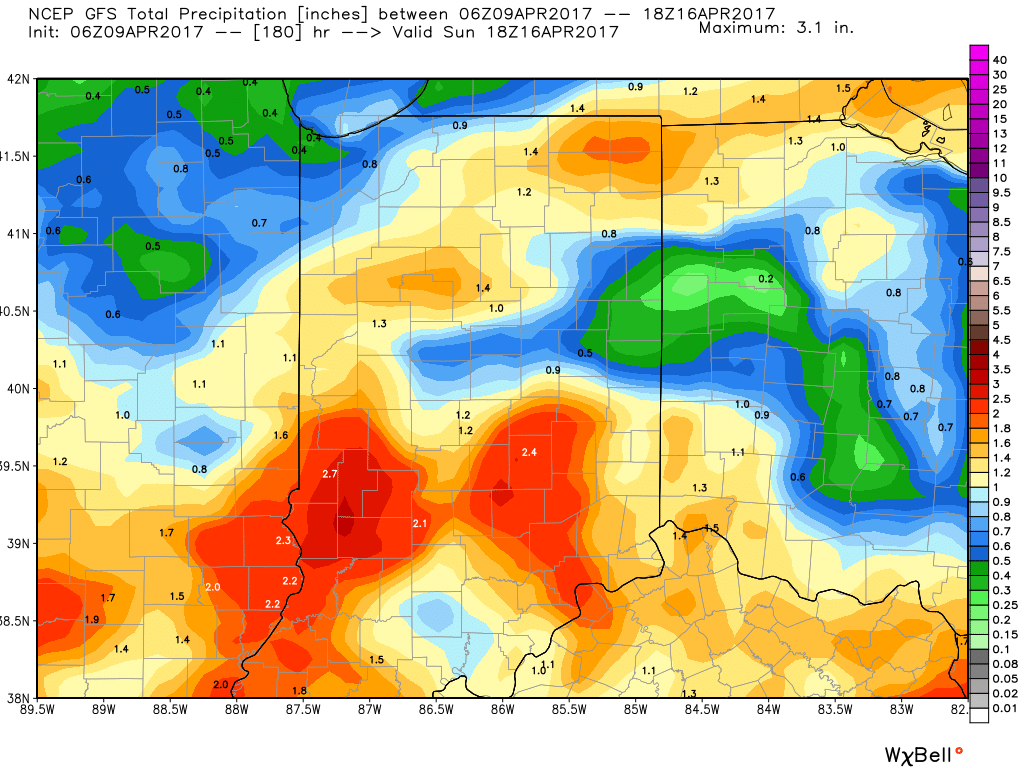
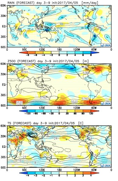 Week 2:
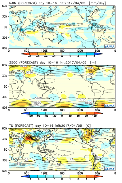 Weeks 3-4:
 The big picture is one that shows a drier pattern developing across the East during Week 1, but we caution that this drier regime doesn’t look to “lock” in. Data suggests we get back to an active pattern between Week’s 2-4, biased wetter than normal in the Mid West and Plains. The other screaming message is that a busy severe season should continue through the period. Cold sets up across the Pacific Northwest, associated with the “mean” trough position, while spring-like warmth continues to build across our region in overall terms. We know what that means as storms eject off the Rockies and track east…