Category: AG Report

Wet Pattern Not Just An OHV Problem…

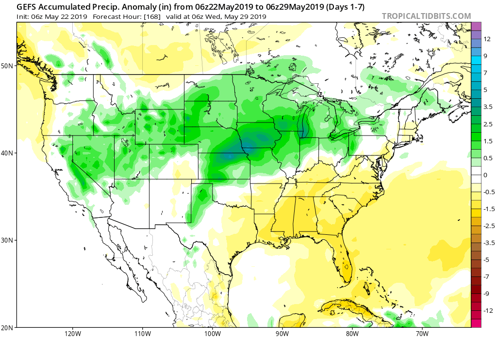
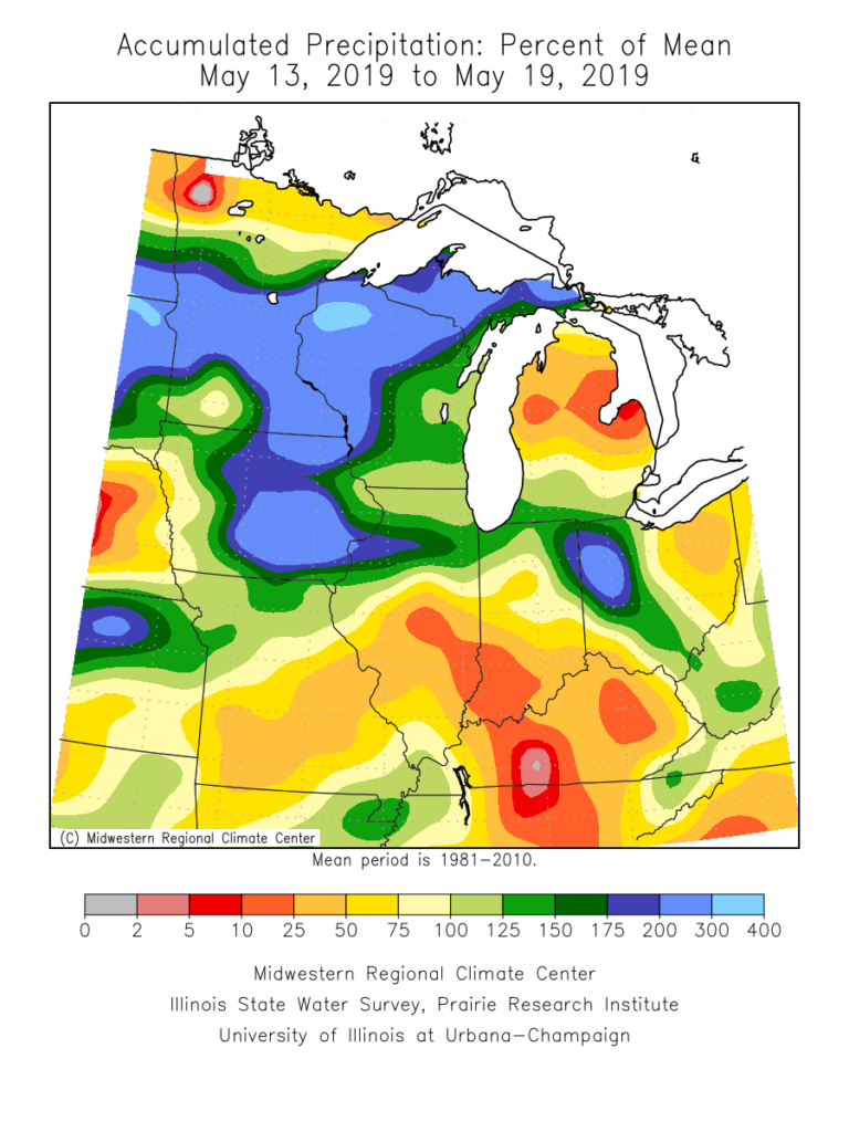
Rain has been dominating the weather pattern lately. A widespread portion of the Ohio Valley is running 125% to 175% of mean over the past (30) days. More specific to central Indiana, the bulk of this fell during the back half of April.

When we broaden out the scale, we note this wet pattern isn’t just an Ohio Valley problem, but focusing the heaviest rain on the Ark-La-Tex region.

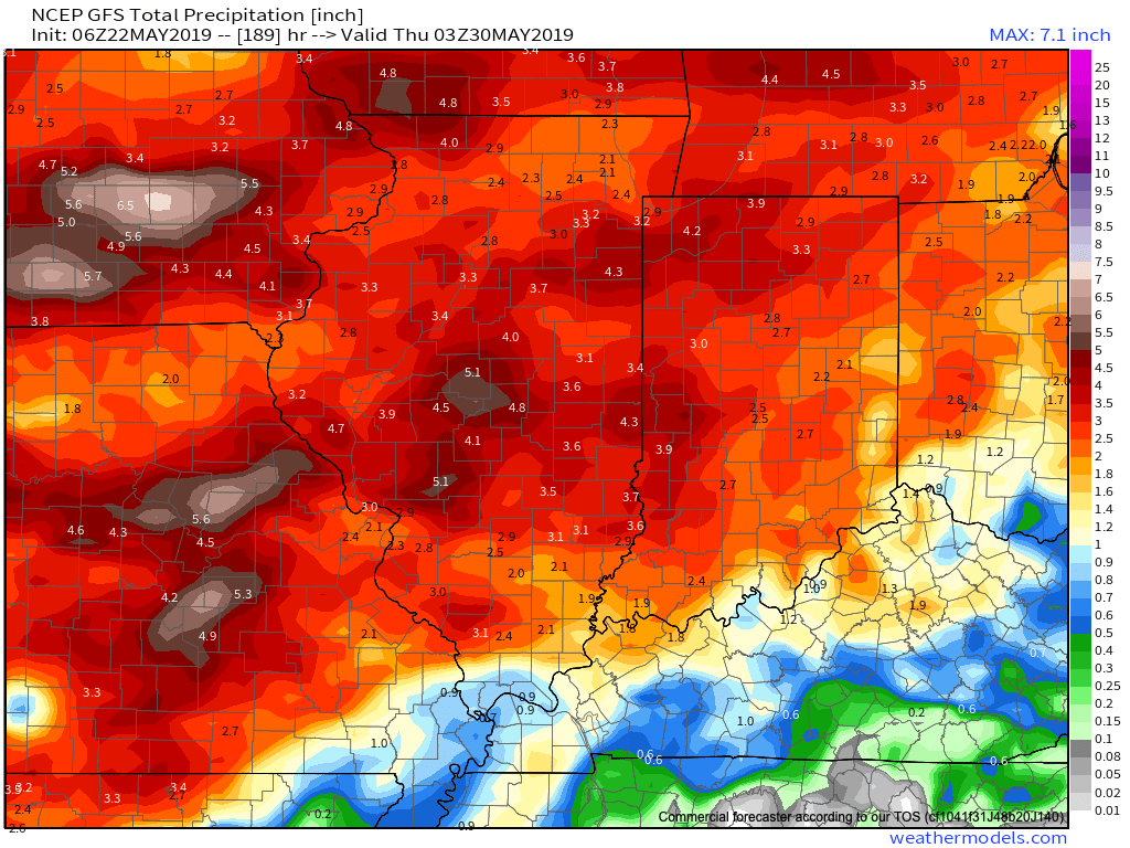
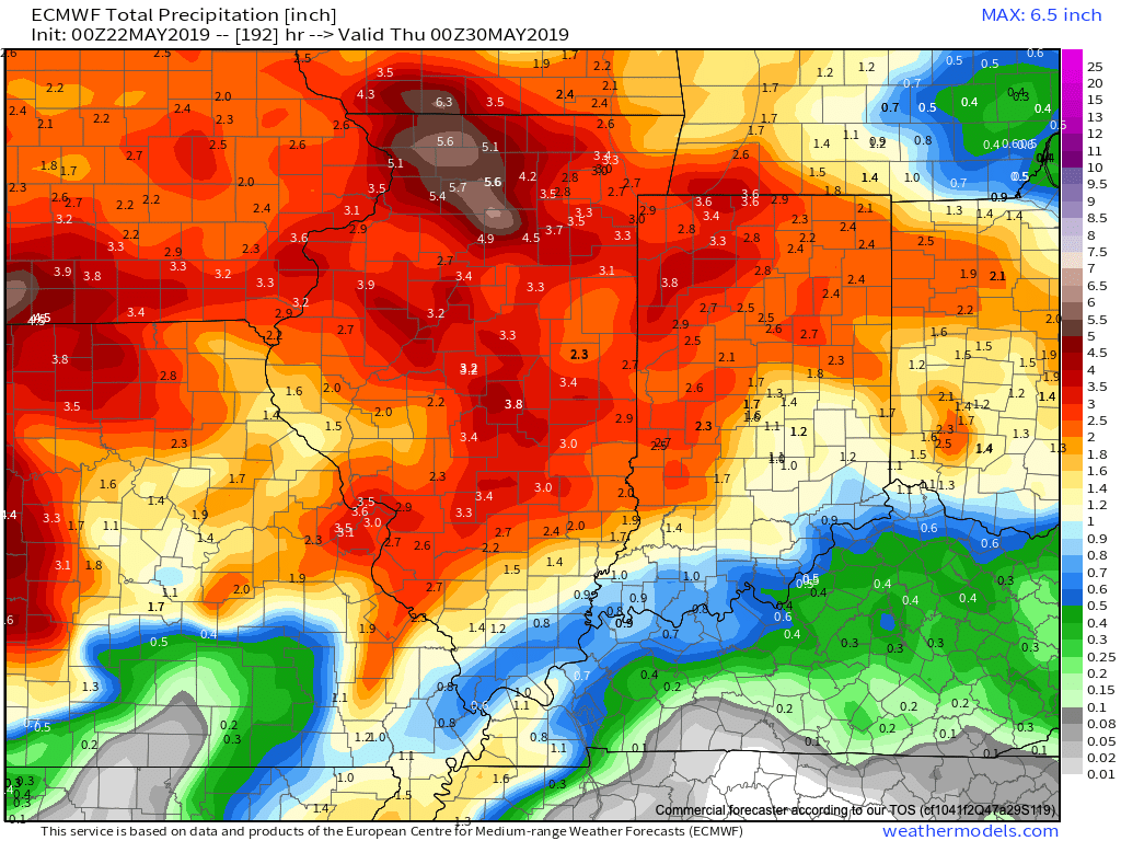
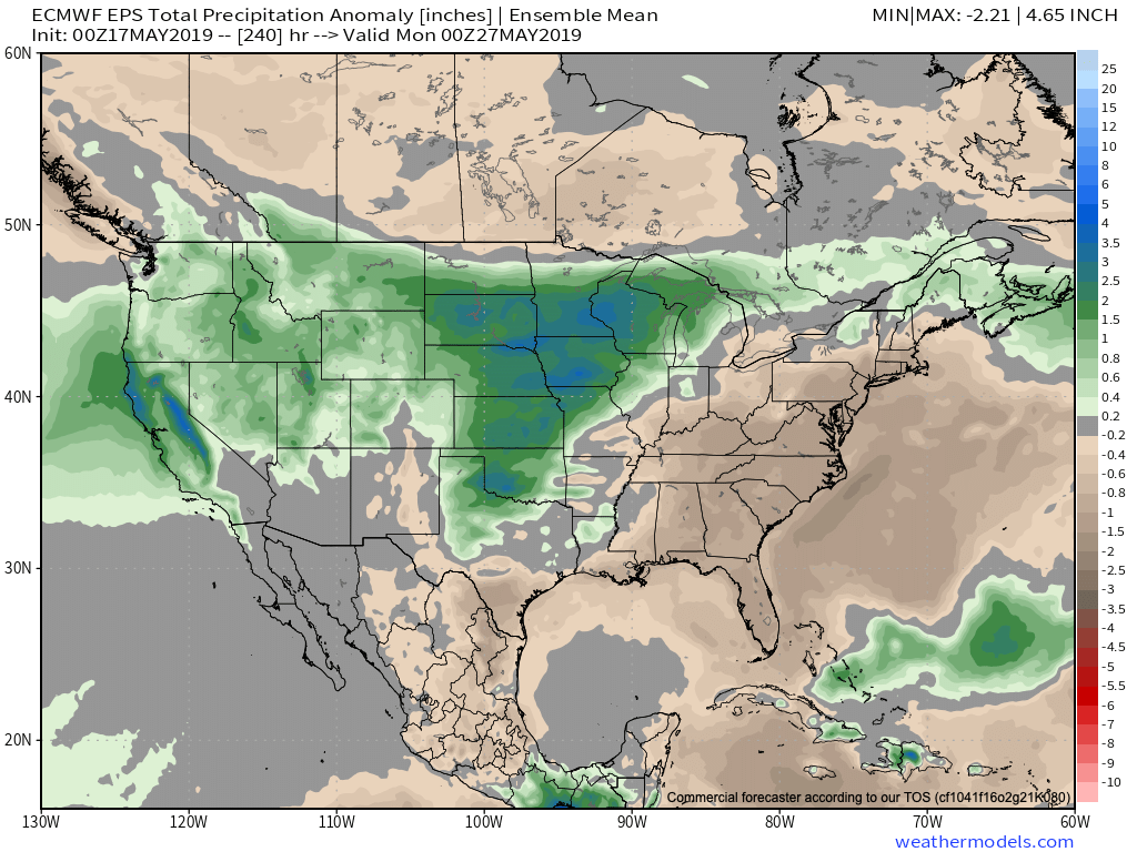
Unfortunately, when we look ahead to the upcoming couple of weeks, the pattern will continue to favor heavier than normal rainfall- not only locally, but especially centered in the area just mentioned- eastern TX, AR, and LA.

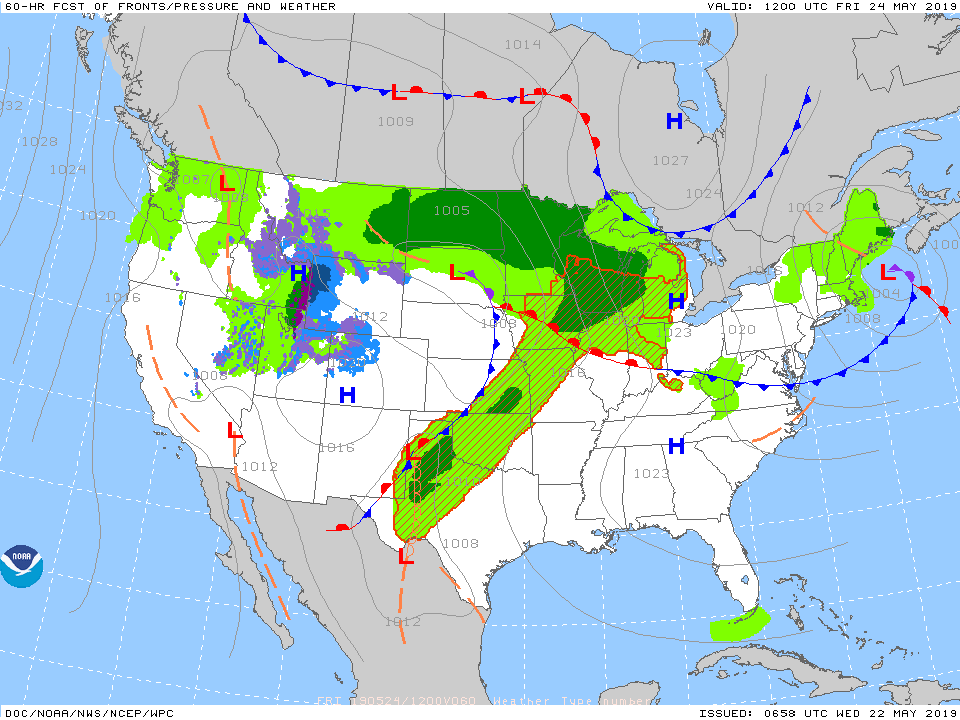
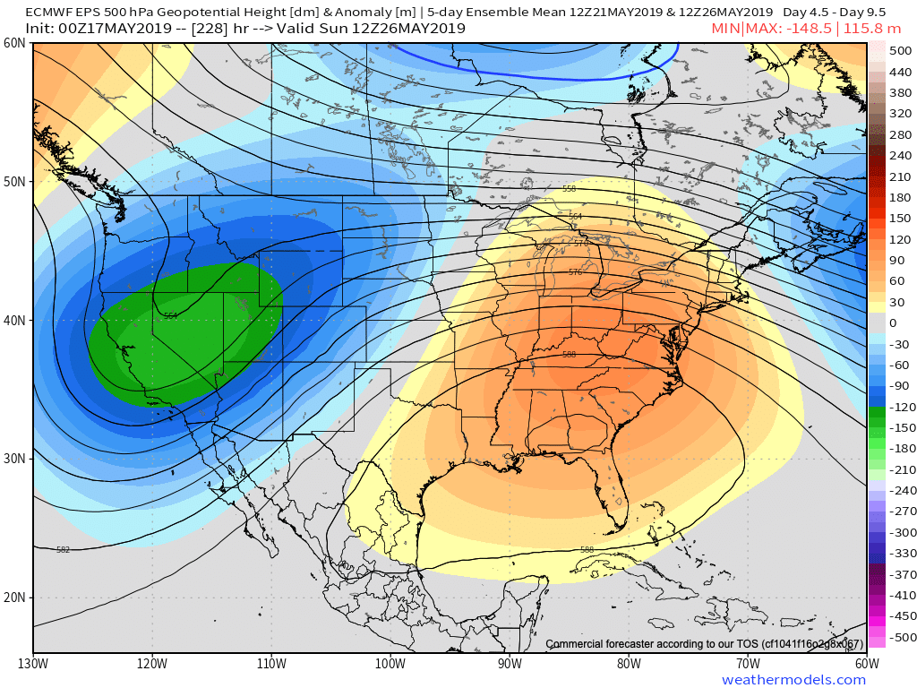
The reason behind this active and wet pattern? A persistent southeast ridge and mean trough digging into the southwest. This, combined with unseasonably cold air across the northern tier, helps set up a battle “in between” (from the s-central Plains into the Ohio Valley). Factor in the broad southwest flow aloft, and multiple disturbances will track in a southwest to northeast fashion next week, enhancing rain intensity and coverage at times. In parts of the Ark-La-Tex region, as much as 8″ to 10″ of rain may fall over the upcoming 10-days.

The excessive rainfall can also impact the upcoming season and we’ll dig in deeper here next week with our 2019 Summer Outlook.

Permanent link to this article: https://indywx.com/wet-pattern-not-just-an-ohv-problem/

Time To Duke It Out…

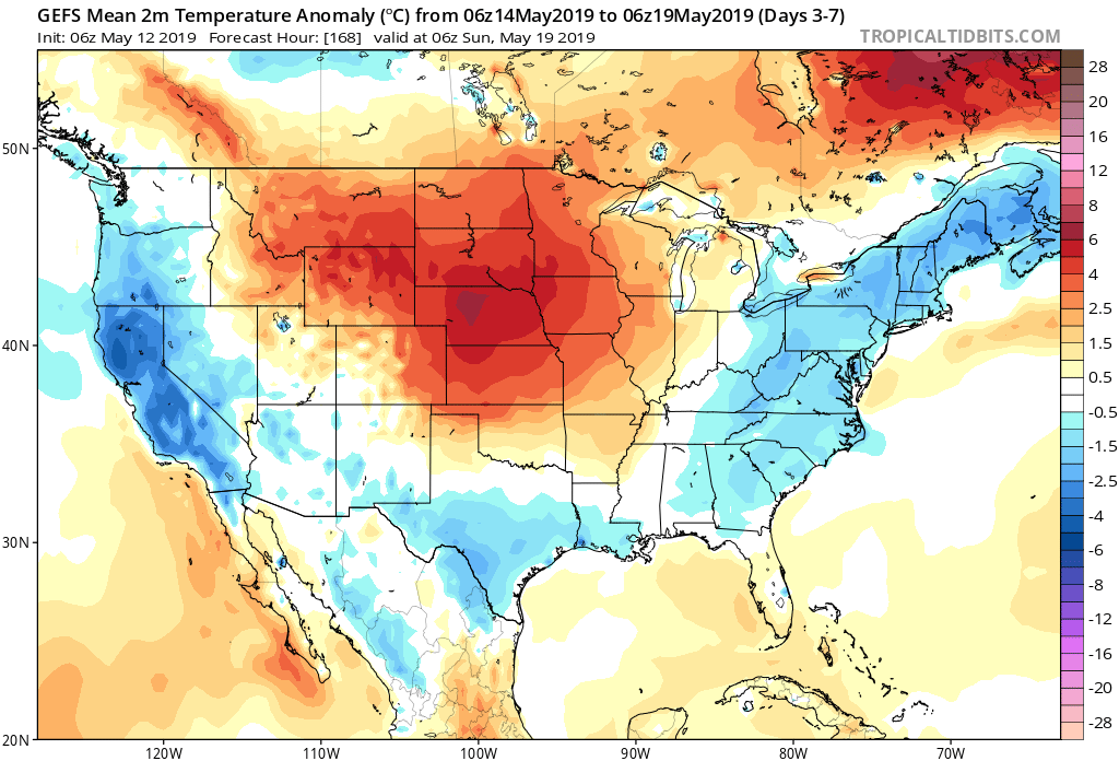
We know the upcoming (10) day period is going to feature a continuation of above average rainfall, but what lies beyond that? Ensemble data is entirely in two different camps once we get to the Day 10-15 period.

GEFS:

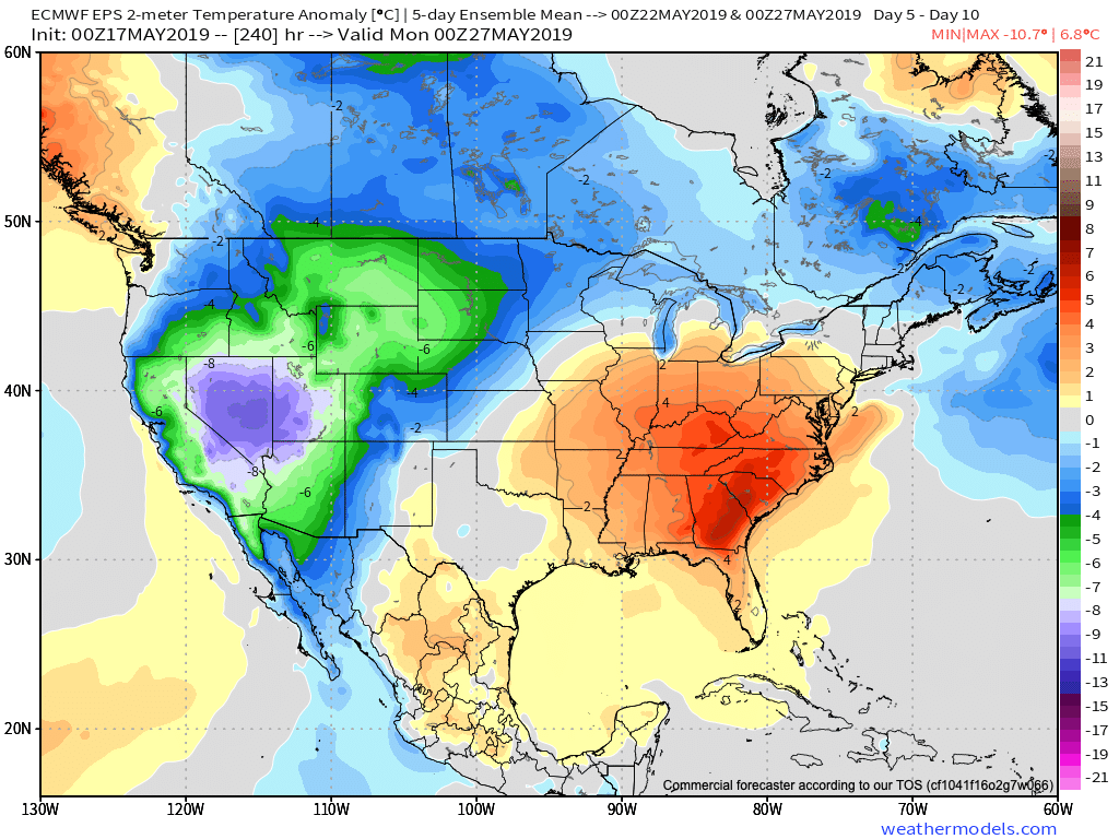
EPS:

Talk about a night and day difference. This would result in widespread 70s and 80s should the GEFS prove accurate (and put our May outlook in jeopardy) versus 50s and 60s should the European turn out to be correct (more in line with our monthly outlook). Unfortunately, from a precipitation perspective, wetter than normal times are expected to continue for the balance of the month of May and the data is in more agreement from that perspective- despite the vast differences at 500mb.

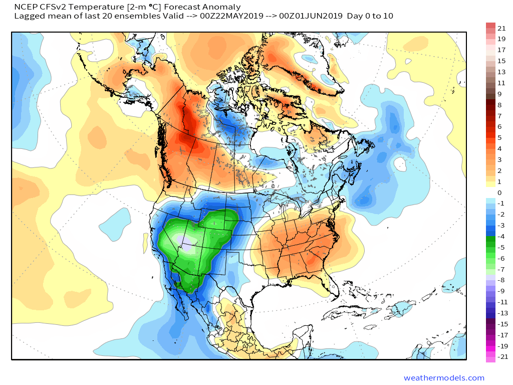
When we look at the latest CFSv2, it’s more in line with the European camp, including rather widespread chilly, damp weather for the mid-to-late May time period.

The combination of a negative NAO and AO, though not nearly to the extent of chill found in late winter/ early spring, do continue to hint at cooler than normal times in May. Eventually I would expect the GEFS to trend cooler, as well.

Furthermore, the PNA (currently negative) is forecast to trend positive by mid-May and that supports the cooler anomalies returning to our immediate region.

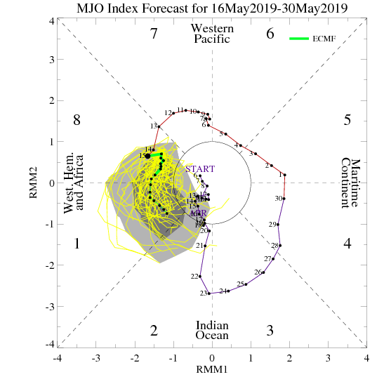
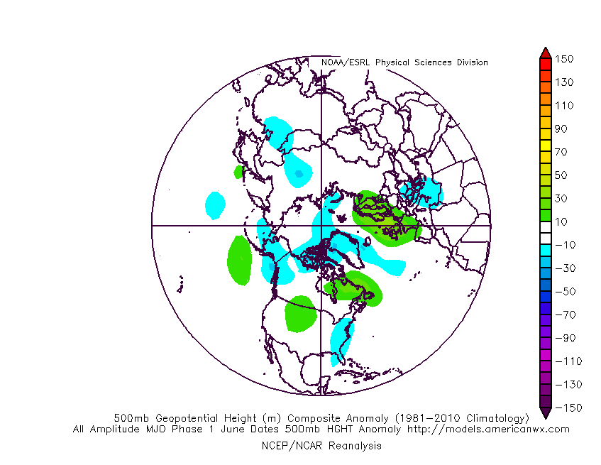
We’ll also have to keep close tabs on the MJO and see if it wants to propagate through Phases 5-8, or go back in the “wheelhouse” and really not be a factor. (More to come there).

To sum things up, we don’t see an end in sight to the overall wetter than average pattern as we progress into the middle of May. We’re less confident on the overall temperature pattern, but lean towards the EPS and CFSv2 “winning” over the warm GEFS solution in the end.

Permanent link to this article: https://indywx.com/time-to-duke-it-out/

Finalized May Outlook: One Word? Volatile

Averages for May are as follows:

*High: 72.8

*Low: 52.6

*Rainfall: 5.05″

*Snowfall: Trace

When all is said and done, this is how we see the last month of meteorological spring shaping up:

Medium and longer range guidance has been anything but consistent over the past few weeks for May, which doesn’t help in producing a monthly outlook. A large part of this may have to do with the renewed hyperactive MJO.

This can lead to volatile swings in the overall pattern as we get into the mid to late part of the month. Early on, confidence is higher in a “battle” setting up between late season anomalous cold across the north and budding summer-like warmth across the south.

This will help add fuel to the fire in what should be an overall wet month across a large portion of the country.

With that said, we think ridging is likely to keep the extreme southeastern region drier than normal for the bulk of the month.

As we look towards mid-May, that battle between southeastern ridging and troughiness across the northern region continues to argue for active times remaining.

Speaking more specific to central IN and the greater OHV region overall, we think a cooler and wetter than normal month awaits. Unfortunately, delays are likely to continue from an agriculture/ Plant ’19 perspective…

Permanent link to this article: https://indywx.com/finalized-may-outlook-one-word-volatile/

Special Evening Video Update On Next Week’s Flood Threat…

You must be logged in to view this content. Click Here to become a member of IndyWX.com for full access.  Already a member of IndyWx.com All-Access?  Log-in here.

Permanent link to this article: https://indywx.com/special-evening-video-update-on-next-weeks-flood-threat/

#AGwx And Weekly Severe Weather Outlook

Forecast Period: 04.21.19 through 04.28.19

7-Day Precipitation: Rainfall is expected to run below average through the period.

7-Day Temperatures: Above normal temperatures are expected through the period.

Severe Weather: Widespread severe weather isn’t anticipated through the period, locally.

Summary: A much quieter period is expected for the week ahead, especially when compared to this past week. High pressure will build in and supply pleasant weather as we go through Easter and into the new work week. A weak system will result in scattered showers and thunderstorms Tuesday into early Wednesday, but excessive rain and strong to severe thunderstorms aren’t expected. High pressure will then return and lead to dry, pleasant weather conditions as we move into at least the first half of next weekend.

Permanent link to this article: https://indywx.com/agwx-and-weekly-severe-weather-outlook/