Weekly AG And Severe Weather Update…
Forecast Period: 09.15.19 through 09.21.19
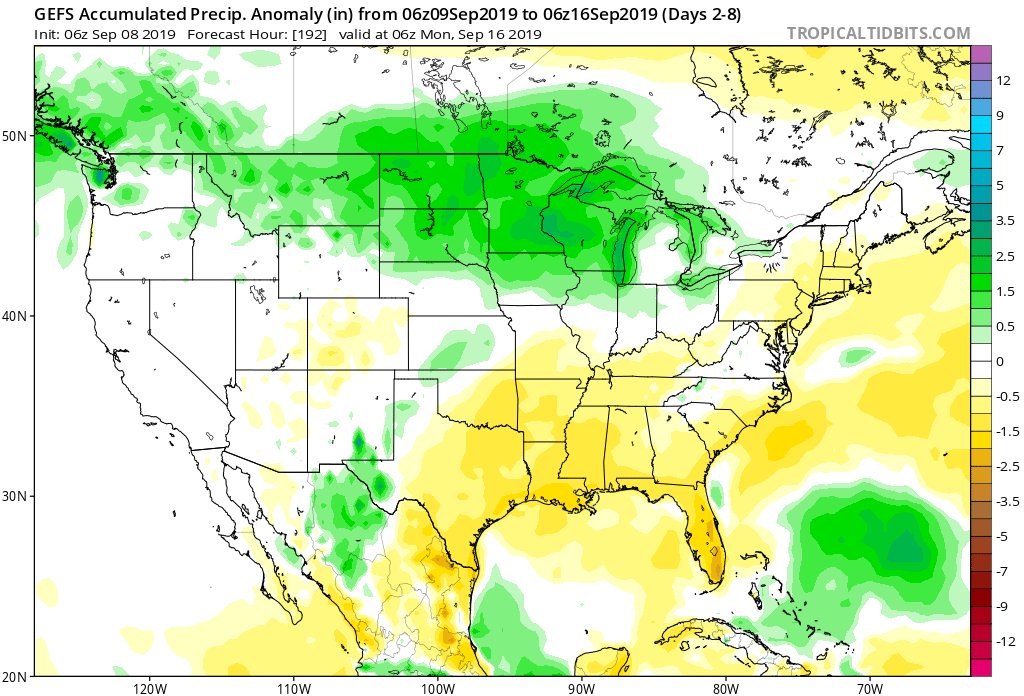
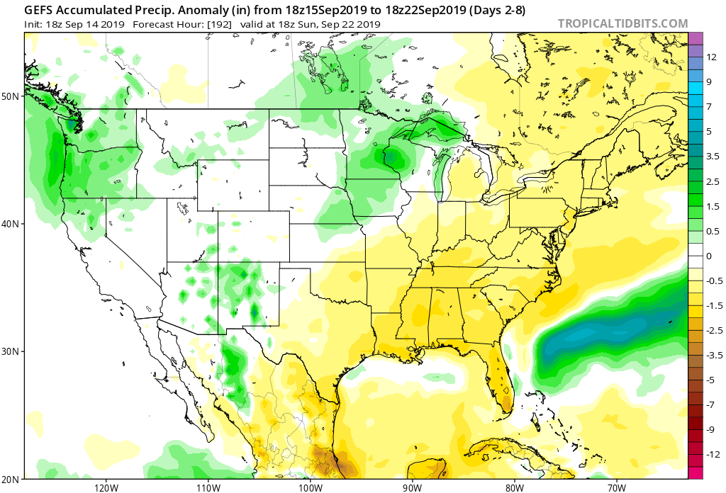
7-Day Precipitation: Precipitation is expected to run below normal through the forecast period.
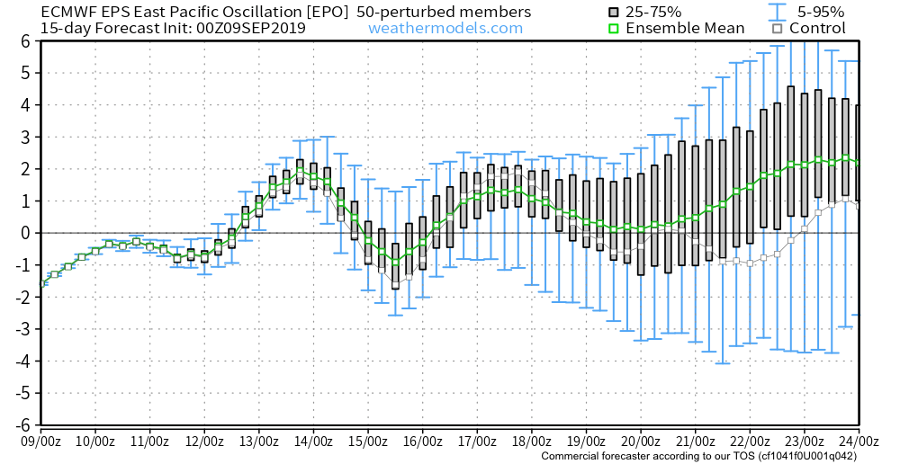
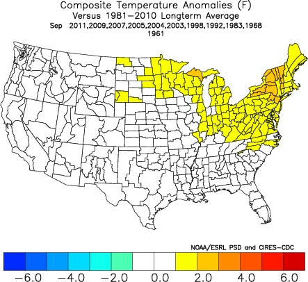
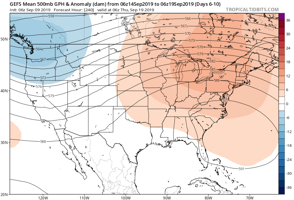
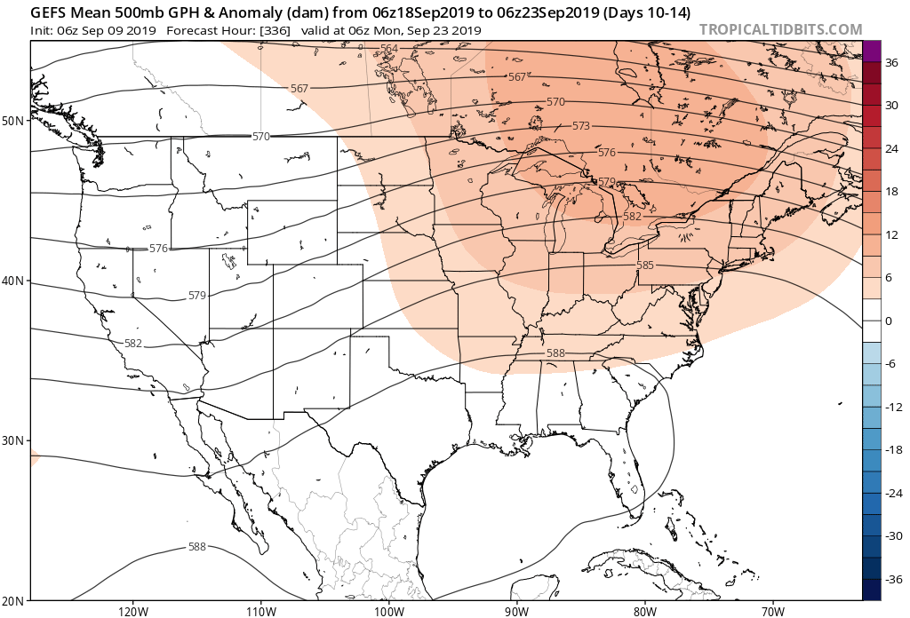
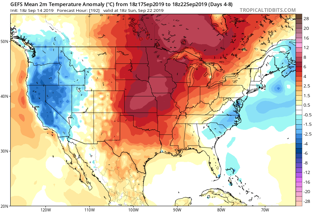
7-Day Temperatures: The upcoming forecast period above will feature well above average temperatures.
Severe Outlook: Widespread and organized severe weather isn’t expected through the forecast period.
Summary: A couple of storm complexes will “flirt” with central Indiana as we open up the new week, but these should be in a weakening state (if not flat-out diminish entirely) as they grow closer to our immediate region. Other than that, dry and warm/ hot weather is expected until late week. Things look increasingly unsettled with better coverage of showers and thunderstorms during this time. We’re still only looking at scattered coverage with any one particular rain gauge expected to accumulate less than half an inch by late next weekend.
*Next week’s AG/ Severe Weather Update will incorporate frost/ freeze outlooks, as well as drought discussion(s) across the Lower 48.