Harvest ’19: Tis The Season For Changeable Weather Patterns…
*Starting November 1st, our weekly agriculture and harvest updates will transition to weekly winter storm outlooks. We’ll maintain a lot of the feedback y’all have provided with the new weekly winter products. Come next growing season, the weekly agriculture and severe weather updates will return.
Forecast Period: 10.13.19 through 10.20.19
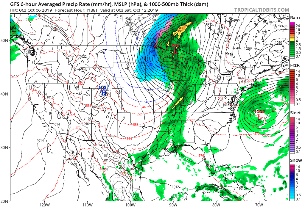
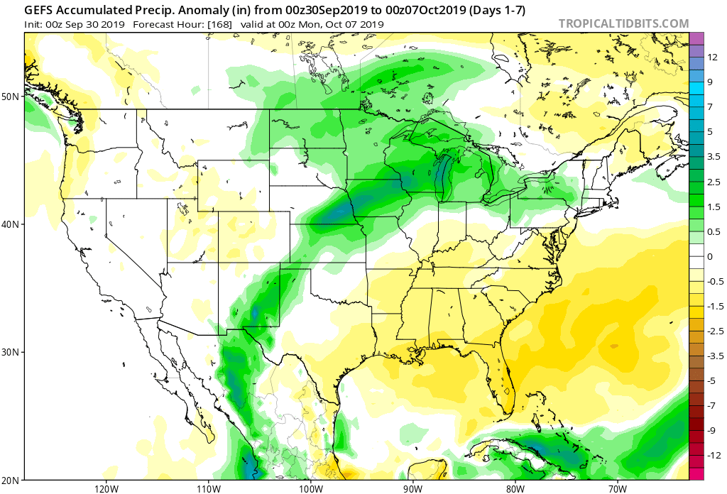
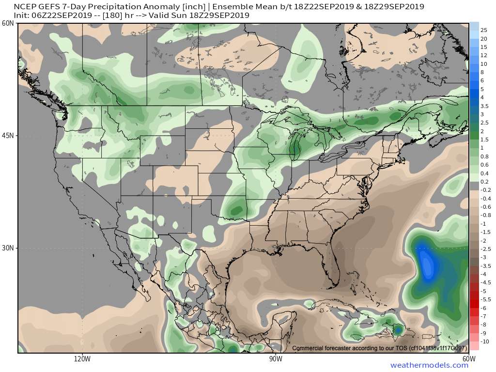
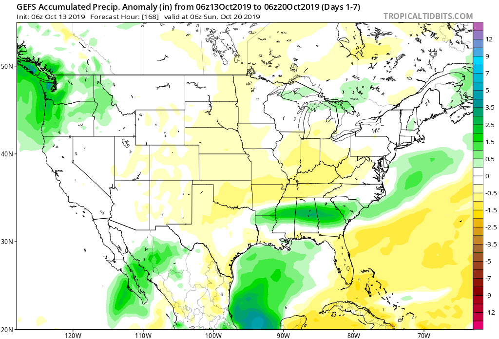
7-Day Precipitation: Below average precipitation is expected through the period.
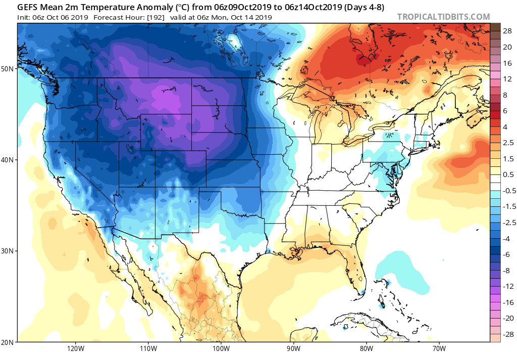
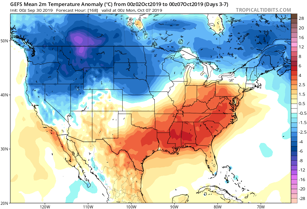
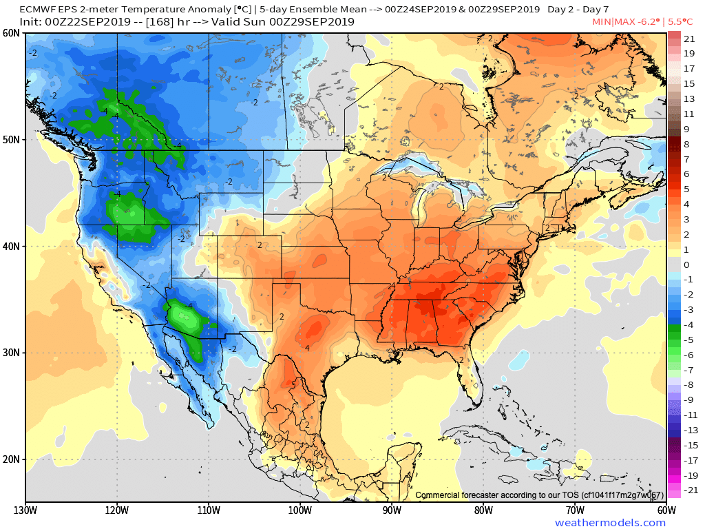
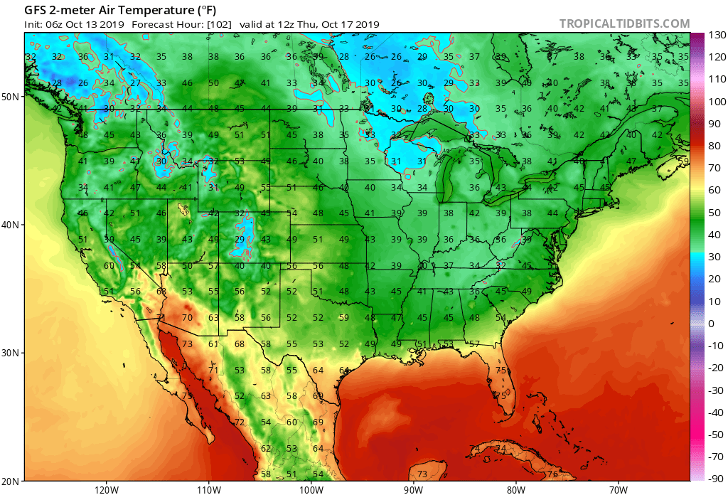
7-Day Temperatures: Below average temperatures are expected overall throughout the period.

Severe Weather: Severe weather isn’t anticipated through the period.
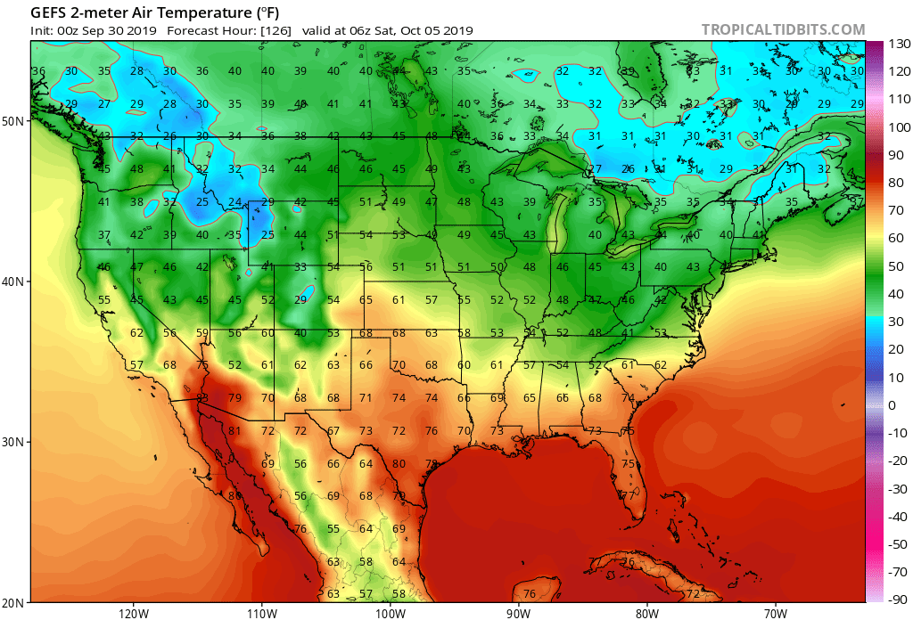
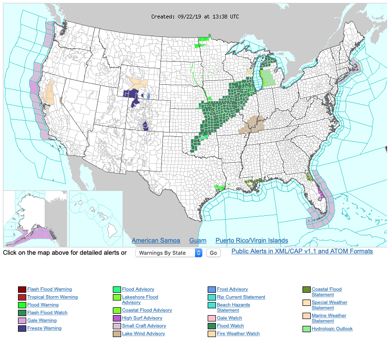
Frost/ Freeze: Many across the central and northern Ohio Valley have now recorded their first frost or freeze of the season. Additional frosty mornings are ahead during the upcoming forecast period with Thursday morning looking like the coldest as of now. The first frost and/ or freeze of the season will continue to advance southeast with the southern Appalachians likely putting an end to their growing season by Thursday morning.
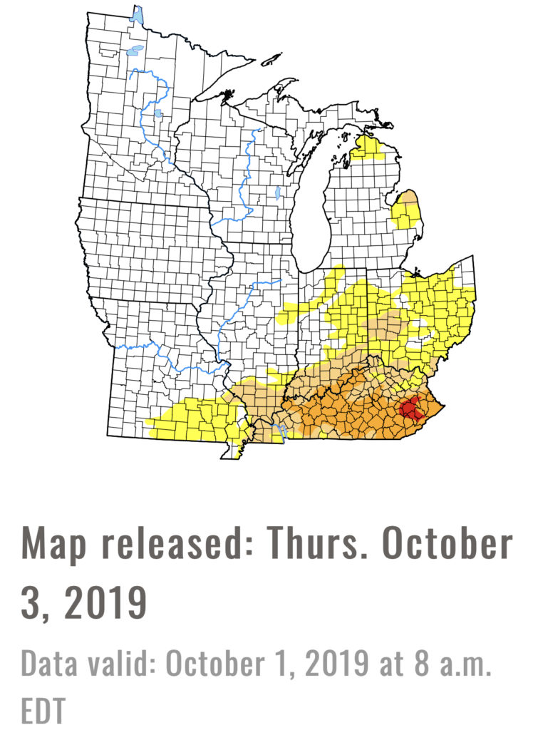
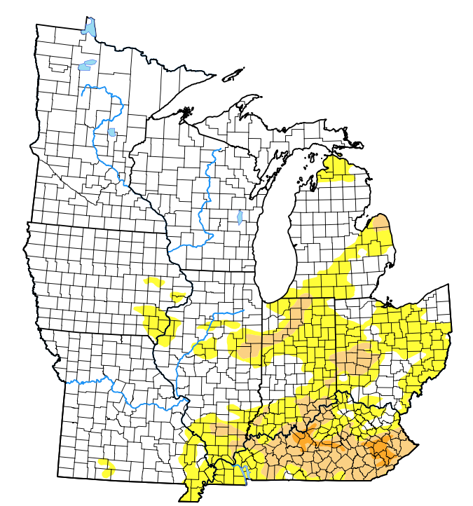
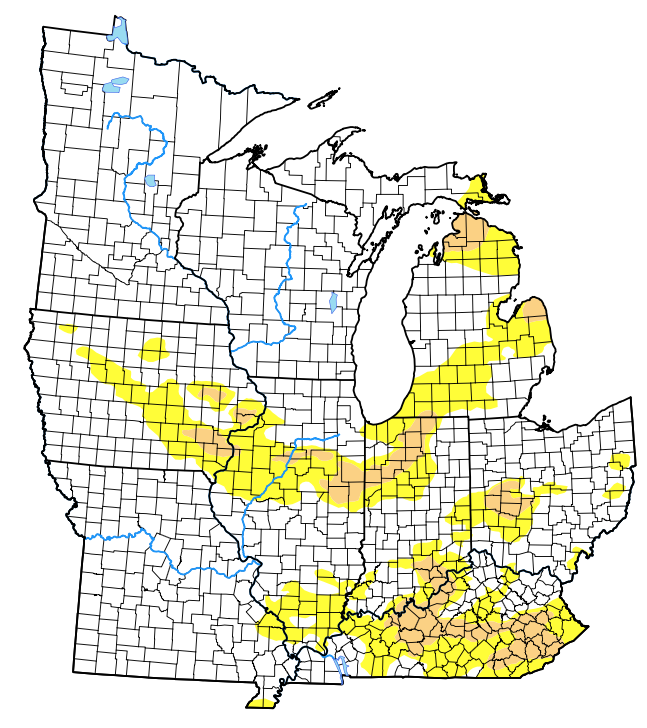
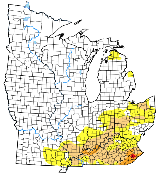
Drought Monitor: The southern and eastern portion of the Ohio Valley remains in either a drought or abnormally dry state. Unfortunately, heaviest rains with Friday’s cold front targeted areas west or north of these areas. While the upcoming week won’t provide significant relief, the drivers behind the pattern ahead promise to deliver more frequent and beneficial precipitation events in the next 2-3 weeks.
Summary: The upcoming 7-day period will feature a quiet and pleasant open to the week before a fast moving system passes Tuesday evening with a round of showers followed by a windy mid-week period. Strong and gusty northwest winds will drive another unseasonably chilly air mass into central Indiana Tuesday night through Thursday before our air flow backs around to the south into next weekend. This will provide for modifying temperatures Friday into Saturday.