Monitoring Prospects For Heavy Weekend Rain…
A combination of ingredients are coming together to offer up the potential of heavy rain for portions of the region this weekend.
An approaching cold front will drop slowly southeast out of the Plains while a tropical low moves inland from the central Gulf Coast.
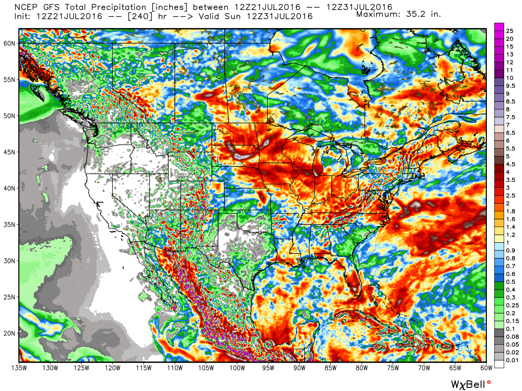
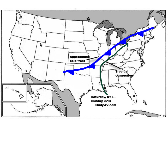 The precise placement of the front will serve as the focal point for heavy weekend rains. As we’d expect from this distance, modeling disagrees on the all-important specifics. Using a model blend, central Indiana is on the table for heavy late week-weekend rain as of now. Precipitable water values (PWATs) will be above 2″ and suggest the threat of torrential downpours, including localized flash flooding across the Ohio Valley. Eventually, the cold front will sweep the tropical-rich moisture away from the region and cooler, much less humid air will press in by this time next week.
We still have time to watch the evolution of things play out as we progress through mid week. Stay tuned as we “sure-up” the details and hone in on the area where heavy rain is likely.
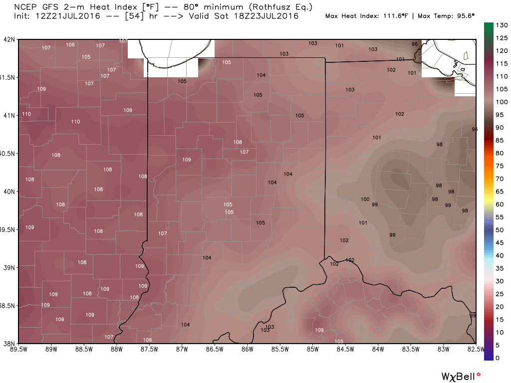
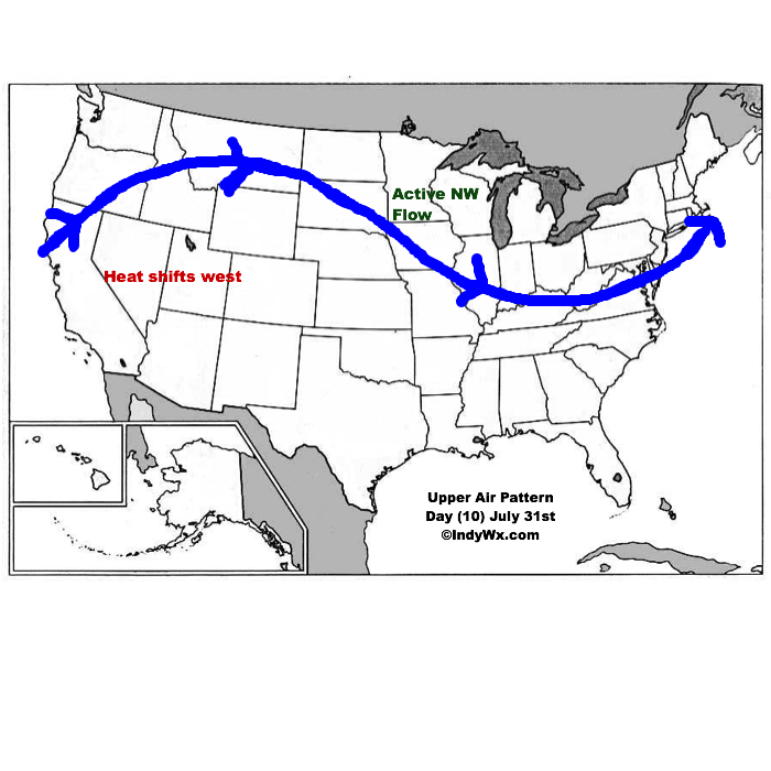
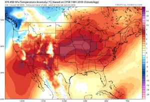
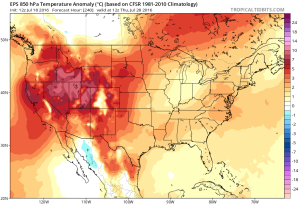 While some oppressive heat and humidity will impact our local area to wrap up the work week and head into the weekend, this is a pattern where it’s incredibly difficult to deal with any sort of one particular weather pattern for any time of substance. Looking forward to August, we don’t see this changing. Remember that word we leaned on to begin summer? “Transient” remains the best way to describe the pattern moving forward, as well.
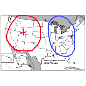
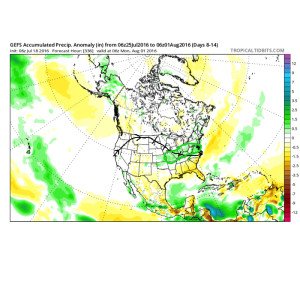 To close, we’ll leave you with a look at the latest PNA pattern. This has been the primary driver of our weather this summer, and it also argues any sort of dry, hot weather doesn’t last. Note the positive PNA returning to close July. This also lines up well with our idea of unsettled times returning…
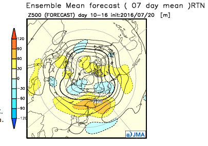
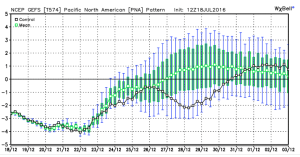
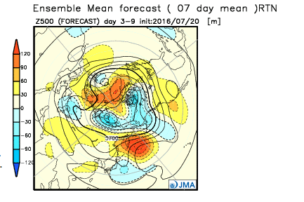
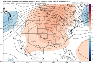
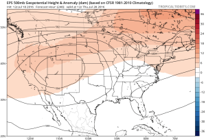
 Ensemble data continues to suggest that the mean ridge position (hot dome) develops over the eastern portion of the country early next week before slowly retrograding northwest with time.
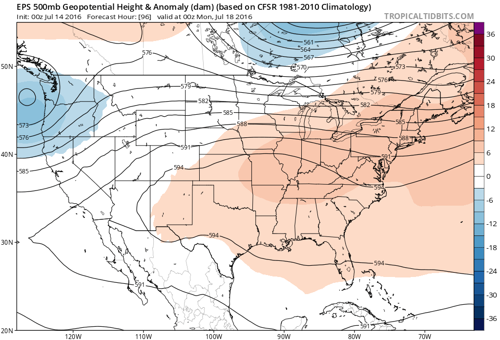 By the middle and latter portions of next week, the hot dome is set up in a position that will yield an extended stretch of hot temperatures across the state, including multiple mid-90 degree highs across central IN.
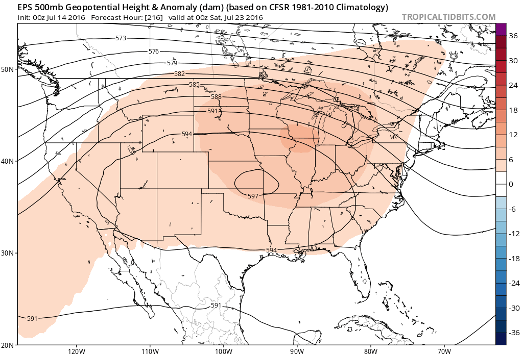
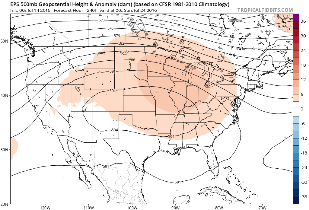 Given the current look of the ridge position, this would also be a rather dry pattern, as well, as the storm and rain track would shift north across the Canadian border into the northern Great Lakes states. (Follow that 588 line above for a good indicator of the storm track).
 One always has to be careful in trying to predict the timing of the ridge breaking down/ overall placement this time of year (models can struggle), but for now it appears as if we really heat things up and dry things out as we move through next week- especially the middle and latter portions of the week.