Updated 03.18.23 @ 2:33p
The short-term pattern will be highlighted by today’s wintry conditions. Snow showers accompanied bitter cold (at least by March standards) this morning, including wind chill values that even dipped below zero in spots. Sunday will also feature unseasonable cold before a slow moderation in the temperature department eventually takes us back into the 60s by midweek.
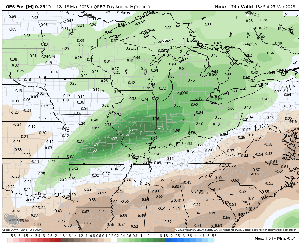
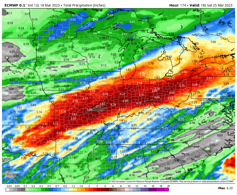
Speaking of midweek, that’s when unsettled weather will return. We don’t anticipate particularly heavy rain, but rain chances will be on the increase Wednesday. Early numbers suggest we’re looking at 0.25” to 0.50” type of an event but this appears to set the stage for a more significant rain storm as we get set to close the week. As is typically the case 5-6 days out, forecast models differ on the specifics but the overall pattern favors a heavy rain and local flood threat unfolding across the Ohio Valley. Specifics regarding whether or not this is a central or more of a southern OHV threat will be dealt with in the days ahead.

As it is, the GFS and European are in great agreement from this distance on the heavy rain and flood threat, including the opportunity of 3”+ of rain through at least a portion of the forecast area (most of which falls Friday). Specifics around more details with locations/ rainfall numbers will be fine tuned in the days ahead.


