
Updated 03.30.23 @ 7:48a
Today is easy. We’ll have a few clouds drifting through the state at times, but also expect a good deal of sunshine and temperatures warming into the upper 50s to lower 60s after the cold start to the day.
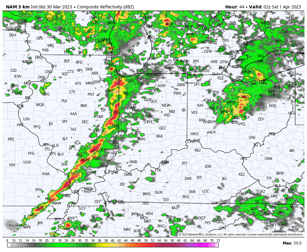
In the short-term, all eyes remain squarely focused on Friday into the early morning hours Saturday. The Storm Prediction Center’s latest severe weather outlook Friday places all of the state in some sort of risk of severe. Far northeastern Indiana (Auburn and Angola) is in a “marginal” risk. The majority of the state, including Indianapolis, Bloomington, South Bend, and Lafayette is in a “slight” risk, and places such as Terre Haute down to Evansville and Jasper is included in an “enhanced” risk. Bottom line, all of us can expect a threat of severe weather tomorrow and it’ll be important to have a means of getting the latest information regarding any warnings that will likely be issued.

As we time things out, we’ll wake up to widespread showers and embedded thunder Friday morning, but most, if not all, of this activity will remain well below severe levels.

It’s as we progress into tomorrow evening and the overnight that the concern of severe weather will increase. We bracket the hours of 10p and 3a from west to east that should feature a heightened risk of severe, with the biggest concern being damaging straight line winds with a line of storms that will roll across the state. There’s also an opportunity for a couple of discrete cells within the broader line to rotate and produce a tornado or two.

We also want to be sure to hit on the “gradient” (non thunderstorm) winds that will impact the entire area. Gusts approaching 50 MPH can be expected Friday afternoon/ evening and again Saturday morning into the afternoon.
Speaking of Saturday- it’ll feature improving conditions from a severe perspective, but we’ll be left with falling temperatures (it’ll be one of those days with a “midnight high”), gusty winds, and a few leftover light showers. After a high around 60° at midnight, temperatures will be spent in the 30s and 40s most of the day with colder ‘chills.
Bigger improvements are on deck Sunday before we have to turn our attention to our next severe weather episode early next week. More on that and updated long range thoughts later this evening.